Free Downloads: Raster Street Maps
When you are looking for a powerful tool to satisfy various needs regarding vectors, Raster and satellite imagery, you will find ILWIS Academic an efficient application. The program comes with such useful features as points to create Maps, lines for segment Maps, closed area segments for polygon Maps, spatial operations for Raster Maps and so on. Whilst...
Category: Home & Education / Miscellaneous
Publisher: ITC, License: Freeware, Price: USD $0.00, File Size: 19.4 MB
Platform: Unknown
NOVA Maps provides appraisers and appraisal users with complete, high-resolution location Maps (also known as “Street Maps”) for forms and addenda in seconds. NOVA Maps even automatically places labels for subject properties and comparables.
For just pennies per map and with just a click of the mouse, users have access to the entire...
Category: Home & Education / Miscellaneous
Publisher: Day One, License: Demo, Price: USD $0.00, File Size: 5.7 MB
Platform: Windows
APRS SA does most of the functions of the original APRS(tm) with a big difference: The Maps it uses to plot the locations are Street Atlas 4.0 or 5.0 Maps. This allows great precision in locating objects and stations. This program track a moving vehicle and do it at the Street level.
Category: Home & Education / Miscellaneous
Publisher: Brent Hildebrand, KH2Z, License: Freeware, Price: USD $0.00, File Size: 2.0 MB
Platform: Windows
UK Local business directory with addresses, telephone numbers and street maps.
UK Local business directory with addresses, telephone numbers and Street Maps. Including accountants, builders, car hire, computer shops, dentists, doctors, driving schools, estate agents, florists, garages, hotels, photographers, jewellers, post offices, printers, pubs solicitors, taxis and used car dealers.
Category: Desktop Enhancements / Screensavers
Publisher: Localdir, License: Freeware, Price: USD $0.00, File Size: 696.0 KB
Platform: Windows
London business directory with addresses, telephone numbers and street maps.
London business directory with addresses, telephone numbers and Street Maps. Including accountants, builders, car hire, computer shops, dentists, doctors, driving schools, estate agents, florists, garages, hotels, photographers, jewellers, post offices, printers, pubs solicitors, taxis and used car dealers.
Category: Desktop Enhancements / Screensavers
Publisher: London-Dir, License: Freeware, Price: USD $0.00, File Size: 697.0 KB
Platform: Windows

Vectorizer for CAD/CAM/GIS professionals, designers and illustrators. Available also as Raster to Vector SDK, ActiveX and Com Component. Converts, digitizes and refines architectural, mechanical, various technical drawings, Maps, math graphs, graphics for books and journals and more from Raster to vector. Digitizes math graphics. Also refines vector graphics, creates fine...
Category: Multimedia & Design / Image Editing
Publisher: Algolab, License: Shareware, Price: USD $99.00, File Size: 1.7 MB
Platform: Windows
The Street Fighter legacy continues with this expanded version of Street Fighter II.
The Street Fighter legacy continues with this expanded version of Street Fighter II. Included are four new characters - Cammy, Dee Jay, Fei-Long, and T.Hawk -with new backgrounds for each. Returning fighters have also been given a make-over (both in in-game art as well as in the character portraits) and have learned new moves for the ongoing tournament.
System Requirements:...
Category: Games / Action
Publisher: Pyramid-Games, License: Freeware, Price: USD $0.00, File Size: 3.2 MB
Platform: Windows

Raster to Vector is a stand-alone program that converts scanned drawings, Maps and Raster images into accurate vector files (such as DXF, HPGL, WMF, EMF, etc) for editing in any CAD application. Key Features: 1. Input image formats: BMP, JPG, TIF, GIF, PNG, PCX, TGA, RLE, JPE, J2K, JAS, JBG, MNG and more. 2. Output vector formats: DXF, HPGL, EMF, WMF and...
Category: Audio
Publisher: Raster to Vector, Inc., License: Shareware, Price: USD $99.00, File Size: 530.3 KB
Platform: Windows

Raster to Vector is a stand-alone program that converts scanned drawings, Maps and Raster images into accurate vector files (such as DXF, HPGL, WMF, EMF, etc) for editing in any CAD application. Key Features: 1. Input image formats: BMP, JPG, TIF, GIF, PNG, PCX, TGA, RLE, JPE, J2K, JAS, JBG, MNG and more. 2. Output vector formats: DXF, HPGL, EMF, WMF and...
Category: Multimedia & Design
Publisher: Raster to Vector, Inc., License: Shareware, Price: USD $99.00, File Size: 546.9 KB
Platform: Windows

Raster to Vector is a stand-alone program that converts scanned drawings, Maps and Raster images into accurate vector files (such as DXF, HPGL, WMF, EMF, etc) for editing in any CAD application. Key Features: 1. Input image formats: BMP, JPG, TIF, GIF, PNG, PCX, TGA, RLE, JPE, J2K, JAS, JBG, MNG and more. 2. Output vector formats: DXF, HPGL, EMF, WMF and...
Category: Audio
Publisher: Raster to Vector, Inc., License: Shareware, Price: USD $99.00, File Size: 546.9 KB
Platform: Windows
Raster to Vector Gold is a stand-alone program that converts scanned drawings, Maps and Raster images into accurate vector files (such as DXF, HPGL, WMF, EMF, etc) for editing in any CAD application. Key Features: 1. Input image formats: BMP, JPG, TIF, GIF, PNG, PCX, TGA, RLE, JPE, J2K, JAS, JBG, MNG and more. 2. Output vector formats: DXF, HPGL, EMF, WMF and...
Category: Multimedia & Design
Publisher: Raster to Vector, Inc., License: Shareware, Price: USD $99.00, File Size: 530.3 KB
Platform: Windows
Nokia Maps 3D browser plugin is a free mapping product and service by Nokia for its mobile phones and for internet browsers. Nokia Maps includes voice guided navigation for both pedestrians and drivers for 74 countries in 46 different languages and there are Maps for over 180 countries.
See the world in high-resolution 3D. Everything from the sky to the Street....
Category: Internet / Browser Accessories
Publisher: Nokia, License: Freeware, Price: USD $0.00, File Size: 9.8 MB
Platform: Windows
News Maps visually reflect news aggregated from numerous sources including Reuters, Wall Street Journal, NY Times, Washington Post, BBC, Digg, Reddit and many more news outlets from around the world.
The most popular stories occupy the largest rectangles while less popular stories fall into progressively smaller rectangles. You can see all the headlines and read any...
Category: Utilities / Misc. Utilities
Publisher: TimBukOne (Pty) Ltd, License: Freeware, Price: USD $0.00, File Size: 5.9 MB
Platform: Windows
UK Post Offices Directory with addresses, telephone numbers and street maps
UK Post Offices Directory with addresses, telephone numbers and Street Maps. Covering hundreds of towns within the UK.
Category: Business & Finance
Publisher: Directory of Post Offices, License: Freeware, Price: USD $0.00, File Size: 685.9 KB
Platform: Windows
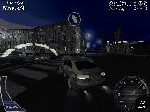
3D street racing game. Night street racing is a major attraction in big cities around the world.
3D Street racing game. Night Street racing is a major attraction in big cities around the world. The racers are legendary for their need for speed, while the cars they drive signify the perfect union of consumer-grade auto manufacturing and extreme vehicular tuning. Now you can become a night Street racer. You will take part in competitions, earning cash and winning new...
Category: Games / Simulations
Publisher: gamehitzone.com, License: Freeware, Price: USD $0.00, File Size: 34.3 MB
Platform: Windows
UK Solicitors Directory with addresses, telephone numbers and street maps. Covering hundreds of towns within the UK.
Category: Business & Finance
Publisher: solicitors-dir, License: Freeware, Price: USD $0.00, File Size: 696.8 KB
Platform: Windows
UK Restaurants Directory with addresses, telephone numbers and street maps. Covering hundreds of towns within the UK.
Category: Home & Education
Publisher: restaurants-dir, License: Freeware, Price: USD $0.00, File Size: 696.8 KB
Platform: Windows
Vextractor Lite is an auto-tracing program for converting Raster images into vector formats by building centerlines and outlines. This tool could be used for the tracing photo, logotypes and other line art images for use in Vector Graphics Design software. You can also vectorize charts, drawings, Maps and schemes for input to CAD or GIS systems. Main features of Vextractor:...
Category: Multimedia & Design / Image Editing
Publisher: VextraSoft, License: Shareware, Price: USD $49.95, File Size: 13.2 MB
Platform: Windows
This program is a tool for stretching a bitmap image (a Raster image), trimming it to a box, and calibrating it. This is primarily of use when dealing with a scanned image of a paper map. Often when making a scan it is hard to get the image precisely aligned; sometimes with old Maps the paper has stretched. It can be useful where you want to make a tiled map from a number of...
Category: Multimedia & Design / Multimedia App's
Publisher: Map Library, License: Freeware, Price: USD $0.00, File Size: 755.8 KB
Platform: Windows
For many countries Street coordinates are present with coverage degrees upto 100 percent. The geo data offered here are in high-precision quality and are present in different coordinate and reference systems. Street coordinates or also called Street section coordinates are meaning the summary of several postal house addresses to an averaged position on Street or...
Category: Business & Finance
Publisher: C. Killet Software Ing.-GbR, License: Demo, Price: USD $625.00, File Size: 66.6 KB
Platform: Unknown

For the area of the Federal Republic of Germany more than 2,7 million Street coordinates with a coverage of 100% are available. The geo data offered here are in high-precision quality and are present in different coordinate and reference systems. Street coordinates or also called Street section coordinates are meaning the summary of several postal house addresses to an...
Category: Business & Finance
Publisher: C. Killet Software Ing.-GbR, License: Demo, Price: USD $625.00, File Size: 68.4 KB
Platform: Unknown
PHOTOMOD GeoMosaic is intended for working with various types of digital images, including aerial and space imagery as well as digitized Raster Maps.
The program functionality includes:
- Georeferencing of Raster images;
- Transforming images from one coordinate system to another, using an extensive database supplied or custom created...
Category: Multimedia & Design / Multimedia App's
Publisher: Racurs, License: Freeware, Price: USD $0.00, File Size: 36.5 MB
Platform: Windows
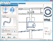
SeeYou is a flight planning and analysis tool for glider pilots.
SeeYou is a flight planning and analysis tool for glider pilots. It is designed for both desktop and notebook PCs.
Main features:
- Vector Maps: Vector Maps are sharp, fast and accurate at all zoom settings. Objects are presented in the detail, that keeps the map readable.
- Raster Maps. They are bitmap files, useful for viewing your...
Category: Games / Simulations
Publisher: Naviter d.o.o., License: Shareware, Price: USD $167.22, File Size: 17.4 MB
Platform: Windows

For the area of the Federal Republic of Germany more than 2,7 million Street coordinates with a coverage of 100% are available. The geo data offered here are in high-precision quality and are present in different coordinate and reference systems. Street coordinates or also called Street section coordinates are meaning the summary of several postal house addresses to an...
Category: Business & Finance
Publisher: C. Killet Software Ing.-GbR, License: Demo, Price: USD $625.00, File Size: 68.4 KB
Platform: Unknown