Free Downloads: Satellites Coordinates
The Use of Videography in Tracking Earth Satellites.
The Use of Videography in Tracking Earth Satellites.Scattered around the world is a network of about sixteen amateur observers who spend most of their spare time looking at earth Satellites.They concentrate on tracking classified military Satellites.Working in close collaboration
this group keeps regular track of about 120 Satellites moving in a wide variety of...
Category: Home & Education / Science
Publisher: www.satelliteimage-of-my-house.com, License: Freeware, Price: USD $0.00, File Size: 1.7 MB
Platform: Windows
SatCalc is a free software which calculates Azimuth and Elevation for geostationary Satellites used for television broadcast.
Features include the calculation of the LNB skew and calculation of sun outage which occurs in spring and fall. The calculated data is presented graphically and can also be printed out and exported to HTML or CSV.
A list of Longitude...
Category: Business & Finance / Applications
Publisher: Martin Kirisits, License: Freeware, Price: USD $0.00, File Size: 1.6 MB
Platform: Windows
Cartesian Coordinates, spherical Coordinates und cylindrical Coordinates can be transformed into each other. (5 languages, 2 and 3 dimensions)
Category: Home & Education / Miscellaneous
Publisher: Greuer Andreas, License: Shareware, Price: USD $11.00, File Size: 993.3 KB
Platform: Windows
PreviSat is a satellite tracking software for observing purposes.
PreviSat is a satellite tracking software for observing purposes. Very easy to use, it shows the positions of the Satellites in real-time or manual mode. PreviSat is able to make predictions of their passes and also predictions of Iridium flares.
Features
- NORAD SGP4 model (Vallado, 2006)
- Real time / manual mode
- Topocentric / Equatorial /...
Category: Home & Education / Astrology & Numerology
Publisher: Astropedia, License: Freeware, Price: USD $0.00, File Size: 1.4 MB
Platform: Windows
DESA Satellite Tracker allows you to track the International Space Station and other Satellites in real time. The built in radar alarm will alert you to Satellites that would be visible to you and let you know where to look (although you will only be able to actually see the Satellites an hour before sunrise and an hour after sunset).
DESA Satellite Tracker is...
Category: Home & Education / Astrology & Numerology
Publisher: red diligence, License: Freeware, Price: USD $0.00, File Size: 977.8 KB
Platform: Windows
The Surface Area Calculator is a tool for easily calculating surface and planimetric areas, as well as volumes.
The extent and shape of the area in question are given in terms of the Coordinates of a number of points throughout the area.
These Coordinates can be specified as either latitude, longitude, and height, as GPS Coordinates (geocentric Cartesian...
Category: Business & Finance / Calculators
Publisher: Microsearch Corp, License: Shareware, Price: USD $134.00, File Size: 1.2 MB
Platform: Windows
The 3D Satellites wallpaper is a cool wallpaper where you can see planets and stars form the space.
The 3D Satellites wallpaper is a cool wallpaper where you can see planets and stars form the space.The Earth is in the center of the wallpaper an a few shiny stars.This wallpaper is very popular an you will be pleased about it.Is very easy to download and install.
Category: Desktop Enhancements / Misc. Themes
Publisher: WallpaperPimper, License: Freeware, Price: USD $0.00, File Size: 128.0 KB
Platform: Windows
Orbcomm is a satellite communication system (www.
Orbcomm is a satellite communication system (www.orbcomm.com) providing two-way data and positioning service to small, portable user terminals in the VHF frequency bands. You can use a simple VHF radio receiver (scanner) tuned to the band between 137 and 138 MHz to pick up the strong signals from these Satellites. With OrbcommPlotter you can decode the telemetry and find out the...
Category: Home & Education / Miscellaneous
Publisher: COAA, License: Demo, Price: USD $0.00, File Size: 730.0 KB
Platform: Windows
Freefall Satellite Screen Saver
Freefall - the condition of unrestrained motion in a gravitational field
Iridium Satellites
Features
Includes the Freefall screen saver and application
Over 850 Satellites with detailed descriptions
Stunning earth imagery, coastlines, political boundaries, major cities, and reference grid
Real-time satellite...
Category: Home & Education / Astrology & Numerology
Publisher: Advanced Analytic, License: Shareware, Price: USD $19.95, File Size: 28.3 MB
Platform: Windows
- Plot regular and parametric equations.
- Plot regular and parametric equations.
- Plot Coordinates tables.
Graphing Calculator 3D is an easy-to-use tool that plots 2D and 3D functions.
Graphing Calculator 3D features :
- Instant quick plotting after each key stroke.
- Cartesian/Polar Coordinates in 2D.
- Cart/Cylindrical/Spherical Coordinates in 3D.
- Inequalities in 2D...
Category: Home & Education / Mathematics
Publisher: Runiter Company, License: Shareware, Price: USD $49.95, File Size: 4.3 MB
Platform: Windows
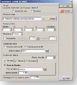
CoordTrans converts geographic coordinates between different coordinate systems.
CoordTrans converts geographic Coordinates between different coordinate systems.
CoordTrans is very easy to use, and full of Wizards to help you with more complex tasks.
Convert between UTM, WGS84 and NAD27 / NAD83, and more... almost all projections and datums on Earth are supported. See complete list..
You can convert single Coordinates, or...
Category: Business & Finance / Business Finance
Publisher: Franson, License: Shareware, Price: USD $49.00, File Size: 6.5 MB
Platform: Windows
View a 3D planet with satellites and flying astronaut on your screen.
View a 3D planet with Satellites and flying astronaut on your screen. This nice screensaver has everything required for your pleasure and recreation: beautiful 3D graphics (DirectX), gripping music and outstanding scenario.
Category: Desktop Enhancements / Screensavers
Publisher: softoverdose.com, License: Freeware, Price: USD $0.00, File Size: 1.0 MB
Platform: Windows, Mac, 2K, 2K3
Aerial, topograhpic, and other types of maps are an important resource in the visualization of your information. HuntSmart big game hunting software gives you the ability to view your information on maps. Once you enter information with Coordinates into the system, this information can be viewed on all available maps that contain those Coordinates. One thing to remember is that...
Category: Multimedia & Design / Multimedia App's
Publisher: HuntingSouth, License: Shareware, Price: USD $0.00, File Size: 17.1 MB
Platform: Windows
DXF2XYZ converts a DXF file to an XYZ file, ie a comma delimited text file containing just xyz Coordinates. It can be useful for extracting the raw XYZ Coordinates from a DXF file containing say contours or other elevation entities.
This utility it limited to extracting the XYZ Coordinates from the following DXF entity types:
POINT, LINE, POLYLINE /...
Category: Business & Finance / Calculators
Publisher: H. Wind, License: Freeware, Price: USD $0.00, File Size: 657.6 KB
Platform: Windows
Stellarium is a free open source planetarium for your computer.
Stellarium is a free open source planetarium for your computer.
It shows a realistic sky in 3D, just like what you see with the naked eye, binoculars or a telescope.
It is being used in planetarium projectors. Just set your Coordinates and go.
Main features:
- default catalogue of over 600,000 stars
- extra catalogues with more than 210...
Category: Desktop Enhancements / Shell & Desktop Managers
Publisher: Stellarium Contributers, License: Shareware, Price: USD $0.00, File Size: 0
Platform: Windows
GoArrow displays an arrow on your screen that points towards coordinates that you specify.
GoArrow displays an arrow on your screen that points towards Coordinates that you specify. This is very handy if you have to run to Coordinates with obstacles in the way (like mountains), or if you're just directionally-challenged.
GoArrow has the ability to find a route between any two locations in Dereth, as well as look up locations' details from either the...
Category: Home & Education / Miscellaneous
Publisher: Digero of Leafcull, License: Freeware, Price: USD $0.00, File Size: 7.7 MB
Platform: Windows
The CooRecorder program is used for registration of coordinates taken from images.
The CooRecorder program is used for registration of Coordinates taken from images.
You can use your computer scanner to take interesting photos of things which can be placed on the top of your scanner. If the things are transparent and small, they can be taped up on transparent film and then inserted into a film scanner. An image scanned as a photo from such a thing can be...
Category: Home & Education / Science
Publisher: Cybis Elektronik & Data AB, License: Shareware, Price: USD $68.00, File Size: 0
Platform: Windows
FlashPoints is a tool for creating and managing points Groups (topographic points for example). FlashPoints allows you to : * import/export points Coordinates from and to a file * create points and their attributes "Number", "Elevation" and "Description" by clicking * modify the points elevation * modify the height and rotation of the attributes * create...
Category: Multimedia & Design
Publisher: DeliCAD, License: Shareware, Price: USD $49.00, File Size: 1.2 MB
Platform: Windows
Do you have coordinates for some places of interest?
Do you have Coordinates for some places of interest? Do you want to find them on Earth's surface? There are more than 2,000 coordinate systems available to make Google Earth follow your interests! Plex.Mark! simply placemarks your world!
Have you found a place in Google Earth and you would like to have the Coordinates in your coordinate system? Plex.Mark! will now make...
Category: Internet / Browser Accessories
Publisher: Plexscape, License: Freeware, Price: USD $0.00, File Size: 601.9 KB
Platform: Windows
This program calculates the location of almost any tipe of locator.
This program calculates the location of almost any tipe of locator. It also calculates the distance, azimuth, longitude and latitude betweent two locators. The software converts latitude/longitude Coordinates to Maidenhead locators and vice versa. It converts IARU locator and longitude/latitude Coordinates ti UI-View format Coordinates.
Category: Home & Education / Miscellaneous
Publisher: ON6MU Group, License: Freeware, Price: USD $0.00, File Size: 367.8 KB
Platform: Windows
This application will allow you to simply edit Enigma1 & Enigma2 services with only few clicks.
This application will allow you to simply edit Enigma1 & Enigma2 services with only few clicks. You load the list, choose Satellites you want and you’re done. All unselected Satellites, empty bouquets and markers are automatically removed from the list. Delimiters (lines used to visually divide bouquets) specified in the application will be preserved even when empty.
Category: Home & Education / Miscellaneous
Publisher: Krkadoni, License: Shareware, Price: USD $0.00, File Size: 484.4 KB
Platform: Windows
Earth Orbit Objects is free program which predict satellite passes for your local or any selected area. Use flat Earth view to display satellite tracks with visibility circle.
The globe view shows selected Satellites around the Earth as a sphere and sky view shows Satellites as you would see them in a starry night. The line elements are processed using SGP4 and SDP4...
Category: Home & Education / Miscellaneous
Publisher: Bluewing Trg, License: Freeware, Price: USD $0.00, File Size: 1.6 MB
Platform: Windows
The fast track to GPS success.
The fast track to GPS success. The Linx MDEV-GPS-SR contains everything needed to rapidly evaluate the SR Series GPS modules and implement them in record time. This all-inclusive Master Development System features a pre-assembled development board with an on-board OLED display for standalone testing. The system can also be attached to a PC via USB and operated using the supplied software. The...
Category: Software Development / Misc. Programming
Publisher: Linx Technologies, Inc., License: Freeware, Price: USD $0.00, File Size: 98.5 MB
Platform: Windows
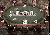
Everest Poker offer the latest in the most exciting form of online poker: Multi-Player Texas Holdem Poker. Everest Poker is proud to offer our players the opportunity to win their way to live, land-based tournaments around the world. We strive to provide our players with an enticing selection of Satellites to popular tournaments so they can rub shoulders with the pros and test their...
Category: Games
Publisher: Everest-Poker, License: Freeware, Price: USD $0.00, File Size: 226.5 KB
Platform: Windows
 Demo
Demo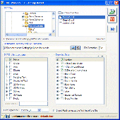
DXF Works is an application that allows to extract Coordinates and other various data from DXF files. You can choose which entities to process and which data to extract, creating your own file format. DXF Works can process several files at one time and lets save your settings in reusable configuration files. DXF Works can be used for several purposes : extracting Coordinates,...
Category: Multimedia & Design / Graphics Viewers
Publisher: DeliCAD, License: Demo, Price: USD $49.00, EUR49, File Size: 783.4 KB
Platform: Windows