Free Downloads: Sid Image In Mapinfo
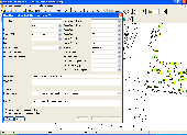
EasyLoader is a Windows-only utility available from Pitney Bowes Mapinfo Corporation that allows you to upload Mapinfo .tab files to a remote database.If using this release of the EasyLoader v10.0 MBX via the Tools menu in Mapinfo Professional, it will require Mapinfo Professional v10.0.
Category: Multimedia & Design / Multimedia App's
Publisher: Pitney Bowes Software Inc., License: Freeware, Price: USD $0.00, File Size: 1.8 MB
Platform: Windows
GEScene is a Mapinfo utility that allows images to be exchanged in both directions between Mapinfo and Google Earth. Placemarks can also be created in Google Earth by using Mapinfo as a point of reference to easily pinpoint more obscure locations. Images saved in Google Earth can be registered and displayed in Mapinfo to compliment existing map layers. Conversely,...
Category: Utilities / Misc. Utilities
Publisher: Peter Doyle, License: Freeware, Price: USD $0.00, File Size: 3.2 MB
Platform: Windows
The Mapinfo License Server must be installed on your network and be accessible to all Mapinfo Professional users. Mapinfo Professional is a powerful Microsoft Windows-based mapping and geographic analysis application from the experts in location intelligence. Designed to easily visualize the relationships between data and geography, Mapinfo Professional helps...
Category: Home & Education / Miscellaneous
Publisher: Pitney Bowes MapInfo, License: Freeware, Price: USD $0.00, File Size: 12.1 MB
Platform: Windows
Mapinfo ProViewer™ lets you share location intelligence with clients and co-workers, even if they do not have Mapinfo Professional. ProViewer allows anyone to open, view and manipulate your Mapinfo Professional maps, tables and analyses with easy-to-use functionality including print, zoom, scroll, select objects, measure distances and view details.
Category: Multimedia & Design / Graphics Viewers
Publisher: MapInfo Corporation, License: Freeware, Price: USD $0.00, File Size: 419.6 KB
Platform: Windows
Allows to display and register rasters of ERDAS Imagine (*.
Allows to display and register rasters of ERDAS Imagine (*.IMG files) in Mapinfo. Georeferenced *.IMG images will be displayed directly in Mapinfo Professional, MapX, and MapXtreme environments. Additional utilities for free: img2tab utility - creates *.TAB file for each *.IMG file in batch mode. Mapinfo Table is created automatically and then can be used to open the...
Category: Utilities / System Utilities
Publisher: MicroOLAP Technologies LTD, License: Shareware, Price: USD $99.95, File Size: 1.1 MB
Platform: Windows
The Mapinfo Line Style Editor works by modifying the file from which Mapinfo reads its line style definitions. MILISTED can open any valid Mapinfo line style definition file, modify it, and save it with any name, however, Mapinfo only experiences the changes when it starts up and reads the mapinfow.pen file it finds in the same directory as mapinfow.exe. You can have...
Category: Multimedia & Design / Digital Media Editors
Publisher: Victor O. Lomtev, License: Freeware, Price: USD $0.00, File Size: 961.7 KB
Platform: Windows
The TM Forum’s Information Framework (commonly referred to as the Sid) provides a common vocabulary for communication service providers. Common models the size of the Sid can be challenging to absorb, but the Progress® DataXtend® Browser for Sid makes learning your way around the Sid easy.
The TM Forum's Information Model, the...
Category: Business & Finance / Business Finance
Publisher: Progress, License: Freeware, Price: USD $0.00, File Size: 268.0 MB
Platform: Windows
The Geosoft Plug-in for Mapinfo is an extension to the Mapinfo desktop software that provides data retrieval using DAP and also support for reading Geosoft file formats. The plug-in enables users to view Geosoft grid files as a raster layer inside Mapinfo. The plug-in also enables users to view Geosoft Maps as layers.
Category: Home & Education / Miscellaneous
Publisher: GEOSoft, License: Freeware, Price: USD $0.00, File Size: 109.1 MB
Platform: Windows
BosqMap software is a .mbx program for Mapinfo which enables the user to add, view and edit data held in Mapinfo tables, simply and easily link tables to other tables and link multiple photos and other files to map-objects and all this through one simple dialog box or form.
BosqMap can display your existing Mapinfo tables or can be used to design new ones
BosqMap...
Category: Business & Finance / Applications
Publisher: BosqMap Limited, License: Shareware, Price: USD $90.00, File Size: 2.0 KB
Platform: Windows
Mapinfo Professional® is a powerful Microsoft® Windows®–based mapping and geographic analysis application. Designed to easily visualise the relationships between data and geography, Mapinfo Professional 11 makes it faster and easier than ever to create, share and use maps.
Category: Software Development / Misc. Programming
Publisher: Pitney Bowes Software, Inc, License: Shareware, Price: USD $1950.00, File Size: 15.1 MB
Platform: Windows
GlobeXplorer's ImageConnect for Mapinfo is a unique extension that instantly brings georeferenced satellite and aerial photos into your desktop or mobile project from our online database. ImageConnect takes away the time, cost and hassle of locating an Image provider, waiting for delivery, and managing large Image files.
Category: Internet / Misc. Plugins
Publisher: GlobeXplorer, LLC, License: Freeware, Price: USD $0.00, File Size: 2.0 MB
Platform: Windows
Mapinfo Professional® is a powerful Microsoft® Windows®-based mapping and geographic analysis application from the experts in location intelligence. Designed to easily visualize the relationships between data and geography, Mapinfo Professional helps business analysts, planners, GIS professionals – even non-GIS users – gain new insights into their markets,...
Category: Home & Education / Miscellaneous
Publisher: Pitney Bowes Software Inc., License: Shareware, Price: USD $0.00, File Size: 58.8 KB
Platform: Windows
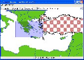
It`s a FREE ESRI shape files (*.shp), Mapinfo interchange (*.mif) and AutoCAD *.dxf viewer. Using this utility you can view *.shp files (ESRI shape files), *.mif files (Mapinfo interchange) and AutoDesk AutoCAD *.dxf. No other files are needed.
Category: Multimedia & Design
Publisher: Avangardo, License: Freeware, Price: USD $0.00, File Size: 420.9 KB
Platform: Windows

Sid is an End-to-end secure teamwork tool to make your team communication safer, simpler and more efficient. Connect with your team members and keep everyone on the same page. Fast communication - one-to-one or within groups Set up your team easily and start right away with secure messaging and file transfer. Use it for private and team communication. Team contacts are exchanged...
Category: Internet / Chat
Publisher: Spherebox UG (haftungsbeschränkt), License: Freeware, Price: USD $0.00, File Size: 7.8 MB
Platform: Mac, Windows,
Sid Meier's Pirates! is a strategy game created by Sid Meier for Firaxis. The main character is a pirate, a man who was part of the nobility and is stripped of his property and his families. The adventures begin when he decides to join a vessel which can be selected (the choices are English, Spanish, Dutch and French). The game presents the Caribbean Sea in map mode. At first...
Category: Games / Strategy & War
Publisher: 2K Games, License: Commercial, Price: USD $39.99, File Size: 0
Platform: Windows
With MapCAD another 11 CAD features are available for MapInfo Pro.
With MapCAD another 11 CAD features are available for Mapinfo Pro. Particularly MapCAD cells are an excellent opportunity to create symbols and one's own pattern or hatches. These cells are vector symbols managed in a library.
Category: Multimedia & Design / Image Editing
An existing polyline or area (red object) can be converted to a Spline with the Spline function. The result is a polyline again (blue object).
Publisher: AGIS GmbH, License: Shareware, Price: USD $0.00, File Size: 2.2 MB
Platform: Windows
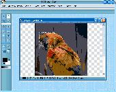
Sid Image In Depth consumer-level photo editor is the professional standard in digital imaging, with an endless selection of drawing tools, filters, and color-adjustment capabilities for manipulating items in almost any way. Offers unique features designed specifically for amateur photographers, hobbyists, and business users who want a simple-to-use yet powerful digital-imaging...
Category: Multimedia & Design
Publisher: SoundInDepth.com, License: Freeware, Price: USD $0.00, File Size: 5.0 MB
Platform: Windows
NTF2MIF translates Ordnance Survey NTF data files to MapInfo MIF/MID format.
NTF2MIF translates Ordnance Survey NTF data files to Mapinfo MIF/MID format. This format can also be imported into many other GIS applications.
NTF2MIF translates the following data products:
Land-Line Plus; Meridian 2; Strategi; Landform Panorama Contour and DTM; Landform Profile Contour and DTM; OSCAR Traffic-Manager; OSCAR Asset-Manager; Code-Point NTF.
Category: Home & Education / Miscellaneous
Publisher: Nigel James, License: Shareware, Price: USD $0.00, File Size: 0
Platform: Windows
This softwareis a program specially designed to convert Mapinfo files from the old Australian Geodetic Datum (AGD) to the new Geocentric Datum of Australia (GDA) using the distortion modeling method which is the most accurate method possible. It provides consistency of Australia's mapping datum with international coordinate systems.
Category: Home & Education / Miscellaneous
Publisher: Peter Meier, License: Shareware, Price: USD $1582.19, File Size: 9.8 MB
Platform: Windows
EasyMap VCL is a Delphi/C++Builder components set for creating your own GIS-related solutions without Mapinfo, MapX, MapObjects, WinGIS and so on. EasyMap VCL allows to add following functionalities in Delphi/C++Builder application: - MIF/MID vector maps displaying in Longitude/Lantitude projection; - Map objects related data in grid or tabular controls displaying; -...
Category: Software Development / Tools & Editors
Publisher: MicroOLAP Technologies LTD, License: Shareware, Price: USD $79.95, File Size: 2.3 MB
Platform: Windows
Save your self the trouble of minimizing Flight Simulator window or printing out tons of papers in order to follow your assigned Sid, STAR or other aviation chart.
ChartsViewer Gauge is a product which enables you to view your charts right within the Flight Simulator it self.
It is a quick and easy way to have your charts right infront of you in an mater of...
Category: Games / Simulations
Publisher: SkyHighSim, License: Shareware, Price: USD $13.15, File Size: 3.0 MB
Platform: Windows
Chips, the Copenhagen Image Processing System, is a general-purpose software package for remote sensing Image processing and spatial data analysis with extensive support for NOAA AVHRR data.
Chips can be used both as a stand-alone system, as well as a powerful supplemental Image-processing tool for GIS products like Mapinfo™ and ArcView™.
Category: Multimedia & Design / Multimedia App's
Publisher: Chips Development Team, License: Freeware, Price: USD $0.00, File Size: 5.9 MB
Platform: Windows
Workspace Control software provides a range of powerful tools to simplify maintenance tasks and eliminates the guesswork when it comes to searching, editing, batching and reporting. Workspace Control software provides you with a suite of tools to perform a range of tasks simply, effectively and professionally. Mapinfo tables contain many properties that affect the way a workspace is...
Category: Business & Finance / Database Management
Publisher: 4thbeach Software, License: Shareware, Price: USD $70.00, File Size: 21.0 MB
Platform: Windows
 Shareware
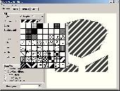
DrawStyles Library contains functions and resources for drawing lines and regions with use various styles of lines and brush pattern (as well as in Mapinfo). Library contains following components: TDSPatternStyleComboBox - intend for select pattern style of brush TDSLineStyleComboBox - intend for select line style TDSLineWidthComboBox - intend for select line width...
Category: Software Development / Components & Libraries
Publisher: Igor Ilyinsky software, License: Shareware, Price: USD $29.95, EUR24.95, File Size: 435.5 KB
Platform: Windows
MapImagery Professional is an upgrade to MapImagery, that provides an advanced set of raster tools, usually only available in high cost dedicated Image processing products. MapImagery Professional can be used for preparing, adjusting and enhancing imagery, for use within Mapinfo Professional based applications.
The additional features of MapImagery Professional can...
Category: Business & Finance / Business Finance
Publisher: MapImagery Limited, License: Shareware, Price: USD $599.00, File Size: 11.6 MB
Platform: Windows