Free Downloads: State Plane Coordinate Conversion

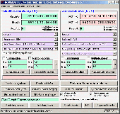
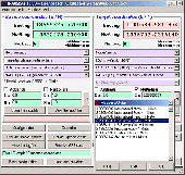
TRANSDAT geosoftware executes Coordinate transformations and geodetic datum shifts between many Coordinate and reference systems of America, Australasia, Europe, Germany special and world-wide, with high precision and high speed: 1.The current and historical Coordinate and reference systems of all countries of the European Union (EU) including the eastern extensions and the...
Category: Home & Education / Science
Publisher: Killet Software Ing.-GbR, License: Shareware, Price: USD $170.00, EUR160, File Size: 4.4 MB
Platform: Windows
 Shareware
GPS SDK to add GPS and Coordinate Conversion functionality to your software and scripts). All NMEA0183 protocol versions are supported and can be filtered by NMEA sentence type and talker ID. Garmin USB PVT support. Information on GPS status can also be retrieved: GPS fix quality, satellites used in fix, satellites in view, satellite azimuth, elevation and signal strengths....
Category: Software Development
Publisher: Eye4Software B.V., License: Shareware, Price: USD $99.00, EUR79, File Size: 2.3 MB
Platform: Windows
In the Dynamic Link Library GeoDLL geodesic functions like Coordinate transformation, datum changes, meridian strip changes, user defined Coordinate and reference systems, distance calculation, maps functions, Digital Elevation Models and more geodesic functions are contained to bind them into own applications. WINDOWS operating system allows building of function libraries...
Category: Software Development
Publisher: Killet Softwareentwicklung GbR, License: Shareware, Price: USD $290.00, File Size: 999.9 KB
Platform: Windows
TRANSDAT Geosoftware executes Coordinate transformations and geodetic datum shifts between lots of Coordinate and reference systems of Germany, Europe, America, Australia and world wide in high quality and with high performance: 1. The German Coordinate and Reference Systems of the old and new Federal Countries including the 40 Prussian Soldner Land Registers and Soldner...
Category: Business & Finance / Applications
Publisher: Killet Softwareentwicklung GbR, License: Shareware, Price: USD $230.00, File Size: 2.6 MB
Platform: Windows
Shareware
Java toolkit to add Coordinate Conversion functionality to your Java applications and applets. The toolkit offers functionality to perform map grid and datum transformations: latitude and longitude can be converted to various map grids, like Transverse Mercator (TM), Oblique Mercator, Mercator, Oblique Stereographic, Polar Stereographic, Cassini, Albers Equal Area Conal, Gauss...
Category: Software Development / Components & Libraries
Publisher: Eye4Software B.V., License: Shareware, Price: USD $199.00, EUR179, File Size: 155.5 KB
Platform: Unknown
GraphSight Junior is an easy to use freeware handy 2D math-graphing program.
GraphSight Junior is an easy to use freeware handy 2D math-graphing program. It was originally designed to help students and teachers satisfy their day-after-day math plotting needs. It makes it easy to plot and explore common Y(X) = F(X) Cartesian graphs, set text labels on the Coordinate Plane, zoom or shift a graph with just a single click & move of mouse. The resulting...
Category: Home & Education / Miscellaneous
Publisher: CradleFields.com, License: Freeware, Price: USD $0.00, File Size: 393.0 KB
Platform: Windows
Coordinate Conversion for Object Oriented Programming!
Coordinate Conversion for Object Oriented Programming! GeoCalc.NET is the latest drag-and-drop component for .NET application development. GeoCalc.NET provides .NET developers seamless Coordinate Conversion when creating custom GIS software for said development platform.
The latest version of GeoCalc.NET has full support for HTDP Reference Frames and...
Category: Software Development / Misc. Programming
Publisher: Blue Marble Geographics, License: Demo, Price: USD $0.00, File Size: 48.8 MB
Platform: Windows
CopanMobile for Palm OS is a very functional and easy-to-use geomatics engineering tool for computing and managing Plane surveying and mapping coordinates. It does numerous Coordinate geometry (COGO) calculations, processes and adjusts raw field survey data, computes and adjusts map traverse data, performs map or deed checks, calculates curves, areas and perimeters, performs...
Category: Multimedia & Design / Multimedia App's
Publisher: Underhill Geomatics Ltd., License: Freeware, Price: USD $0.00, File Size: 341.0 KB
Platform: Palm
CopanMobile for Pocket PC is a very functional and easy-to-use geomatics engineering tool for computing and managing Plane surveying and mapping coordinates. It does numerous Coordinate geometry (COGO) calculations, processes and adjusts raw field survey data, computes and adjusts map traverse data, performs map or deed checks, calculates curves, areas and perimeters, performs...
Category: Business & Finance / Applications
Publisher: Underhill Geomatics Ltd., License: Freeware, Price: USD $0.00, File Size: 341.0 KB
Platform: Windows
GEOPosCalc is an easy to use and powerfull tool for coordinate systems (grid) and datum conversion.
GEOPosCalc is an easy to use and powerfull tool for Coordinate systems (grid) and datum Conversion. It does support more than 200 predefined datums, 20 ellipsoids and 10 Coordinate systemsand the ability to define your own datums and ellipsoids.
Category: Home & Education / Science
Publisher: American Outland, License: Shareware, Price: USD $40.00, File Size: 4.7 MB
Platform: Windows
Copan for Pocket PC is a very functional and easy-to-use geomatics engineering tool for computing and managing Plane surveying and mapping coordinates.
It does numerous Coordinate geometry (COGO) calculations, processes and adjusts raw field survey data, computes and adjusts map traverse data, performs map or deed checks, calculates curves, areas and perimeters, performs...
Category: Multimedia & Design / Multimedia App's
Publisher: Underhill Geomatics Ltd, License: Freeware, Price: USD $0.00, File Size: 662.0 KB
Platform: Windows
Copan for Mobile 6 is a very functional and easy-to-use geomatics engineering tool for computing and managing Plane surveying and mapping coordinates.
It does numerous Coordinate geometry (COGO) calculations, processes and adjusts raw field survey data, computes and adjusts map traverse data, performs map or deed checks, calculates curves, areas and perimeters, performs...
Category: Multimedia & Design / Multimedia App's
Publisher: Underhill Geomatics Ltd, License: Freeware, Price: USD $0.00, File Size: 662.0 KB
Platform: Windows

TRANSDATpro can prove a helpful tool for professionals, providing them with the possibility to perform Coordinate transformations fast and easy by use of the Coordinate reference systems of their choice. TRANSDATpro performs Coordinate Transformations fast and with high accuracy. The Coordinate Conversion software supports worldwide thousands of...
Category: Home & Education / Science
Publisher: Killet GeoSoftware Ing.-GbR, License: Shareware, Price: USD $270.00, EUR240, File Size: 5.3 MB
Platform: Windows
MMS Coordinate Converter is a free utility with which you can convert a survey Coordinate between different systems and datums.
The utility will convert between the Cape (Clarke) / Wgs84 datums with coordinates in Geographical / UTM / LO formats similar to the functions available in Model- and Survey-Maker.
Category: Multimedia & Design / Media Management
Publisher: Model Maker Systems, License: Freeware, Price: USD $0.00, File Size: 6.8 MB
Platform: Windows

Piloting the fighting Plane, free the world from air invaders in the game "Cool Plane Game". Your Plane is equipped with fighting weapons and a bomber. You are entrusted with a difficult mission - to eliminate all enemy raiders and land invaders. The detachments of airplanes, helicopters, fighting airships and landing party force will attack you during the mission. Besides,...
Category: Games
Publisher: FreeGamesWay.com, License: Freeware, Price: USD $0.00, File Size: 3.7 MB
Platform: Windows
FIDES Flow can easily perform the calculation of steady State or transient water flow, the free water surface, the streaming quantities and velocities as well as the water pressure in Plane sections. The results can be visualized and used for stability calculations in other programs of the FIDES Geotech-nics Series. Thus, FIDES-Flow will not be used as a standalone program, but as...
Category: Utilities / Misc. Utilities
Publisher: Fides DV-Partner, License: Demo, Price: USD $0.00, File Size: 22.7 MB
Platform: Windows
ProLat DLL is a complete coordinate conversion toolkit for most programming languages and Excel.
ProLat DLL is a complete Coordinate Conversion toolkit for most programming languages and Excel. Its ease-of-use and industry standard accuracy make it an ideal solution. ProLat DLL software requires one license for each developer work-station where it is used for development even if the software is installed on a server.
Category: Software Development / Misc. Programming
Publisher: Effective Objects, License: Shareware, Price: USD $250.00, File Size: 2.6 MB
Platform: Windows
GPS Sway is a simple coordinate conversion program.
GPS Sway is a simple Coordinate Conversion program. It handles all forms of latitude and longitude (degrees, degrees minutes, degrees minutes seconds) as well as UTM coordinates and will convert from any form to another. It also handles signs or character direction.
Category: Multimedia & Design / Media Management
Publisher: GPSFileDepot, License: Freeware, Price: USD $0.00, File Size: 154.2 KB
Platform: Windows
Copan Pro -- for Windows 98, NT, 2000, ME, XP, Vista, or 7 -- is a very functional and easy-to-use desktop/netbook geomatics engineering tool for computing and managing Plane land surveying and mapping coordinates, and drafting survey maps and plans.
It does numerous Coordinate geometry (COGO) calculations, processes and adjusts raw field survey data, computes and adjusts...
Category: Multimedia & Design / Multimedia App's
Publisher: Underhill Geomatics Ltd, License: Demo, Price: USD $650.00, File Size: 9.0 MB
Platform: Windows
One Against 100 Planes is a 3D game where you will pilot a plane.
One Against 100 Planes is a 3D game where you will pilot a Plane. Your mission is to take down a given number of planes to advance on the next level. To do this, you must avoid the enemy planes and shoot them when they are near enough. You are able to drive your Plane by using the cursor movement keys and fire your weapons through the CTRL key. You will see ten planes, you can...
Category: Games / Action
Publisher: Jonathan Weinreb, License: Freeware, Price: USD $0.00, File Size: 24.9 MB
Platform: Windows
PrimaCode Transform for Windows is a Windows based computer solution built using the Microsoft .
PrimaCode Transform for Windows is a Windows based computer solution built using the Microsoft .Net Framework and designed to best-fit one Coordinate system to another using a least-squares two-dimensional conformal Coordinate transformation.
When the transformation is complete, the two surveys (Coordinate systems) share the same meridian and the same origin, that is...
Category: Business & Finance / Business Finance
Publisher: PrimaCode Technologies, License: Shareware, Price: USD $445.00, File Size: 11.0 MB
Platform: Windows
Shareware
The Eye4Software Coordinate Calculator is an easy to use tool to perform map or GPS Coordinate conversions. The software can be used to transform a single Coordinate or a batch of coordinates read from a comma separated, database or ESRI shapefiles. The software is shipped with a MS Access database file, containing more then 3500 ellipsoid, map datum and map grid...
Category: Business & Finance / Calculators
Publisher: Eye4Software B.V., License: Shareware, Price: USD $49.00, EUR39, File Size: 3.2 MB
Platform: Windows
The Geocentric Datum of Australia (GDA) is a Coordinate reference system that best fits the shape of the earth as a whole. It has an origin that coincides with the centre of mass of the earth, hence the term 'geocentric'.
The State datum in Queensland is the Geocentric Datum of Australia 1994 (GDA94) replacing the previously adopted Australian Geodetic Datum 1984...
Category: Home & Education / Miscellaneous
Publisher: Department of Natural Resources and Mines, License: Freeware, Price: USD $0.00, File Size: 7.7 MB
Platform: Windows