Free Downloads: Surveying
PC Survey is the best bang for the buck in the surveying software industry.
PC Survey is the best bang for the buck in the Surveying software industry. It has been in development since 1988 and selling since 1994. It is being used by DOT's, universities and private surveyors. It is cheap enough for the small Surveying company, yet powerful enough for governments. PC Survey was the first Surveying package to be developed in Microsoft Windows...
Category: Audio / Utilities & Plug-Ins
Publisher: Soft-Art, License: Shareware, Price: USD $249.00, File Size: 16.1 MB
Platform: Windows
RelMo is a combination of a surveying program, a CAD program and a 3D rendering program.
RelMo is a combination of a Surveying program, a CAD program and a 3D rendering program. The name is derived from the words Relative Motion which describes what the program can achieve since it has the capability to move objects around a scene using user defined rules.
Category: Multimedia & Design / Image Editing
Publisher: AiTS Software, License: Demo, Price: USD $0.00, File Size: 11.9 MB
Platform: Windows
Topocad is a CAD system made for surveying, mapping, design and GIS.
Topocad is a CAD system made for Surveying, mapping, design and GIS.Topocad is built up by different modules. Start with Topocad Reader, a freeware application that you can use for communication with your instruments, calculation and the result is a map or drawing.
Category: Multimedia & Design / Image Editing
Publisher: Chaos systems AB, License: Shareware, Price: USD $39.00, File Size: 84.2 MB
Platform: Windows
A state-of-the art CAD software for land surveying and civil engineering.
A state-of-the art CAD software for land Surveying and civil engineering. It is one of the most powerful and intuitive applications ever designed. Specialized drawing tools, cogo functions and design tools are all tightly integrated in a complete standalone package that runs on PC. It's easy to use, so you'll be up and running in no time.
Category: Multimedia & Design / Image Editing
Publisher: Pythagoras BVBA, License: Demo, Price: USD $0.00, File Size: 14.8 MB
Platform: Windows
Survex is an open source cave-surveying software package, licensed under the GPL.
Survex is an open source cave-Surveying software package, licensed under the GPL. It is designed to be portable and can be run on a variety of platforms, including Linux/Unix, Mac OS X, and Microsoft Windows.
Survex is very powerful cave survey software, and is actively developing into a complete cave visualisation package. It has a sophisticated GUI frontend.
Survex has no...
Category: Multimedia & Design / Image Editing
Publisher: The Survex Project, License: Freeware, Price: USD $0.00, File Size: 2.0 MB
Platform: Windows
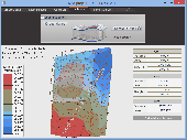
JointMetriX3D is an innovative system for measuring and assessing rock and terrain surfaces used in geotechnics, engineering geology, and Surveying. It delivers outstanding detailed 3D images and provides 3D software for getting measurements.
The system has significant influence on safety when applied in tunnelling, mining, terrain assessments, or various documentation purposes as...
Category: Software Development / Help File Utilities
Publisher: 3GSM, License: Demo, Price: USD $0.00, File Size: 2.3 KB
Platform: Windows
Leica X-change provides a seamless link between Leica System 1200 Surveying equipment and the Autodesk Civil 3D 2009 and 2010 environment. Autodesk became best known for AutoCAD but now develops a broad range of software for design, engineering, and entertainment as well as a line of software for consumers, including Sketchbook, Homestyler, and Pixlr.
Category: Multimedia & Design / Multimedia App's
Publisher: Leica Geosystems, License: Freeware, Price: USD $0.00, File Size: 10.7 MB
Platform: Windows
Available at two levels of productivity (Advanced and Standard), Trimble Business Center provides the key functionality needed to finish work faster.
Trimble Business Center is a powerful Surveying application that is the perfect desktop complement to Trimble's full range of survey solutions. Edit, process, and adjust data from all Trimble Surveying instruments...
Category: Business & Finance / Business Finance
Publisher: Trimble Navigation Limited, License: Demo, Price: USD $0.00, File Size: 0
Platform: Windows
UK Based Civil Engineering and Surveyor Software Developers, covering all aspects of Surveying and engineering including digital terrain modeling.
- Reduce Traverse and Resection Observations?
- Reduce Field Observations?
- Reduce Levels?
- Compute Least Squares Solutions
Category: Home & Education / Miscellaneous
Publisher: NRG Surveys, License: Shareware, Price: USD $161.00, File Size: 17.6 MB
Platform: Windows
A comprehensive field software for Windows OS to control your receivers, automate GNSS post processing Surveying tasks (Static, Fast Static, Stop&Go, Data Acquisition), and to perform RTK survey and stakeout tasks with the following features:
- Always provides information on receiver while Surveying.
- Data logging to receiver and controller.
-...
Category: Utilities / Misc. Utilities
Publisher: JAVAD GNSS Inc., License: Freeware, Price: USD $0.00, File Size: 25.9 MB
Platform: Windows
SURPAC Surveying Software consists of eight Modules, whose applications are accessed via seven pull-down Menus.The SURPAC "Lite" Module consisting of the General Menu applications, plus certain applications from other Menus. Least Squares Module consisting of the Least Squares Menu applications.
Category: Home & Education / Miscellaneous
Publisher: Keith W. Young, License: Shareware, Price: USD $0.00, File Size: 30.9 MB
Platform: Windows
Magellan Real Time Data Server ( RTDS ) is a new software offering land Surveying companies the possibility of using GNSS equipment to build their own direct IP RTK corrections server.
The RTDS software will collect corrections sent by a GNSS base station and act as a gateway to make them available to any rover that connects to the software. Magellan RTDS is a PC software...
Category: Internet / Misc. Servers
Publisher: Plaska GPS Service, Inc., License: Demo, Price: USD $0.00, File Size: 24.6 MB
Platform: Windows
CopanMobile for Palm OS is a very functional and easy-to-use geomatics engineering tool for computing and managing plane Surveying and mapping coordinates. It does numerous coordinate geometry (COGO) calculations, processes and adjusts raw field survey data, computes and adjusts map traverse data, performs map or deed checks, calculates curves, areas and perimeters, performs coordinate...
Category: Multimedia & Design / Multimedia App's
Publisher: Underhill Geomatics Ltd., License: Freeware, Price: USD $0.00, File Size: 341.0 KB
Platform: Palm
CopanMobile for Pocket PC is a very functional and easy-to-use geomatics engineering tool for computing and managing plane Surveying and mapping coordinates. It does numerous coordinate geometry (COGO) calculations, processes and adjusts raw field survey data, computes and adjusts map traverse data, performs map or deed checks, calculates curves, areas and perimeters, performs coordinate...
Category: Business & Finance / Applications
Publisher: Underhill Geomatics Ltd., License: Freeware, Price: USD $0.00, File Size: 341.0 KB
Platform: Windows
Terra Excess is land Surveying and civil engineering CAD software developed to be extremely intuitive. Even by those without previous experience, Terra Excess will allow you to handle the following tasks in just a few minutes - GENERATING AND LABELING CONTOUR LINES IN ORDER TO PRODUCE TOPOGRAPHIC PLANS AND MAPS: Terra Excess can generate contour lines from topographic survey data...
Category: Multimedia & Design / Graphics Viewers
Publisher: Terra Excess Software, License: Shareware, Price: USD $298.00, File Size: 46.0 MB
Platform: Windows
Copan for Pocket PC is a very functional and easy-to-use geomatics engineering tool for computing and managing plane Surveying and mapping coordinates.
It does numerous coordinate geometry (COGO) calculations, processes and adjusts raw field survey data, computes and adjusts map traverse data, performs map or deed checks, calculates curves, areas and perimeters, performs...
Category: Multimedia & Design / Multimedia App's
Publisher: Underhill Geomatics Ltd, License: Freeware, Price: USD $0.00, File Size: 662.0 KB
Platform: Windows
Copan for Mobile 6 is a very functional and easy-to-use geomatics engineering tool for computing and managing plane Surveying and mapping coordinates.
It does numerous coordinate geometry (COGO) calculations, processes and adjusts raw field survey data, computes and adjusts map traverse data, performs map or deed checks, calculates curves, areas and perimeters, performs...
Category: Multimedia & Design / Multimedia App's
Publisher: Underhill Geomatics Ltd, License: Freeware, Price: USD $0.00, File Size: 662.0 KB
Platform: Windows
Stand alone software version of the pavement design portion of the CECALC website.
Stand alone software version of the pavement design portion of the CECALC website. Runs on the Windows .NET platform. Performs civil engineering calculations for traffic/road geometry, Surveying/earthwork, pavement, concrete floors and unit conversions.
Category: Multimedia & Design / Image Editing
Publisher: Up2Specs Engineering, License: Demo, Price: USD $0.00, File Size: 9.9 MB
Platform: Windows
GROMA is a program designed for geodetic calculations.
GROMA is a program designed for geodetic calculations. It works under all versions of 32bit MS Windows. System is designed for processing of geodetic measurements from raw fieldbook data to result coordinates, reports and check graphics. This system is used at all Czech Cadastral Offices and its branches all over the Czech Republic as well as at hundreds of private Surveying companies.
Category: Business & Finance / Applications
Publisher: GEOLINE, spol. s r.o., License: Shareware, Price: USD $0.00, File Size: 0
Platform: Windows

iPJC is an easy-to-use record keeping system for the land surveying industry.
iPJC is an easy-to-use record keeping system for the land Surveying industry. It allows your staff to securely store, retrieve and cross-reference all of your company's survey database records -- of estimates, plans, jobs and contacts -- using your web browsers.
It is an open-source system, based on industry-standard web and database server technology. Different levels of...
Category: Business & Finance / Database Management
Publisher: Underhill Geomatics Ltd, License: Freeware, Price: USD $0.00, File Size: 6.5 MB
Platform: Windows, Linux, Mac
VisiWave Site Survey is a complete 802.
VisiWave Site Survey is a complete 802.11a/b/g/n site Surveying solution. You can collect survey data using a standard wireless adapter while walking around the survey area clicking on a floor plan image, using a GPS receiver to track your location, or using a customized navigation device.
VisiWave quickly and automatically maps out radio characteristics in the survey area...
Category: Internet / Monitoring
Publisher: AZO Technologies, Inc., License: Shareware, Price: USD $549.00, File Size: 7.1 MB
Platform: Windows
Copan Pro -- for Windows 98, NT, 2000, ME, XP, Vista, or 7 -- is a very functional and easy-to-use desktop/netbook geomatics engineering tool for computing and managing plane land Surveying and mapping coordinates, and drafting survey maps and plans.
It does numerous coordinate geometry (COGO) calculations, processes and adjusts raw field survey data, computes and adjusts map...
Category: Multimedia & Design / Multimedia App's
Publisher: Underhill Geomatics Ltd, License: Demo, Price: USD $650.00, File Size: 9.0 MB
Platform: Windows
All the lisps and macros have been provided considering the needs of thousands of professionals in the Civil and Surveying Industry. This area was extensively researched and designed this product to directly target their needs and demands.
Under Text categories, you can rotate, change angle or align texts with respect to selected text or parallel to line. Also, you can...
Category: Business & Finance / Business Finance
Publisher: E Surveying Solutions, License: Demo, Price: USD $0.00, File Size: 9.2 MB
Platform: Windows
PhotoModeler photogrammetry software provides image-based modeling, for accurate measurement and 3D models in engineering, architecture, film, forensics, and more! The most cost-effective and affordable way to do accurate 3D scanning, measurement and Surveying.
Category: Multimedia & Design / Multimedia App's
Publisher: Eos Systems Inc., License: Shareware, Price: USD $995.00, File Size: 61.4 MB
Platform: Windows
Flexijet is a new, revolutionary CAD-Measuring system with a diversity that enables first-time users, all-rounders and specialists with the optimum measurement creation.
Whether stonemasonry, fair-, stairways- or furniture design, carpentry, land Surveying or kitchen fitting: Flexijet qualifies for diverse measuring assignments; the possibilities of application are just...
Category: Multimedia & Design / Image Editing
Publisher: Techni-Soft GmbH, License: Demo, Price: USD $0.00, File Size: 24.8 MB
Platform: Windows