Free Downloads: Terrain Cad
Terrain Generator Terrain Generator allows you to generate terrain for specific games.
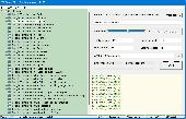
Terrain Generator Terrain Generator allows you to generate Terrain for specific games. You can specify almost everything when it's about creating a Terrain which then later can be used aside textures for a beautiful product. The program can export to different file formats for easy integration.
Category: Games / Tools & Editors
Publisher: Ryan Gregg, License: Freeware, Price: USD $0.00, File Size: 522.8 KB
Platform: Windows
Terrain for Rhino is a terrain modeling plug-in for Rhinoceros (commonly known as Rhino).
Terrain for Rhino is a Terrain modeling plug-in for Rhinoceros (commonly known as Rhino). This plug-in gives Rhino the ability to create a Terrain mesh from a set of unordered points. The Terrain mesh is created as a Delaunay Triangulation, which is regarded as the best method to create a Terrain mesh from unorganized point data. Terrain for Rhino is...
Category: Multimedia & Design / Multimedia App's
Publisher: SYCODE, License: Commercial, Price: USD $95.00, File Size: 2.2 MB
Platform: Windows
Terrain for AutoCAD is a terrain modeling plug-in for AutoCAD.
Terrain for AutoCAD is a Terrain modeling plug-in for AutoCAD. This plug-in gives AutoCAD the ability to create a Terrain mesh from a set of unordered points, lines, polylines and splines. The Terrain mesh is created as a Delaunay Triangulation, which is regarded as the best method to create a Terrain mesh from unorganized point data. Terrain for...
Category: Multimedia & Design / Multimedia App's
Publisher: SYCODE, License: Commercial, Price: USD $195.00, File Size: 2.6 MB
Platform: Windows
With this FREE AutoCAD add-on you can create Terrain sections
from geodetic points(heights) in the drawing. You can also
specify position of pipe(cable, road, ...) or set auxiliary
marks in the section.
Text settings, scale in X,Y axis, height of the reference
plane and type of the Terrain section can be set at start-up.
There are two ways how you can create...
Category: Multimedia & Design / Multimedia App's
Publisher: Cadhedral, License: Freeware, Price: USD $0.00, File Size: 69.0 KB
Platform: Windows
While the Terrain that ships out-of-the-box with FSX is much-improved over previous versions, the newly-enhanced Terrain engine still leaves much vacant capabilities to fill. So FSGenesis has bumped it up a notch, filling those capabilities while providing our most accurate and detailed Terrain yet, taking advantage of the efficiency of the new all-LODs-in-one-file format...
Category: Home & Education / Miscellaneous
Publisher: FSGenesis, License: Freeware, Price: USD $0.00, File Size: 28.0 MB
Platform: Windows
Introducing you AEC Terrain interface which is designed to simplify Terrain management and 3D-modeling. AEC Terrain creates Digital Elevation Model from multiple input point files on AutoCAD graphic editor. All purpose multi-level pads, road alignments, mining applications and airfields can be generated on the Terrain on different layers with different slope...
Category: Business & Finance / Project Management
Publisher: AEC Logic Private Limited, License: Shareware, Price: USD $750.00, File Size: 16.3 MB
Platform: Windows


 Shareware
Google Maps Terrain Downloader is a tool that can automatically download the google Terrain maps images to your PC. It can download the small tiles and save them to your hard disk. After downloading, you can view the maps offline by its tool Maps Viewer, or you can combine the small images into one big map image. If you want to make a map of your city by yourself, it is very...
Category: Internet / Download Managers
Publisher: allmapsoft.com, License: Shareware, Price: USD $29.99, File Size: 305.3 MB
Platform: Windows
P-CAD 2004 Libraries is part of the P-CAD 2004 Service Pack 4.
P-Cad 2004 Libraries is part of the P-Cad 2004 Service Pack 4. P-Cad 2004 Service Pack 4 (SP4) includes over 120 features and enhancements, further strengthening system performance and delivering increased stability. Any prior version of P-Cad 2004 can be upgraded directly to P-Cad 2004 SP4.
Category: Multimedia & Design / Image Editing
Publisher: Altium Limited, License: Freeware, Price: USD $0.00, File Size: 291.5 MB
Platform: Windows
Terrain Tools - Create maps quickly and easily!
Terrain Tools - Create maps quickly and easily!
Terrain Tools is the ideal tool for outdoor recreationists, real-estate professionals, farmers, ecologists, archaeologists and others who need to create basic maps, calculate areas, lengths, bearings and distances.
Overlay GPS tracks on scanned images such as USGS or Canadian NTS topos. Import and export...
Category: Business & Finance / Applications
Publisher: Softree, License: Shareware, Price: USD $124.00, File Size: 15.0 MB
Platform: Windows
Oriantica is the new generation orienteering simulation software.
Oriantica is the new generation orienteering simulation software. Using a map and a compass you have to find your way through the Terrain to locate the controls as fast as possible.
In Oriantica it is possible to compete with other players over a network, or play against the computer.
The map and Terrain is much more flexible than in previous versions, with more...
Category: Games / Misc. Games
Publisher: Melin Software HB, License: Shareware, Price: USD $39.00, File Size: 16.5 MB
Platform: Windows
SC3K Map Editor is the fastest and most accurate Terrain editor currently available for SimCity 3000. It gives you the finest possible control over modifications to your Terrain.
With SC3K Map Editor you can use an interface very similar to that given by SimCity 3000 so that you can see exactly what your Terrain will look like as you create it.
Also you...
Category: Games / Tools & Editors
Publisher: Tenermerx Software, License: Freeware, Price: USD $0.00, File Size: 990.5 KB
Platform: Windows
FSGenesis is your one-stop supplier for top-quality terrain mesh products for FS2004 and FSX.
FSGenesis is your one-stop supplier for top-quality Terrain mesh products for FS2004 and FSX. Since 1996 we have provided the world-wide flight simulator community with high-quality products at a low price. If you're looking for Terrain mesh for Microsoft Flight Simulator, look no further.
Category: Games / Simulations
Publisher: FSGenesis, License: Freeware, Price: USD $0.00, File Size: 116.0 MB
Platform: Windows
Cad Closure allows you to generate geometric closures from the dimension text (not line properties) in your Cad drawing. Works seamlessly with AutoCAD but it is not required as Cad Closure contains its own built-in viewer. The closure graphic is developed in real-time as you select the text. Cad Closure will compute area and check curves to see if they are...
Category: Business & Finance / Applications
Publisher: Gateway Software Productions, License: Shareware, Price: USD $400.00, File Size: 15.3 MB
Platform: Windows
SurfMate is a digital Terrain modelling and earthworks design solution giving the designer many enhanced features for use in Digital Terrain Modelling and Earthworks design completely integrated with AutoCAD.
TECHNoCAD have put great effort into packing as many useful options as possible into the software to make it the most valuable add-on to AutoCAD available to the...
Category: Multimedia & Design / Image Editing
Publisher: TECHNoCAD, License: Demo, Price: USD $0.00, File Size: 78.5 MB
Platform: Windows
EaziCAM is a 2D and 3D CAD/CAM system.
EaziCAM is a 2D and 3D Cad/CAM system.
Using EaziCAM you can programme drilling, profiling, pocketing and contouring operations from Cad data or models. EaziCAM is based on the EaziForm Cad/CAM software used by the automotive industry to rapidly manufacture 3D form-blocks for assembly lines and fixtures.
Category: Business & Finance / Applications
Publisher: Conqueror Design and Engineering Limited, License: Shareware, Price: USD $350.00, File Size: 7.0 MB
Platform: Windows
Creeper World 2 thrusts you into the 14th millennium fighting an enemy that flows and oozes through the Terrain. Employ advanced weapons, gravity manipulating repulsors, wormhole like rifts, and your own wit against this never yielding enemy.
Excavate Terrain, unearth techs, crystals, remnants and other artifacts. Face a new mechanical enemy that employs gravity manipulation...
Category: Games / Kids
Publisher: Knuckle Cracker, LLC, License: Shareware, Price: USD $9.95, File Size: 30.1 MB
Platform: Windows
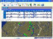
Importation/Exportation: Import/export trails to gpx file. Unlimited number of trails, and TrackPoints. Export to gpx, Excel, PDF, XPS and KML/KMZ. Data table: Very flexible data table that allows sorting by columns, with inheritance of data, attributes, etc. Presentation on map: View on map in accordance with the active trail, which comes from providers of maps, as in 'Satellite' mode...
Category: Home & Education / Miscellaneous
Publisher: Aplicaciones Topográficas S.L., License: Freeware, Price: USD $0.00, File Size: 27.0 MB
Platform: Windows
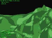
Visual Terrain Maker is a 3D-Modeling program allows visually create landscapes (maps) for games or other purposes. Works in XP/NT/2k. The program can export to Direct X file format(*.x). The program is not critical to the video adapters and drivers. Suitable for Dark Basic developers. No special software and hardware required (just OpenGL v1.1). Visual Terrain Maker can export to...
Category: Multimedia & Design
Publisher: UNGSoft Developers Group, License: Freeware, Price: USD $0.00, File Size: 321.2 KB
Platform: Windows
Convert Cad plans and drawings from DXF file format into the PDF file format. This is usefull if you need to make sure that everyone can view your Cad plans without the need to have a Cad application installed. So you can publish your Cad drawing on internet or send it as email. The program saves all layout inside of one or multiple PDF files. You only have to select...
Category: Business & Finance
Publisher: CAD-KAS GbR, License: Demo, Price: USD $49.00, File Size: 811.3 KB
Platform: Windows
Freeworld3D 2.4 is a fully interactive real-time 3D Terrain editor and world editor specifically designed for game development. FreeWorld3D gives you the ability to produce complete 3D Terrain, worlds and environments in a matter of no time. FreeWorld3D's ease of use and intuitive interface makes it extremely easy to use.
Category: Games / Tools & Editors
Publisher: Pariman, License: Freeware, Price: USD $0.00, File Size: 5.2 MB
Platform: Windows
JointMetriX3D is an innovative system for measuring and assessing rock and Terrain surfaces used in geotechnics, engineering geology, and surveying. It delivers outstanding detailed 3D images and provides 3D software for getting measurements.
The system has significant influence on safety when applied in tunnelling, mining, Terrain assessments, or various documentation...
Category: Software Development / Help File Utilities
Publisher: 3GSM, License: Demo, Price: USD $0.00, File Size: 2.3 KB
Platform: Windows
RED CAD EI
The easiest way of drawing professional electrical installation plans.
RED Cad EI
The easiest way of drawing professional electrical installation plans.
As an electrician or planner you receive the plans from architects or owners as a pdf file. The pdfs are imported to RED Cad and converted to the RED Cad format.
After the import of a pdf the scale of the plan is not known. Therefore you need to define a...
Category: Multimedia & Design / Image Editing
Publisher: RED CAD GmbH, License: Shareware, Price: USD $0.00, File Size: 34.5 MB
Platform: Windows
Adobe Illustrator ~2D-CAD Component Plug-in~.
Adobe Illustrator ~2D-Cad Component Plug-in~. Cad-COMPO 2 is a plug-in software includes "BPT-Pro2" and "EXDXF-Pro2". "BPT-Pro2" is a software to add a highly functional 2D-Cad program into Illustrator. "EXDXF-Pro2" provides that to import Cad standard DXF files to Illustrator, and to export AI files to Cad. Illustrator...
Category: Multimedia & Design / Multimedia App's
Publisher: BABY UNIVERSE inc., License: Shareware, Price: USD $150.00, File Size: 4.3 MB
Platform: Mac
GTXImage Cad is a total raster and vector drawing system for bringing paper drawings into a modern Cad, EDM or GIS environment. It includes powerful, industry standard two-dimensional Cad functionality that fully supports comprehensive hybrid raster and vector capabilities. It also provides highly efficient raster enhancement and editing features that permit you to make the...
Category: Multimedia & Design / Image Editing
Publisher: GTX, License: Freeware, Price: USD $0.00, File Size: 248.0 MB
Platform: Windows
Ashampoo 3D Cad Professional 3, is the most extensive software in the software series Cad & Construction by Ashampoo,it combines a quick start and intuitive handling with highly professional Cad features,.Plan your building and furnishing projects yourself on your PC with Ashampoo 3D Cad Professional 3.
Category: Multimedia & Design / Image Editing
Publisher: ashampoo GmbH & Co. KG, License: Shareware, Price: USD $0.00, File Size: 1014.2 MB
Platform: Windows

