Free Downloads: Transverse Mercator
License: All | Free
 Shareware
The Eye4Software Coordinate Calculator is an easy to use tool to perform map or GPS coordinate conversions. The software can be used to transform a single coordinate or a batch of coordinates read from a comma separated, database or ESRI shapefiles. The software is shipped with a MS Access database file, containing more then 3500 ellipsoid, map datum and map grid definitions around the world,...
Category: Business & Finance / Calculators
Publisher: Eye4Software B.V., License: Shareware, Price: USD $49.00, EUR39, File Size: 3.2 MB
Platform: Windows
PHOTOMOD GeoCalculator is the software for points coordinates transformation, included in the PHOTOMOD system, as well as a stand-alone free application.
Its installation package includes databases of reference systems used in the world and in Russia (approximately 1500 reference systems). User can also add reference systems on his own by specifying:
-units (coefficient for...
Category: Business & Finance / Applications
Publisher: Racurs, License: Freeware, Price: USD $0.00, File Size: 7.6 MB
Platform: Windows
Shareware
Toolkit to add GPS functionality to your software and scripts (GPS SDK). All NMEA0183 protocol versions are supported and can be filtered by NMEA sentence type and talker ID. Information on GPS status can also be retrieved: GPS fix quality, satellites used in fix, satellites in view, satellite azimuth, elevation and signal strengths. The toolkit also offers functionality to perform map grid...
Category: Software Development / ActiveX
Publisher: Eye4Software B.V., License: Shareware, Price: USD $150.81, File Size: 1.6 MB
Platform: Windows
Shareware
Java toolkit to add coordinate conversion functionality to your Java applications and applets. The toolkit offers functionality to perform map grid and datum transformations: latitude and longitude can be converted to various map grids, like Transverse Mercator (TM), Oblique Mercator, Mercator, Oblique Stereographic, Polar Stereographic, Cassini, Albers Equal Area...
Category: Software Development / Components & Libraries
Publisher: Eye4Software B.V., License: Shareware, Price: USD $199.00, EUR179, File Size: 155.5 KB
Platform: Unknown
GeoDataSource Cities Database Gold Edition contains 2.
GeoDataSource Cities Database Gold Edition contains 2.9+ million entries with city names in original language and English, feature type classifications, country names in FIPS and ISO, regions, sub-regions, state or First-Order Administrative Division, county or Second-Order Administrative Division, longitude and latitude in degree and decimal, Univeral Transverse Mercator...
Category: Web Authoring / Web Design Utilities
Publisher: GeoDataSource.com, License: Data Only, Price: USD $1049.95, File Size: 164.0 KB
Platform: Windows, Mac, Palm
Shareware
GPS SDK to add GPS and coordinate conversion functionality to your software and scripts). All NMEA0183 protocol versions are supported and can be filtered by NMEA sentence type and talker ID. Garmin USB PVT support. Information on GPS status can also be retrieved: GPS fix quality, satellites used in fix, satellites in view, satellite azimuth, elevation and signal strengths. The toolkit also...
Category: Software Development
Publisher: Eye4Software B.V., License: Shareware, Price: USD $99.00, EUR79, File Size: 2.3 MB
Platform: Windows
You have the choice of spherical, cylindrical, Lambert and Mercator projections.
You have the choice of spherical, cylindrical, Lambert and Mercator projections.
All coordinates are precessed to the nearest Julian day at which the sky is being viewed. If proper motions are available then these are used to correct star positions. Planet positions are accurate to 30 arcseconds over the next 180 years.
Main Features:
- Creates simple maps...
Category: Home & Education / Astrology & Numerology
Publisher: Marc R. Baril, License: Freeware, Price: USD $0.00, File Size: 18.5 MB
Platform: Windows
Animated display drawn to perspective of a horizontally and a vertically polarized transverse wave together with their superposition (resultant wave)
Category: Home & Education / Science
Publisher: MichaelGraphics, License: Freeware, Price: USD $0.00, File Size: 0
Platform: Windows
GeoDataSource Cities Database Gold Edition contains 2.9+ million entries with city names in original language and English, feature type classifications, country names in FIPS and ISO, regions, sub-regions, state or First-Order Administrative Division, county or Second-Order Administrative Division, longitude and latitude in degree and decimal, Univeral Transverse Mercator...
Category: Security & Privacy / Other
Publisher: GeoDataSource.com, License: Data Only, Price: USD $1049.95, File Size: 160.3 KB
Platform: Windows, Mac, Linux, Palm,
Making Waves is an interactive wave construction set that allows students to create and explore situations involving any number of Transverse and longitudinal waves. This software takes an interactive, visual approach to physics. Making Waves will help students develop an intuition for wave interactions. Students will gain a better understanding of the physics behind the images. By...
Category: Home & Education / Miscellaneous
Publisher: Living Graphs Inc., License: Commercial, Price: USD $24.00, File Size: 1.1 MB
Platform: Windows
The GeoDataSource .NET Control works with Microsoft Access, SQL Server and mySQL to query the complete GeoDataSource World Cities Database (Basic, Premium and Gold Edition). You can use the software object to query database by city and also calculate the distance between two cities or two latitude and longitude sets. This component will help developers to speed up the integration of the...
Category: Web Authoring / Site Management
Publisher: GeoDataSource.com, License: Shareware, Price: USD $99.95, File Size: 1.2 MB
Platform: Windows
Features
Freeais.org is a Java based application to receive AIS information from vessels.
Freeais.org is a software for:
Monitoring of vessels with our own sea chart rendering engine
Search for a vessel with a certain criteria
You do not know where to find your vessel? No problem, just search it!
Sea chart calibration
calibrate “raw” card...
Category: Multimedia & Design / Graphics Viewers
Publisher: Freeais.org, License: Shareware, Price: USD $0.00, File Size: 3.7 MB
Platform: Windows
RISAMasonry offers a complete answer for analysis and design of masonry construction.
RISAMasonry offers a complete answer for analysis and design of masonry construction. RISAMasonry designs masonry walls, columns and beams (lintels) to the latest codes and includes a library of masonry units. The program addresses the working stress design of beams, columns and both in-plane and out-of-plane walls. The program designs slender walls using the iterative strength design...
Category: Multimedia & Design / Image Editing
Publisher: RISA Technologies, License: Demo, Price: USD $0.00, File Size: 108.0 MB
Platform: Windows
EM3DS (ElectroMagnetic 3D Simulator) is an equation based electromagnetic wave simulator.
EM3DS (ElectroMagnetic 3D Simulator) is an equation based electromagnetic wave simulator. It uses a technique called Generalized Transverse Resonance Diffraction (GTRD) , developed by MEM (Microwave and ElectroMagnetics) Research. This simulator accounts for thickness, conductivity, etc. of real conductors or dielectrics.
The free version is an educational tool with less...
Category: Home & Education / Miscellaneous
Publisher: MEM Research, License: Freeware, Price: USD $0.00, File Size: 34.5 MB
Platform: Windows
DPLOT95 is a software for creating and manipulating graphs in 1, 2, 3, and 4-D.
DPLOT95 is a software for creating and manipulating graphs in 1, 2, 3, and 4-D. With its help you you can create presentation-quality graphs as well as contour plots of 3-D and 4-D data while using data from a variety of sources. You can use multiple scaling types, including linear, logarithmic, and probability scales on the X and/or Y axes. DPlot also provides several special purpose scale...
Category: Multimedia & Design / Multimedia App's
Publisher: USAERDC, License: Shareware, Price: USD $195.00, File Size: 9.9 MB
Platform: Windows
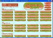
Genius Maker contains 32 educational softwares covering the subjects Mathematics, Physics and Chemistry for High school students. It includes Graph plotter, Analytical geometry, Matrix algebra, Equation solver, Triangle solver, Unit converter, Refraction of rays, Lens and mirrors, Color theory, Transverse waves, Radioactive decay, Periodic table, Gas Laws etc. Out of the 32 softwares,...
Category: Home & Education / Science
Publisher: Golden K star Private Ltd, License: Freeware, Price: USD $0.00, File Size: 3.4 MB
Platform: Windows
The CANVAS 9 GIS Mapping Edition adds native support for Geographic Information System (GIS) data to Canvas. You can take measurements in geographic coordinates, import industry standard SHAPE and GeoTIFF files into unlimited numbers of automatically aligned overlapping layers and choose among the following options: 2,104 Coordinate Reference Systems 67 Operation Methods (like Mercator,...
Category: Multimedia & Design / Multimedia App's
Publisher: ACD Systems, License: Shareware, Price: USD $549.99, File Size: 51.9 MB
Platform: Mac, PPC
Taskforce is a turn based strategy game where you command an elite team of soliders on a variety of missions. As a Taskforce Commander, you will control Taskforce team TF1 to fight exciting and terrifying enemies as you Transverse a complex plot that starts with a seemingly ordinary hostage situation. Taskforce: The Mutants Of October Morgane is a squad level turn based strategy game in...
Category: Games / Misc. Games
Publisher: Cornutopia, License: Shareware, Price: USD $24.00, File Size: 5.9 MB
Platform: Windows
Shareware
PANOVOLO is a tool for the precise stitching of drone-captured panoramas.
PANOVOLO is a specialized software tool engineered for the precise stitching of drone-captured panoramas. It integrates advanced algorithms with the image location and orientation metadata saved by drones to facilitate rapid and reliable panorama creation. Image Compatibility: Processes both JPEG and DNG (RAW) images, offering users flexibility in image selection. When working with...
Category: Multimedia & Design / Image Editing
Publisher: Simulogic Inc., License: Shareware, Price: USD $29.99, File Size: 38.4 MB
Platform: Windows
The CANVAS 9 Advanced GIS Mapping Edition adds native support for Geographic Information System (GIS) data to Canvas. You can take measurements in geographic coordinates, import industry standard SHAPE and GeoTIFF files into unlimited numbers of automatically aligned overlapping layers and choose among the following options:2,104 Coordinate Reference Systems67 Operation Methods (like...
Category: Multimedia & Design / Multimedia App's
Publisher: ACD Systems, License: Shareware, Price: USD $999.95, File Size: 54.2 MB
Platform: Windows
The CANVAS 9 Advanced GIS Mapping Edition adds native support for Geographic Information System (GIS) data to Canvas. You can take measurements in geographic coordinates, import industry standard SHAPE and GeoTIFF files into unlimited numbers of automatically aligned overlapping layers and choose among the following options:·2,104 Coordinate Reference Systems·67 Operation Methods...
Category: Multimedia & Design / Multimedia App's
Publisher: ACD Systems, License: Shareware, Price: USD $999.95, File Size: 51.9 MB
Platform: Mac, PPC
With Fath ImageX control you can easily add bitmap image view, print, create and convert capabilities to your applications.
It supports methods to create image viewer or full-featured graphics editor application.
Features:
- Load and save various image formats
- Easily print images
- Resize, create thumbnails, change bit-depth of images
- Apply various image...
Category: Multimedia & Design / Digital Media Editors
Publisher: Fath Software, License: Shareware, Price: USD $199.00, File Size: 1.5 MB
Platform: Windows
spBeam is highly efficient and widely used for analysis, design, and investigation of beams and one-way slabs in reinforced concrete floor systems.
spBeam features torsion effects in the shear design and investigation allowing engineers to achieve more economical cross sections where coupled shear and torsion occur (in accordance with US and Canadian codes). Save more in both material and...
Category: Multimedia & Design / Multimedia App's
Publisher: STRUCTUREPOINT, LLC, License: Shareware, Price: USD $995.00, File Size: 19.1 MB
Platform: Windows
With XYit you can digitize the xy co-ordinates of points & lines within images, enabling you to capture their original x-y values. And you can do the reverse, plotting xy numerical data back onto an image, ideal for making maps of proposed routes for reports, or for automated graph plotting to a pre-existing image. FacilitiesXYit offers full manual digitizing facilities with an on-screen...
Category: Business & Finance / Personal Finance
Publisher: Geomatix, License: Shareware, Price: USD $89.00, File Size: 3.1 MB
Platform: Windows
License: All | Free