Free Downloads: Vector City Maps
 Demo
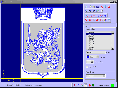
DemoCreate City Maps that look perfect on screen and on paper. Standard City Icons come in a variety of sizes and resolutions, making City plans perfectly legible on any media from PDA screens to poster-size prints. The smallest size is 16x16, but the largest-resolution versions are in 1200x1200 pixels. Objects of City infrastructure are shown in the isometric...
Category: Desktop Enhancements / Icon Tools
Publisher: Aha-Soft, License: Demo, Price: USD $99.95, EUR79.95, File Size: 2.7 MB
Platform: Windows, Mac, Linux,
Roleplaying gamemasters know how time-consuming the generation of city maps can be.
Roleplaying gamemasters know how time-consuming the generation of City Maps can be. The Roleplaying City Map Generator does this job comfortably in few minutes requiring only a couple of mouseclicks for generating and printing realistic Maps of e. g. villages, medieval towns, or big cities. You define the values of various City-parameters, either manually or...
Category: Games / Adventure & RPG
Publisher: BHS, License: Shareware, Price: USD $0.00, File Size: 0
Platform: Windows
An exceptional tool for drawing publication and Vector catalog quality Maps and designing cloning experiments.
Whether you are a catalog company selling engineered plasmids or conducting restriction or recombinant cloning experiments, SimVector will help you simulate the experiments and create publication quality Maps from start to finish. Use it to draw...
Category: Multimedia & Design / Digital Media Editors
Publisher: Biosoft Internationa, License: Shareware, Price: USD $885.00, File Size: 28.8 MB
Platform: Windows
SeeYou is a flight planning and analysis tool for glider pilots.
SeeYou is a flight planning and analysis tool for glider pilots. It is designed for both desktop and notebook PCs.
Main features:
- Vector Maps: Vector Maps are sharp, fast and accurate at all zoom settings. Objects are presented in the detail, that keeps the map readable.
- Raster Maps. They are bitmap files, useful for...
Category: Games / Simulations
Publisher: Naviter d.o.o., License: Shareware, Price: USD $167.22, File Size: 17.4 MB
Platform: Windows
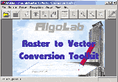
Vectorizer for CAD/CAM/GIS professionals, designers and illustrators. Available also as Raster to Vector SDK, ActiveX and Com Component. Converts, digitizes and refines architectural, mechanical, various technical drawings, Maps, math graphs, graphics for books and journals and more from raster to Vector. Digitizes math graphics. Also refines Vector graphics,...
Category: Multimedia & Design / Image Editing
Publisher: Algolab, License: Shareware, Price: USD $99.00, File Size: 1.7 MB
Platform: Windows
Shareware
Google Hybrid Maps Downloader is a tool that can automatically download the google hybrid Maps images to your PC. It can download the small tiles and save them to your hard disk. After downloading, you can view the Maps offline by its tool Maps Viewer, or you can combine the small images into one big map image. If you want to make a map of your City by...
Category: Internet / Download Managers
Publisher: allmapsoft.com, License: Shareware, Price: USD $29.99, File Size: 30.6 MB
Platform: Windows
Shareware
Google Maps Terrain Downloader is a tool that can automatically download the google terrain Maps images to your PC. It can download the small tiles and save them to your hard disk. After downloading, you can view the Maps offline by its tool Maps Viewer, or you can combine the small images into one big map image. If you want to make a map of your City by...
Category: Internet / Download Managers
Publisher: allmapsoft.com, License: Shareware, Price: USD $29.99, File Size: 305.3 MB
Platform: Windows
MOTOEXTRAS™ offers several bundles of popular Maps and other extra content such as 3D City Maps at special prices. MOTONAV Toolbox is a FREE Windows utility designed to connect your navigation device with your PC.
You must download it to see all available updates, purchase updates, download the necessary files and upload updates and new content to your...
Category: Multimedia & Design / Graphics Viewers
Publisher: Nav N Go Kft., License: Freeware, Price: USD $0.00, File Size: 8.0 MB
Platform: Windows
From Prague castle to the New Town - the 10 best of everything to see, buy, do, taste and avoid in Prague, plus Maps and a Metro map.
Discover the most haunted sites in the medieval City, the greatest Czech writers and composers, unmissable museums and galleries, most fun places for kids, top restaurants and cafes, best hotels on every budget and much more.
With...
Category: Internet / Communications
Publisher: Mobile Systems, License: Shareware, Price: USD $9.80, File Size: 0
Platform: Windows

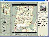
Commercial realtors require accurate and reliable tools to publish available properties online and show them on the website (specifying region, county, state, and City). We have created a unique Interactive Real Estate Map with all USA states and counties on it for real estate business. USA Real Estate Map is a unique and amazing Vector-based tool that is very simple to use....
Category: Internet
Publisher: USFlashMap.com, License: Shareware, Price: USD $399.00, File Size: 3.9 MB
Platform: Windows, Mac, Linux, Unix, MS-DOS, AS/400, OS/2
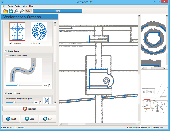
Vextractor Lite is an auto-tracing program for converting raster images into Vector formats by building centerlines and outlines. This tool could be used for the tracing photo, logotypes and other line art images for use in Vector Graphics Design software. You can also vectorize charts, drawings, Maps and schemes for input to CAD or GIS systems. Main features of...
Category: Multimedia & Design / Image Editing
Publisher: VextraSoft, License: Shareware, Price: USD $49.95, File Size: 13.2 MB
Platform: Windows
Create online and printed matters of transport infrastructure. Standard Transport Icons are drawn in four angles, come in a variety of sizes and resolutions, and are available as 3D Vector models for clear high-resolution printing. Standard Transport Icons are perfect to illustrate Web sites, brochures and presentations of any transport, logistics or shipping company, and can be used to...
Category: Desktop Enhancements / Icon Tools
Publisher: Aha-Soft, License: Demo, Price: USD $99.95, EUR79.95, File Size: 7.9 MB
Platform: Windows, Mac, Linux,
From Gothic St. Stephens Cathedral to the Imperial Palace - the 10 best of everything to see, buy, do, taste and avoid in Vienna, plus Maps and transport Maps.
Discover the best historic palaces and gardens, great walks and itineraries, most fun places for kids, venues for concerts and opera, liveliest beer halls, tastiest schnitzel and Viennese cakes, best hotels on every...
Category: Internet / Communications
Publisher: Mobile Systems, License: Shareware, Price: USD $9.80, File Size: 0
Platform: Windows

Raster to Vector is a stand-alone program that converts scanned drawings, Maps and raster images into accurate Vector files (such as DXF, HPGL, WMF, EMF, etc) for editing in any CAD application. Key Features: 1. Input image formats: BMP, JPG, TIF, GIF, PNG, PCX, TGA, RLE, JPE, J2K, JAS, JBG, MNG and more. 2. Output Vector formats: DXF, HPGL, EMF, WMF...
Category: Audio
Publisher: Raster to Vector, Inc., License: Shareware, Price: USD $99.00, File Size: 530.3 KB
Platform: Windows

Raster to Vector is a stand-alone program that converts scanned drawings, Maps and raster images into accurate Vector files (such as DXF, HPGL, WMF, EMF, etc) for editing in any CAD application. Key Features: 1. Input image formats: BMP, JPG, TIF, GIF, PNG, PCX, TGA, RLE, JPE, J2K, JAS, JBG, MNG and more. 2. Output Vector formats: DXF, HPGL, EMF, WMF...
Category: Multimedia & Design
Publisher: Raster to Vector, Inc., License: Shareware, Price: USD $99.00, File Size: 546.9 KB
Platform: Windows

Raster to Vector is a stand-alone program that converts scanned drawings, Maps and raster images into accurate Vector files (such as DXF, HPGL, WMF, EMF, etc) for editing in any CAD application. Key Features: 1. Input image formats: BMP, JPG, TIF, GIF, PNG, PCX, TGA, RLE, JPE, J2K, JAS, JBG, MNG and more. 2. Output Vector formats: DXF, HPGL, EMF, WMF...
Category: Audio
Publisher: Raster to Vector, Inc., License: Shareware, Price: USD $99.00, File Size: 546.9 KB
Platform: Windows
Raster to Vector Gold is a stand-alone program that converts scanned drawings, Maps and raster images into accurate Vector files (such as DXF, HPGL, WMF, EMF, etc) for editing in any CAD application. Key Features: 1. Input image formats: BMP, JPG, TIF, GIF, PNG, PCX, TGA, RLE, JPE, J2K, JAS, JBG, MNG and more. 2. Output Vector formats: DXF, HPGL, EMF,...
Category: Multimedia & Design
Publisher: Raster to Vector, Inc., License: Shareware, Price: USD $99.00, File Size: 530.3 KB
Platform: Windows
The world's first dynamic travel guides. Schmap 2.0 opens a new world of flexibility for browsing, searching and customizing travel guide content (reviews, photos and Maps). Once installed, simply choose from Schmap's rapidly growing series of US, European and Canadian destination guides, each with zooming, panning Maps, useful links, playable virtual tours, top picks, plus...
Category: Home & Education
Publisher: Schmap, License: Freeware, Price: USD $0.00, File Size: 1.5 MB
Platform: Windows
Software development kit for CAD/CAM/ GIS and graphic software developers.
Software development kit for CAD/CAM/ GIS and graphic software developers. Converts from raster to Vector and refines architect, mechanical, tech drawing, Maps, math graphs, graphics for books and journals and more. ActiveX and Com Component are also available. Refines Vector graphics, creates fine lines and shapes. Scanned drawings are recognized and represented in a...
Category: Software Development / Tools & Editors
Publisher: AlgoLab Inc., License: Shareware, Price: USD $0.00, File Size: 2.7 MB
Platform: Windows
Create Maps of City infrastructure including the basic facilities, services, and installations typical for an urban or sub-urban community or society. Standard Infrastructure Icons depict objects of City infrastructure such as transportation, communication, social, governmental, industrial and emergency response systems, as presented by the Federal Geographic Data Committee...
Category: Desktop Enhancements / Icon Tools
Publisher: Aha-Soft, License: Demo, Price: USD $49.95, EUR39.95, File Size: 6.6 MB
Platform: Windows, Mac, Linux,

We invite you to walk in the evening city.
We invite you to walk in the evening City. It will walk on water. On the remarkable boats you see the main attractions of the City. It is a City which dreams of any man. We give you the opportunity to go there right now.
Category: Desktop Enhancements / Screensavers
Publisher: Box2k.com, License: Freeware, Price: USD $0.00, File Size: 6.2 MB
Platform: Windows
R2V is a tool for converting raster images to Vector by drawing centerlines and outlines. R2V converts architect, mechanical and various technical drawings, Maps and other types from raster to Vector format. A Vector format can be imported into your CAD/CAM or drawing program. R2V supports the Bmp and Jpeg raster format. The output Vector file can be saved in...
Category: Multimedia & Design
Publisher: MR Soft, License: Shareware, Price: USD $42.00, File Size: 1.6 MB
Platform: Windows
Shareware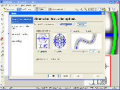
Vextractor is a vectorizer program for transforming raster images into Vector formats by building centerlines and outlines. This tool could be used for the vectorizing photo, logotypes and other line art images for use in Vector Graphics Design software. You can also vectorize charts, drawings, Maps and schemes for input to CAD or GIS systems. Main features of...
Category: Multimedia & Design / Image Editing
Publisher: VextraSoft, License: Shareware, Price: USD $99.95, File Size: 3.0 MB
Platform: Windows
Seek-and-find your way from the Emerald City to Sin City!
Seek-and-find your way from the Emerald City to Sin City!
Two games, one download! Plan a perfect wedding at a lavish casino resort in Dream Day Wedding: Viva Las Vegas! Seek and find hidden gems of the ‘Emerald City’ in City Sights: Hello, Seattle!
Category: Games / Arcade
Publisher: Oberon Media, License: Shareware, Price: USD $6.95, File Size: 280.9 KB
Platform: Windows
Moagu: The Mother Of All GPS Utilities.
Moagu: The Mother Of All GPS Utilities.
You can convert USGS topographic Maps, aerial/satellite imagery, and any other raster map imagery for use on Garmin handled GPS units.
Garmin Maps have been in a "Vector" format; Moagu creates Maps using a "bitmap" format.
Category: Home & Education / Miscellaneous
Publisher: Moagu, License: Shareware, Price: USD $19.95, File Size: 38.2 MB
Platform: Windows