Free Downloads: Vector Style Planning Maps
SeeYou is a flight planning and analysis tool for glider pilots.
SeeYou is a flight Planning and analysis tool for glider pilots. It is designed for both desktop and notebook PCs.
Main features:
- Vector Maps: Vector Maps are sharp, fast and accurate at all zoom settings. Objects are presented in the detail, that keeps the map readable.
- Raster Maps. They are bitmap files, useful for...
Category: Games / Simulations
Publisher: Naviter d.o.o., License: Shareware, Price: USD $167.22, File Size: 17.4 MB
Platform: Windows
An exceptional tool for drawing publication and Vector catalog quality Maps and designing cloning experiments.
Whether you are a catalog company selling engineered plasmids or conducting restriction or recombinant cloning experiments, SimVector will help you simulate the experiments and create publication quality Maps from start to finish. Use it to draw...
Category: Multimedia & Design / Digital Media Editors
Publisher: Biosoft Internationa, License: Shareware, Price: USD $885.00, File Size: 28.8 MB
Platform: Windows
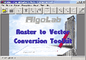
Vectorizer for CAD/CAM/GIS professionals, designers and illustrators. Available also as Raster to Vector SDK, ActiveX and Com Component. Converts, digitizes and refines architectural, mechanical, various technical drawings, Maps, math graphs, graphics for books and journals and more from raster to Vector. Digitizes math graphics. Also refines Vector graphics,...
Category: Multimedia & Design / Image Editing
Publisher: Algolab, License: Shareware, Price: USD $99.00, File Size: 1.7 MB
Platform: Windows
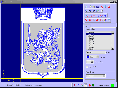
Vextractor Lite is an auto-tracing program for converting raster images into Vector formats by building centerlines and outlines. This tool could be used for the tracing photo, logotypes and other line art images for use in Vector Graphics Design software. You can also vectorize charts, drawings, Maps and schemes for input to CAD or GIS systems. Main features of...
Category: Multimedia & Design / Image Editing
Publisher: VextraSoft, License: Shareware, Price: USD $49.95, File Size: 13.2 MB
Platform: Windows

Raster to Vector is a stand-alone program that converts scanned drawings, Maps and raster images into accurate Vector files (such as DXF, HPGL, WMF, EMF, etc) for editing in any CAD application. Key Features: 1. Input image formats: BMP, JPG, TIF, GIF, PNG, PCX, TGA, RLE, JPE, J2K, JAS, JBG, MNG and more. 2. Output Vector formats: DXF, HPGL, EMF, WMF...
Category: Audio
Publisher: Raster to Vector, Inc., License: Shareware, Price: USD $99.00, File Size: 530.3 KB
Platform: Windows

Raster to Vector is a stand-alone program that converts scanned drawings, Maps and raster images into accurate Vector files (such as DXF, HPGL, WMF, EMF, etc) for editing in any CAD application. Key Features: 1. Input image formats: BMP, JPG, TIF, GIF, PNG, PCX, TGA, RLE, JPE, J2K, JAS, JBG, MNG and more. 2. Output Vector formats: DXF, HPGL, EMF, WMF...
Category: Multimedia & Design
Publisher: Raster to Vector, Inc., License: Shareware, Price: USD $99.00, File Size: 546.9 KB
Platform: Windows

Raster to Vector is a stand-alone program that converts scanned drawings, Maps and raster images into accurate Vector files (such as DXF, HPGL, WMF, EMF, etc) for editing in any CAD application. Key Features: 1. Input image formats: BMP, JPG, TIF, GIF, PNG, PCX, TGA, RLE, JPE, J2K, JAS, JBG, MNG and more. 2. Output Vector formats: DXF, HPGL, EMF, WMF...
Category: Audio
Publisher: Raster to Vector, Inc., License: Shareware, Price: USD $99.00, File Size: 546.9 KB
Platform: Windows
Raster to Vector Gold is a stand-alone program that converts scanned drawings, Maps and raster images into accurate Vector files (such as DXF, HPGL, WMF, EMF, etc) for editing in any CAD application. Key Features: 1. Input image formats: BMP, JPG, TIF, GIF, PNG, PCX, TGA, RLE, JPE, J2K, JAS, JBG, MNG and more. 2. Output Vector formats: DXF, HPGL, EMF,...
Category: Multimedia & Design
Publisher: Raster to Vector, Inc., License: Shareware, Price: USD $99.00, File Size: 530.3 KB
Platform: Windows
Software development kit for CAD/CAM/ GIS and graphic software developers.
Software development kit for CAD/CAM/ GIS and graphic software developers. Converts from raster to Vector and refines architect, mechanical, tech drawing, Maps, math graphs, graphics for books and journals and more. ActiveX and Com Component are also available. Refines Vector graphics, creates fine lines and shapes. Scanned drawings are recognized and represented in a...
Category: Software Development / Tools & Editors
Publisher: AlgoLab Inc., License: Shareware, Price: USD $0.00, File Size: 2.7 MB
Platform: Windows
Wedding Planning Checklist, toolbar browser for IE, Planning Wedding Guide, Wedding Planning Timeline, Planning Wedding on a budget, Wedding Planning Secrets, Tips on Planning a Wedding, For the Bride to Be, Planning Wedding of Your Dreams on a Budget, Money Saving Secrets for your Wedding, wedding invitations, wedding consultants, bride and...
Category: Internet / Browsers
Publisher: Wedding Planning Checklist, License: Freeware, Price: USD $0.00, File Size: 1.1 MB
Platform: Windows
BPC stands for Business Planning and Consolidation.
BPC stands for Business Planning and Consolidation. As the name suggest, BPC is used for both Planning and Consolidations, unlike IP, which is used for only Planning.
The concept of Planning is the same as you have in any other tool. The functional side of the Planning remains the same. However, the tool differs. The way you configure a Planning...
Category: Business & Finance / Business Finance
Publisher: SAP, License: Freeware, Price: USD $0.00, File Size: 10.5 MB
Platform: Windows
R2V is a tool for converting raster images to Vector by drawing centerlines and outlines. R2V converts architect, mechanical and various technical drawings, Maps and other types from raster to Vector format. A Vector format can be imported into your CAD/CAM or drawing program. R2V supports the Bmp and Jpeg raster format. The output Vector file can be saved in...
Category: Multimedia & Design
Publisher: MR Soft, License: Shareware, Price: USD $42.00, File Size: 1.6 MB
Platform: Windows
 Shareware
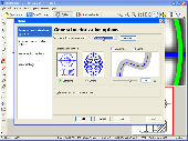
Vextractor is a vectorizer program for transforming raster images into Vector formats by building centerlines and outlines. This tool could be used for the vectorizing photo, logotypes and other line art images for use in Vector Graphics Design software. You can also vectorize charts, drawings, Maps and schemes for input to CAD or GIS systems. Main features of...
Category: Multimedia & Design / Image Editing
Publisher: VextraSoft, License: Shareware, Price: USD $99.95, File Size: 3.0 MB
Platform: Windows
Moagu: The Mother Of All GPS Utilities.
Moagu: The Mother Of All GPS Utilities.
You can convert USGS topographic Maps, aerial/satellite imagery, and any other raster map imagery for use on Garmin handled GPS units.
Garmin Maps have been in a "Vector" format; Moagu creates Maps using a "bitmap" format.
Category: Home & Education / Miscellaneous
Publisher: Moagu, License: Shareware, Price: USD $19.95, File Size: 38.2 MB
Platform: Windows
Sophistique combines the features of Vector images and a smooth drawing Style that retains the realistic appeal of Windows Vista design. It has a beautiful Style between realistic and smooth figurative appearance. Colors have been graded for a peaceful appearance which retains a lifelike taste, normally only achieved through bitmap images, but in this case presented as...
Category: Desktop Enhancements / Icons
Publisher: Iconshock - Web Icons, License: Freeware, Price: USD $0.00, File Size: 488.0 KB
Platform: Windows, Linux, Mac
Rationale is the first high-quality "argument processing" software.
Rationale is the first high-quality "argument processing" software. Use Rationale to create "argument Maps", diagrams of reasoning and argument. Rationale will help students learn the fundamentals of good reasoning, critical thinking, and argumentative essay writing. Three Map Types. Use Grouping, Reasoning, or Analysis Maps depending on the thinking task and...
Category: Home & Education
Publisher: Austhink Software, License: Demo, Price: USD $59.95, File Size: 7.8 MB
Platform: Windows
Vector Studio is an easy to use vector drawing program.
Vector Studio is an easy to use Vector drawing program. With an integrated button designer, you have the perfect tool for producing quick and easy buttons for use on your web pages or anywhere else you might need them.
In addition to powerful drawing tools that you don't have to be an expert to be able to use, Vector Studio includes access to rich resources like...
Category: Audio / Utilities & Plug-Ins
Publisher: Vector Studio, License: Shareware, Price: USD $39.99, File Size: 402.0 KB
Platform: Windows

FSS Google Maps Downloader is a tool that can download the Google Maps images to your PC. This is a clearly free program. There is no spyware or adware. It's absolutely safe to install and to run. The interface is very simple and self explaining. It runs low on system resources consumption and is supported on all Windows versions. It can save them to your hard disk,...
Category: Internet / Download Managers
Publisher: FreeSmartSoft, License: Freeware, Price: USD $0.00, File Size: 874.0 KB
Platform: Windows
Shareware
Vectorize your images into scalable and clear art! Auto Vector converts photographs and images into scalable Vector files. Vector-based graphics appear smooth at any size or resolution. Auto Vector does the conversion automatically, you don't need to do any manual tracing. Just load an image, set the level of details globally and (optionally) locally and the...
Category: Multimedia & Design / Image Editing
Publisher: Caricature Software, License: Shareware, Price: USD $49.95, File Size: 2.1 MB
Platform: Windows
Diffuse maps represent the absorption of light.
Diffuse Maps represent the absorption of light. Diffuse Maps are what people call "textures". They are the color textures or photographic textures usually applied to 3d models.
ShaderMap creates displacement Maps using the light data stored inside of diffuse Maps. Evenly lit diffuse Maps generally create better quality Maps with ShaderMap.
Category: Home & Education / Miscellaneous
Publisher: Rendering Systems Inc., License: Freeware, Price: USD $0.00, File Size: 4.0 MB
Platform: Windows
NOVA Maps provides appraisers and appraisal users with complete, high-resolution location Maps (also known as “street Maps”) for forms and addenda in seconds. NOVA Maps even automatically places labels for subject properties and comparables.
For just pennies per map and with just a click of the mouse, users have access to the entire United...
Category: Home & Education / Miscellaneous
Publisher: Day One, License: Demo, Price: USD $0.00, File Size: 5.7 MB
Platform: Windows
Shareware
Google Maps Terrain Downloader is a tool that can automatically download the google terrain Maps images to your PC. It can download the small tiles and save them to your hard disk. After downloading, you can view the Maps offline by its tool Maps Viewer, or you can combine the small images into one big map image. If you want to make a map of your city by yourself, it...
Category: Internet / Download Managers
Publisher: allmapsoft.com, License: Shareware, Price: USD $29.99, File Size: 305.3 MB
Platform: Windows
Shareware
Google Hybrid Maps Downloader is a tool that can automatically download the google hybrid Maps images to your PC. It can download the small tiles and save them to your hard disk. After downloading, you can view the Maps offline by its tool Maps Viewer, or you can combine the small images into one big map image. If you want to make a map of your city by yourself, it...
Category: Internet / Download Managers
Publisher: allmapsoft.com, License: Shareware, Price: USD $29.99, File Size: 30.6 MB
Platform: Windows

Commercial realtors require accurate and reliable tools to publish available properties online and show them on the website (specifying region, county, state, and city). We have created a unique Interactive Real Estate Map with all USA states and counties on it for real estate business. USA Real Estate Map is a unique and amazing Vector-based tool that is very simple to use. We...
Category: Internet
Publisher: USFlashMap.com, License: Shareware, Price: USD $399.00, File Size: 3.9 MB
Platform: Windows, Mac, Linux, Unix, MS-DOS, AS/400, OS/2

Raster to Vector is a stand-alone program that converts scanned drawings, Maps and raster images into accurate Vector files (such as DXF, HPGL, WMF, EMF, etc) for editing in any CAD application. Key Features: 1. Input image formats: BMP, JPG, TIF, GIF, PNG, PCX, TGA, RLE, JPE, J2K, JAS, JBG, MNG and more. 2. Output Vector formats: DXF, HPGL, EMF, WMF...
Category: Multimedia & Design
Publisher: Raster to Vector, License: Shareware, Price: USD $99.00, File Size: 530.3 KB
Platform: Windows