Free Downloads: Wi Fi Triangulation
Triangulation performs Triangulation of a set of 3D points width compulsory interconnections between the points. The outcome is represented by 3DFACE entities. ISOLINES determines the curves of intersection of a set of 3DFACE entities width a set of plane equidistances horizontally or vertically. The outcome is made up of POLYLINE entities optionally interpolated. VOLUME...
Category: Multimedia & Design / Multimedia App's
Publisher: Rcad Software, License: Shareware, Price: USD $49.00, File Size: 359.0 KB
Platform: Windows
TRIANGULATION, ISOLINES, VOLUME and 3DINTERSECTION; 4 functions for IntelliCAD
Triangulation performs Triangulation of a set of 3D points width compulsory interconnections between the points. The outcome is represented by 3DFACE entities. ISOLINES determines the curves of intersection of a set of 3DFACE entities width a set of plane equidistances horizontally or vertically. The outcome is made up of POLYLINE entities optionally interpolated. VOLUME...
Category: Multimedia & Design
Publisher: Rcad Software, License: Shareware, Price: USD $49.00, File Size: 359.6 KB
Platform: Windows
 Shareware
An add-on for AUTOCAD or BricsCAD, which makes the Triangulation of a set of POINT entities, the intersection curves (isolines) between a set of 3DFACE entities and a set of equidistance plans, horizontally or vertically and the volume and center of gravity of a set of bodies or between surfaces composed of 3DFACE entities. You can also load and draw a file of points having the format:...
Category: Multimedia & Design / Graphics Viewers
Publisher: Rcad Software, License: Shareware, Price: USD $64.00, EUR59, File Size: 2.5 MB
Platform: Windows
Shareware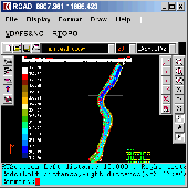
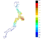
Simple, powerful and inexpensive CAD software for surveying. You can do Triangulation, isolines, color-filled contour maps, sections, intersections, volume and much more. You can process hundreds of thousands of points or triangles, even on less powerful PCs. Through its own CAD system (called RCAD), specialized for 3D and for a large number of entities, you can: -load and draw a file...
Category: Multimedia & Design / Graphics Viewers
Publisher: Rcad Software, License: Shareware, Price: USD $49.00, File Size: 1.0 MB
Platform: Windows
ORIMA is an LPS add-on providing advanced aerial triangulation and visual analysis tools.
ORIMA is an LPS add-on providing advanced aerial Triangulation and visual analysis tools. The premiere solution for frame, ADS40 and ADS80 sensors, and other digital sensors, ORIMA is proven and robust technology relied on by photogrammetry professionals around the world. Providing a strong set of analysis tools, ORIMA supports production jobs requiring high throughput.
Category: Multimedia & Design / Multimedia App's
Publisher: Leica Geosystems Geospatial Imaging, LLC, License: Shareware, Price: USD $0.00, File Size: 0
Platform: Windows
Isoliner is the ArcGIS extension for make grids and points theme with interpolate by Kriging's and Triangulation method. Last version of extension include Slide Analyst as free function.
Isoliner include additional 3D functions, interpolation by features, generation of random points.
Category: Multimedia & Design / Multimedia App's
Publisher: GIS Planet, License: Shareware, Price: USD $0.00, File Size: 0
Platform: Windows
The program runs on Autocad 2007/2008/2009 32bits, Autocad 2010 32bits, Autocad 2009 64bits, Autocad 2010 64bits, and BricsCAD v10.
Geographical information.- You can draw the DTM of all the world, because the program is compatible with SRTM format and it download the files by you and draws the result.
Professional.- It's not only a program to calculate a delaunay Triangulation but...
Category: Home & Education / Science
Publisher: Aplicaciones Topogr?ficas S.L., License: Freeware, Price: USD $0.00, File Size: 24.8 MB
Platform: Windows
FlashMNT is a program that allows the creation of a Digital Terrain Model and 3D computations, comprising the following functions: data verification, Triangulation, 3D area computation, cut/fill quantities between 2 DTM’s, cross section, meshing, entities projection over a DTM, min and max Z values, 3D poly-lines offset, contour lines, and so on.
Category: Multimedia & Design / Image Editing
Publisher: DeliCAD, License: Shareware, Price: USD $0.00, File Size: 0
Platform: Windows
Geosense is a Windows Sensor that provides the Location and Sensors platform in Windows 7 with accurate and reasonably ubiquitous positioning information without requiring or the assistance of GPS hardware, enabling more practical location-based applications and scenarios on Windows 7.
Geosense is designed to use a hybrid mix of geolocation service providers and geolocation methods...
Category: Home & Education / Miscellaneous
Publisher: Within Network, LLC, License: Freeware, Price: USD $0.00, File Size: 3.9 MB
Platform: Windows
Shareware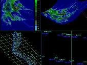
AutoLISP source code can be run on AutoCAD or IntelliCAD (Bricscad, ProgeCAD, Cadopia, etc.), on any number of computers. There are 6 programs for: - "Triangulation" will generate triangular 3DFACE entities, on the convex hull of the set of points, - "Load XYZ and 4D files"; file types: x y z color, x y z scalar, x y z r g b, no. x y z code, - "B-spline control polygon and...
Category: Multimedia & Design / Graphics Viewers
Publisher: Rcad Software, License: Shareware, Price: USD $100.00, File Size: 1.4 MB
Platform: Windows
HelloEURO - Multi-Currency Conversion Software HelloEURO has been astounding users by converting multi-currency amounts to/from the euro since 1998. Running from the Taskbar, it converts any currency amount(s) to/from the euro within MS Word, MS Excel, MS PowerPoint, potentially any Database including MS Access and any clipboard handling application.You simply highlight the amount(s) to be...
Category: Business & Finance / Calculators
Publisher: Heidi Computers Ltd, License: Commercial, Price: USD $59.00, File Size: 4.0 KB
Platform: Windows, MS-DOS
Features:
- orthographic / perspective projection
- interactive zoom / pan / rotate
- five different selection modes
- layers support
- soft shadow
- area and volume calculations
- retrieve 3D coordinates of a vertex
- Triangulation, meshing and marching cube
Category: Multimedia & Design / Image Editing
Publisher: devDept Software, License: Shareware, Price: USD $1233.00, File Size: 48.2 MB
Platform: Windows
Ideal for business or families.
Ideal for business or families. Revolutionary GSM mobile phone tracking technology now allows registered users to locate a mobile and then displays the
GSM mobile phone tracking system via the GPS-TRACK satellite network. Based on repeater Triangulation, the system tracks mobile phones using GPS Java ME. Find a mobile - Worried where your children, car, items are? Anxious if they stay...
Category: Internet / Communications
Publisher: 8Mail, License: Freeware, Price: USD $0.00, File Size: 13.0 KB
Platform: Windows
Draw points in AutoCAD and generate 3D models using data in Excel.
XLPoints Plus is the easiest way to massively draw points in AutoCAD and generate 3D models using coordinate data in Excel. Key Features: - Quickly draw points using coordinate data in Excel. - Create new drawings or update existing ones by establishing an open channel with AutoCAD. - Create "true" 3D faces or simply connect all points with a 3D polyline. For the 3D modelling,...
Category: Multimedia & Design
Publisher: Productivity Tools, License: Shareware, Price: USD $30.00, File Size: 1.7 MB
Platform: Windows
Terrain for Rhino is a terrain modeling plug-in for Rhinoceros (commonly known as Rhino).
Terrain for Rhino is a terrain modeling plug-in for Rhinoceros (commonly known as Rhino). This plug-in gives Rhino the ability to create a terrain mesh from a set of unordered points. The terrain mesh is created as a Delaunay Triangulation, which is regarded as the best method to create a terrain mesh from unorganized point data. Terrain for Rhino is powered by PointLib, a state of the...
Category: Multimedia & Design / Multimedia App's
Publisher: SYCODE, License: Commercial, Price: USD $95.00, File Size: 2.2 MB
Platform: Windows
Terrain for AutoCAD is a terrain modeling plug-in for AutoCAD.
Terrain for AutoCAD is a terrain modeling plug-in for AutoCAD. This plug-in gives AutoCAD the ability to create a terrain mesh from a set of unordered points, lines, polylines and splines. The terrain mesh is created as a Delaunay Triangulation, which is regarded as the best method to create a terrain mesh from unorganized point data. Terrain for AutoCAD can also import a set of points...
Category: Multimedia & Design / Multimedia App's
Publisher: SYCODE, License: Commercial, Price: USD $195.00, File Size: 2.6 MB
Platform: Windows
Introducing you AEC Terrain interface which is designed to simplify terrain management and 3D-modeling. AEC Terrain creates Digital Elevation Model from multiple input point files on AutoCAD graphic editor. All purpose multi-level pads, road alignments, mining applications and airfields can be generated on the terrain on different layers with different slope parameters for CUT and FILL The...
Category: Business & Finance / Project Management
Publisher: AEC Logic Private Limited, License: Shareware, Price: USD $750.00, File Size: 16.3 MB
Platform: Windows
War Ship presents us a fun and healthy way of entertainment, in which you will have to be clever and good strategist if you wish to win this war.
When the game begins you will be given five ships which you have to position on the left side of your screen. The left panel is your sea field, and the right panel is the opponent's sea field. Attempt to locate your ships in such a...
Category: Games / Strategy & War
Publisher: Novel Games Limited, License: Freeware, Price: USD $0.00, File Size: 285.5 KB
Platform: Windows
Currency Server was designed to be the most advanced currency-enabling component on the market. It provides exchange rate information and currency conversion services to COM/ActiveX and .NET and SOAP Web service clients on any platform, and supports a larger number of independent providers of exchange rate data than other tools. By working locally rather than relying on remote servers for each...
Category: Business & Finance
Publisher: Cloanto Corporation, License: Demo, Price: USD $995.00, File Size: 6.6 MB
Platform: Windows

Importation/Exportation: Import/export trails to gpx file. Unlimited number of trails, and TrackPoints. Export to gpx, Excel, PDF, XPS and KML/KMZ. Data table: Very flexible data table that allows sorting by columns, with inheritance of data, attributes, etc. Presentation on map: View on map in accordance with the active trail, which comes from providers of maps, as in 'Satellite' mode...
Category: Home & Education / Miscellaneous
Publisher: Aplicaciones Topográficas S.L., License: Freeware, Price: USD $0.00, File Size: 27.0 MB
Platform: Windows
GeoDataSource Structural Features Database Gold Edition contains structural feature names in original language and English, feature type classifications, country names in FIPS and ISO, regions and sub-regions. Database in text format suitable for applications requiring a complete list of city names. It is a subset of the GeoDataSource Structural Features Database Gold Editions. Please visit...
Category: Business & Finance / Database Management
Publisher: GeoDataSource.com, License: Data Only, Price: USD $1099.95, File Size: 75.0 KB
Platform: Windows, Mac, Palm
GeoDataSource Structural Features Database Premium Edition contains structural feature names in original language and English, feature type classifications, country names in FIPS and ISO, regions and sub-regions. Database in text format suitable for applications requiring a complete list of city names. It is a subset of the GeoDataSource Structural Features Database Gold Editions. Please visit...
Category: Home & Education / Science
Publisher: GeoDataSource.com, License: Data Only, Price: USD $899.95, File Size: 48.0 KB
Platform: Windows, Mac, Palm
GeoDataSource Structural Features Database Basic Edition contains structural feature names in original language and English, feature type classifications, country names in FIPS and ISO, regions and sub-regions. Database in text format suitable for applications requiring a complete list of city names. It is a subset of the GeoDataSource Structural Features Database Premium and Gold Editions....
Category: Business & Finance / Applications
Publisher: GeoDataSource.com, License: Data Only, Price: USD $699.95, File Size: 37.0 KB
Platform: Windows, Mac, Palm
GeoDataSource Structural Features Database Gold Edition contains structural feature names in original language and English, feature type classifications, country names in FIPS and ISO, regions and sub-regions. Database in text format suitable for applications requiring a complete list of city names. It is a subset of the GeoDataSource Structural Features Database Gold Editions. Please visit...
Category: Web Authoring / Site Management
Publisher: GeoDataSource.com, License: Data Only, Price: USD $1099.95, File Size: 73.0 KB
Platform: Windows,
GeoDataSource Structural Features Database Premium Edition contains structural feature names in original language and English, feature type classifications, country names in FIPS and ISO, regions and sub-regions. Database in text format suitable for applications requiring a complete list of city names. It is a subset of the GeoDataSource Structural Features Database Gold Editions. Please visit...
Category: Web Authoring / Site Management
Publisher: GeoDataSource.com, License: Data Only, Price: USD $899.95, File Size: 47.0 KB
Platform: Windows,