Free Downloads: Windows Satellite Views
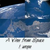
See Satellite-eye Views of different parts of Europe. See pictures of Spain, England, France, Denmark, Sweden, Ireland, Germany, Italy and more. This 32-bit screen-saver engine rotates photos of different locations of Europe as seen on clear days from the earth's orbit. Over a dozen visual effects can appear between images. Plus, each of the photos can be displayed as your...
Category: Utilities / Screensavers
Publisher: !13-Soft, License: Shareware, Price: USD $14.95, EUR10.25, File Size: 2.2 MB
Platform: Windows
JSatTrak is a Satellite tracking program written in Java.
JSatTrak is a Satellite tracking program written in Java. It allows you to predict the position of any Satellite in real time or in the past or future. It uses advanced SGP4/SDP4 algorithms developed by NASA/NORAD or customizable high precision solvers to propagate Satellite orbits. The program also allows for easy updating of current Satellite tracking data via...
Category: Home & Education / Miscellaneous
Publisher: Shawn Gano, License: Freeware, Price: USD $0.00, File Size: 17.6 MB
Platform: Windows
Protect your monitor with satellite-eye views of different parts of Europe.
Protect your monitor with Satellite-eye Views of different parts of Europe. See pictures of Spain, England, France, Germany, Italy and more. This 32-bit screen-saver engine rotates photos of different locations of Europe as seen on clear days from the earth's orbit. Over a dozen visual effects can appear between images. Plus, each of the photos can be displayed as your desktop...
Category: Desktop Enhancements / Screensavers
Publisher: Tazmaniacs, License: Shareware, Price: USD $12.95, File Size: 1.9 MB
Platform: Windows
Free Satellite Maps is a free tool from Google which offers a satellite mapping service worldwide.
Free Satellite Maps is a free tool from Google which offers a Satellite mapping service worldwide.These are accompanied by a street service, a route planner and information about business in almost all countries.In this way we can fly the world from Satellite view or in birds eye.The level of detail is different depending on where you are located.Major cities have a very...
Category: Home & Education / Science
Publisher: www.satelliteview-of-my-house.com, License: Freeware, Price: USD $0.00, File Size: 612.0 KB
Platform: Windows
The EQMODLX is a LX200 Emulator program that accepts Satellite tracking issued by a LX200 Compatible Satellite Tracking Software.This configuration allows you to track the Satellite continuously instead of the the "Leap Frog" fashion as made available to the old nextstar protocol.This software application can also converts the Satellite tracks to EQ custom...
Category: Home & Education / Astrology & Numerology
Publisher: chrisshillito, eqmodarchie, sarmientomon, License: Freeware, Price: USD $0.00, File Size: 354.2 KB
Platform: Windows
Protect your monitor with satellite-eye views of different parts of Canada.
Protect your monitor with Satellite-eye Views of different parts of Canada. See pictures of Adams lake, Alberta, Newfoundland,Calgary, Clearwater Lakes, Ontario, Edmonton, Halifay, British Columbia, Montreal, Sable Island, Vancouver, Winnipeg and many more.This 32-bit screen-saver engine rotates photos of different locations of Canada as seen on clear days from the earth's orbit....
Category: Desktop Enhancements / Screensavers
Publisher: Tazmaniacs, License: Shareware, Price: USD $9.95, File Size: 2.9 MB
Platform: Windows
Satellite earth is a software for viewing satellite and aerial imagery of the Earth.
Satellite earth is a software for viewing Satellite and aerial imagery of the Earth.Satellite Earth allows you to enjoy virtual travel around the world, look up local information and plan trips, exploring multimedia content and share information about your trips.Explore towns, cities and terrain relief shown in three-dimensional images of high resolution associated with...
Category: Home & Education / Science
Publisher: www.satelliteview-of-my-house.com, License: Freeware, Price: USD $0.00, File Size: 584.0 KB
Platform: Windows
Hurricanes screensaver provides an informative and dynamic look at the power and size of these oceanic monsters. Rotate 30 different Satellite Views of a few of the recent storms. The program is powered by an excellent screen-saver engine, which lets you adjust the time between slide changes, show pictures full-screen or at original size, mute the relaxing MIDI-based soundtrack,...
Category: Desktop Enhancements / Screensavers
Publisher: NexusMedia, License: Shareware, Price: USD $10.00, File Size: 3.1 MB
Platform: Unknown
Live Satellite Maps or Google maps is a web server mapping applications.
Live Satellite Maps or Google maps is a web server mapping applications.Provides scrolling map images and Satellite photos around the earth and even the route between different places.Since 6 October 2005, live Satellite Maps is part of local Google.Google live Satellite Map provides the ability to zoom in or zoom out to show the map.The user can control the map with...
Category: Home & Education / Science
Publisher: www.satelliteview-of-my-house.com, License: Freeware, Price: USD $0.00, File Size: 643.0 KB
Platform: Windows
Earth Orbit Objects is free program which predict Satellite passes for your local or any selected area. Use flat Earth view to display Satellite tracks with visibility circle.
The globe view shows selected satellites around the Earth as a sphere and sky view shows satellites as you would see them in a starry night. The line elements are processed using SGP4 and SDP4...
Category: Home & Education / Miscellaneous
Publisher: Bluewing Trg, License: Freeware, Price: USD $0.00, File Size: 1.6 MB
Platform: Windows
CamIQ Satellite - digital recording and reliable image analysis.
CamIQ Satellite - digital recording and reliable image analysis.
CamIQ Satellite is based on a client-server-architecture which guarantees robustness and security as a basis. It can be extended flexible with modules just as the application requires.Comprehensive producer support for network based and analogue image sources (megapixelcameras, networkcameras, encoder and...
Category: Multimedia & Design / Multimedia App's
Publisher: rosemann software GmbH, License: Demo, Price: USD $0.00, File Size: 112.3 MB
Platform: Windows

Dishnetwork Deals Dish Satellite TV.
Dishnetwork Deals Dish Satellite TV. Dish Network Discounts. Dish Network TV Deals! Dish Network Television Deals and Free Offers! DISH Network installation and service nationwide. Satellite TV systems from Profressional Dealers. Free Dishnet receivers and DVR systems. Satelite Television, DISH, Digital TV, Broadband Internet, HD and DirectTV free satlite deals available. Order...
Category: Internet / Browsers
Publisher: Dishnetwork Deals, License: Freeware, Price: USD $0.00, File Size: 1.5 MB
Platform: Windows
Can you imagine how large an Satellite image is, which has dimensions of 86400 pixels wide and 43200 pixels high?This is a simple article which describes the Worlds Largest Satellite Images.See the largest Satellite images using a free software which is included inside.This free software will enables you to see Satellite images of the entire earth for free.
Category: Home & Education / Miscellaneous
Publisher: www.satelliteimage-of-my-house.com, License: Freeware, Price: USD $0.00, File Size: 590.0 KB
Platform: Windows
Orbitron 3.71is a Satellite tracking system for radio amateur and observing purposes.
The program can be also used by weather professionals, Satellite communication users, astronomers, UFO hobbyist and astrologers.
The program shows the positions of satellites at any moment (in real or simulated time).
Orbitron 3.71 can be installed in 35...
Category: Internet / Communications
Publisher: Sebastian Stoff, License: Freeware, Price: USD $0.00, File Size: 2.0 MB
Platform: Windows
Tuner4PC allows configuring and establishing internet connection via satellite.
Tuner4PC allows configuring and establishing internet connection via Satellite. Once you have specified all the necessary parameters in the application, Tuner4PC will automatically configure a VPN, OpenVPN, Slonax, Globax, or Sprint link to your provider, depending on your choice.
Main Features:
- Automatic configuration of Satellite Internet connection...
Category: Utilities / Misc. Utilities
Publisher: Skysoftware, License: Shareware, Price: USD $39.99, File Size: 9.6 MB
Platform: Windows
SATBUSTER for Windows is especially designed for satellite visual observers and trackers.
SATBUSTER for Windows is especially designed for Satellite visual observers and trackers. Its users, mainly amateur astronomers, radio amateurs and Satellite trackers, appreciate both the accuracy and the simple to use graphical interface. The software is aimed to hobbysts. However a growing number of plain folks are starting to use this tool to recognize and look at the...
Category: Internet / Misc. Plugins
Publisher: PC, License: Freeware, Price: USD $0.00, File Size: 6.0 MB
Platform: Windows
 Shareware
Google Satellite Maps Downloader is a cute tool that can automatically download Google Maps Satellite tile images and then combine them into one big map image. It supports multithreads, so the download speed is very fast. And it is very easy to use. All downloaded small images are saved on the disk. You can combine them after downloading or later. Isn't it very cool that you make...
Category: Internet / Download Managers
Publisher: allmapsoft.com, License: Shareware, Price: USD $39.00, File Size: 30.6 MB
Platform: Windows
View amazing satellite images of earth with the free version of google earth software.
View amazing Satellite images of earth with the free version of google earth software.Google earth is a totally free software which enables you zoom in from Satellite,view,rotate or tilt just like a camera of the entire earth inside your pc.It works just point and click on any part of earth or by typing addrees name of city or country and google earth will down from space to the...
Category: Home & Education / Miscellaneous
Publisher: www.satelliteimage-of-my-house.com, License: Freeware, Price: USD $0.00, File Size: 798.0 KB
Platform: Windows

Ready to start saving? It's never been a better time to switch to Satellite Television then now. You won't find better Dish Network deals available any where else on the internet.
If you've been throwing away your money on cable tv or DirecTV then you've come to the right place.
Order now
Save with special web only promotions! We are a high volume Satellite tv system...
Category: Internet / Browsers
Publisher: Dish Network Channel Packages, License: Freeware, Price: USD $0.00, File Size: 1.6 MB
Platform: Windows, Linux, Mac
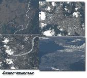
Protect your monitor with satellite-eye views of different parts of Germany.
Protect your monitor with Satellite-eye Views of different parts of Germany.See pictures of Berlin, Munich, Cologne, Koblenz Area, Rhein River, Mosel River, Kiel, Frankfurt am Main, Wiesbaden, Mainz, Leipzig, Cottbus, Darmstadt, Duisburg, Hamburg, Karlsruhe, Kassel, Speyer and many more.This 32-bit screen-saver engine rotates photos of different locations of Germany as seen on...
Category: Desktop Enhancements / Screensavers
Publisher: Tazmaniacs Screen Savers, License: Shareware, Price: USD $9.95, File Size: 3.3 MB
Platform: Windows
Shareware
SatHunter is a program for calculating the orientation of a Satellite antenna. SatHunter contains all the necessary information for adjusting the Satellite antenna to the selected Satellite. The adjustment is made with the help of available tools (a compass or a protractor, a plumb, a tape measure) and requires neither expensive equipment nor deep knowledge about...
Category: Home & Education / Astrology & Numerology
Publisher: Protectedsoft Ltd., License: Shareware, Price: USD $29.95, File Size: 5.4 MB
Platform: Windows
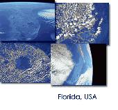
Protect your monitor with satellite-eye views of different parts of Florida, USA.
Protect your monitor with Satellite-eye Views of different parts of Florida, USA.See pictures of Apalachicola Basin, West Florida, Cape Canaveral, Cape Coral, Fort Myers, Cape San Blas, the East Coast, Florida Keys, Florida Panhandle, Florida Peninsula, Greater Miami Area, Homestead, Jacksonville, Lake Okeechobee, Lakeland Area, Orlando, Panama City, Pensacola, Saint Joseph Bay,...
Category: Desktop Enhancements / Screensavers
Publisher: Tazmaniacs, License: Shareware, Price: USD $9.95, File Size: 2.9 MB
Platform: Windows

Protect your monitor with satellite-eye views of different parts of Florida, USA.
Protect your monitor with Satellite-eye Views of different parts of Florida, USA. See pictures of Apalachicola Basin, West Florida, Cape Canaveral, Cape Coral, Fort Myers, Cape San Blas, the East Coast, Florida Keys, Florida Panhandle, Florida Peninsula, Greater Miami Area, Homestead, Jacksonville, Lake Okeechobee, Lakeland Area, Orlando, Panama City, Pensacola, Saint Joseph Bay,...
Category: Desktop Enhancements / Screensavers
Publisher: Tazmaniacs Screen Savers, License: Shareware, Price: USD $9.95, File Size: 1.9 MB
Platform: Windows
The Orbit Visualization Tool (OVT) is a software for visualization of Satellite orbits in the Earth's magnetic field. The program can display Satellite orbits in five coordinate systems (GEI, GEO, GSM, SMC, GSE), Satellite footprints projected on the Earth's surface and shown in either geographic (GEO) or geomagnetic (SMC) coordinates. In addition to...
Category: Home & Education / Astrology & Numerology
Publisher: OVT Team, License: Freeware, Price: USD $0.00, File Size: 0
Platform: Windows
Freeware
DreamBoxTools - a program for tuning your DreamBox Satellite receiver. Control your receiver right from the computer. Main features: - Lyngsat-to-Dreambox transponders parser. Update data about satellites and transponders to your receiver directly from the site Lyngsat.com - Satellite filter - Europe, Asia, Atlantic, America, only HD, manual choice, saved...
Category: DVD & Video / Video Conversion
Publisher: Protectedsoft Ltd., License: Freeware, Price: USD $0.00, File Size: 1014.4 KB
Platform: Windows