Free Downloads: World Interactive Color Maps
Your personal interactive guide to Walt Disney World for your Pocket PC.
Your personal Interactive guide to Walt Disney World for your Pocket PC. The software features fully detailed, Interactive Maps of the four major Walt Disney World theme parks: Magic Kingdom, Epcot, MGM Studios, and Animal Kingdom. It is navigation, with the information of a guide book, all in one package. Map Features------------------------------Full...
Category: Games / Misc. Games
Publisher: Mouse Explorer, LLC., License: Shareware, Price: USD $19.95, File Size: 0
Platform: Mac,
Trizbort is a simple tool which can be used to create maps for interactive fiction.
Trizbort is a simple tool which can be used to create Maps for Interactive fiction.
Over the years a number of styles have evolved for Interactive fiction mapping. Trizbort focuses on creating Maps in only one of these styles, as popularised by Infocom: labelled boxes for rooms, with lines connecting them.
Whether you're playing or writing...
Category: Multimedia & Design / Digital Media Editors
Publisher: Genstein, License: Freeware, Price: USD $0.00, File Size: 596.2 KB
Platform: Windows
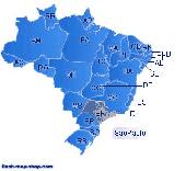
Dongsoft Interactive Brazil Flash Maps for websites, Interactive map applications, presentations, and more.
The innovation of this fully-clickable map will revolutionize your website navigation and provide visitors with a simple and seamless method of accessing information. Using the map as a central navigation tool, information can be accessed with greater speed,...
Category: Software Development / Help File Utilities
Publisher: maps flash, License: Freeware, Price: USD $0.00, File Size: 156.0 KB
Platform: Windows
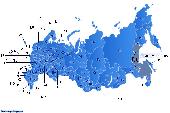
Dongsoft Interactive Russia Flash Maps for websites, Interactive map applications, presentations, and more.
The innovation of this fully-clickable map will revolutionize your website navigation and provide visitors with a simple and seamless method of accessing information. Using the map as a central navigation tool, information can be accessed with greater speed,...
Category: Software Development / Help File Utilities
Publisher: clickable map, License: Freeware, Price: USD $0.00, File Size: 156.0 KB
Platform: Windows
Region Map Generator is a tool to make region map with self-definition Color. The original Maps in the software are blank political region ones for different countries or areas. You can Color any region with whatever Color as you like. By this software, you can easily make lively Maps. These Maps can be used as data analysis charts, teaching materials,...
Category: Business & Finance / Applications
Publisher: cciyy, License: Shareware, Price: USD $36.95, File Size: 1.3 MB
Platform: Windows
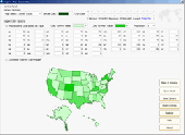
Interactive Flash maps US States.
Interactive Flash Maps US States.
Suitable for Real-Estate, Dealer Maps, Branch Offices Locators.
With this fully-clickable map you will be able to improve navigation and provide visitors with better and quicker access to information as well as improve the way you present the information. The map can be used "as is" however it is also easily customizable....
Category: Web Authoring / Web Design Utilities
Publisher: Fla-shop.com, License: Demo, Price: USD $24.90, File Size: 229.0 KB
Platform: Windows
iMapBuilder Interactive Flash Map Builder creates Interactive flash map and image Maps, with clickable regions, editable points and icons. You can easily embed online Maps to your website for showing facts and figures interactively. It is easy to use and requires no coding or flash knowledge.
Map templates gallery are included for easy editing and...
Category: Multimedia & Design / Animation
Publisher: WebUnion Media Ltd., License: Shareware, Price: USD $0.00, File Size: 0
Platform: Windows

Commercial realtors require accurate and reliable tools to publish available properties online and show them on the website (specifying region, county, state, and city). We have created a unique Interactive Real Estate Map with all USA states and counties on it for real estate business. USA Real Estate Map is a unique and amazing vector-based tool that is very simple to use. We...
Category: Internet
Publisher: USFlashMap.com, License: Shareware, Price: USD $399.00, File Size: 3.9 MB
Platform: Windows, Mac, Linux, Unix, MS-DOS, AS/400, OS/2
Anychart is a flexible Macromedia Flash based-solution, which allows you to easily display any sort of data dealing with geographical locations. It contains United States Maps with Counties, World Map, etc. XML data file and a set of customizable options make AnyChart Maps a universal solution for web developers. AnyChart allows you to create superb, compact,...
Category: Software Development
Publisher: AnyChart.Com, License: Shareware, Price: USD $199.00, File Size: 2.8 MB
Platform: Windows, Mac, Linux, Palm,
Covering every month of every theatre of World War II, this huge atlas is for wargamers and anyone interested in World War II. It provides a highly Interactive and thought-provoking view of the war, and is a great starting point for what-if scenarios. Each map contains date, movement, unit strengths and other military details.
From the World overview you...
Category: Home & Education / Miscellaneous
Publisher: ProFantasy Software, License: Shareware, Price: USD $27.95, File Size: 57.0 MB
Platform: Windows
Diffuse maps represent the absorption of light.
Diffuse Maps represent the absorption of light. Diffuse Maps are what people call "textures". They are the Color textures or photographic textures usually applied to 3d models.
ShaderMap creates displacement Maps using the light data stored inside of diffuse Maps. Evenly lit diffuse Maps generally create better quality Maps with...
Category: Home & Education / Miscellaneous
Publisher: Rendering Systems Inc., License: Freeware, Price: USD $0.00, File Size: 4.0 MB
Platform: Windows
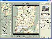
NOVA Maps provides appraisers and appraisal users with complete, high-resolution location Maps (also known as “street Maps”) for forms and addenda in seconds. NOVA Maps even automatically places labels for subject properties and comparables.
For just pennies per map and with just a click of the mouse, users have access to the entire United...
Category: Home & Education / Miscellaneous
Publisher: Day One, License: Demo, Price: USD $0.00, File Size: 5.7 MB
Platform: Windows
MIMTool is an interactive tool for drawing Molecular Interaction Maps in MIM notation.
MIMTool is an Interactive tool for drawing Molecular Interaction Maps in MIM notation. It contributes a novel semi-automatic orthogonal drawing engine which minimizes bends and crossovers when edges are drawn. As output, it generates SBML, MIMML and pdf files of the drawn Maps. MIMTool is written in C and uses the Qt graphical user interface libraries.
Category: Multimedia & Design / Fonts
Publisher: Microsoft, License: Shareware, Price: USD $0.00, File Size: 19.8 MB
Platform: Windows
 Freeware
Free standalone software DataPult Desktop creates heat Maps from your data quickly and efficiently. Key features: Direct data import from MS Excel with one click. The ability to create animated Maps of data over several years. Interactive Maps and diagrams. 39 map colorings for making heat Maps. Intelligent identification of...
Category: Business & Finance / MS Office Addons
Publisher: DataPult, License: Freeware, Price: USD $0.00, File Size: 21.0 MB
Platform: Windows
Shareware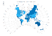
AnyMap JS Maps is an advanced JavaScript/HTML5 mapping library which makes you able to easily create Interactive Maps that look great on any device including PCs, Macs, iPhones, iPads, Android devices and others - on any platform and in any browser. AnyMap JS is perfect for Interactive dashboards and side-by-side reporting. You can use it to display sales by...
Category: Web Authoring / JavaScript
Publisher: AnyChart JavaScript Charts, License: Shareware, Price: USD $49.00, File Size: 23.3 MB
Platform: Windows, Mac, Linux,
Freeware
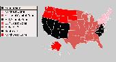
An Interactive Flash USA map with all the features you need for your web site or project. This is the ideal solution for dealer Maps, real-estate listings, or visualizing state statistics. Nearly every aspect of the map is customizable. However, unlike competing products, our map is very simple to install and edit. Just upload XML and SWF files and embed.
Category: Internet / Flash Tools
Publisher: http://www.flashusamap.com/trial/flashus, License: Freeware, Price: USD $0.00, File Size: 93.8 KB
Platform: Unknown
The Creeper World Map Editor (CWME) allows you to create and edit maps for use in Creeper World.
The Creeper World Map Editor (CWME) allows you to create and edit Maps for use in Creeper World. You can specify the terrain, change the background image, and create/edit Creeper emitters and spore waves. You can also specify the location and the number of totems, upgrades, survival pods, and artifacts. In short, you can create nearly any map you can imagine.
Category: Games / Tools & Editors
Publisher: Knuckle Cracker, LLC, License: Freeware, Price: USD $0.00, File Size: 2.3 MB
Platform: Windows
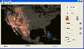
Representing a new concept in the field of Ham Maps, the Global Overlay Mapping System is packed full of features for all Ham Radio enthusiasts, including : 1 World Map, with specialised satellite images and World region-boundaries. 8 Continental Maps - Europe, Asia, Africa, North and South America, Oceania, Arctic, Antarctica. 29 Sub Continental Maps, with...
Category: Home & Education / Miscellaneous
Publisher: MapAbility, License: Freeware, Price: USD $0.00, File Size: 4.9 MB
Platform: Windows
Color Scheme Editor 2.1 is a simple Color editing tool, designed specially for Tom Tom Navigator users. With this program you can easily change the Color of the Maps on Tom Tom Navigator. With its simple interface, you can use this tool without any effort at all. It provides a number of colors and allows you to use them to change the Color of each object on...
Category: Multimedia & Design / Multimedia App's
Publisher: Post Productions, License: Freeware, Price: USD $0.00, File Size: 1.2 MB
Platform: Windows
Allows you to create video travel logs of all the places you visit and then turn them into movies that iMovie and other movie editors will recognize (Quicktime Format). Comes with 17 high quality Maps from all over the World that you can use as is, or customize for your specific needs. You can also use your own Maps. (.jpg, .bmp, .png, .pict or .tiff) Configure and...
Category: Multimedia & Design
Publisher: Sol Robots L.L.C., License: Shareware, Price: USD $9.95, File Size: 8.6 MB
Platform: Windows
The World's first dynamic travel guides. Schmap 2.0 opens a new World of flexibility for browsing, searching and customizing travel guide content (reviews, photos and Maps). Once installed, simply choose from Schmap's rapidly growing series of US, European and Canadian destination guides, each with zooming, panning Maps, useful links, playable virtual tours,...
Category: Home & Education
Publisher: Schmap, License: Freeware, Price: USD $0.00, File Size: 1.5 MB
Platform: Windows
Presenting an array of maps, focusing on the world?
Presenting an array of Maps, focusing on the World?s physical geography.
Category: Home & Education / Miscellaneous
Publisher: myfreeware.lyall-web.co.uk, License: Freeware, Price: USD $0.00, File Size: 8.0 MB
Platform: Windows, Mac, Vista

FSS Google Maps Downloader is a tool that can download the Google Maps images to your PC. This is a clearly free program. There is no spyware or adware. It's absolutely safe to install and to run. The interface is very simple and self explaining. It runs low on system resources consumption and is supported on all Windows versions. It can save them to your hard disk,...
Category: Internet / Download Managers
Publisher: FreeSmartSoft, License: Freeware, Price: USD $0.00, File Size: 874.0 KB
Platform: Windows
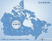
Canada Flash map (with FLA source) for web sites, interactive applications, presentations, and more.
Canada Flash map (with FLA source) for web sites, Interactive applications, presentations, and more.
With this fully-clickable map you will be able to improve navigation and provide visitors with better and quicker access to information as well as improve the way you present the information. The map can be easily customizable. In just a few minutes you can make any required changes -...
Category: Web Authoring / Web Design Utilities
Publisher: Fla-shop.com, License: Demo, Price: USD $44.90, File Size: 83.0 KB
Platform: Windows
Nokia Maps 3D browser plugin is a free mapping product and service by Nokia for its mobile phones and for internet browsers. Nokia Maps includes voice guided navigation for both pedestrians and drivers for 74 countries in 46 different languages and there are Maps for over 180 countries.
See the World in high-resolution 3D. Everything from the sky to the street....
Category: Internet / Browser Accessories
Publisher: Nokia, License: Freeware, Price: USD $0.00, File Size: 9.8 MB
Platform: Windows