Free Downloads: World Satellite Real
World Wind lets you zoom from satellite altitude into any place on Earth.
World Wind lets you zoom from Satellite altitude into any place on Earth. Leveraging Landsat Satellite imagery and Shuttle Radar Topography Mission data, World Wind lets you experience Earth terrain in visually rich 3D, just as if you were really there. V
Category: Home & Education / Mathematics
Publisher: worldwind.arc.nasa.gov, License: Freeware, Price: USD $0.00, File Size: 16.0 MB
Platform: Windows
JSatTrak is a Satellite tracking program written in Java.
JSatTrak is a Satellite tracking program written in Java. It allows you to predict the position of any Satellite in Real time or in the past or future. It uses advanced SGP4/SDP4 algorithms developed by NASA/NORAD or customizable high precision solvers to propagate Satellite orbits. The program also allows for easy updating of current Satellite tracking data...
Category: Home & Education / Miscellaneous
Publisher: Shawn Gano, License: Freeware, Price: USD $0.00, File Size: 17.6 MB
Platform: Windows
Orbitron 3.71is a Satellite tracking system for radio amateur and observing purposes.
The program can be also used by weather professionals, Satellite communication users, astronomers, UFO hobbyist and astrologers.
The program shows the positions of satellites at any moment (in Real or simulated time).
Orbitron 3.71 can be installed...
Category: Internet / Communications
Publisher: Sebastian Stoff, License: Freeware, Price: USD $0.00, File Size: 2.0 MB
Platform: Windows
Free Satellite Maps is a free tool from Google which offers a satellite mapping service worldwide.
Free Satellite Maps is a free tool from Google which offers a Satellite mapping service worldwide.These are accompanied by a street service, a route planner and information about business in almost all countries.In this way we can fly the World from Satellite view or in birds eye.The level of detail is different depending on where you are located.Major cities have a...
Category: Home & Education / Science
Publisher: www.satelliteview-of-my-house.com, License: Freeware, Price: USD $0.00, File Size: 612.0 KB
Platform: Windows
Satellite earth is a software for viewing satellite and aerial imagery of the Earth.
Satellite earth is a software for viewing Satellite and aerial imagery of the Earth.Satellite Earth allows you to enjoy virtual travel around the World, look up local information and plan trips, exploring multimedia content and share information about your trips.Explore towns, cities and terrain relief shown in three-dimensional images of high resolution associated...
Category: Home & Education / Science
Publisher: www.satelliteview-of-my-house.com, License: Freeware, Price: USD $0.00, File Size: 584.0 KB
Platform: Windows
DESA Satellite Tracker allows you to track the International Space Station and other satellites in Real time. The built in radar alarm will alert you to satellites that would be visible to you and let you know where to look (although you will only be able to actually see the satellites an hour before sunrise and an hour after sunset).
DESA Satellite Tracker is...
Category: Home & Education / Astrology & Numerology
Publisher: red diligence, License: Freeware, Price: USD $0.00, File Size: 977.8 KB
Platform: Windows
Satellite Forms is an ideal tool for business and enterprise developers looking to build custom mobile applications, or to transform processes typically performed on paper to an electronic format for improved productivity and efficiency. Satellite Forms allows you to create usable, Real-World applications without writing a single line of code. Even more sophisticated...
Category: Business & Finance / Project Management
Publisher: Thacker Network Technologies Inc., License: Shareware, Price: USD $0.00, File Size: 0
Platform: Windows
TerraClient allows viewing and printing of ground level satellite photographs of the United States.
TerraClient allows viewing and printing of ground level Satellite photographs of the United States. Featured is a unique map overlay option that automatically superimposes a "paper" roadmap over the Satellite photos. This map overlay option has been designed to help users identify indistinct land features in the Satellite photos. All map and photographic data is...
Category: Home & Education / Miscellaneous
Publisher: Bill Friedrich Software, License: Freeware, Price: USD $0.00, File Size: 1.3 MB
Platform: Windows
The EQMODLX is a LX200 Emulator program that accepts Satellite tracking issued by a LX200 Compatible Satellite Tracking Software.This configuration allows you to track the Satellite continuously instead of the the "Leap Frog" fashion as made available to the old nextstar protocol.This software application can also converts the Satellite tracks to EQ custom...
Category: Home & Education / Astrology & Numerology
Publisher: chrisshillito, eqmodarchie, sarmientomon, License: Freeware, Price: USD $0.00, File Size: 354.2 KB
Platform: Windows
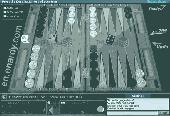
Welcome to the amazing backgammon World where you can play for Real money or for fun absolutely free of charge. Our room is one of the biggest online and you can play with thousands players from all over the World any moment.
The software offers classical backgammon (tavla) for 2 players with perfect 3D graphics and sound, the board is set in a traditional wood...
Category: Games / Misc. Games
Publisher: Play Backgammon Online, License: Freeware, Price: USD $0.00, File Size: 2.1 MB
Platform: Windows
PreviSat is a satellite tracking software for observing purposes.
PreviSat is a Satellite tracking software for observing purposes. Very easy to use, it shows the positions of the satellites in Real-time or manual mode. PreviSat is able to make predictions of their passes and also predictions of Iridium flares.
Features
- NORAD SGP4 model (Vallado, 2006)
- Real time / manual mode
- Topocentric /...
Category: Home & Education / Astrology & Numerology
Publisher: Astropedia, License: Freeware, Price: USD $0.00, File Size: 1.4 MB
Platform: Windows
World Time is a simple to use but intelligent graphical utility that displays in Real time, not only the time in cities around the World, but it also features viewable time zones, which displays night and day around the World. World Time features cloud maps, which allow you to view animated cloud formations from around the World using Satellite...
Category: Home & Education / Miscellaneous
Publisher: Trellian Limited, License: Shareware, Price: USD $0.00, File Size: 0
Platform: Windows
Live Satellite Maps or Google maps is a web server mapping applications.
Live Satellite Maps or Google maps is a web server mapping applications.Provides scrolling map images and Satellite photos around the earth and even the route between different places.Since 6 October 2005, live Satellite Maps is part of local Google.Google live Satellite Map provides the ability to zoom in or zoom out to show the map.The user can control the map with...
Category: Home & Education / Science
Publisher: www.satelliteview-of-my-house.com, License: Freeware, Price: USD $0.00, File Size: 643.0 KB
Platform: Windows
CamIQ Satellite - digital recording and reliable image analysis.
CamIQ Satellite - digital recording and reliable image analysis.
CamIQ Satellite is based on a client-server-architecture which guarantees robustness and security as a basis. It can be extended flexible with modules just as the application requires.Comprehensive producer support for network based and analogue image sources (megapixelcameras, networkcameras, encoder and...
Category: Multimedia & Design / Multimedia App's
Publisher: rosemann software GmbH, License: Demo, Price: USD $0.00, File Size: 112.3 MB
Platform: Windows

Dishnetwork Deals Dish Satellite TV.
Dishnetwork Deals Dish Satellite TV. Dish Network Discounts. Dish Network TV Deals! Dish Network Television Deals and Free Offers! DISH Network installation and service nationwide. Satellite TV systems from Profressional Dealers. Free Dishnet receivers and DVR systems. Satelite Television, DISH, Digital TV, Broadband Internet, HD and DirectTV free satlite deals available. Order...
Category: Internet / Browsers
Publisher: Dishnetwork Deals, License: Freeware, Price: USD $0.00, File Size: 1.5 MB
Platform: Windows
Can you imagine how large an Satellite image is, which has dimensions of 86400 pixels wide and 43200 pixels high?This is a simple article which describes the Worlds Largest Satellite Images.See the largest Satellite images using a free software which is included inside.This free software will enables you to see Satellite images of the entire earth for free.
Category: Home & Education / Miscellaneous
Publisher: www.satelliteimage-of-my-house.com, License: Freeware, Price: USD $0.00, File Size: 590.0 KB
Platform: Windows
Prog Finder was designed to help users conveniently adjust their Terristeral antenna and Satellite dish.
This program is designed simply enough. Even a novice can easily understand how to modify its options. The interface is user-friendly, and the main buttons are organized in such a manner, as to easily guide you through the entire configuration process. Furthermore, this...
Category: Business & Finance / Applications
Publisher: ProgDVB, License: Freeware, Price: USD $0.00, File Size: 6.4 MB
Platform: Windows
World Wind lets PC users zoom from satellite altitude into any place on the globe.
World Wind lets PC users zoom from Satellite altitude into any place on the globe. Leveraging Landsat Satellite imagery and Shuttle Radar Topography Mission data, World Wind lets you experience Earth terrain in visually rich 3D, just as if you were really there. Virtually visit any place in the World. Look across the Andes, into the Grand Canyon, over the...
Category: Home & Education / Science
Publisher: NASA, License: Freeware, Price: USD $0.00, File Size: 15.0 MB
Platform: Windows, 2K
TV Online Pro With one easy software download, you can be watching thousands of worldwide channels in tons of categories such as movies, news, sports, music, shopping and much, much more! #1 Satellite TV to PC Software - Over 3000 Satellite Channels - Works Anywhere in the World - Over 1000 000 Satisfied Users - User Friendly Interface - Privacy Protection Works anywhere in...
Category: DVD & Video / Video Tools
Publisher: TV Online Pro, License: Shareware, Price: USD $39.95, File Size: 3.5 MB
Platform: Windows
Freefall Satellite Screen Saver
Freefall - the condition of unrestrained motion in a gravitational field
Iridium satellites
Features
Includes the Freefall screen saver and application
Over 850 satellites with detailed descriptions
Stunning earth imagery, coastlines, political boundaries, major cities, and reference grid
Real-time...
Category: Home & Education / Astrology & Numerology
Publisher: Advanced Analytic, License: Shareware, Price: USD $19.95, File Size: 28.3 MB
Platform: Windows
Tuner4PC allows configuring and establishing internet connection via satellite.
Tuner4PC allows configuring and establishing internet connection via Satellite. Once you have specified all the necessary parameters in the application, Tuner4PC will automatically configure a VPN, OpenVPN, Slonax, Globax, or Sprint link to your provider, depending on your choice.
Main Features:
- Automatic configuration of Satellite Internet connection...
Category: Utilities / Misc. Utilities
Publisher: Skysoftware, License: Shareware, Price: USD $39.99, File Size: 9.6 MB
Platform: Windows
Catfood Desktate is an eye catching earth simulator that combines Satellite imagery, near Real time cloud data and optional layers including political borders and place names. The continuously updated result can be set as your desktop wallpaper or used as a screensaver. Desktate features include: The terminator between day and night is continuously calculated; you can see sunrise...
Category: Desktop Enhancements / Wallpaper
Publisher: Catfood Software, License: Shareware, Price: USD $19.95, File Size: 9.8 MB
Platform: Windows
Get a full 3D satellite map view of El Petacon on your PC.
Get a full 3D Satellite map view of El Petacon on your PC. If you have already installed Google Earth, you will be able to view the El Petacón 3D map. You will enjoy a beautiful view of this geographic place and you will have the World's geographic information at your fingertips.
Category: Home & Education / Miscellaneous
Publisher: Maplandia, License: Freeware, Price: USD $0.00, File Size: 331 B
Platform: Windows
 Shareware
Google Satellite Maps Downloader is a cute tool that can automatically download Google Maps Satellite tile images and then combine them into one big map image. It supports multithreads, so the download speed is very fast. And it is very easy to use. All downloaded small images are saved on the disk. You can combine them after downloading or later. Isn't it very cool that you make...
Category: Internet / Download Managers
Publisher: allmapsoft.com, License: Shareware, Price: USD $39.00, File Size: 30.6 MB
Platform: Windows
WinPilot 3D is flight analysis and planning software, that lets you zoom in from Satellite altitude into any place on Earth, leveraging Landsat Satellite imagery and Shuttle Radar Topography Mission elevation data. WinPilot 3D lets you experience Earth terrain in visually rich 3D, just as if you were really there. WinPilot 3D also shows airspace in 3D, and contains...
Category: Home & Education / Miscellaneous
Publisher: WinPilot, License: Shareware, Price: USD $59.00, File Size: 3.8 MB
Platform: Windows