Free Downloads: Bricscad
License: All | Free
BricsTurn is a Free Vehicle Turning Simulation (Swept path analysis) for Bricscad.
BricsTurn is a Free Vehicle Turning Simulation (Swept path analysis) for Bricscad. It supports Bricscad version V10/V11.
Main features:
- Build your own vehicles and do analysis in the drawing.
- Turning Report visualizes wheel and element angles.
- Lock to lock Report visualizes speed.
Category: Games / Simulations
Publisher: Glamsen utveckling (Lars Karlsson), License: Freeware, Price: USD $0.00, File Size: 2.5 MB
Platform: Windows
The program runs on Autocad 2007/2008/2009 32bits, Autocad 2010 32bits, Autocad 2009 64bits, Autocad 2010 64bits, and Bricscad v10.
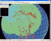
Geographical information.- You can draw the DTM of all the world, because the program is compatible with SRTM format and it download the files by you and draws the result.
Professional.- It's not only a program to calculate a delaunay triangulation but...
Category: Home & Education / Science
Publisher: Aplicaciones Topogr?ficas S.L., License: Freeware, Price: USD $0.00, File Size: 24.8 MB
Platform: Windows
CabloCAD 2009 is an application which supports the design of cable routes made from CABLOFIL wire
mesh cable trays. This software is a plugin to more frequently used versions of CAD software:
AutoCAD, AutoCAD LT*, Bricscad, ZWCAD, and various distributions of IntelliCAD.
Category: Business & Finance / Business Finance
Publisher: CADProfi, License: Freeware, Price: USD $0.00, File Size: 135.4 MB
Platform: Windows

Importation/Exportation: Import/export trails to gpx file. Unlimited number of trails, and TrackPoints. Export to gpx, Excel, PDF, XPS and KML/KMZ. Data table: Very flexible data table that allows sorting by columns, with inheritance of data, attributes, etc. Presentation on map: View on map in accordance with the active trail, which comes from providers of maps, as in 'Satellite' mode...
Category: Home & Education / Miscellaneous
Publisher: Aplicaciones Topográficas S.L., License: Freeware, Price: USD $0.00, File Size: 27.0 MB
Platform: Windows