Free Downloads: Bulding Surveying
License: All | Free
Survex is an open source cave-surveying software package, licensed under the GPL.
Survex is an open source cave-Surveying software package, licensed under the GPL. It is designed to be portable and can be run on a variety of platforms, including Linux/Unix, Mac OS X, and Microsoft Windows.
Survex is very powerful cave survey software, and is actively developing into a complete cave visualisation package. It has a sophisticated GUI frontend.
Survex has no...
Category: Multimedia & Design / Image Editing
Publisher: The Survex Project, License: Freeware, Price: USD $0.00, File Size: 2.0 MB
Platform: Windows
Leica X-change provides a seamless link between Leica System 1200 Surveying equipment and the Autodesk Civil 3D 2009 and 2010 environment. Autodesk became best known for AutoCAD but now develops a broad range of software for design, engineering, and entertainment as well as a line of software for consumers, including Sketchbook, Homestyler, and Pixlr.
Category: Multimedia & Design / Multimedia App's
Publisher: Leica Geosystems, License: Freeware, Price: USD $0.00, File Size: 10.7 MB
Platform: Windows
A comprehensive field software for Windows OS to control your receivers, automate GNSS post processing Surveying tasks (Static, Fast Static, Stop&Go, Data Acquisition), and to perform RTK survey and stakeout tasks with the following features:
- Always provides information on receiver while Surveying.
- Data logging to receiver and controller.
-...
Category: Utilities / Misc. Utilities
Publisher: JAVAD GNSS Inc., License: Freeware, Price: USD $0.00, File Size: 25.9 MB
Platform: Windows
CopanMobile for Palm OS is a very functional and easy-to-use geomatics engineering tool for computing and managing plane Surveying and mapping coordinates. It does numerous coordinate geometry (COGO) calculations, processes and adjusts raw field survey data, computes and adjusts map traverse data, performs map or deed checks, calculates curves, areas and perimeters, performs coordinate...
Category: Multimedia & Design / Multimedia App's
Publisher: Underhill Geomatics Ltd., License: Freeware, Price: USD $0.00, File Size: 341.0 KB
Platform: Palm
CopanMobile for Pocket PC is a very functional and easy-to-use geomatics engineering tool for computing and managing plane Surveying and mapping coordinates. It does numerous coordinate geometry (COGO) calculations, processes and adjusts raw field survey data, computes and adjusts map traverse data, performs map or deed checks, calculates curves, areas and perimeters, performs coordinate...
Category: Business & Finance / Applications
Publisher: Underhill Geomatics Ltd., License: Freeware, Price: USD $0.00, File Size: 341.0 KB
Platform: Windows
Copan for Pocket PC is a very functional and easy-to-use geomatics engineering tool for computing and managing plane Surveying and mapping coordinates.
It does numerous coordinate geometry (COGO) calculations, processes and adjusts raw field survey data, computes and adjusts map traverse data, performs map or deed checks, calculates curves, areas and perimeters, performs...
Category: Multimedia & Design / Multimedia App's
Publisher: Underhill Geomatics Ltd, License: Freeware, Price: USD $0.00, File Size: 662.0 KB
Platform: Windows
Copan for Mobile 6 is a very functional and easy-to-use geomatics engineering tool for computing and managing plane Surveying and mapping coordinates.
It does numerous coordinate geometry (COGO) calculations, processes and adjusts raw field survey data, computes and adjusts map traverse data, performs map or deed checks, calculates curves, areas and perimeters, performs...
Category: Multimedia & Design / Multimedia App's
Publisher: Underhill Geomatics Ltd, License: Freeware, Price: USD $0.00, File Size: 662.0 KB
Platform: Windows

iPJC is an easy-to-use record keeping system for the land surveying industry.
iPJC is an easy-to-use record keeping system for the land Surveying industry. It allows your staff to securely store, retrieve and cross-reference all of your company's survey database records -- of estimates, plans, jobs and contacts -- using your web browsers.
It is an open-source system, based on industry-standard web and database server technology. Different levels of...
Category: Business & Finance / Database Management
Publisher: Underhill Geomatics Ltd, License: Freeware, Price: USD $0.00, File Size: 6.5 MB
Platform: Windows, Linux, Mac
COGO (COordinate GeOmetry) is an engineering tool used to determine geometric relationships.
COGO (COordinate GeOmetry) is an engineering tool used to determine geometric relationships. There are a number of ways to create a geometric model. There is a command language that allows the user to define and solve geometric problems in engineering terms. There are Windows forms that you fill in to create the geometry. And you can execute COGO inside of AutoCAD using the Windows forms and...
Category: Multimedia & Design / Image Editing
Publisher: Colorado DOT, License: Freeware, Price: USD $0.00, File Size: 3.5 MB
Platform: Windows
The Grad601 is a single axis, vertical component fluxgate gradiometer comprising a data logger, battery cassette and either one or two Grad-01-1000L cylindrical gradiometer sensors mounted on a rigid carrying bar. Each sensor contains two fluxgate magnetometers with one metre vertical separation.
The system provides a good depth response with its one metre baseline, along with exceptional...
Category: Audio / Utilities & Plug-Ins
Publisher: Bartington Intruments, License: Freeware, Price: USD $0.00, File Size: 6.9 MB
Platform: Windows
WolfPack software is for educational use.
WolfPack software is for educational use. It includes:
-Wolfpack.exe: The executable program.
-Wolfpack.chm: A compiled help file
-30 sample data files located in the Elementary Surveying subdirectory of My Documents
-6 digital aerial photo files in three resolutions: Only one resolution (low, medium, high) can be loaded with one installation of the software. This...
Category: Home & Education / Miscellaneous
Publisher: Elementary Surveying, License: Freeware, Price: USD $0.00, File Size: 102.8 MB
Platform: Windows
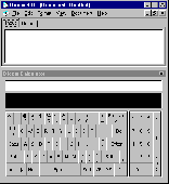
Dicom calculates, converts and computes. The first ever computing tool that deals with dimensions of physical quantities in mathematical expression, Dicom, has the answer to expression like: 30 mi./h.+6 ft./s.+15.24 m./s. to ft./s. Dicom can evaluate expressions anywhere in a rich text formatted document. It has a built-in rich text editor. Process your words, numbers, and measurements at one...
Category: Home & Education
Publisher: Knowbotron, License: Freeware, Price: USD $0.00, File Size: 2.5 MB
Platform: Windows
Topcon's Topcon Tools software provides a powerful post-processing solution, network analysis and adjustment with an intuitive operator interface that's easy to learn and use.
Category: Multimedia & Design / Digital Media Editors
Main Features:
- Supports all Topcon survey instruments and data collectors
- Modular software including Total Station, RTK, Post Processing, GIS, Design, and Imaging
Publisher: Topcon Positioning System, License: Freeware, Price: USD $0.00, File Size: 5.1 MB
Platform: Windows
Abykus is an easy-to-use spreadsheet designed for business and scientific applications. The program combines object-oriented functionality with traditional spreadsheet operations, allowing you to store multi-value data types (such as arrays and matrixes) in a single cell. This not only saves valuable space on your worksheets, but it also significantly reduces the overhead needed to manage...
Category: Business & Finance
Publisher: Abykus.com, License: Freeware, Price: USD $0.00, File Size: 581.9 KB
Platform: Windows

Revulytics Usage Intelligence, the first solution purpose-built for distributed software on Windows, Macintosh, and Linux platforms, provides deep insight into application usage. See which features are being used and which remain ignored or undiscovered. Advanced reporting lets you filter by properties including region, version, OS platform, and architecture to focus your roadmap development....
Category: Software Development / Components & Libraries
Publisher: Revulytics, Inc., License: Freeware, Price: USD $0.00, File Size: 937.0 KB
Platform: Linux
Revulytics Usage Intelligence, the first solution purpose-built for distributed software on Windows, Macintosh, and Linux platforms, provides deep insight into application usage. See which features are being used and which remain ignored or undiscovered. Advanced reporting lets you filter by properties including region, version, OS platform, and architecture to focus your roadmap development....
Category: Software Development / Components & Libraries
Publisher: Revulytics, Inc., License: Freeware, Price: USD $0.00, File Size: 482.0 KB
Platform: Mac

Importation/Exportation: Import/export trails to gpx file. Unlimited number of trails, and TrackPoints. Export to gpx, Excel, PDF, XPS and KML/KMZ. Data table: Very flexible data table that allows sorting by columns, with inheritance of data, attributes, etc. Presentation on map: View on map in accordance with the active trail, which comes from providers of maps, as in 'Satellite' mode...
Category: Home & Education / Miscellaneous
Publisher: Aplicaciones Topográficas S.L., License: Freeware, Price: USD $0.00, File Size: 27.0 MB
Platform: Windows