Free Downloads: Data Mapping Tool
License: All | Free
iMindMap Basic is a Mind Mapping software which will get you Mind Mapping quickly and easily.
iMindMap Basic is a Mind Mapping software which will get you Mind Mapping quickly and easily. A simple Tool to help you start thinking in a clear and creative way, iMindMap Basic uses a process that has been enhancing the way people think for decades. iMindMap Basic is completely free for life and is a great starter package for those who want to start exploring the uses of...
Category: Home & Education / Teaching Tools
Publisher: Buzan Online, License: Freeware, Price: USD $0.00, File Size: 213.6 MB
Platform: Windows
The Microdrone Airborne Mapping extension to Orbit GIS provides the tools required for automated flight and high precision Mapping. It contains a Waypoint Generator, a Microdrone in-flight tracker, and a captation Tool. Further image-, stereoprocessing and orthorectification can be executed using the Strabo Photogrammetry extension to Orbit GIS.
Category: Multimedia & Design / Multimedia App's
Publisher: Orbit GeoSpatial Technologies, License: Freeware, Price: USD $0.00, File Size: 30.0 MB
Platform: Windows
Codus is a comprehensive code generation tool for object-relational mapping.
Codus is a comprehensive code generation Tool for object-relational Mapping. For a given database it automatically generates a full Data access layer, web services for distributed programming, strongly-typed collections, and a full set of unit tests.
Category: Software Development / Misc. Programming
Publisher: intesar66, License: Freeware, Price: USD $0.00, File Size: 4.4 MB
Platform: Windows
If you don't have internet access on your phone, or you want to self-select a larger region of Mapping, then the Map Chooser Tool can be used to make map tile selections. Choose your own Mapping areas with the flexible select Tool that lets you select unlimited areas of Mapping. Based on a grid, you can choose any grid squares you like - so you can pick...
Category: Home & Education / Miscellaneous
Publisher: ViewRanger, License: Freeware, Price: USD $0.00, File Size: 213.2 MB
Platform: Windows
Trizbort is a simple tool which can be used to create maps for interactive fiction.
Trizbort is a simple Tool which can be used to create maps for interactive fiction.
Over the years a number of styles have evolved for interactive fiction Mapping. Trizbort focuses on creating maps in only one of these styles, as popularised by Infocom: labelled boxes for rooms, with lines connecting them.
Whether you're playing or writing interactive fiction,...
Category: Multimedia & Design / Digital Media Editors
Publisher: Genstein, License: Freeware, Price: USD $0.00, File Size: 596.2 KB
Platform: Windows
So that you can identify the Mapping & GIS product that best suits your needs, use this simple Product Comparison. There are four main product types that you can use to create a GPS Data collection and maintenance system, or mobile GIS solution. Use the links below to select a product group, and compare the features of each product within that group.
Category: Internet / Communications
Publisher: Trimble Navigation Limited, License: Freeware, Price: USD $0.00, File Size: 2.7 MB
Platform: Windows
Water Point Mapping is a process for monitoring the distribution and status of water points in rural and urban areas. It supports local level planning and can improve accountability for water sector performance at local and national levels.
It uses the Google Earth application to visualise Data. Once Google Earth has been installed, it can be run offline.
...
Category: Home & Education / Miscellaneous
Publisher: WaterAid, License: Freeware, Price: USD $0.00, File Size: 880.0 KB
Platform: Windows
GPSeismic® is a suite of survey, Mapping, and Data management applications to support geophysical exploration.
GPSeismic applications offer advanced functionality to assist
the GNSS, INS, and conventional surveyor with a variety of tasks including the following:
-A wide range of both graphical, numeric and SQL based controller upload point selection methods...
Category: Business & Finance / Applications
Publisher: Dynamic Survey Solutions, Inc., License: Freeware, Price: USD $0.00, File Size: 162.8 MB
Platform: Windows
Cincom includes Cincom® ObjectStudio® as part of Cincom Smalltalk™.
Cincom includes Cincom® ObjectStudio® as part of Cincom Smalltalk™. ObjectStudio is the first—and only—Compatible with Windows 7 Smalltalk environment. For customers needing to build applications that cleanly fold into a Microsoft-centric infrastructure, ObjectStudio is the best choice. ObjectStudio is a Windows-specific platform that is oriented toward building client...
Category: Software Development / Misc. Programming
Publisher: Cincom Systems Inc., License: Freeware, Price: USD $0.00, File Size: 4.1 MB
Platform: Windows
MICRODEM is a freeware microcomputer Mapping program written by Professor Peter Guth of the Oceanography Department, U.S. Naval Academy. It requires a 32 bit version of Windows (NT/2000/XP or 95/98/ME). You may freely use MICRODEM with no restrictions.
MICRODEM displays and merges
- digital elevation models
- satellite imagery
- scanned maps
...
Category: Multimedia & Design / Graphics Viewers
Publisher: Petmar Triilobite Breeding Ranch, License: Freeware, Price: USD $0.00, File Size: 84.9 MB
Platform: Windows
 Freeware
NConstruct Lite is a powerful wizard-like Tool for creating application's Data layer source code for NHibernate object/relational persistence and query framework. NConstruct Lite examines database's metadata and creates NHibernate HBM files, entities' source code, Microsoft Visual Studio project file, and some optional helper files. NConstruct Lite is a derivative of more...
Category: Software Development / IDEs & Coding Utilities
Publisher: Biro M&T, License: Freeware, Price: USD $0.00, File Size: 9.2 MB
Platform: Windows
QuakeMap is a powerful GPS/mapping program for your Windows computer.
QuakeMap is a powerful GPS/Mapping program for your Windows computer. It can be downloaded here for free. The trial mode allows you to use most features indefinitely. When you need to unlock certain powerful features, a License Key can be ordered here. QuakeMap is designed for ease of use. It eatures intuitive user interface, supports most popular Garmin and Magellan receivers, reads and...
Category: Utilities / Misc. Utilities
Publisher: quakemap.com, License: Freeware, Price: USD $0.00, File Size: 821.2 KB
Platform: Windows
Ekahau HeatMapper is a free software tool for quick and easy coverage mapping of Wi-Fi (802.
Ekahau HeatMapper is a free software Tool for quick and easy coverage Mapping of Wi-Fi (802.11) networks. It's the only free, easy-to-use Tool that shows, on a map, the wireless network coverage in your home or small office. HeatMapper also locates all access points.
Category: Internet / Monitoring
Publisher: Ekahau Inc., License: Freeware, Price: USD $0.00, File Size: 94.6 MB
Platform: Windows
DIVA-GIS is a free computer program for Mapping and geographic Data analysis (a geographic information system (GIS). With DIVA-GIS you can make maps of the world, or of a very small area, using, for example, state boundaries, rivers, a satellite image, and the locations of sites where an animal species was observed.
Category: Business & Finance / Applications
Publisher: diva-gis, License: Freeware, Price: USD $0.00, File Size: 3.8 MB
Platform: Windows
PCM SurveyCERT makes pipe mapping easier for surveyors in the field.
PCM SurveyCERT makes pipe Mapping easier for surveyors in the field. Survey Data may either be viewed in real time or be saved within the PCM to be reviewed later.The PCM SurveyCERT installation bundle includes both PC and PDA versions of the application.
Category: Software Development / Misc. Programming
Publisher: Radiodetection Ltd, License: Freeware, Price: USD $0.00, File Size: 5.7 MB
Platform: Windows
HydroSHEDS is a Mapping product that provides hydrographic information for regional and global-scale applications in a consistent format. It offers a suite of geo-referenced Data sets (vector and raster) at various scales, including river networks, watershed boundaries, drainage directions, and flow accumulations. HydroSHEDS is based on high-resolution elevation Data...
Category: Home & Education / Miscellaneous
Publisher: WWF-CSP, License: Freeware, Price: USD $0.00, File Size: 1.7 MB
Platform: Windows
RD8000 SurveyCERT makes cable & pipe mapping easier for surveyors in the field.
RD8000 SurveyCERT makes cable & pipe Mapping easier for surveyors in the field. Survey Data may either be viewed in real time or be saved within the RD8000 to be reviewed later.
An useful software that you can easy get it on your computers. The RD8000 can pass survey Data to a compatible PDA or PC in real time using Bluetooth® wireless technology.
Category: Multimedia & Design / Multimedia App's
Publisher: Radiodetection Ltd., License: Freeware, Price: USD $0.00, File Size: 5.9 MB
Platform: Windows
PMapServer7 is a free add-on for UI-View32.
PMapServer7 is a free add-on for UI-View32. To use it, first download and register a copy of UI-View32. There are versions of PMapServer that will work with with Precision Mapping V5, V6 and V7.UI-View32 street level Mapping of the whole of the USA. To support Precision Mapping, UI-View32 uses a plug-in map server (PMapServer) that integrates seamlessly into the program....
Category: Home & Education / Miscellaneous
Publisher: Bill Diaz, License: Freeware, Price: USD $0.00, File Size: 5.4 MB
Platform: Windows
The LaCie IP configurator is an easy Tool for Mapping and configuring the LaCie Ethernet Disks on the network. Designed for Ethernet Disk (rack), Ethernet Disk mini and Ethernet Big Disk. It stated in the latest log you may not apply configuration when change static to DHCP
Category: Internet / Misc. Plugins
Publisher: LACIE GROUP, License: Freeware, Price: USD $0.00, File Size: 1.8 MB
Platform: Windows
This software Tool is a professional astronomy planetarium and star Mapping program specially designed for Windows 9x/ME/NT/2000/XP. StarCalc illustrates the star positions at any instance of the day as observed from any geographic location on Earth. The star positions can be viewed and presented as images in a hemispherical whole sky or in any of the user-defined sub-areas.
Category: Home & Education / Astrology & Numerology
Publisher: Alexander E. Zavalishin, License: Freeware, Price: USD $0.00, File Size: 753.4 KB
Platform: Windows
Spatial Workshop is Mapping software used for spatial information integration, query, analysis and reporting.
You build spatial applications with a few clicks or support complex business processes with geospatial and business Data from Oracle, Smallworld, ESRI, maps, files, spreadsheets and other sources.
You can combine and model geospatial Data,...
Category: Multimedia & Design / Multimedia App's
Publisher: Spatial Eye bv, License: Freeware, Price: USD $0.00, File Size: 176.7 MB
Platform: Windows
Free Satellite Maps is a free tool from Google which offers a satellite mapping service worldwide.
Free Satellite Maps is a free Tool from Google which offers a satellite Mapping service worldwide.These are accompanied by a street service, a route planner and information about business in almost all countries.In this way we can fly the world from satellite view or in birds eye.The level of detail is different depending on where you are located.Major cities have a very excellent...
Category: Home & Education / Science
Publisher: www.satelliteview-of-my-house.com, License: Freeware, Price: USD $0.00, File Size: 612.0 KB
Platform: Windows
Freeware
OzGIS is an extensive system for the analysis and display of geographically referenced Data. About 150 menus provide an enormous range of options for: . importing Data from databases, spreadsheets and Geographic Information Systems (GISs) or downloaded from Census Bureaux or Mapping agencies. . processing Data in preparation for display and analysis ....
Category: Home & Education / Mathematics
Publisher: OzGIS, License: Freeware, Price: USD $0.00, File Size: 313.0 KB
Platform: Windows
Ais Decoder accepts AIS Data from an AIS Receiver, the Internet or a Local Network connection, decodes the Data and presents the decoded Data in a form suitable for display and analysis by Mapping program (eg Google Earth or Google Maps), or for analysis using Excel, or by a database (eg MySql).
The decoder will decode all the NMEA content of all 27 AIS mesage...
Category: Business & Finance / Business Finance
Publisher: Neal Arundale, License: Freeware, Price: USD $0.00, File Size: 2.8 MB
Platform: Windows
EntityDAC Express is a free ORM for Delphi with LINQ support. It provides a powerful framework that allows performing object-relational Mapping of database objects to Delphi classes with full support for encapsulation, inheritance, polymorphism and other OOP features. To retrieve Data from a database, LINQ is used as a database independent query engine. In addition, there is a...
Category: Software Development / Databases & Networks
Publisher: Devart, License: Freeware, Price: USD $0.00, File Size: 111.5 MB
Platform: Windows
Freeware
Data Exchange Manager is an example of tomorrow's technology today. With this Tool database administration is a breeze. Transfer Data from any Data source to another. Use our custom designed templates to increase speed for any Database platforms. The most innovative and valuable feature would be our scheduler, which allows users to schedule their Data...
Category: Utilities / Misc. Utilities
Publisher: SaaS Technologies Inc, License: Freeware, Price: USD $0.00, File Size: 1.9 MB
Platform: Windows
Easily create HTML image/photo maps with this free friendly image Mapping utility from the authors of the best free photo editing software - Photo Pos Pro photo editor . Pos HTML Image Mapper includes WYSIWYG interface allowing you Mapping images and photos fast and easy. Using the software you can easily create graphic toolbars to your website; you can easily link desired...
Category: Web Authoring / HTML Color Pickers
Publisher: PowerOfSoftware Ltd., License: Freeware, Price: USD $0.00, File Size: 7.9 MB
Platform: Windows
Entity Developer is a free powerful modeling and code generation Tool for ADO.NET Entity Framework, NHibernate, and LINQ to SQL. You can use Model-First and Database-First approaches to design your model and generate C# or Visual Basic .NET code for it. Entity Developer Express for SQL Server is a free limited version of Entity Developer for SQL Server. The Express Edition does not...
Category: Business & Finance / Database Management
Publisher: Devart, License: Freeware, Price: USD $0.00, File Size: 30.7 MB
Platform: Windows
ArcReader is a free, easy-to-use desktop Mapping application that allows users to view, explore, and print maps and globes. Anyone with ArcReader can view high-quality interactive maps authored by a high-level ArcGIS Desktop product and published with the ArcGIS Publisher extension.
ArcReader is a free and easy-to-use application that allows users to view and print maps that...
Category: Desktop Enhancements / Shell & Desktop Managers
Publisher: Environmental System Research Institute, Inc., License: Freeware, Price: USD $0.00, File Size: 499.2 MB
Platform: Windows
The Coverage Calculator software is used to configure EAW Commercial loudspeaker systems listed within the program in a distributed layout using SPL (sound pressure level) Mapping as the primary criteria.
FEATURES:
-User-adjustable layout density.
-SPL map of listening area with adjustable resolution and frequency.
-Database of measured loudspeaker Data...
Category: Audio / Utilities & Plug-Ins
Publisher: EAW, License: Freeware, Price: USD $0.00, File Size: 3.9 MB
Platform: Windows
Thoughtograph is simple, effective and rewarding to use.
Thoughtograph is simple, effective and rewarding to use.
A Thot is a Thoughtograph document, it is a visual representation of your thoughts taking shape.
For those familiar with mind Mapping, spider diagrams and concept Mapping the interface will feel familiar and intuitive.
For those new to laying out their thoughts visually it will liberate...
Category: Home & Education / Miscellaneous
Publisher: 3MRT Limited, License: Freeware, Price: USD $0.00, File Size: 15.5 MB
Platform: Windows
CopanMobile for Palm OS is a very functional and easy-to-use geomatics engineering Tool for computing and managing plane surveying and Mapping coordinates. It does numerous coordinate geometry (COGO) calculations, processes and adjusts raw field survey Data, computes and adjusts map traverse Data, performs map or deed checks, calculates curves, areas and perimeters,...
Category: Multimedia & Design / Multimedia App's
Publisher: Underhill Geomatics Ltd., License: Freeware, Price: USD $0.00, File Size: 341.0 KB
Platform: Palm
The LookLOCAL Firefox Toolbar is a convenient extension to the Firefox browser that enables you to map a location, get directions, or search for products and services from any web site or page you are on without first navigating to an online Mapping site. Highlight and right click on a search topic, an address in your browser window or type an address directly into the toolbar, click...
Category: Business & Finance / MS Office Addons
Publisher: IDELIX Software Inc., License: Freeware, Price: USD $0.00, File Size: 29.0 KB
Platform: Windows
CopanMobile for Pocket PC is a very functional and easy-to-use geomatics engineering Tool for computing and managing plane surveying and Mapping coordinates. It does numerous coordinate geometry (COGO) calculations, processes and adjusts raw field survey Data, computes and adjusts map traverse Data, performs map or deed checks, calculates curves, areas and...
Category: Business & Finance / Applications
Publisher: Underhill Geomatics Ltd., License: Freeware, Price: USD $0.00, File Size: 341.0 KB
Platform: Windows
The XML Converter Standard Edition is a Data converting program which lets the user to interactively create a Data transformation. It allows you to use XML documents by exporting source Data into XML file. This program is a visual Mapping and conversion Tool, which manages all dialects of XML such as DTD(document type definition), XSD(XML Schema Definition),...
Category: Web Authoring / XML/CSS Utilities
Publisher: RustemSoft, License: Freeware, Price: USD $0.00, File Size: 4.8 MB
Platform: Windows
This is a Windows utility for those Tengwar fonts that use the key mapping invented by Daniel S.
This is a Windows utility for those Tengwar fonts that use the key Mapping invented by Daniel S. Smith. The program allows you to write text in Roman letters (the ones most Europeans and Americans use), select a Tengwar mode, and have the text transcribed to Tengwar.
Category: Utilities / System Utilities
Publisher: Mans Bjorkman, License: Freeware, Price: USD $0.00, File Size: 2.2 MB
Platform: Windows
This free Tool enables efficient and easy selection of SNP sets to distinguish mouse strains of interest, with specific applications in genotype/phenotype Mapping and strain verification. Mouse SNPbrowser selects from more than 10,000 Pre-Designed SNP Genotyping assays using either TaqMan® Assay or SNPlex™ Genotyping Systems.The mouse SNP database underlying the software...
Category: Utilities / Misc. Utilities
Publisher: Applied Biosystems, License: Freeware, Price: USD $0.00, File Size: 5.2 MB
Platform: Windows
Copan for Pocket PC is a very functional and easy-to-use geomatics engineering Tool for computing and managing plane surveying and Mapping coordinates.
It does numerous coordinate geometry (COGO) calculations, processes and adjusts raw field survey Data, computes and adjusts map traverse Data, performs map or deed checks, calculates curves, areas and...
Category: Multimedia & Design / Multimedia App's
Publisher: Underhill Geomatics Ltd, License: Freeware, Price: USD $0.00, File Size: 662.0 KB
Platform: Windows
Copan for Mobile 6 is a very functional and easy-to-use geomatics engineering Tool for computing and managing plane surveying and Mapping coordinates.
It does numerous coordinate geometry (COGO) calculations, processes and adjusts raw field survey Data, computes and adjusts map traverse Data, performs map or deed checks, calculates curves, areas and...
Category: Multimedia & Design / Multimedia App's
Publisher: Underhill Geomatics Ltd, License: Freeware, Price: USD $0.00, File Size: 662.0 KB
Platform: Windows
The OSTN02 extension for ArcPad is a FREE Tool that automatically transforms GPS Data and aligns it with Ordnance Survey (OS) background map. This easy-to-use extension removes the need to manually post-process GPS Data by providing’ on the fly’ transformation of WGS84 latitude and longitude into OSTN02 corrected British National Grid coordinate. Data...
Category: Home & Education / Miscellaneous
Publisher: ESRI (UK) Ltd, License: Freeware, Price: USD $0.00, File Size: 8.0 MB
Platform: Windows
The Mapping and GIS License Manager software allows you to manage multiple licenses for the GPS Pathfinder Office software. Using the GPS Pathfinder Office License Administrator software, users of the GPS Pathfinder Office software can choose either a single use or a floating license.
Category: Business & Finance / Business Finance
Publisher: Trimble, License: Freeware, Price: USD $0.00, File Size: 26.8 MB
Platform: Windows
Karvonite is a FREE persistence framework for the .
Karvonite is a FREE persistence framework for the .NET Framework 2 and it focuses on the manipulation and persistence of .NET objects. This technology provides a new direction for how small to midsize applications can store and deploy Data. Karvonite is not an O/R Mapping Tool for a very good reason. There is no relational world to map to. In Karvonite, object Data...
Category: Software Development / Components & Libraries
Publisher: AdventurerLand Entertainment, License: Freeware, Price: USD $0.00, File Size: 5.9 MB
Platform: Windows,
You can use your existing digital (vector) maps in Autodesk MapGuide® software by converting them to Spatial Data Files (SDF). SDF is a special Data format for delivering large amounts of Data quickly over an intranet or the Internet. The SDF Loader is a utility used to create Spatial Data Files (SDF) and their accompanying Spatial Index Files (SIF) from a...
Category: Multimedia & Design / Multimedia App's
Publisher: Autodesk, Inc., License: Freeware, Price: USD $0.00, File Size: 54.6 MB
Platform: Windows
Freeware
MindMaple is an effective software method for brainstorming, note taking, organizing, and managing projects by stimulating both sides of the brain through use of visual contents and maps. MindMaple is focused on improving user friendly interface to create maps. The interface allows the user to add topics by click-dragging from an existing topic box, so called the Drawing Interface, This feature...
Category: Business & Finance / MS Office Addons
Publisher: MindMaple Inc., License: Freeware, Price: USD $0.00, File Size: 9.7 MB
Platform: Windows
GigaBASE inherits most of the features of FastDB, but uses page pool instead of direct Mapping of file on virtual memory. So GigaBASE is able to handle database, which size significantly exceeds size of computer physical memory. Convenient and flexible C interface makes development of application for GigaBASE very easy and automatic scheme evaluation simplifies maintenance and...
Category: Software Development / Misc. Programming
Publisher: Konstantin Knizhnik, License: Freeware, Price: USD $0.00, File Size: 1.9 MB
Platform: Windows
This project has as objective the analysis of interactions between the protein motifs in molecular docking with the Mapping of protein surfaces.
With this aim in mind the first phase of the project was to develop the MSProt - Viewer. An open-source software able to visualize protein structures in 3D.
The MSProt - Viewer was developed with the programming...
Category: Home & Education / Science
Publisher: UNIFESP, License: Freeware, Price: USD $0.00, File Size: 4.4 MB
Platform: Windows
Utilizing the latest Geo-Mapping technology, PhotoTrackr allows you to precisely record and review your trip no matter where you have traveled. If you took pictures on your trip, it will show you the exact location and time of your pictures. Furthermore, if you loved sharing, PhotoTrackr will enable you to share your whole vacation experience with others.
Category: Home & Education / Miscellaneous
Publisher: GiSTEQ, License: Freeware, Price: USD $0.00, File Size: 17.0 MB
Platform: Windows
The ARC3WMS client is an ArcView 3 extension (.
The ARC3WMS client is an ArcView 3 extension (.AVX) that provides access to Data sets stored on a Web Map Server (WMS). WMS is an internet Mapping protocol published by the OpenGIS Consortium. WMS servers publish map images to remote clients using standard internet technologies. There are WMS servers for LandSat Data, USGS DOQ photos, bathymetry, and many other Data...
Category: Multimedia & Design / Multimedia App's
Publisher: Refractions Research Inc, License: Freeware, Price: USD $0.00, File Size: 2.1 MB
Platform: Windows
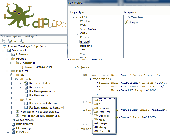
dPulpo is a code generation Tool that generates your database and Data access layer, starting from a database-, framework- and language-independent Entity Relationship model described in XML. It's main assets are simplicity, speed and user-friendliness, taking away the grunt work for developers, without sacrificing flexibility. Built on existing database engines, frameworks and...
Category: Software Development / Misc. Programming
Publisher: Pulpo, License: Freeware, Price: USD $0.00, File Size: 1.2 MB
Platform: Windows
Freeplane is a free mind mapping software and knowledge management software.
Freeplane is a free mind Mapping software and knowledge management software.
Freeplane is a powerful and free software for building mind maps. It is a redesigned version of the well known FreeMind. The software is written in Java, and supports any platform capable of running current versions of Java, including:
- Microsoft Windows
- Mac OS X
- Linux / BSD /...
Category: Home & Education / Miscellaneous
Publisher: Volker Boerchers, Dimitry Polivaev, License: Freeware, Price: USD $0.00, File Size: 16.4 MB
Platform: Windows