Free Downloads: Esri
License: All | Free
This utility scans exe or dll files of your choosing and detects usage of .
This utility scans exe or dll files of your choosing and detects usage of .NET types released by Esri. It then generates a report of this usage for your review.
Among other things, you can use the information provided to verify that you are not using types from assemblies that require licenses beyond your target license level or to generate a list of types that you can...
Category: Utilities / Misc. Utilities
Publisher: Environmental Systems Research Institute, Inc., License: Freeware, Price: USD $0.00, File Size: 743.3 KB
Platform: Windows
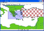
It`s a FREE Esri shape files (*.shp), MapInfo interchange (*.mif) and AutoCAD *.dxf viewer. Using this utility you can view *.shp files (Esri shape files), *.mif files (MapInfo interchange) and AutoDesk AutoCAD *.dxf. No other files are needed.
Category: Multimedia & Design
Publisher: Avangardo, License: Freeware, Price: USD $0.00, File Size: 420.9 KB
Platform: Windows
ArcScripts is intended for the free exchange of scripts and tools related to ESRI software products.
ArcScripts is intended for the free exchange of scripts and tools related to Esri software products. Please alert the moderator if this script is a demo, trial-version, or an advertisement for a retail product.
New implementation of the toolbar, plus fixed an issue that was preventing the button from appearing for some users
Category: Home & Education / Miscellaneous
Publisher: ESRI, License: Freeware, Price: USD $0.00, File Size: 406.3 KB
Platform: Windows
gSpatial Toolbar allows you to import, display and manipulate ESRI shapefile data in Google Earth.
gSpatial Toolbar allows you to import, display and manipulate Esri shapefile data in Google Earth. Annotate your data and perform thematic queries on your Excel spreadsheet data or ODBC data sources, visualize results in Google Earth
Category: Multimedia & Design / Graphics Viewers
Publisher: gSpatial, License: Freeware, Price: USD $0.00, File Size: 686.1 KB
Platform: Windows
This is a tool for converting CSV ("Comma Separated Value") files, or any delimited text files, into Esri Shapefiles, the format used by ArcMap and MapWindow. This software is open source under the MPL and was created using MapWinGIS. This tool works only with Net Framework 2.0.
Category: Multimedia & Design / Media Management
Publisher: Christopher Michaelis, License: Freeware, Price: USD $0.00, File Size: 47.8 MB
Platform: Windows
Shape2Earth Globe lets you quickly and easily capture Google Earth images for your personal use.
Shape2Earth Globe lets you quickly and easily capture Google Earth images for your personal use. Capture images for use in popular applications like Microsoft Office and Esri's ArcMap.
Shape2Earth Globe also saves the bounding box of the image in a kml file. This data is then used to generate a world file and projection file so that your image can be loaded into a GIS, such...
Category: Multimedia & Design / Multimedia App's
Publisher: Shape2Earth, License: Freeware, Price: USD $0.00, File Size: 402.5 KB
Platform: Windows
ArcScripts is intended for the free exchange of scripts and tools related to ESRI software products.
ArcScripts is intended for the free exchange of scripts and tools related to Esri software products. Please alert the moderator if this script is a demo, trial-version, or an advertisement for a retail product.
Akin to the GRIDSPOT AML in workstation ArcInfo, this VB tool overlays a point shapefile or point coverage on a raster layer and assigns the value of the raster to...
Category: Multimedia & Design / Multimedia App's
Publisher: Dan Rathert, License: Freeware, Price: USD $0.00, File Size: 7.4 KB
Platform: Windows
Shape Viewer is a free tool, which you can use to view ESRI Shape files.
Shape Viewer is a free tool, which you can use to view Esri Shape files.
Shape Viewer can open (.shp) files that contain the geometry information of the shape file.With Shape Viewer you can also create new (.shx) file, and new empty (.dbf) file for your shape file.
If you have hundreds of shape files, and you want to view their contents rapidly, and you don't want to...
Category: Multimedia & Design / Graphics Viewers
Publisher: Mohammed Hammoud, License: Freeware, Price: USD $0.00, File Size: 35.0 KB
Platform: Windows
 Freeware
Convert Esri ShapeFiles (.SHP) geolocation data into AnyMap format to be used with AnyChart. AnyChart Flash Map Converter allows making use of a wide choice of maps with AnyChart Flash Component, a GIS visualization system that recognizes map data in AnyMap format only. AnyChart Flash Map Converter makes it easy to visualize any geolocation data without hefty expenses associated with...
Category: Web Authoring / Image Mapping Tools
Publisher: AnyChart.Com, License: Freeware, Price: USD $0.00, File Size: 1.6 MB
Platform: Windows
FloppyGIS runs on Windows. It is a free compact Shapefile Viewer. It also supports image files that have geo-reference from Esri World Files.
Category: Multimedia & Design / Graphics Viewers
Publisher: ldinakis.googlepages.com, License: Freeware, Price: USD $0.00, File Size: 619.0 KB
Platform: Windows, Vista
Windows GUI utility for SDE. Preview Shape and Coverage files before you load them to SDE. Export, Describe, Delete, and examine Layers stored in SDE. Creates batch command line scripts for administration of SDE. ArcScripts is intended for the free exchange of scripts and tools related to Esri software products
Category: Home & Education / Miscellaneous
Publisher: ESRI, Redlands CA. 92373, License: Freeware, Price: USD $0.00, File Size: 4.9 MB
Platform: Windows
AtlasStyler is a user-friendly application to style geodata.
AtlasStyler is a user-friendly application to style geodata. The resulting styles can be saved to XML files that follow the OGC SLD/SE standard 1.0. The AtlasStyler is a "stand-alone" application, that can be used independently for any vector data. Esri Shapefiles, OGC WFS and PostGIS datasources are supported.
Category: Software Development / Misc. Programming
Publisher: Geopublisher, License: Freeware, Price: USD $0.00, File Size: 6.9 KB
Platform: Windows
Spatial Workshop is mapping software used for spatial information integration, query, analysis and reporting.
You build spatial applications with a few clicks or support complex business processes with geospatial and business data from Oracle, Smallworld, Esri, maps, files, spreadsheets and other sources.
You can combine and model geospatial data, services and...
Category: Multimedia & Design / Multimedia App's
Publisher: Spatial Eye bv, License: Freeware, Price: USD $0.00, File Size: 176.7 MB
Platform: Windows
The MapMart On-Demand™ toolbar enables a user to access aerial, satellite, DEM, topography and vector data from within the ArcMap application. Once a user installs the plug-in within Esri ArcMap 9.2 or 9.3, users will be able to research, preview, purchase and download imagery and data for their projects inside ArcMap
Category: Software Development / Misc. Programming
Publisher: MapMart, License: Freeware, Price: USD $0.00, File Size: 954.8 KB
Platform: Windows
Geocando is a 3d Viewer for visualisation and querying of geodata and geomodels.
Geocando is a 3d Viewer for visualisation and querying of geodata and geomodels. It is especially developed for Paradigm's GOCAD® objects. Another supported format is the typical GIS exchange format Esri Shapefile. In Geocando the objects can be visualized with different symbols, colours, scalebars, vertical exaggeration factors,etc. Typical features like get coordinates and...
Category: Multimedia & Design / Graphics Viewers
Publisher: Manuel Feige, License: Freeware, Price: USD $0.00, File Size: 9.4 MB
Platform: Windows
ER Mapper Image Compressor - compressing, mosaicking and color balancing aerial and satellite images to JPEG 2000 and ECW formats makes them manage, share and use in your business activities. ER Mapper Image Compressor is a flexible, high-speed geospatial image data compression application.
Category: Multimedia & Design / Image Editing
Main features:
-ER Mapper Algorithm (.alg)
-ER Mapper Raster Dataset (.ers)
Publisher: Earth Resource Mapping, License: Freeware, Price: USD $0.00, File Size: 33.5 MB
Platform: Windows
You can change the # of objects in the config file.
You can change the # of objects in the config file. However, the trace file is not overwritten/regenerated if it already exists. If you change the # of objects in the config file, but use a trace file that was generated with a different # of objects, some objects might not have traces, which can cause an exception.
Main Features:
- generate mobility traces for mobile...
Category: Web Authoring / Web Design Utilities
Publisher: Georgia Tech, License: Freeware, Price: USD $0.00, File Size: 10.1 MB
Platform: Windows
Land surveyors and civil engineers:
o Calculate surveys and manage points, effortlessly
o Run Copan on Windows 2K/XP/Vista/7
o Use it forever and pay nothing
o Choose quadrant bearings or N/S azimuths, and gons or DMS
o Create point files quickly and easily
o Edit any point's number, name, coords, code or note
o Specify groups of points for...
Category: Multimedia & Design / Multimedia App's
Publisher: Underhill Geomatics Ltd, License: Freeware, Price: USD $0.00, File Size: 5.6 MB
Platform: Windows

The free AvisMap Viewer opens most GIS/CAD and raster image file types and most ArcView, ArcExplorer, and MapInfo projects. Besides just opening and viewing files, the Viewer supports an extensive list of features including visual layer properties control, legend control, thematic mapping, spatial and attribute querying, custom labeling, on-map measurements, hyper-linking, PDF export and much...
Category: Software Development / Components & Libraries
Publisher: AvisMap GIS Technologies, License: Freeware, Price: USD $0.00, File Size: 22.3 MB
Platform: Windows

OkMap is a GPS and map software that:
-Works with vectorial maps and calibrates raster maps
-Organizes paths by creating waypoints, routes and tracks
-Uploads/downloads data to/from your GPS
-Uses altitude DEM data
-Supports GPS real-time navigation
-Sends/receives vehicles position and display tracks on maps in real time
-Provides autorouting and geocoding...
Category: Business & Finance / Applications
Publisher: Gian Paolo Saliola, License: Freeware, Price: USD $0.00, File Size: 20.2 MB
Platform: Windows
Features
- Easy-to-learn WINDOWS™ based user interface
- Easy-to-use thanks to single key functions
- Fully automatic (no user interface needed... suited for mobile applications)
- Very fast because of a special file format (XIM file format)
- Imperial or international units or mixture of both
- Rich, detailed configuration
- Utilizes most...
Category: Multimedia & Design / Multimedia App's
Publisher: Sapper Oy, Finland, License: Freeware, Price: USD $0.00, File Size: 1.6 MB
Platform: Windows