Free Downloads: Geo Information
License: All | Free
The Balloon Browser recognizes and highlights geo-coordinates in web pages.
The Balloon Browser recognizes and highlights Geo-coordinates in web pages. Hovering over a recognized location advises another application to show a map of the corresponding area. For now the only program Balloon Browser can interact with is Google Earth.
Instead of waiting for the one true Geo-notation and markup standard, Balloon Browser tries to parse a variety of...
Category: Internet / Browsers
Publisher: Michael Krause, License: Freeware, Price: USD $0.00, File Size: 5.6 MB
Platform: Windows
When posting a photo on your favorite Social Network, online photo gallery, or web page, you are inviting danger.Most smartphones and some cameras made today are equipped with Geo tags. Geo tags are imbedded in the picture and use the same concept as GPS.
The Geo tag in the photo is a smart tool that allows the photo to be tagged to an exact location. Unless you know...
Category: Security & Privacy / Other
Publisher: Geotag Security Software, Inc, License: Freeware, Price: USD $0.00, File Size: 2.2 MB
Platform: Windows
Metal Slug is a series of run and gun video games first released on Neo-Geo arcade machines and game consoles created by SNK. It was also ported to other consoles, such as the Sega Saturn, the PlayStation, the Neo-Geo Pocket Color and more.
Now You can play on your PC for free on Softendo Mario Games. Collect many interesting weapons and bonuses, fight againts many...
Category: Games / Action
Publisher: Softendo, License: Freeware, Price: USD $0.00, File Size: 7.2 MB
Platform: Windows
Geo.De.Sy is a complete drawing environment with survey utilities free for the customers of IQSoft and CivilShop. You can create drawing , open and save DWG and DXF untill Autocad version 2011, insert point to drawing , create grid, dtm beta , image correlation.
It is the first release of the program. It is under hard development. The features that are in active development...
Category: Multimedia & Design / Image Editing
Publisher: IQSoft, License: Freeware, Price: USD $0.00, File Size: 14.3 MB
Platform: Windows
Metal Slug is a series of run and gun video games first released on Neo-Geo arcade machines and game consoles created by SNK.
Metal Slug was also ported to other consoles, such as the Sega Saturn, the PlayStation, the Neo-Geo Pocket Color and others more.
Fight your way through the canyons taking out the enemy on the way down. Look out for upgrades and...
Category: Games / Action
Publisher: Softendo, License: Freeware, Price: USD $0.00, File Size: 8.2 MB
Platform: Windows
Geo-SLOPE GeoBorrow
License borrowing allows a company that has purchased GeoStudio 2007 network licenses to have an end-user ‘check out’ a license for use while disconnected from the corporate network. This feature enables you to temporarily make use of a network license in a standalone capacity. Once a license is borrowed, the license is removed from the pool,...
Category: Business & Finance / Database Management
Publisher: GEO-SLOPE International Ltd., License: Freeware, Price: USD $0.00, File Size: 1.6 MB
Platform: Windows
GeoSetter is a freeware tool for Windows (XP or higher) for showing and changing Geo data and other metadata (IPTC/XMP/Exif) of image files (e.g. images taken by digital cameras).
fEATURES:
- Reads and writes the formats JPEG and TIFF as well as camera RAW formats DNG (Adobe), CRW, CR2 and THM (Canon), NEF and NRW (Nikon), MRW (Konica Minolta), PEF (Pentax), ORF (Olympus),...
Category: Multimedia & Design / Media Management
Publisher: Friedemann Schmidt, License: Freeware, Price: USD $0.00, File Size: 18.8 MB
Platform: Windows
Create the GeoDatabase for the entire world. This program create the geographical location Latitude, Longitude, and Altitude (Elevation) for every city, village, region, state, county in the World. The program crawls the data from the website www.heavens-above.com which collect data from US Geological Survey for the USA (and dependencies) and The National Imaging and Mapping Agency for all...
Category: Software Development
Publisher: Mewsoft, License: Freeware, Price: USD $0.00, File Size: 1.1 MB
Platform: Windows
The MapSys Cadastral GIS offers specialized functionality for each stage of processing including the digital map creation, plotting cadastral and topographical plans, generating and combining Geo-referenced data in order to obtain a validated relational Geo-database. This can be used in MapSys or in other GIS programs or database application.
Category: Home & Education / Teaching Tools
Publisher: GEOTOP, License: Freeware, Price: USD $0.00, File Size: 143.9 MB
Platform: Windows
World Heroes is a fighting game series created by ADK.
World Heroes is a fighting game series created by ADK.Originally released for the Neo Geo. Also ported onto Sega Genesis on August 16, 1994 and SNES in September of 1993 by Sega Midwest Development Division/ Sega Midwest Studio and Sunsoft, respectively. The Neo-Geo version has been released through Nintendo's Virtual Console service and in SNK Arcade Classics Vol. 1 as a...
Category: Games / Misc. Games
Publisher: Sega, License: Freeware, Price: USD $0.00, File Size: 1.8 MB
Platform: Windows
GEOCatalog is an application to allow easy management of the files created by the authoring programs that comprise the Geo Software Suite.
GEOCatalog finds and collates all ODF files within any defined local or network path(s), and displays them within a customizable 'spread-sheet' format.
Category: Utilities / Misc. Utilities
Publisher: SDC Software Ltd., License: Freeware, Price: USD $0.00, File Size: 15.3 MB
Platform: Windows
Utilizing the latest Geo-Mapping technology, PhotoTrackr allows you to precisely record and review your trip no matter where you have traveled. If you took pictures on your trip, it will show you the exact location and time of your pictures. Furthermore, if you loved sharing, PhotoTrackr will enable you to share your whole vacation experience with others.
Category: Home & Education / Miscellaneous
Publisher: GiSTEQ, License: Freeware, Price: USD $0.00, File Size: 17.0 MB
Platform: Windows
TrendyMac is a GUI based analyzer (preview) for log files of web servers. Using its interactive view, you may browse through generated reports. Since TrendyMac is a Windows application, it doesn't require support technology like a web server to push your results to. Analyzed functionality: - Visitor - Browsers - Search phrases of Google - Requested pages - Referring pages -...
Category: Internet
Publisher: turingart, License: Freeware, Price: USD $0.00, File Size: 4.8 MB
Platform: Windows, Mac
Panoply is a Java application which enables the user to plot raster images of Geo-gridded data from netCDF datasets. Panoply is an utility that enable user to plot raster image. Depending on the data, it can draw global longitude-latitude images or pole-t
Category: Multimedia & Design / Illustration
Publisher: giss.nasa.gov, License: Freeware, Price: USD $0.00, File Size: 9.4 MB
Platform: Windows, Mac, 2K, 2K3, Vista
The Orbit Visualization Tool (OVT) is a software for visualization of satellite orbits in the Earth's magnetic field. The program can display satellite orbits in five coordinate systems (GEI, Geo, GSM, SMC, GSE), satellite footprints projected on the Earth's surface and shown in either geographic (Geo) or geomagnetic (SMC) coordinates. In addition to satellite orbits the...
Category: Home & Education / Astrology & Numerology
Publisher: OVT Team, License: Freeware, Price: USD $0.00, File Size: 0
Platform: Windows
Instant QR Codes is able to generate QR codes for web url addresses, email, Geo locations, phone numbers, contact cards, me-cards, wifi configuration and even Android Marketplace. The best part is that the program does not need a active Internet connection, it is totally self-contained.
Category: Utilities / Misc. Utilities
Publisher: JettDigitals, License: Freeware, Price: USD $0.00, File Size: 2.5 MB
Platform: Windows
With this program, you can store GPS data and real address information for every picture.
With this program, you can store GPS data and real address Information for every picture. Using photoGPS, you can capture Geo-data on site, automatically combine GPS and location data with pictures (using included Matching software), search, sort and organise all pictures acc. to country, city, street (using included Organizer software).
Category: Multimedia & Design / Multimedia App's
Publisher: JOBO, License: Freeware, Price: USD $0.00, File Size: 46.4 MB
Platform: Windows
How MobiAudit™ helps:
On-the-spot data collection and submission
Data validation during entry
Instantaneous data submission
Increased accuracy and efficiency of the shoppers
Geo-verification and time-validation of all answers
Seamless integration with the Shopmetrics™ mystery shopping platform
Category: Home & Education / Miscellaneous
Publisher: Research Metrics, LLC, License: Freeware, Price: USD $0.00, File Size: 2.4 MB
Platform: Windows
Geographic databases management and exploitation, attribute-based and spatial queries, several join types, several classification methods, thematic cartography, statistics and Geo-statistics, spatial analysis, interpolations, digital elevation models, remote-sensing and image processing, simulation, operational research, interactive metric measurements
Category: Home & Education / Miscellaneous
Publisher: IRD, License: Freeware, Price: USD $0.00, File Size: 14.2 MB
Platform: Windows
HydroSHEDS is a mapping product that provides hydrographic Information for regional and global-scale applications in a consistent format. It offers a suite of Geo-referenced data sets (vector and raster) at various scales, including river networks, watershed boundaries, drainage directions, and flow accumulations. HydroSHEDS is based on high-resolution elevation data obtained...
Category: Home & Education / Miscellaneous
Publisher: WWF-CSP, License: Freeware, Price: USD $0.00, File Size: 1.7 MB
Platform: Windows
TerraView handles vector data (polygons, lines and points) and raster data (grids and images), both stored in a relational or Geo-relational database, including ACCESS, PostgreSQL, MySQL and Oracle. TerraView is able to convert to the current version of TerraLib database only databases in the immediately previous version.
Category: Home & Education / Miscellaneous
Publisher: TerraView, License: Freeware, Price: USD $0.00, File Size: 113.9 MB
Platform: Windows
Dynamic project tree
Automatically displays all files in the current project directory and its sub-directories. Geo monitors changes in these directories which makes it easy to see whether files are being added or removed. The files are ordered by file type which makes it easier to open them without having to use the "Open file" dialog. Double-clicking a file opens it,...
Category: Business & Finance / Business Finance
Publisher: SBG AB, License: Freeware, Price: USD $0.00, File Size: 1.4 MB
Platform: Windows
 Freeware
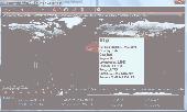
Bandwidth Vista 2, The Next Generation bandwidth monitor with Geo-IP Connection Mapper. Displays Real-Time TCP and UDP Connections including Country and City. Holds a full log of bandwidth usage. New to Bandwidth Vista 2 is Voice Alerts and a Whois Lookup Tool and two kinds of graph. Bandwidth Vista 2 runs quietly from the system tray displaying network activity while you work or you can...
Category: Utilities / Network
Publisher: Bandwidth Vista, License: Freeware, Price: USD $0.00, File Size: 16.2 MB
Platform: Windows
TerraExplorer allows users to shape their own digital world.
TerraExplorer allows users to shape their own digital world.
By editing and annotating Geo-referenced 3D terrain databases created through TerraBuilder, users can customize the experience to highlight specific geographic content. By overlaying unique or proprietary Information onto a 3D map, the user creates an exciting, interactive application that can highlight...
Category: Home & Education / Miscellaneous
Publisher: Skyline Software Systems, Inc., License: Freeware, Price: USD $0.00, File Size: 29.5 MB
Platform: Windows
Freeware
There is no good rule of thumb to determine the geolocation of Internet IP addresses. While some IP blocks tend to belong to certain countries, other IP blocks are distributed in an almost anarchic fashion. Moreover, the IP distribution is not static but in a continuous mutation with new additions, reallocations and deletions. AWIPLOC allows you to resolve IPs to Country, City, Region and...
Category: Internet / Internet Phone and Teleconferencing
Publisher: AtelierWeb Software, License: Freeware, Price: USD $0.00, File Size: 2.9 MB
Platform: Windows
MapCreator 2.0 is a software to create maps and animated maps with a good quality.
MapCreator can be used in presentations because is versatile and can be adequate for any kind of presentation, from travel presentations to professional presentations.
MapCreator is Geo-referenced so any map or portion of the map will have the exactly portions of latitude and longitude, even...
Category: Home & Education / Miscellaneous
Publisher: primap software, License: Freeware, Price: USD $0.00, File Size: 103.3 MB
Platform: Windows
Freeware
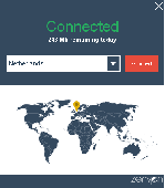
PaladinVPN, is a free VPN service without limitation on bandwidth or Geo IP switching. No signup or email required. Using a PaladinVPN will protect your privacy and protect your data from preying is. Security: A VPN can help protect your online data and activities from hackers and cybercriminals by encrypting your internet connection. 1. Privacy: A VPN can help protect your...
Category: Internet / Online Privacy
Publisher: Ledger Media Ltd, License: Freeware, Price: USD $0.00, File Size: 2.3 MB
Platform: Windows
FloppyGIS runs on Windows. It is a free compact Shapefile Viewer. It also supports image files that have Geo-reference from ESRI World Files.
Category: Multimedia & Design / Graphics Viewers
Publisher: ldinakis.googlepages.com, License: Freeware, Price: USD $0.00, File Size: 619.0 KB
Platform: Windows, Vista
ZenVPN routes all your Internet traffic via an encrypted tunnel to a remote server allowing you to - Bypass any website blocks enacted by your government or network operator - Access Geo-restricted services such as TV streaming - Protect your connection from snooping - Protect your identity by concealing your real IP address from the sites you visit - Escape traffic logging...
Category: Internet / Online Privacy
Publisher: Liberconnect Inc., License: Freeware, Price: USD $0.00, File Size: 10.0 MB
Platform: Windows
Freeware
Modern ribbon-based data manipulation tool for Microsoft SQL Server Main features: Quick database browser. Database oriented perspective, database projects. Table designer, edit columns, keys, uniques, checks. Database editor, view and and views, stored procedures, functions, triggers. Export, import - CSV, HTML, SQL, MS Excel, dBase DBF files. Data analysis without importing...
Category: Business & Finance / Database Management
Publisher: JenaSoft, License: Freeware, Price: USD $0.00, File Size: 6.2 MB
Platform: Windows
Skydur is very easy to install and use.
Skydur is very easy to install and use. Simple as 1-2-3. Download, Install, and Login, it's that simple. Skydur is automatic, set-ups the network configuration for you, this makes Skydur a plug-n-play.Sometimes you want to use a service or application that requires a US or UK IP address.There are numerous websites and services that target customers Geo-locally, Skydur IP address...
Category: Internet / Monitoring
Publisher: Skydur, License: Freeware, Price: USD $0.00, File Size: 1.6 MB
Platform: Windows
AVIC FEEDS creates a link between your Pioneer AVIC Navigation system and your PC.
AVIC FEEDS creates a link between your Pioneer AVIC Navigation system and your PC.You can use AVIC FEEDS to view and edit data from your AVIC system.It allows you to bring content from your PC and the Internet to your AVIC system, import a Location from a Geo-Tagged Photo from Flickr and much more.
Category: Internet / Misc. Plugins
Publisher: PIONEER CORPORATION, License: Freeware, Price: USD $0.00, File Size: 12.8 MB
Platform: Windows
Road Doctor™ Viewer is a free software for clients.
Road Doctor™ Viewer is a free software for clients. It can be used to view projects and data views created by Road Doctor™ and Geo Doctor™ software. New views or data cannot be linked to the project. Views created with Road Doctor™ 3D GPR module and single ground penetrating radar files can be opened to the view.
Category: Multimedia & Design / Graphics Viewers
Publisher: Roadscanners Oy, License: Freeware, Price: USD $0.00, File Size: 43.6 MB
Platform: Windows
The Speak Logic Information Analysis for Internet Explorer enables users to analyze Information and communications in Internet Explorer. While reading a website or webpage, if a user identifies Information that?s needed to be analyzed, the user can analyze that Information or flag it to analyze it later.
The Speak Logic Information Analysis for Internet...
Category: Internet / Communications
Publisher: The Speak Logic Project, License: Freeware, Price: USD $0.00, File Size: 29.9 MB
Platform: Windows
RTXAnalyzer is a diagnostic tool used for retrieving Information that can help in evaluating system status and identifying potential system inefficiencies or other problem areas.
The RTXAnalyzer retrieves operating system Information, RTX installation Information, Visual Studio Information, boot.ini/bcdedit Information, processor Information, BIOS...
Category: Utilities / Misc. Utilities
Publisher: IntervalZero, Inc., License: Freeware, Price: USD $0.00, File Size: 7.1 MB
Platform: Windows
On-line Information through the Internet has drastically changed the way people live and work. Online Information can either impede and frustrate an end user or assist in making life easier. The choice is up to each one of us. The world is moving too fast, both on business and personal levels, to allow us to make decisions for our family and work environment in a vacuum....
Category: Internet
Publisher: Viyya Technologies, License: Freeware, Price: USD $0.00, File Size: 14.0 MB
Platform: Windows
PC Utillities is a small software which provides basic information about your PC.
PC Utillities is a small software which provides basic Information about your PC.
PC Utillities offers general computer Information, display Information, installed software Information, Information about you internet connection and hard drive capacity.
Another feature of this program is a system cleaner, which cleans temporary files,...
Category: Utilities / File & Disk Management
Publisher: Arvin Soft, License: Freeware, Price: USD $0.00, File Size: 6.6 MB
Platform: Windows
G2G is a P2P (peer to peer) extension for ArcGIS Desktop.
G2G is a P2P (peer to peer) extension for ArcGIS Desktop. The extension allows two or more users to collaborate without any intermediate server. G2G (gis to gis) supports:
1) Text chatting,
2) Exchange of map content (Geo-referenced screenshots),
3) Ink and graphics collaboration (shared editing),
4) Share navigation (one person can pan the map display of other...
Category: Internet / Misc. Servers
Publisher: ESRI, License: Freeware, Price: USD $0.00, File Size: 1.3 MB
Platform: Windows

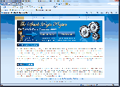
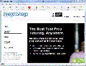
With the information in this guide you can find information about percentiles gre.
With the Information in this guide you can find Information about percentiles gre. You will be on your way in no time. Once you read this Information you will have a better idea of how easy it can be to find percentiles gre. For more Information visit our website http://www.nextsteptestprep.com/
Category: Business & Finance / Applications
Publisher: percentiles gre, License: Freeware, Price: USD $0.00, File Size: 417.0 KB
Platform: Windows
With the information in this guide you can find information about practice lsats.
With the Information in this guide you can find Information about practice lsats. You will be on your way in no time. Once you read this Information you will have a better idea of how easy it can be to find practice lsats. For more Information visit our website http://www.nextsteptestprep.com/
Category: Business & Finance / Applications
Publisher: practice lsats, License: Freeware, Price: USD $0.00, File Size: 417.0 KB
Platform: Windows

With the information in this guide you can find information about lsat tutors.
With the Information in this guide you can find Information about lsat tutors. You will be on your way in no time. Once you read this Information you will have a better idea of how easy it can be to find lsat tutors. For more Information visit our website http://www.nextsteptestprep.com/
Category: Business & Finance / Applications
Publisher: lsat tutors, License: Freeware, Price: USD $0.00, File Size: 417.0 KB
Platform: Windows
The KilletSoft freeware program CONVERT converts dBase, CSV, SDF and MySQL data bases into other data formats. The data can be filtered horizontal and vertically and sorted in other orders. Thus the import of the data in any data base management system or file system will be possible. With the program for example you can convert dBase data into the SDF format (Simple Document Format) or into...
Category: Business & Finance
Publisher: C. Killet Software Ing.-GbR, License: Freeware, Price: USD $0.00, File Size: 1.9 MB
Platform: Windows, Linux, Unix
This utility allows you to import airports plates in PDF format as well as images in JPEG and BMP format and compile them to MGL Avionics plates format which combines multiple plates into single files (for example plates retated to an airport). Plates can also be cropped and Geo-referenced.
Category: Games / Simulations
Publisher: MGL Avionics, License: Freeware, Price: USD $0.00, File Size: 3.8 MB
Platform: Windows
TransDEM Trainz Edition is a dedicated version of TransDEM, enhanced with specific export functionality for Auran/N3V Trainz Simulator 2010, Trainz Simulator 2009, Trainz Railroad Simulator 2006 and 2004. This additional export functionality enables the user to create Trainz route maps in TransDEM, using Geo data currently loaded. Direct creation of all files which make up a Trainz route...
Category: Multimedia & Design / Image Editing
Publisher: Roland Ziegler, License: Freeware, Price: USD $0.00, File Size: 981.3 KB
Platform: Windows
SysJewel collects hardware and software information from the computer.
SysJewel collects hardware and software Information from the computer. It provides Information about the complete list of hardware including the Input Devices, Mass Storage Devices, Mother Board, Controllers, Ports, BIOS, Networking Devices, Power Devices, Printers, Modems, Video Controllers, Cooling Device all in a very detailed way. SysJewel collects software Information...
Category: Utilities / System Surveillance
Publisher: SysJewel, License: Freeware, Price: USD $0.00, File Size: 1.7 MB
Platform: Windows

There are hundreds of different combinations of colors, backgrounds and layout combinations to choose from. The web site of your choice can have both video media and your uploaded pictures along with your text. No knowledge of web site design is required. Share with friends as a blog or a web page to sell your items. Advertise your business, or special sale items. Just have fun having your own...
Category: Internet / Internet Phone and Teleconferencing
Publisher: BizBook, License: Freeware, Price: USD $0.00, File Size: 2.4 MB
Platform: Windows, Android
PHOTOMOD GeoMosaic is intended for working with various types of digital images, including aerial and space imagery as well as digitized raster maps.
The program functionality includes:
- Georeferencing of raster images;
- Transforming images from one coordinate system to another, using an extensive database supplied or custom created coordinate systems;
-...
Category: Multimedia & Design / Multimedia App's
Publisher: Racurs, License: Freeware, Price: USD $0.00, File Size: 36.5 MB
Platform: Windows
The freeware program CONVERT from KilletSoft converts data files to other data formats and character sets. For the import in MySQL or SQL databases the 'CREATE TABLE' script can be generated. Thus the import of the data in any data base management system or file system will be possible. Conversions between this data formats are possible: CSV (Comma Separated Value), SDF (Simple Document...
Category: Software Development / Help File Utilities
Publisher: Killet GeoSoftware Ing.-GbR, License: Freeware, Price: USD $0.00, File Size: 6.5 MB
Platform: Windows
Freeware
Secure File Sharing With Digital Rights Management.Safeguard file sharing without boundaries. AssureFiles Secure File Sharing combines AES 256 bit encryption with digital rights management to give businesses persistent control over all stages of its life,enables employees to share files with anyone, via any method, without compromising business data or risking liability from data loss....
Category: Security & Privacy / Encrypting
Publisher: EaseFilter Inc., License: Freeware, Price: USD $0.00, File Size: 4.0 MB
Platform: Windows