Free Downloads: Gps Satellite Garmin Nuvi Link Pc
License: All | Free
Keep track of discount Garmin GPS deals on with this Firefox toolbar.
Keep track of discount Garmin Gps deals on with this Firefox toolbar.compare and buy all the latest Garmin Satellite navigation systems. If you want a discount Garmin Gps system this is the Firefox toolbar to use. We also provide information on the latest offers, price cuts and discount voucher codes to help you buy the latest Garmin Gps...
Category: Internet / Browsers
Publisher: Discount Garmin GPS, License: Freeware, Price: USD $0.00, File Size: 1.1 MB
Platform: Windows
FREE GPS Software for your Garmin, Magellan or Lowrance GPS.
FREE Gps Software for your Garmin, Magellan or Lowrance Gps.
EasyGPS is the fast and easy way to upload and download waypoints, routes, and tracks between your Windows computer and your Garmin, Magellan, or Lowrance Gps. EasyGPS lists all of your waypoints on the left side of the screen, and shows a plot of your Gps data on the right. Use EasyGPS...
Category: Internet / Communications
Publisher: TopoGrafix, License: Freeware, Price: USD $0.00, File Size: 3.9 MB
Platform: Windows
Upgrading software for your Garmin Gps just got easier thanks to WebUpdater—Garmin's free new application that automatically detects and installs the most recent version of operating software for your compatible Garmin Gps. WebUpdater's simple interface makes it easy to upgrade your operating software. Just connect your Garmin Gps...
Category: Utilities / Misc. Utilities
Publisher: Garmin Ltd or its subsidiaries, License: Freeware, Price: USD $0.00, File Size: 7.2 MB
Platform: Windows
Garmin nRoute is the popular piece of software that allows for auto-routing on a laptop computer with a Garmin Gps unit.
nRoute is a powerful and feature-rich tool that supports waypoints, tracks, points of interest, addresses and more, but is primarily for navigating and tracking in real time.
nRoute is also compatible with most Garmin...
Category: Internet / Misc. Plugins
Publisher: Garmin Ltd or its subsidiaries, License: Freeware, Price: USD $0.00, File Size: 105.4 MB
Platform: Windows
The Garmin Communicator Plugin is a free Internet browser plugin that transfers data between your Garmin Gps device and your computer.
For example, with the Garmin Communicator Plugin you can add the maps you purchase at Garmin.com to your device. Or, you can upload your training data from your Garmin fitness device to Garmin Connect™.
Category: Internet / Communications
Publisher: Garmin Ltd or its subsidiaries, License: Freeware, Price: USD $0.00, File Size: 14.2 MB
Platform: Windows
DNRGarmin is a smart tool used to directly transfer data between Garmin Gps handheld receivers and various GIS software packages.
DNRGarmin was built to provide users the ability to directly transfer data between Garmin Gps handheld receivers and various GIS software packages. Using DNRGarmin a user can use point features (graphics or shapefile) and...
Category: Utilities / Misc. Utilities
Publisher: GIS Section, Minnesota Department of Natural Resources, License: Freeware, Price: USD $0.00, File Size: 11.3 MB
Platform: Windows
Palm Desktop for Garmin iQue 3600 is one of the first PDAs to offer built-in Gps, as opposed to the jackets often used with other models.
Mapping integrates well - you can add a location to any address book entry, for example - but you can only route to an address from your present location, not from one distant one to another.
Category: Multimedia & Design / Multimedia App's
Publisher: Garmin Ltd or its subsidiaries, License: Freeware, Price: USD $0.00, File Size: 11.7 MB
Platform: Windows
Portable GPS Navigation toolbar for Internet Explorer.
Portable Gps Navigation toolbar for Internet Explorer. Find portable Gps units for your car, truck or minvan from top name brands including Tom Tom, Magellan and Garmin. Discover the world of eBay and shop for portable Gps navigation systems directly from your browser toolbar.
Category: Internet / Browsers
Publisher: Portable GPS Navigation System, License: Freeware, Price: USD $0.00, File Size: 1.1 MB
Platform: Windows
The program accepts NMEA GPS sentences from most GPS receivers that connect to a USB port.
The program accepts NMEA Gps sentences from most Gps receivers that connect to a USB port.
The program can display Satellite images of waypoint locations on the track plotter.
Is a free software for recording , monitoring and plotting Gps data, very useful and very easy.
Category: Home & Education / Miscellaneous
Publisher: Club Cruceros de La Paz A.C., License: Freeware, Price: USD $0.00, File Size: 10.6 MB
Platform: Windows
Northwest Trails is a mapset of trails designed for upload to any map-enabled Garmin GPS receiver.
Northwest Trails is a mapset of trails designed for upload to any map-enabled Garmin Gps receiver. It is more than just a mapset, though; it is also a community effort initiated to record and collect Gps data for trails in the Northwest (Washington, Idaho, Oregon, Montana, Wyoming, Alaska, British Columbia and Alberta) and provide that data for general public use.
Category: Internet / Misc. Plugins
Publisher: Jon F. Stanley, License: Freeware, Price: USD $0.00, File Size: 31.7 MB
Platform: Windows
The Windows PC shareware program for Garmin and Magellan GPS receivers.
The Windows Pc shareware program for Garmin and Magellan Gps receivers.
Main Features:
- transfer your waypoints, routes, and tracks from and to the Gps receiver, and save it on your computer disk
- review your waypoints
- enter and edit your waypoints
- define your routes and get the estimated traveling time
- review...
Category: Home & Education / Miscellaneous
Publisher: Heinrich Pfeifer, License: Freeware, Price: USD $0.00, File Size: 2.9 MB
Platform: Windows
KMLCSV Converter is a tool that enables you to convert the KML file generated from Google Earth (free version) into a formatted CSV file (and vice versa). This CSV file can then be uploaded into your Garmin Gps by using Garmin POI Loader, which can be downloaded for free. This allows you to plot all the custom point of interests (POI) with Google Earth first. Then, you can...
Category: Business & Finance / Calculators
Publisher: Choon-Chern Lim, License: Freeware, Price: USD $0.00, File Size: 2.3 MB
Platform: Windows
Turtle Sport is a free software developed to communicate with Garmin fitness products (forerunner and edge).
Turtle Sport retrieves yours training sessions from your Garmin and it makes diagram. You can also order your training sessions by category and training mode. With Turtle Sport, it is also possible to map your Gps training paths in Google Earth.
...
Category: Home & Education / Miscellaneous
Publisher: TurtleSport, License: Freeware, Price: USD $0.00, File Size: 6.9 MB
Platform: Windows
The navigation device is a kind of mini computer which contains a GPS satellite navigation receiver.
The navigation device is a kind of mini computer which contains a Gps Satellite navigation receiver. This allows the device to determine its current position. At least 4 satellites need to be received in order to be able to perform acceptable navigation. The fifth Satellite is required to obtain an altitude. As navigation takes place in a dynamic state, there is scarcely...
Category: Business & Finance / Business Finance
Publisher: United Navigation, License: Freeware, Price: USD $0.00, File Size: 13.8 MB
Platform: Windows
The Gps TrackManager is an application for planning routes and managing routes, waypoints and trackpoints.
The application support functions such as: open and save trackpoints files in various formats (GPX, Ozi Trackpoint file, Ozi Waypoint file, NMEA log, EasyGPS file), transmit Trackpoints, Waypoints and Routes to Garmin Gps receivers (Geko 201, GPSmap 60C), saves...
Category: Internet / Communications
Publisher: Frank Hamaekers, Write4u, License: Freeware, Price: USD $0.00, File Size: 4.8 MB
Platform: Windows
GeoVisu is a program that displays georeferenced data (images, graphics) and downloads data recorded by some Gps devices.
GeoVisu has a "Moving map" navigation function, which can be used with any NMEA 0183 compatible or Garmin USB Gps device.
Main features:
- Displays georeferenced image formats : GeoTiff, ECW and ECWP,...
Category: Multimedia & Design / Graphics Viewers
Publisher: GeoVisu, License: Freeware, Price: USD $0.00, File Size: 1.7 MB
Platform: Windows
The fast track to GPS success.
The fast track to Gps success. The Linx MDEV-Gps-SR contains everything needed to rapidly evaluate the SR Series Gps modules and implement them in record time. This all-inclusive Master Development System features a pre-assembled development board with an on-board OLED display for standalone testing. The system can also be attached to a Pc via USB and operated using...
Category: Software Development / Misc. Programming
Publisher: Linx Technologies, Inc., License: Freeware, Price: USD $0.00, File Size: 98.5 MB
Platform: Windows
QuakeMap is a powerful GPS/mapping program for your Windows computer.
QuakeMap is a powerful Gps/mapping program for your Windows computer. It can be downloaded here for free. The trial mode allows you to use most features indefinitely. When you need to unlock certain powerful features, a License Key can be ordered here. QuakeMap is designed for ease of use. It eatures intuitive user interface, supports most popular Garmin and Magellan receivers,...
Category: Utilities / Misc. Utilities
Publisher: quakemap.com, License: Freeware, Price: USD $0.00, File Size: 821.2 KB
Platform: Windows
Free Fleet Management Windows-Desktop standalone application work with Garmin and A1.
Free Fleet Management Windows-Desktop standalone application work with Garmin and A1.You can send messages and STOPs (destinations on Garmin MAP) with short message to driver, direct to his Garmin navigation device.Driver can send message to you using touch-screen keyboard. Ideal for taxi / delivery dispatch. Lowest communication cost by GPRS. Tracking vehicles at map at...
Category: Security & Privacy / Other
Publisher: Clarion LLC, License: Freeware, Price: USD $0.00, File Size: 3.4 MB
Platform: Windows
MarineUpdater is a Windows-based Pc application which works in conjunction with a Garmin USB card reader, a Garmin data card, and an Internet connection to generate software update cards for your fixed-mount Garmin marine products. Products which support MarineUpdater will program a data card with information about your Garmin marine product and other...
Category: Home & Education / Miscellaneous
Publisher: Garmin Ltd or its subsidiaries, License: Freeware, Price: USD $0.00, File Size: 2.0 MB
Platform: Windows
GPSBabel is a program that allows users to transfer GPS data files to and from numerous GPS devices.
GPSBabel is a program that allows users to transfer Gps data files to and from numerous Gps devices. It also enables the transfer of waypoints, routes and tracks between Gps receivers and mapping programs. As already mentioned before, this application offers support for several popular Gps devices, such as Tom Tom, Garmin, Magellan, Columbus, etc.
...
Category: Multimedia & Design / Media Management
Publisher: Robert Lipe, License: Freeware, Price: USD $0.00, File Size: 973.5 KB
Platform: Windows
This software package enables simulation of digital links via satellite.
This software package enables simulation of digital links via Satellite. Supporting all modern modulation and coding schemes (e.g. DVB-S2), it can assist in the planning of new services by preserving the Link quality of existing services.
The software is used in many areas, including Link analysis, transmission planning, system engineering, systems architecture,...
Category: Business & Finance / Business Finance
Publisher: SES ASTRA, License: Freeware, Price: USD $0.00, File Size: 15.2 MB
Platform: Windows
GPS PLUS Collar Manager for your PC is a powerful tool to manage your collars.
Gps PLUS Collar Manager for your Pc is a powerful tool to manage your collars. It is designed to communicate with your collars, the UHF/VHF handheld terminal and GSM ground station and is the basic tool to design your study. You can:
- manage collars and GSM/email communication details,
- read out data from collar, handheld terminal and GSM ground station,
-...
Category: Home & Education / Miscellaneous
Publisher: VECTRONIC Aerospace GmbH, License: Freeware, Price: USD $0.00, File Size: 8.4 MB
Platform: Windows
My Gps Logger 1.01 is a program designed to be used with My Fuel Tax 4.0. With My Gps Logger you can log all the locations where your truck has been to a monthly data file. This data file can later be imported into My Fuel Tax 4.0 by calculating the miles in state using Microsoftâ Mappoint. This is what you will need to use My Gps Logger with My Fuel Tax:a laptop with...
Category: Home & Education / Miscellaneous
Publisher: Spinnaker Software Solutions, License: Freeware, Price: USD $0.00, File Size: 477.7 KB
Platform: Windows
JSatTrak is a Satellite tracking program written in Java.
JSatTrak is a Satellite tracking program written in Java. It allows you to predict the position of any Satellite in real time or in the past or future. It uses advanced SGP4/SDP4 algorithms developed by NASA/NORAD or customizable high precision solvers to propagate Satellite orbits. The program also allows for easy updating of current Satellite tracking data via...
Category: Home & Education / Miscellaneous
Publisher: Shawn Gano, License: Freeware, Price: USD $0.00, File Size: 17.6 MB
Platform: Windows
MyGPS is a Freeware software for the creation and the management of longitude and latitude calibrated maps.
The software can define points of interest obtaining their coordinates (waypoints), can create routes (routepoints), can visualize track paths (trackpoints).
Using a serial Link, points routes and tracks can be shared with "eTrex" and "Geko"...
Category: Home & Education / Miscellaneous
Publisher: GPSInfo, License: Freeware, Price: USD $0.00, File Size: 2.3 MB
Platform: Windows
Whether you need accurate data for GIS applications or visual simulation applications, GeoGenesis provides you the ability to exploit commercial Satellite or aerial imagery to meet your requirements. For aerial or Satellite imagery, GeoGenesis provides advanced automated tie point extraction to geospatially Link multiple images together. Using our bundle adjustment...
Category: Home & Education / Miscellaneous
Publisher: IAVO Research And Scientific, License: Freeware, Price: USD $0.00, File Size: 73.9 MB
Platform: Windows
Free Satellite Maps is a free tool from Google which offers a satellite mapping service worldwide.
Free Satellite Maps is a free tool from Google which offers a Satellite mapping service worldwide.These are accompanied by a street service, a route planner and information about business in almost all countries.In this way we can fly the world from Satellite view or in birds eye.The level of detail is different depending on where you are located.Major cities have a very...
Category: Home & Education / Science
Publisher: www.satelliteview-of-my-house.com, License: Freeware, Price: USD $0.00, File Size: 612.0 KB
Platform: Windows
With SMART Link NetFone, you can call from anywhere in the world with your SMART Link SIM Card!
With SMART Link NetFone, you can call from anywhere in the world with your SMART Link SIM Card! All you need is a computer with Internet connection, and the SMART Link NetFone application downloaded and installed into your computer*!
Main Features:
- Use it to call wherever you are in the world – as long as there is a computer with internet...
Category: Internet / Communications
Publisher: Smart Link, License: Freeware, Price: USD $0.00, File Size: 23.0 MB
Platform: Windows
Want to download and be able to add additional custom POI 's to your Navigon Sat Nav but can't work out how? If you have bought one of the newer, 40/70 series Satellite Navigation (Sat Nav) or Gps device from Navigon, then you should be good to go. Simply install and then run Navigon Fresh and use the new POI-Assistant utility.
This is a fairly simple to use...
Category: Home & Education / Miscellaneous
Publisher: Paul Tomlinson, License: Freeware, Price: USD $0.00, File Size: 17.8 MB
Platform: Windows
The EQMODLX is a LX200 Emulator program that accepts Satellite tracking issued by a LX200 Compatible Satellite Tracking Software.This configuration allows you to track the Satellite continuously instead of the the "Leap Frog" fashion as made available to the old nextstar protocol.This software application can also converts the Satellite tracks to EQ custom...
Category: Home & Education / Astrology & Numerology
Publisher: chrisshillito, eqmodarchie, sarmientomon, License: Freeware, Price: USD $0.00, File Size: 354.2 KB
Platform: Windows
Golf GPS Devices toolbar for internet explorer.
Golf Gps Devices toolbar for internet explorer. Find golf Gps devices are great bargain prices. We have all the latest golf Gps devices for sale both new and used. Whether you're looking for the iGolf, Golf Buddy, GolfLogix, SonoCaddie, or SkyCaddie, you can find it here along with their accessories. We are always searching our networks to bring you the best deals on golf...
Category: Internet / Browsers
Publisher: Golf GPS Devices, License: Freeware, Price: USD $0.00, File Size: 1.1 MB
Platform: Windows

Gps Clock Software is a freeware utility that runs on any Windows NT/2000/XP/2003 workstation or server. The software polls time from a standard NMEA Gps time receiver connected to the host Pc's serial port and optionally allows time to be synchronised on the host Pc. The Gps clock utility polls GPRMC messages from a standard NMEA Gps time receiver....
Category: Utilities
Publisher: ntp time server, License: Freeware, Price: USD $0.00, File Size: 1.9 MB
Platform: Windows
Satellite earth is a software for viewing satellite and aerial imagery of the Earth.
Satellite earth is a software for viewing Satellite and aerial imagery of the Earth.Satellite Earth allows you to enjoy virtual travel around the world, look up local information and plan trips, exploring multimedia content and share information about your trips.Explore towns, cities and terrain relief shown in three-dimensional images of high resolution associated with...
Category: Home & Education / Science
Publisher: www.satelliteview-of-my-house.com, License: Freeware, Price: USD $0.00, File Size: 584.0 KB
Platform: Windows
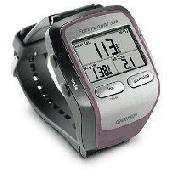
Screensaver with a Garmin Forerunner theme. .
Screensaver with a Garmin Forerunner theme.
Category: Desktop Enhancements / Screensavers
Publisher: Garmin Forerunner 305, License: Freeware, Price: USD $0.00, File Size: 1.5 MB
Platform: Windows
Are you looking for a Gps tracking system or a Gps tracker but haven't found the one that is ideal for you? Then, look no further as our site has the best deals and information about the kind of Gps tracker you should buy.
Category: Security & Privacy / Other
Publisher: Top GPS Tracking Srl., License: Freeware, Price: USD $0.00, File Size: 722.0 KB
Platform: Windows
Ideal for business or families.
Ideal for business or families. Revolutionary GSM mobile phone tracking technology now allows registered users to locate a mobile and then displays the
GSM mobile phone tracking system via the Gps-TRACK Satellite network. Based on repeater triangulation, the system tracks mobile phones using Gps Java ME. Find a mobile - Worried where your children, car, items are?...
Category: Internet / Communications
Publisher: 8Mail, License: Freeware, Price: USD $0.00, File Size: 13.0 KB
Platform: Windows
Live Satellite Maps or Google maps is a web server mapping applications.
Live Satellite Maps or Google maps is a web server mapping applications.Provides scrolling map images and Satellite photos around the earth and even the route between different places.Since 6 October 2005, live Satellite Maps is part of local Google.Google live Satellite Map provides the ability to zoom in or zoom out to show the map.The user can control the map with...
Category: Home & Education / Science
Publisher: www.satelliteview-of-my-house.com, License: Freeware, Price: USD $0.00, File Size: 643.0 KB
Platform: Windows

OkCustomMap is a software to produce Garmin Custom Maps.
OkCustomMap is a software to produce Garmin Custom Maps.
Supports many map formats:
- OkMap
- Ecw
- GeoTiff
- World files
- OziExplorer
- GpsTuner
You can customize:
- The quality of the output JPEG images (0=Bad, 100=Good)
- The KML transparency (0=Transparent, 255=Opaque)
- The KML draw order (0=Invisible, 1-49=Under the vectorial data,...
Category: Business & Finance / Applications
Publisher: Gian Paolo Saliola, License: Freeware, Price: USD $0.00, File Size: 3.2 MB
Platform: Windows

Dishnetwork Deals Dish Satellite TV.
Dishnetwork Deals Dish Satellite TV. Dish Network Discounts. Dish Network TV Deals! Dish Network Television Deals and Free Offers! DISH Network installation and service nationwide. Satellite TV systems from Profressional Dealers. Free Dishnet receivers and DVR systems. Satelite Television, DISH, Digital TV, Broadband Internet, HD and DirectTV free satlite deals available. Order...
Category: Internet / Browsers
Publisher: Dishnetwork Deals, License: Freeware, Price: USD $0.00, File Size: 1.5 MB
Platform: Windows
Can you imagine how large an Satellite image is, which has dimensions of 86400 pixels wide and 43200 pixels high?This is a simple article which describes the Worlds Largest Satellite Images.See the largest Satellite images using a free software which is included inside.This free software will enables you to see Satellite images of the entire earth for free.
Category: Home & Education / Miscellaneous
Publisher: www.satelliteimage-of-my-house.com, License: Freeware, Price: USD $0.00, File Size: 590.0 KB
Platform: Windows
Garmin MapConverter was developed to be a tool that will allow you to convert maps and unlock codes on your Windows Pc to the Macintosh format. Transferred maps will remain fully accessible on your Windows Pc. It works on Windows XP, Windows Vista, Windows 7.
Category: Utilities / Misc. Utilities
Publisher: Garmin Ltd or its subsidiaries, License: Freeware, Price: USD $0.00, File Size: 2.6 MB
Platform: Windows
GPS Tuner was first launched in 2003.
Gps Tuner was first launched in 2003. Success followed introduction shortly. Over the years it became a best-selling favourite Gps software among off-roaders as a reliable, versatile feature-packed application suiting the needs of outdoor enthusiasts and professional off-road users alike. After five years of continuous development of previous Gps Tuner versions Gps...
Category: Web Authoring / Web Design Utilities
Publisher: GPS Tuner Ltd., License: Freeware, Price: USD $0.00, File Size: 4.5 MB
Platform: Windows
Orbitron 3.71is a Satellite tracking system for radio amateur and observing purposes.
The program can be also used by weather professionals, Satellite communication users, astronomers, UFO hobbyist and astrologers.
The program shows the positions of satellites at any moment (in real or simulated time).
Orbitron 3.71 can be installed in 35...
Category: Internet / Communications
Publisher: Sebastian Stoff, License: Freeware, Price: USD $0.00, File Size: 2.0 MB
Platform: Windows
The Gps Detector software is used to update the Gps detector's database , updating maps , routes and camera locations . The device itself is based on pre-installed Gps coordinates, the device can indicate various road hazards like: Fixed cameras, Red light speed cameras and bus lane cameras, Usual speed measurement places and dangerous zones.
Category: Business & Finance / Business Finance
Publisher: Euro Noliker Kft., License: Freeware, Price: USD $0.00, File Size: 5.5 MB
Platform: Windows
View amazing satellite images of earth with the free version of google earth software.
View amazing Satellite images of earth with the free version of google earth software.Google earth is a totally free software which enables you zoom in from Satellite,view,rotate or tilt just like a camera of the entire earth inside your Pc.It works just point and click on any part of earth or by typing addrees name of city or country and google earth will down from space...
Category: Home & Education / Miscellaneous
Publisher: www.satelliteimage-of-my-house.com, License: Freeware, Price: USD $0.00, File Size: 798.0 KB
Platform: Windows

Ready to start saving? It's never been a better time to switch to Satellite Television then now. You won't find better Dish Network deals available any where else on the internet.
If you've been throwing away your money on cable tv or DirecTV then you've come to the right place.
Order now
Save with special web only promotions! We are a high volume Satellite tv system...
Category: Internet / Browsers
Publisher: Dish Network Channel Packages, License: Freeware, Price: USD $0.00, File Size: 1.6 MB
Platform: Windows, Linux, Mac
The Gps Controller software is a free program designed to allow you to configure a range of Gps receivers. There are versions that run on Windows desktop computers, or Windows Mobile devices.
Before downloading the software, it recommend downloading and reading the documentation to confirm which version you need.
Category: Home & Education / Miscellaneous
Publisher: Trimble Navigation, License: Freeware, Price: USD $0.00, File Size: 30.9 MB
Platform: Windows
This software will not work unless you already own a MapSource product.
This software will not work unless you already own a MapSource product.
Main Features:
- Improved memory issues when running on Windows 7.
- Improved map projection for many map products.
- Changed mouse-wheel functionality to zoom in and out.
- Added support for enhanced map security.
- Fixed unlocking issue.
...
Category: Home & Education / Miscellaneous
Publisher: Garmin Ltd or its subsidiaries, License: Freeware, Price: USD $0.00, File Size: 8.4 MB
Platform: Windows
 Freeware
org, uses file and position names that suit to the display of the TomTom Rider, uses file, route and position names that suit to the display of the Map&Guide Motorrad Tourenplaner, remembers language, paths, window size and position. . .
Category: Business & Finance / Conversion Applications
Publisher: Christian Pesch, License: Freeware, Price: USD $0.00, File Size: 6.6 MB
Platform: Windows, Mac, Linux, Solaris, FreeBSD, OpenBSD, Java