Free Downloads: Latitude Longitude City Web Server
License: All | Free
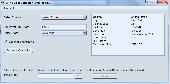
Create the GeoDatabase for the entire world. This program create the geographical location Latitude, Longitude, and Altitude (Elevation) for every City, village, region, state, county in the World. The program crawls the data from the website www.heavens-above.com which collect data from US Geological Survey for the USA (and dependencies) and The National Imaging and...
Category: Software Development
Publisher: Mewsoft, License: Freeware, Price: USD $0.00, File Size: 1.1 MB
Platform: Windows
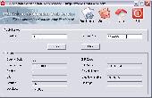
World Cities Database with Latitude Longitude and time zone Info Global World
World Cities Database with Latitude Longitude and time zone Info Global World Database viewer program is a useful utility which help you to: 1.Display all information about any City (location) in the Database and search into it, 2.Export the Database in Text Format so you can use it easily with Major Database Systems SQL Server, Oracle, Access, MySQL and any...
Category: Software Development
Publisher: geographicdb, License: Freeware, Price: USD $0.00, File Size: 35.2 MB
Platform: Windows
You can enter your City/State OR Zipcode and it outputs a lot of useful information like Azimuth, Elevation, Latitude, Longitude, and Magnetic Deviation. It also has a text database for the satellites that makes it easy to modify satellite names and easy to add or delete satellites.
Category: Home & Education / Miscellaneous
Publisher: NeuroSoft, License: Freeware, Price: USD $0.00, File Size: 1.6 MB
Platform: Windows
IP2Location Desktop translates IP address to country, City, region, Latitude, Longitude, ZIP code, ISP and domain name using XML Web Service. Users can perform 90 queries per month using Free account. Please visit http://www.fraudlabs.com for more information.
Category: Internet
Publisher: FraudLabs.com, License: Freeware, Price: USD $0.00, File Size: 777.7 KB
Platform: Windows
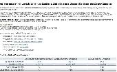
One stop solution for Latitude Longitude Database, Cities Database, Zipcode Database and County Database. Our product line covers a basic edition world cities database that includes major cities of the world which is perfectly suitable to capture country and City information of a visitor registering on your website. In addition, we have a detailed county/cities database...
Category: Web Authoring / Web Design Utilities
Publisher: Best World Cities Database Ever, License: Freeware, Price: USD $0.00, File Size: 51.4 KB
Platform: Windows, Mac,
This program calculates the location of almost any tipe of locator.
This program calculates the location of almost any tipe of locator. It also calculates the distance, azimuth, Longitude and Latitude betweent two locators. The software converts Latitude/Longitude coordinates to Maidenhead locators and vice versa. It converts IARU locator and Longitude/Latitude coordinates ti UI-View format coordinates.
Category: Home & Education / Miscellaneous
Publisher: ON6MU Group, License: Freeware, Price: USD $0.00, File Size: 367.8 KB
Platform: Windows
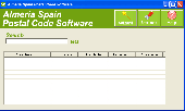
The Software includes postal code, City name, colony name, area abbreviation, Latitude and Longitude, time zone and area code in Almeria. Enter 2 area name and get the distance between them. Easy to download reports in excel.
Category: Business & Finance
Publisher: Almeria Properties, License: Freeware, Price: USD $0.00, File Size: 3.3 MB
Platform: Windows
This converter is actually part of Balloon Track.
This converter is actually part of Balloon Track. However, I often found myself needing a quick conversion. Loading BT for this was just a bit cumbersome, so I lifted the converter and made it a program in its own right.
Enter Latitude and Longitude at the top and click the button corresponding to the output you wish to see.
It's simple right?
...
Category: Business & Finance / Calculators
Publisher: EOSS, License: Freeware, Price: USD $0.00, File Size: 248.1 KB
Platform: Windows
LocationTool appears to be a very interesting application.
LocationTool appears to be a very interesting application. It allows one to know Latitude, Longitude and time zone of towns or cities all around the world.
It has a very simple interface that consists of only one window. This window includes search fields, a list with search results and the world map. The application allows to search by City name or by its...
Category: Home & Education / Miscellaneous
Publisher: Square One research, License: Freeware, Price: USD $0.00, File Size: 0
Platform: Windows
Suncycle is a calendar with the sunrise and sunset time for a latitude/longitude and timezone.
Suncycle is a calendar with the sunrise and sunset time for a Latitude/Longitude and timezone. Now with azimuth features.Suncycle can be run in the systray.Now suncycle with graphic. In the graph you see the evolution of the sunrise and sunset for 360 day
Category: Home & Education / Miscellaneous
Publisher: users.pandora.be, License: Freeware, Price: USD $0.00, File Size: 428.5 KB
Platform: Windows, Mac, 2K, 2K3, Vista
MyGPS is a Freeware software for the creation and the management of Longitude and Latitude calibrated maps.
The software can define points of interest obtaining their coordinates (waypoints), can create routes (routepoints), can visualize track paths (trackpoints).
Using a serial link, points routes and tracks can be shared with "eTrex" and "Geko"...
Category: Home & Education / Miscellaneous
Publisher: GPSInfo, License: Freeware, Price: USD $0.00, File Size: 2.3 MB
Platform: Windows
Salat calculates the prayer times for your location.
Salat calculates the prayer times for your location.
If your City is not in the database (unlikely, since it has 36,000 cities in it), just feed it the Latitude and Longitude of your place (Get that from Google Earth) and it will calculate the times of Namaz.
Options for calculating according to Hanafi and Shafe'ee schools of Jurisprudence.
Category: Games / Misc. Games
Publisher: IQSoft Software Consultants, License: Freeware, Price: USD $0.00, File Size: 15.9 MB
Platform: Windows
Windows DLL to find the distance in miles between 2 latitude/longitude points, specified in degrees.
Category: Home & Education / Miscellaneous
Publisher: kjlsoftware.com, License: Freeware, Price: USD $0.00, File Size: 36.0 KB
Platform: Windows, Mac, 2K
WGS-84 Calculator is used to calculate geodetic distance and azimuth between two points (Latitude and Longitude). In addition, it can calculate a new point from origin using the given azimuth and distance.
Lat/long values can be inserted using three different formats; DD:MM:SS.ssss, DD:MM.mmmmmm or DD.dddddddd.
Calculations are based on WGS-84 (World...
Category: Home & Education / Mathematics
Publisher: MR Soft Tmi, License: Freeware, Price: USD $0.00, File Size: 502.0 KB
Platform: Windows
This software was developed because from time to time, we found it necessary to convert GPS meter readings from fractional Latitude and Longitude to degrees, minutes and seconds (DMS). It only does this one thing but it does it very well. Version 2.0, just released 5/23/2007, now converts both directions (DMS to fractional and fractional to DMS). It also has a new, modern look.
Category: Home & Education / Miscellaneous
Publisher: Rad Pro Calculator, License: Freeware, Price: USD $0.00, File Size: 33.1 MB
Platform: Windows

IPSearchLight is a software component used to identify the geographic location of website visitors, often within a few miles from the exact location. The process utilizes each visitor's IP address; this technique is silent and unintrusive. IPSearchLight is ideal for practical applications like the delivery of localized content, targeted advertising, multi-lingual websites, e-commerce...
Category: Software Development
Publisher: IPSearchLight, License: Freeware, Price: USD $0.00, File Size: 8.5 MB
Platform: Windows
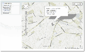
Manifold Toolbar is a powerful and handy application that allows you to view a map or satellite image of any place on Earth directly on your browser without the need of any other program. You just have to type a location (City and country, City and state) in the search bar and it automatically displays satellite images or street maps, allowing you zoom in and out to see more...
Category: Internet / Browser Accessories
Publisher: CDA International, License: Freeware, Price: USD $0.00, File Size: 1.5 MB
Platform: Windows
Free Vista IPGeoLocation Gadget can show you the geolocation information for certain IP quickly and easily. You only need to enter the target IP address. The gadget will retrieve the following information: country, region, City, Latitude, Longitude, ZIP code, time zone, net speed, ISP and domain. It's a free product. You may use it without any limitations. The only...
Category: Desktop Enhancements / Wallpaper
Publisher: Antelle.Net, License: Freeware, Price: USD $0.00, File Size: 50.0 KB
Platform: Windows
Product Locator is a Magento extension, which displays product locations on Google Maps with the ability to filter them by product categories or cities. Upon installing this extension a new menu item appears in the admin panel called Product Locator (System -> Configuration -> Catalog). All attributes of the product location (address, Latitude, Longitude etc.) have to be set in...
Category: Business & Finance / Business Finance
Publisher: Scand Ltd, License: Freeware, Price: USD $0.00, File Size: 1.1 MB
Platform: Unknown
GeoBase is a high performance OEM tool for embedding GIS functions in client and Server applications. GeoBase has a small memory footprint - both on the hard disk for storage and in RAM during use. Compatible with both .NET and Linux, GeoBase is designed for a rapid development cycle and low deployment cost. The Map Engine displays rich, detailed maps for use in Server or client...
Category: Software Development / Compilers & Interpreters
Publisher: Telogis, License: Freeware, Price: USD $0.00, File Size: 87.0 MB
Platform: Windows
You can use your existing digital (vector) maps in Autodesk MapGuide® software by converting them to Spatial Data Files (SDF). SDF is a special data format for delivering large amounts of data quickly over an intranet or the Internet. The SDF Loader is a utility used to create Spatial Data Files (SDF) and their accompanying Spatial Index Files (SIF) from a variety of GIS data formats. These...
Category: Multimedia & Design / Multimedia App's
Publisher: Autodesk, Inc., License: Freeware, Price: USD $0.00, File Size: 54.6 MB
Platform: Windows
Tibetan planets is a program about the zodiac.
Tibetan planets is a program about the zodiac.Its main focus is about how the planets in our solar system affect our daily routine.You can calculate very exactly different things even introduce the Longitude the Latitude and many other interesting features.
Category: Home & Education / Astrology & Numerology
Publisher: Buz Overbeck, License: Freeware, Price: USD $0.00, File Size: 1.5 MB
Platform: Windows
The Balloon Browser recognizes and highlights geo-coordinates in web pages.
The Balloon Browser recognizes and highlights geo-coordinates in Web pages. Hovering over a recognized location advises another application to show a map of the corresponding area. For now the only program Balloon Browser can interact with is Google Earth.
Instead of waiting for the one true geo-notation and markup standard, Balloon Browser tries to parse a variety of common...
Category: Internet / Browsers
Publisher: Michael Krause, License: Freeware, Price: USD $0.00, File Size: 5.6 MB
Platform: Windows

We invite you to walk in the evening city.
We invite you to walk in the evening City. It will walk on water. On the remarkable boats you see the main attractions of the City. It is a City which dreams of any man. We give you the opportunity to go there right now.
Category: Desktop Enhancements / Screensavers
Publisher: Box2k.com, License: Freeware, Price: USD $0.00, File Size: 6.2 MB
Platform: Windows
10000 Year Hijri Calendar-3.5 is a free and easy-to-use calendar. It has a Latitude and Longitude feature, which enables you to easily detect the position. The application displays month-wise dates of Hijri Era and Gregorian date is displayed for every selected Hijri Date.
Category: Home & Education / Miscellaneous
Publisher: SofexIndia, License: Freeware, Price: USD $0.00, File Size: 2.3 MB
Platform: Windows
Temma mounts have numerous different options that can be configured via the driver.
Temma mounts have numerous different options that can be configured via the driver. Highlight the Longitude/Latitude input boxes via a double click or left mouse drag to input new values. The mount safety features is not a failsafe way to protect your equipment from damage, and it is not intended to be a substitute for for good judgment or and attendant at the scope.
Category: Home & Education / Astrology & Numerology
Publisher: Chuck Faranda, License: Freeware, Price: USD $0.00, File Size: 776.9 KB
Platform: Windows
A PC Windows program that continuously identifies which NCDXF/IARU DX beacon station is currently broadcasting on any of the five HF Amateur Radio bands (20, 17, 15, 12, and 10 meter) bands. The current beacon call sign is updated and displayed, along with a flashing Status LED, on a relief map of the world. In addition, as each beacon station becomes active, its country, City,...
Category: Audio / Audio Players
Publisher: W6NEK, License: Freeware, Price: USD $0.00, File Size: 3.1 MB
Platform: Windows
Ham CAP is an electronic knowledge keeper of the whole world.
Ham CAP is an electronic knowledge keeper of the whole world. It contains all the territories, zones etc with good zooming abilities. HamCap is an application with which Dx Atlas is integrated, and for all the radio amateurs it is a propagation tool.
This software can be easily downloaded and by following all the instructions given, the user can set it up within no time. Along with...
Category: Internet / Communications
Publisher: Alex Shovkoplyas, VE3NEA, License: Freeware, Price: USD $0.00, File Size: 1.5 MB
Platform: Windows
City of New York Tool for Internet Explorer.
City of New York Tool for Internet Explorer.Find hotels, broadway shows, sports games, transportaion, transit info, fashion, and tours arounf New yourk City with this helpful toolbar
Category: Internet / Browsers
Publisher: City of New York, License: Freeware, Price: USD $0.00, File Size: 1.1 MB
Platform: Windows
GPS Sway is a simple coordinate conversion program.
GPS Sway is a simple coordinate conversion program. It handles all forms of Latitude and Longitude (degrees, degrees minutes, degrees minutes seconds) as well as UTM coordinates and will convert from any form to another. It also handles signs or character direction.
Category: Multimedia & Design / Media Management
Publisher: GPSFileDepot, License: Freeware, Price: USD $0.00, File Size: 154.2 KB
Platform: Windows
IPSearchLight (www.ipsearchlight.com) for ASP.NET gives you real-time feedback on the geographic location of website visitors by their IP address alone. The technology is completely unintrusive, yet can often track a person's location to a few miles radius on the planet. Some potential uses: - Localization of website language, content and currency. - Targeted advertising. - Preventing...
Category: Internet
Publisher: IPSearchLight, License: Freeware, Price: USD $0.00, File Size: 8.5 MB
Platform: Windows
An accurate simulation of the solar system, including all planets, major moons, all visible stars, and constellations. Multiple views and features. Home in on selected planets, or fly to distant stars quickly and easily. Support for any Latitude and Longitude on Earth. Includes an integrated search feature and accurate positioning from 1950 to 2050.
Category: Home & Education / Miscellaneous
Publisher: Quux Software, License: Freeware, Price: USD $0.00, File Size: 1.6 MB
Platform: Windows
SatCalc is a free software which calculates Azimuth and Elevation for geostationary satellites used for television broadcast.
Features include the calculation of the LNB skew and calculation of sun outage which occurs in spring and fall. The calculated data is presented graphically and can also be printed out and exported to HTML or CSV.
A list of Longitude...
Category: Business & Finance / Applications
Publisher: Martin Kirisits, License: Freeware, Price: USD $0.00, File Size: 1.6 MB
Platform: Windows

City of Sydney in Australia. This is a very beautiful City. On this screen saver depicts the Opera House. Also here there is an animated water and the enchanting sounds.
Category: Desktop Enhancements / Screensavers
Publisher: Box2k.com, License: Freeware, Price: USD $0.00, File Size: 6.1 MB
Platform: Windows
New York City has issued an ordinance that no one can enter or exit the contaminated city.
New York City has issued an ordinance that no one can enter or exit the contaminated City. High above, in the lone remaining skyscraper, a mad scientist is conducting experiments on helpless, mutated victims, transforming them into killing machines. The government has hired you on as a mercenary to exterminate the hordes of gun-wielding beasts that are polluting the City,...
Category: Games / Action
Publisher: GameFabrique, License: Freeware, Price: USD $0.00, File Size: 2.0 MB
Platform: Windows
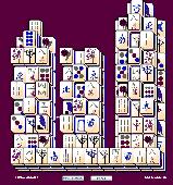
The city never sleeps with City Mahjongg, where you can play all day and night long.
The City never sleeps with City Mahjongg, where you can play all day and night long.
Mahjongg tiles can be removed by clicking matching pairs off the board. Only open tiles can be clicked in this puzzle game. Mahjongg tiles are open when one vertical side is not blocked by anything. Season Mahjongg tiles can be matched with any other seasonal tile, and this also goes with...
Category: Games / Misc. Games
Publisher: Mahjongg, License: Freeware, Price: USD $0.00, File Size: 2.5 MB
Platform: Windows, Mac, Palm
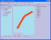
AZMap is a freeware Windows program which will generate, and display an Azimuthal-Equidistance map of the world, centered on any point on the surface of the earth (except very near the poles). The A-E map is also known as a Great Circle map since straight lines from the center point to any other point always fall along a great circle path and represent the shortest distance between the center...
Category: Home & Education / Miscellaneous
Publisher: Paul Burton, License: Freeware, Price: USD $0.00, File Size: 1.1 MB
Platform: Windows
TrendyMac is a GUI based analyzer (preview) for log files of Web servers. Using its interactive view, you may browse through generated reports. Since TrendyMac is a Windows application, it doesn't require support technology like a Web Server to push your results to. Analyzed functionality: - Visitor - Browsers - Search phrases of Google - Requested pages -...
Category: Internet
Publisher: turingart, License: Freeware, Price: USD $0.00, File Size: 4.8 MB
Platform: Windows, Mac
See beautiful places of Los Angeles city in this free screensavers.
See beautiful places of Los Angeles City in this free screensavers.Los angeles is one of the great City and favorite places of visitors. This free screensavers have more than 60 full color and high quality images.See beautiful and modern architecture of buildings,streets,restaurants and parks inside this free los angeles City screensaver.
Category: Desktop Enhancements / Screensavers
Publisher: sm-insurance.com, License: Freeware, Price: USD $0.00, File Size: 4.6 MB
Platform: Windows
This is the ultimate rampage game.
This is the ultimate rampage game. Fly around huge detailed cities causing mass destruction. You can earn money and buy more weapons or other upgrades. There are 24 missions in each City for you to complete in each City and 2 bosses per City. With 18 weap
Category: Games / Action
Publisher: shawn64.com, License: Freeware, Price: USD $0.00, File Size: 15.5 MB
Platform: Windows, Mac, 2K, 2K3

Hey, come to see new free salute screensaver!
Hey, come to see new free salute screensaver! There is holiday in the City and all citizens come together to enjoy the salute. Various salute colors and effects will not leave you indifferent to this screensaver. Salute screensaver has no sound, we don't want to put you off. But please return and check for updates! City Salute screensaver is very compact and fast. For any screen...
Category: Desktop Enhancements / Misc. Themes
Publisher: SaversPlanet.com, License: Freeware, Price: USD $0.00, File Size: 2.9 MB
Platform: Windows
Welcome to Frankfurt. This is a very beautiful City. We invite you to explore the City at night. At night the lights are a huge number of lights. The whole City lights up and sparkles in the glow of floodlights. This is one of the most exciting spectacle on the planet. Hurry up, and it will end soon!
Category: Desktop Enhancements / Screensavers
Publisher: BoxScreenSaver.com, License: Freeware, Price: USD $0.00, File Size: 1.1 MB
Platform: Windows
Sunrise Sunset is a program very easy to use.
Sunrise Sunset is a program very easy to use.On the first run you will need to set your location on the configuration page.
You can either input your Latitude and Longitude, or your Maidenhead Grid locator. One will compute the other. Select the unit of choice for distance measurements and click Accept. These settings will be stored in the registry.
To use the program...
Category: Software Development / Help File Utilities
Publisher: Steinkamp Softare Solutions, License: Freeware, Price: USD $0.00, File Size: 838.2 KB
Platform: Windows
Searching for what you want on Craigslist is limited to one city at a time.
Searching for what you want on Craigslist is limited to one City at a time. Now, you can search ALL Craigslist cities at once to locate the best deals when they are listed. Search every Craigslist City at once, all cities, select cities. Simple, easy to use software. 100% free, no spyware guaranteed!
Category: Internet / Browsers
Publisher: Triple Seven Marketing, License: Freeware, Price: USD $0.00, File Size: 675.8 KB
Platform: Windows
UltiDev Web Server Pro (UWS), also known as UltiDev Cassini Pro, is an an advanced, redistributable Web Server for Windows that can be use as a regular Web Server to host Web sites and ASP.NET applications, or packaged with your ASP.NET Web application and installed on your customers' systems along with your Web app or site,...
Category: Web Authoring / Web Design Utilities
Publisher: UltiDev LLC, License: Freeware, Price: USD $0.00, File Size: 1.0 MB
Platform: Windows
This screensaver shows images of the beautiful city of Sofia in Bulgaria.
This screensaver shows images of the beautiful City of Sofia in Bulgaria. Sofia is the capital and largest City of Bulgaria. It is located in the western part of Bulgaria, at the foot of the mountain massif Vitosha. On a site inhabited as early as the 8th century BC, Sofia is the second oldest capital City in Europe. It has been given several names throughout the course of...
Category: Desktop Enhancements / Screensavers
Publisher: Screensaverdirect, License: Freeware, Price: USD $0.00, File Size: 4.2 MB
Platform: Windows
EZ-Locate is an Internet-based geocoding service that provides real-time access to the Tele Atlas address database and geocoding technology. It is designed to let users enjoy the benefits of high volume batch geocoding without the hassles or high price.
EZ-Locate geocoding client software allows you to access our high-performance batch geocoding engine from your desktop. When you...
Category: Internet / Misc. Plugins
Publisher: Tele Atlas, License: Freeware, Price: USD $0.00, File Size: 31.5 MB
Platform: Windows
Create your own cardsets for use in Solitaire City for Windows or Pocket PC.
Create your own cardsets for use in Solitaire City for Windows or Pocket PC. Solitaire Setty is a powerful cardset design tool. Turn your JPEG collection into a photorealistic cardset for use in Solitaire City. Creates Windows cardsets in Small, Medium, Large, Jumbo and King Size and Pocket PC cardsets in Tiny and Tinier for QVGA displays and Mini and Minier for VGA displays....
Category: Games / Cards, Casino, Lottery
Publisher: Digital Smoke, License: Freeware, Price: USD $0.00, File Size: 8.6 MB
Platform: Windows
Panoply is a Java application which enables the user to plot raster images of geo-gridded data from netCDF datasets. Panoply is an utility that enable user to plot raster image. Depending on the data, it can draw global Longitude-Latitude images or pole-t
Category: Multimedia & Design / Illustration
Publisher: giss.nasa.gov, License: Freeware, Price: USD $0.00, File Size: 9.4 MB
Platform: Windows, Mac, 2K, 2K3, Vista

Stylish City looks stylish. This is the first black-and-white screen saver. Nevertheless, he animated. Have you ever seen an animated black river? We offer you this opportunity is absolutely free. This is a very cool screensaver. Install it and not regret it.
Category: Desktop Enhancements / Screensavers
Publisher: Freesavers2k, License: Freeware, Price: USD $0.00, File Size: 6.4 MB
Platform: Windows