Free Downloads: Mac Website Visual Data Mapping
License: All | Free
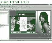
Easily create HTML image/photo maps with this free friendly image Mapping utility from the authors of the best free photo editing software - Photo Pos Pro photo editor . Pos HTML Image Mapper includes WYSIWYG interface allowing you Mapping images and photos fast and easy. Using the software you can easily create graphic toolbars to your Website; you can easily link...
Category: Web Authoring / HTML Color Pickers
Publisher: PowerOfSoftware Ltd., License: Freeware, Price: USD $0.00, File Size: 7.9 MB
Platform: Windows
Namu6 is a fast way to create, maintain, and publish a Website. Create a small business, photo journal, student or personal Website with Namu6. One click publishing, picture effects and themes are included. Namu6 is best suited for people who want hassle free Website maintenance and don't want to spend time editing HTML code.
Category: Internet
Publisher: Namu6 Ltd., License: Freeware, Price: USD $0.00, File Size: 3.9 MB
Platform: Windows
iMindMap Basic is a Mind Mapping software which will get you Mind Mapping quickly and easily.
iMindMap Basic is a Mind Mapping software which will get you Mind Mapping quickly and easily. A simple tool to help you start thinking in a clear and creative way, iMindMap Basic uses a process that has been enhancing the way people think for decades. iMindMap Basic is completely free for life and is a great starter package for those who want to start exploring the uses of Mind...
Category: Home & Education / Teaching Tools
Publisher: Buzan Online, License: Freeware, Price: USD $0.00, File Size: 213.6 MB
Platform: Windows
Thoughtograph is simple, effective and rewarding to use.
Thoughtograph is simple, effective and rewarding to use.
A Thot is a Thoughtograph document, it is a Visual representation of your thoughts taking shape.
For those familiar with mind Mapping, spider diagrams and concept Mapping the interface will feel familiar and intuitive.
For those new to laying out their thoughts visually it will...
Category: Home & Education / Miscellaneous
Publisher: 3MRT Limited, License: Freeware, Price: USD $0.00, File Size: 15.5 MB
Platform: Windows
 Freeware
MindMaple is an effective software method for brainstorming, note taking, organizing, and managing projects by stimulating both sides of the brain through use of Visual contents and maps. MindMaple is focused on improving user friendly interface to create maps. The interface allows the user to add topics by click-dragging from an existing topic box, so called the Drawing Interface, This...
Category: Business & Finance / MS Office Addons
Publisher: MindMaple Inc., License: Freeware, Price: USD $0.00, File Size: 9.7 MB
Platform: Windows
M3 Free Mac Data Recovery is the world's first free Mac Data recovery software for Mac users, it provides the safe, fast and easy way to recover lost Data on Mac OSX. M3 Free Mac Data Recovery is the free Mac photo recovery software to recover lost photos as well as video, documents, emails and other files on Mac OS...
Category: Utilities / File Compression
Publisher: M3 Data Recovery, License: Freeware, Price: USD $0.00, File Size: 2.3 MB
Platform: Mac
So that you can identify the Mapping & GIS product that best suits your needs, use this simple Product Comparison. There are four main product types that you can use to create a GPS Data collection and maintenance system, or mobile GIS solution. Use the links below to select a product group, and compare the features of each product within that group.
Category: Internet / Communications
Publisher: Trimble Navigation Limited, License: Freeware, Price: USD $0.00, File Size: 2.7 MB
Platform: Windows
The Microdrone Airborne Mapping extension to Orbit GIS provides the tools required for automated flight and high precision Mapping. It contains a Waypoint Generator, a Microdrone in-flight tracker, and a captation tool. Further image-, stereoprocessing and orthorectification can be executed using the Strabo Photogrammetry extension to Orbit GIS.
Category: Multimedia & Design / Multimedia App's
Publisher: Orbit GeoSpatial Technologies, License: Freeware, Price: USD $0.00, File Size: 30.0 MB
Platform: Windows
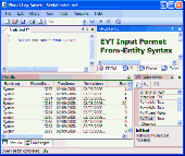
Entity Developer is a free powerful modeling and code generation tool for ADO.NET Entity Framework, NHibernate, and LINQ to SQL. You can use Model-First and Database-First approaches to design your model and generate C# or Visual Basic .NET code for it. Entity Developer Express for SQL Server is a free limited version of Entity Developer for SQL Server. The Express Edition does not...
Category: Business & Finance / Database Management
Publisher: Devart, License: Freeware, Price: USD $0.00, File Size: 30.7 MB
Platform: Windows
Anchorium enables your to create a Visual map of all the links within your web site. Once you are in front of this information you will be able to optimize your Website and push the pages you want to see go up in the search engines by affecting better links within the structure of your pages. Anchorium is a 100% free software for Mac OS X ( no in app purchase ), speed may...
Category: Web Authoring / Site Management
Publisher: SitePenalise, License: Freeware, Price: USD $0.00, File Size: 982.0 KB
Platform: Mac
Japplis Website Optimizer Lite Optimize your web pages.
Japplis Website Optimizer Lite Optimize your web pages.
Using several techniques, it can reduce the size of your HTML pages by more than 50 %.
This will not only make your Website faster but also save bandwidth.
Japplis Website Optimizer Lite can also add the height, width and alt attribute to the images if missing.
It can also generate a .htaccess file to...
Category: Web Authoring / HTML Text Styling Tools
Publisher: Japplis, License: Freeware, Price: USD $0.00, File Size: 768.0 KB
Platform: Windows
Create the GeoDatabase for the entire world. This program create the geographical location Latitude, Longitude, and Altitude (Elevation) for every city, village, region, state, county in the World. The program crawls the Data from the Website www.heavens-above.com which collect Data from US Geological Survey for the USA (and dependencies) and The National Imaging and...
Category: Software Development
Publisher: Mewsoft, License: Freeware, Price: USD $0.00, File Size: 1.1 MB
Platform: Windows
Water Point Mapping is a process for monitoring the distribution and status of water points in rural and urban areas. It supports local level planning and can improve accountability for water sector performance at local and national levels.
It uses the Google Earth application to visualise Data. Once Google Earth has been installed, it can be run offline.
...
Category: Home & Education / Miscellaneous
Publisher: WaterAid, License: Freeware, Price: USD $0.00, File Size: 880.0 KB
Platform: Windows
Recover lost data from iPhone, iPad, iPod touch under Mac OS X.
Do Your Data Recovery for iPhone Free ( Mac version) lets Apple users recover lost iPhone Data or iPad Data under Mac OS X. If you are a Mac user and want to recover lost SMS, contacts, photos, videos, notes etc from iPhone, Do Your Data Recovery for iPhone Free ( Mac version) is a good choice. This free iPhone Data recovery is...
Category: Utilities / File & Disk Management
Publisher: DoYourData, License: Freeware, Price: USD $0.00, File Size: 7.4 MB
Platform: Mac
Freeware
NConstruct Lite is a powerful wizard-like tool for creating application's Data layer source code for NHibernate object/relational persistence and query framework. NConstruct Lite examines database's metadata and creates NHibernate HBM files, entities' source code, Microsoft Visual Studio project file, and some optional helper files. NConstruct Lite is a derivative of more...
Category: Software Development / IDEs & Coding Utilities
Publisher: Biro M&T, License: Freeware, Price: USD $0.00, File Size: 9.2 MB
Platform: Windows
GPSeismic® is a suite of survey, Mapping, and Data management applications to support geophysical exploration.
GPSeismic applications offer advanced functionality to assist
the GNSS, INS, and conventional surveyor with a variety of tasks including the following:
-A wide range of both graphical, numeric and SQL based controller upload point selection methods...
Category: Business & Finance / Applications
Publisher: Dynamic Survey Solutions, Inc., License: Freeware, Price: USD $0.00, File Size: 162.8 MB
Platform: Windows
EntityDAC Express is a free ORM for Delphi with LINQ support. It provides a powerful framework that allows performing object-relational Mapping of database objects to Delphi classes with full support for encapsulation, inheritance, polymorphism and other OOP features. To retrieve Data from a database, LINQ is used as a database independent query engine. In addition, there is a...
Category: Software Development / Databases & Networks
Publisher: Devart, License: Freeware, Price: USD $0.00, File Size: 111.5 MB
Platform: Windows

The iPhone Movies resource plus light website browser.
The iPhone Movies resource plus light Website browser. A functional light Website browser is light and free and is a perfect replacement for Internet Explorer in Windows and Apple's Safari on the Mac. The iPhone Movies resource plus light Website browser. Software functionality: enables multi-window browsing, uses MSIE web browser technology in Windows and the open...
Category: Internet / Browsers
Publisher: iPhone Movies, License: Freeware, Price: USD $0.00, File Size: 5.6 MB
Platform: Windows, Linux, Mac
MICRODEM is a freeware microcomputer Mapping program written by Professor Peter Guth of the Oceanography Department, U.S. Naval Academy. It requires a 32 bit version of Windows (NT/2000/XP or 95/98/ME). You may freely use MICRODEM with no restrictions.
MICRODEM displays and merges
- digital elevation models
- satellite imagery
- scanned maps
...
Category: Multimedia & Design / Graphics Viewers
Publisher: Petmar Triilobite Breeding Ranch, License: Freeware, Price: USD $0.00, File Size: 84.9 MB
Platform: Windows
Visual Form Mail makes it easy to create powerful and secure CGI scripts to process forms on your Website. You can create scripts that validate the information entered by users, send custom email messages (such as a "thank you" or confirmation to the user or a copy of the Data entered to the webmaster), save Data to a text file on your server, and display a custom...
Category: Internet
Publisher: OneSeek.com, License: Freeware, Price: USD $0.00, File Size: 830.1 KB
Platform: Windows
IPSearchLight is a software component used to identify the geographic location of Website visitors, often within a few miles from the exact location. The process utilizes each visitor's IP address; this technique is silent and unintrusive. IPSearchLight is ideal for practical applications like the delivery of localized content, targeted advertising, multi-lingual websites, e-commerce...
Category: Software Development
Publisher: IPSearchLight, License: Freeware, Price: USD $0.00, File Size: 8.5 MB
Platform: Windows
The XML Converter Standard Edition is a Data converting program which lets the user to interactively create a Data transformation. It allows you to use XML documents by exporting source Data into XML file. This program is a Visual Mapping and conversion tool, which manages all dialects of XML such as DTD(document type definition), XSD(XML Schema Definition),...
Category: Web Authoring / XML/CSS Utilities
Publisher: RustemSoft, License: Freeware, Price: USD $0.00, File Size: 4.8 MB
Platform: Windows
Android Sync Mac is a powerful sync tool that allows syncing Data on Mac with any Android devices you own (phones or tablets running Android OS 3.x-8.x). Android Sync Mac is offered in two editions - Free and Expert. With Android Sync Mac Free edition you can sync contacts and calendars between Android and Mac. No need to create events or contacts...
Category: Utilities / Misc. Utilities
Publisher: Eltima Mac Software, License: Freeware, Price: USD $0.00, File Size: 57.2 MB
Platform: Mac
QuakeMap is a powerful GPS/mapping program for your Windows computer.
QuakeMap is a powerful GPS/Mapping program for your Windows computer. It can be downloaded here for free. The trial mode allows you to use most features indefinitely. When you need to unlock certain powerful features, a License Key can be ordered here. QuakeMap is designed for ease of use. It eatures intuitive user interface, supports most popular Garmin and Magellan receivers, reads and...
Category: Utilities / Misc. Utilities
Publisher: quakemap.com, License: Freeware, Price: USD $0.00, File Size: 821.2 KB
Platform: Windows
Codus is a comprehensive code generation tool for object-relational mapping.
Codus is a comprehensive code generation tool for object-relational Mapping. For a given database it automatically generates a full Data access layer, web services for distributed programming, strongly-typed collections, and a full set of unit tests.
Category: Software Development / Misc. Programming
Publisher: intesar66, License: Freeware, Price: USD $0.00, File Size: 4.4 MB
Platform: Windows
DIVA-GIS is a free computer program for Mapping and geographic Data analysis (a geographic information system (GIS). With DIVA-GIS you can make maps of the world, or of a very small area, using, for example, state boundaries, rivers, a satellite image, and the locations of sites where an animal species was observed.
Category: Business & Finance / Applications
Publisher: diva-gis, License: Freeware, Price: USD $0.00, File Size: 3.8 MB
Platform: Windows
Freeplane is a free mind mapping software and knowledge management software.
Freeplane is a free mind Mapping software and knowledge management software.
Freeplane is a powerful and free software for building mind maps. It is a redesigned version of the well known FreeMind. The software is written in Java, and supports any platform capable of running current versions of Java, including:
- Microsoft Windows
- Mac OS X
- Linux...
Category: Home & Education / Miscellaneous
Publisher: Volker Boerchers, Dimitry Polivaev, License: Freeware, Price: USD $0.00, File Size: 16.4 MB
Platform: Windows
ECO is a tool for creating model drive applications in Microsoft Visual Studio.
ECO is a tool for creating model drive applications in Microsoft Visual Studio. By making it faster to do it right than to cut corners, ECO is not only intended for developers that practice DDD (Domain Driven Design) as a matter of principle. It is equally suited for developers that just want to get the job done as fast as possible. When ECO is used, the domain classes are defined in a...
Category: Software Development / Components & Libraries
Publisher: CapableObjects AB, License: Freeware, Price: USD $0.00, File Size: 32.8 MB
Platform: Windows
Freeware
VisualLightBox is a free wizard program that helps you easily generate web photo galleries on Mac OS with a nice Lightbox-style overlay effect, in a few clicks without writing a single line of code. Just upload files generated by the photo album builder to your server and it will run immediately, even if it's a free host without php, mysql, asp support. Visual LightBox Features: *...
Category: Web Authoring / Web Design Utilities
Publisher: VisualLightBox.com, License: Freeware, Price: USD $0.00, File Size: 34.6 MB
Platform: Mac
PCM SurveyCERT makes pipe mapping easier for surveyors in the field.
PCM SurveyCERT makes pipe Mapping easier for surveyors in the field. Survey Data may either be viewed in real time or be saved within the PCM to be reviewed later.The PCM SurveyCERT installation bundle includes both PC and PDA versions of the application.
Category: Software Development / Misc. Programming
Publisher: Radiodetection Ltd, License: Freeware, Price: USD $0.00, File Size: 5.7 MB
Platform: Windows
HydroSHEDS is a Mapping product that provides hydrographic information for regional and global-scale applications in a consistent format. It offers a suite of geo-referenced Data sets (vector and raster) at various scales, including river networks, watershed boundaries, drainage directions, and flow accumulations. HydroSHEDS is based on high-resolution elevation Data...
Category: Home & Education / Miscellaneous
Publisher: WWF-CSP, License: Freeware, Price: USD $0.00, File Size: 1.7 MB
Platform: Windows
RD8000 SurveyCERT makes cable & pipe mapping easier for surveyors in the field.
RD8000 SurveyCERT makes cable & pipe Mapping easier for surveyors in the field. Survey Data may either be viewed in real time or be saved within the RD8000 to be reviewed later.
An useful software that you can easy get it on your computers. The RD8000 can pass survey Data to a compatible PDA or PC in real time using Bluetooth® wireless technology.
Category: Multimedia & Design / Multimedia App's
Publisher: Radiodetection Ltd., License: Freeware, Price: USD $0.00, File Size: 5.9 MB
Platform: Windows
Visual Menu Maker/Free is an intuitive wizard for the rapid development of professional looking menus. Visual Menu Maker/Free offers 100% standards compliant CSS and XML Data formats, allowing for complete separation between content and presentation. Visual Menu Maker/Free creates compiled and compressed Data files, making it the fastest loading menu...
Category: Web Authoring / JavaScript
Publisher: VisualMenu.com, License: Freeware, Price: USD $0.00, File Size: 1.1 MB
Platform: Windows
PMapServer7 is a free add-on for UI-View32.
PMapServer7 is a free add-on for UI-View32. To use it, first download and register a copy of UI-View32. There are versions of PMapServer that will work with with Precision Mapping V5, V6 and V7.UI-View32 street level Mapping of the whole of the USA. To support Precision Mapping, UI-View32 uses a plug-in map server (PMapServer) that integrates seamlessly into the program....
Category: Home & Education / Miscellaneous
Publisher: Bill Diaz, License: Freeware, Price: USD $0.00, File Size: 5.4 MB
Platform: Windows
Trizbort is a simple tool which can be used to create maps for interactive fiction.
Trizbort is a simple tool which can be used to create maps for interactive fiction.
Over the years a number of styles have evolved for interactive fiction Mapping. Trizbort focuses on creating maps in only one of these styles, as popularised by Infocom: labelled boxes for rooms, with lines connecting them.
Whether you're playing or writing interactive fiction,...
Category: Multimedia & Design / Digital Media Editors
Publisher: Genstein, License: Freeware, Price: USD $0.00, File Size: 596.2 KB
Platform: Windows
Do Your Data Recovery for Mac Free provides reliable Data recovery solution for Mac users. This free Data recovery software allows Mac users to recover at most 1GB lost files for free. It not only can recover lost Data from Mac hard drive, but also can retrieve lost files from USB drive, Memory card, SD card, external hard disk or other...
Category: Utilities / File & Disk Management
Publisher: DoYourData, License: Freeware, Price: USD $0.00, File Size: 3.1 MB
Platform: Mac, Other
The API is built on the Microsoft Silverlight platform which is integrated with Visual Studio 2010 and Expression Blend 4. The ArcGIS API for Silverlight enables you to create rich internet and desktop applications that utilize the powerful Mapping, geocoding, and geoprocessing capabilities provided by ArcGIS Server and Bing™ services.
To use the API, simply download...
Category: Software Development / Misc. Programming
Publisher: ESRI, License: Freeware, Price: USD $0.00, File Size: 7.7 MB
Platform: Windows

Visual Image Resizer software gives you all you need to resize images. It offers batch image resize mode to resize all your photos at once. Rename feature make publishing images much easier. Runs on Windows and Mac. It's completely free. Resizing 50,000 images is a no-problem for Visual Image Resizer. 1. We designed both import and export modules to be quick and...
Category: Multimedia & Design / Image Editing
Publisher: Portfoler sp. z o. o., License: Freeware, Price: USD $0.00, File Size: 28.4 MB
Platform: Windows
Spatial Workshop is Mapping software used for spatial information integration, query, analysis and reporting.
You build spatial applications with a few clicks or support complex business processes with geospatial and business Data from Oracle, Smallworld, ESRI, maps, files, spreadsheets and other sources.
You can combine and model geospatial Data,...
Category: Multimedia & Design / Multimedia App's
Publisher: Spatial Eye bv, License: Freeware, Price: USD $0.00, File Size: 176.7 MB
Platform: Windows
Freeware
OzGIS is an extensive system for the analysis and display of geographically referenced Data. About 150 menus provide an enormous range of options for: . importing Data from databases, spreadsheets and Geographic Information Systems (GISs) or downloaded from Census Bureaux or Mapping agencies. . processing Data in preparation for display and analysis ....
Category: Home & Education / Mathematics
Publisher: OzGIS, License: Freeware, Price: USD $0.00, File Size: 313.0 KB
Platform: Windows
Visual LogParser is a free Visual tool for the Microsoft LogParser engine.
Visual LogParser is a free Visual tool for the Microsoft LogParser engine. It enable user to query any log files or Data source with an advanced SQL syntax.
Visual LogParser offer an dockable MDI interface, color syntax hightlighting, customisation of the log source properties, and many more.
Visual LogParser is a composite application of free...
Category: Software Development / Debugging
Publisher: Serialcoder, License: Freeware, Price: USD $0.00, File Size: 423.0 KB
Platform: Windows
Ais Decoder accepts AIS Data from an AIS Receiver, the Internet or a Local Network connection, decodes the Data and presents the decoded Data in a form suitable for display and analysis by Mapping program (eg Google Earth or Google Maps), or for analysis using Excel, or by a database (eg MySql).
The decoder will decode all the NMEA content of all 27 AIS mesage...
Category: Business & Finance / Business Finance
Publisher: Neal Arundale, License: Freeware, Price: USD $0.00, File Size: 2.8 MB
Platform: Windows
If you don't have internet access on your phone, or you want to self-select a larger region of Mapping, then the Map Chooser tool can be used to make map tile selections. Choose your own Mapping areas with the flexible select tool that lets you select unlimited areas of Mapping. Based on a grid, you can choose any grid squares you like - so you can pick an area in...
Category: Home & Education / Miscellaneous
Publisher: ViewRanger, License: Freeware, Price: USD $0.00, File Size: 213.2 MB
Platform: Windows
Freeware
Visual NetTools is a set of network scanning, security, and administrator tools for Apple Mac useful in diagnosing networks and monitoring your computer's network connections. Current version of Visual NetTools includes: Visual Ping Sends out an echo request to a specific computer on the network. It can be used to check communication links or to check whether the...
Category: Security & Privacy / Password Managers & Generators
Publisher: AirGrab, License: Freeware, Price: USD $0.00, File Size: 5.4 MB
Platform: Mac
Visual Code Smith is a free software development platform that works with Visual C/C++.
Visual Code Smith is a free software development platform that works with Visual C/C++. C++ code debugging is supported in V3! To a certain extent, VcSmith is the combination of Source Insight, Visual Assist, CppUnit, and VC debugger, as well as the integration of advantages of multiple tools. However, such integration is not simple accumulation, but organic combination of...
Category: Software Development / Debugging
Publisher: ezTester, License: Freeware, Price: USD $0.00, File Size: 10.9 MB
Platform: Windows
Classic FTP Free for Mac is the most stable and comprehensive FTP client available. The graphic user interface is easy to learn and use. Classic FTP Free helps maintain your Website by uploading and downloading files quickly and efficiently. Classic FTP secures file transfer by using FTP SSL security. Classic FTP Free for Mac is compatible with all popular FTP servers. Use...
Category: Utilities / File & Disk Management
Publisher: NCH Software, License: Freeware, Price: USD $0.00, File Size: 1.9 MB
Platform: Mac
PageBreeze is a powerful FREE HTML Editor which has both visual (WYSIWYG) and HTML tag modes.
PageBreeze is a powerful FREE HTML Editor which has both Visual (WYSIWYG) and HTML tag modes. PageBreeze's design emphasizes simplicity and ease-of-use. You'll find that you'll be creating great looking websites almost instantly--with virtually no learning curve! PageBreeze offers the kind of power you would find in commerical products like Front Page/ Dreamweaver in a free editor....
Category: Web Authoring / HTML Text Styling Tools
Publisher: FormBreeze.com, Inc., License: Freeware, Price: USD $0.00, File Size: 4.9 MB
Platform: Windows
PageBreeze is a powerful FREE HTML Editor which has both visual (WYSIWYG) and HTML tag modes.
PageBreeze is a powerful FREE HTML Editor which has both Visual (WYSIWYG) and HTML tag modes. PageBreeze's design emphasizes simplicity and ease-of-use. You'll find that you'll be creating great looking websites almost instantly--with virtually no learning curve! PageBreeze offers the kind of power you would find in commerical products like Front Page/ Dreamweaver in a free editor....
Category: Web Authoring / HTML Editors
Publisher: FormBreeze.com, Inc., License: Freeware, Price: USD $0.00, File Size: 5.9 MB
Platform: Windows
Scrape websites and extract Data into customizable CSV files ready to be imported anywhere like web databases and office tools. Also great for grabbing inventory lists you want to link or sell (e.g. if you are an affiliate). Mix and mash scraped Website Data to create new mashup Website services such as weather, travel and hotel portals. The crawler engine is highly...
Category: Games / Puzzles
Publisher: Fish Forex Robot, License: Freeware, Price: USD $0.00, File Size: 11.9 MB
Platform: Windows
Freeware
Any Video Converter Freeware for Mac is Freeware to convert any video formats to any video formats for Mac users. This Mac video converter can convert between almost all video formats as an excellent Mac AVI MPEG converter. With various outputs, Any Video Converter is excellent for almost all popular video players such as PSP, PS3, iPod, iPhone, Apple TV, Zune,...
Category: Multimedia & Design / Video
Publisher: any-video-converter.com, License: Freeware, Price: USD $0.00, File Size: 70.6 MB
Platform: Mac