Free Downloads: Map Mapping
License: All | Free
If you don't have internet access on your phone, or you want to self-select a larger region of Mapping, then the Map Chooser tool can be used to make Map tile selections. Choose your own Mapping areas with the flexible select tool that lets you select unlimited areas of Mapping. Based on a grid, you can choose any grid squares you like - so you can pick...
Category: Home & Education / Miscellaneous
Publisher: ViewRanger, License: Freeware, Price: USD $0.00, File Size: 213.2 MB
Platform: Windows
Live Satellite Maps or Google maps is a web server mapping applications.
Live Satellite Maps or Google maps is a web server Mapping applications.Provides scrolling Map images and satellite photos around the earth and even the route between different places.Since 6 October 2005, live satellite Maps is part of local Google.Google live satellite Map provides the ability to zoom in or zoom out to show the Map.The user can control the...
Category: Home & Education / Science
Publisher: www.satelliteview-of-my-house.com, License: Freeware, Price: USD $0.00, File Size: 643.0 KB
Platform: Windows
PMapServer7 is a free add-on for UI-View32.
PMapServer7 is a free add-on for UI-View32. To use it, first download and register a copy of UI-View32. There are versions of PMapServer that will work with with Precision Mapping V5, V6 and V7.UI-View32 street level Mapping of the whole of the USA. To support Precision Mapping, UI-View32 uses a plug-in Map server (PMapServer) that integrates seamlessly into the...
Category: Home & Education / Miscellaneous
Publisher: Bill Diaz, License: Freeware, Price: USD $0.00, File Size: 5.4 MB
Platform: Windows
Easily create HTML image/photo maps with this free friendly image Mapping utility from the authors of the best free photo editing software - Photo Pos Pro photo editor . Pos HTML Image Mapper includes WYSIWYG interface allowing you Mapping images and photos fast and easy. Using the software you can easily create graphic toolbars to your website; you can easily link desired...
Category: Web Authoring / HTML Color Pickers
Publisher: PowerOfSoftware Ltd., License: Freeware, Price: USD $0.00, File Size: 7.9 MB
Platform: Windows
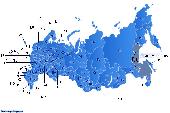
Dongsoft Interactive Russia Flash Maps for websites, interactive Map applications, presentations, and more.
The innovation of this fully-clickable Map will revolutionize your website navigation and provide visitors with a simple and seamless method of accessing information. Using the Map as a central navigation tool, information can be accessed with greater speed,...
Category: Software Development / Help File Utilities
Publisher: clickable map, License: Freeware, Price: USD $0.00, File Size: 156.0 KB
Platform: Windows
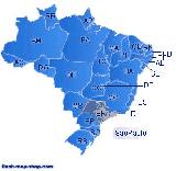
Dongsoft Interactive Brazil Flash Maps for websites, interactive Map applications, presentations, and more.
The innovation of this fully-clickable Map will revolutionize your website navigation and provide visitors with a simple and seamless method of accessing information. Using the Map as a central navigation tool, information can be accessed with greater speed,...
Category: Software Development / Help File Utilities
Publisher: maps flash, License: Freeware, Price: USD $0.00, File Size: 156.0 KB
Platform: Windows
DVEditor 2.2 is provided with English Mapping for all the Malayalam characters in a unique pattern which is really easy to follow it up. With the new design, user doesn't have to memorize any English Map for a Malayalam character. DVEditor's Quick Map watch window, monitors your typing activities and display all the combination of the Malayalam character and its...
Category: Utilities / Misc. Utilities
Publisher: Deshavani, License: Freeware, Price: USD $0.00, File Size: 743.1 KB
Platform: Windows
 Freeware
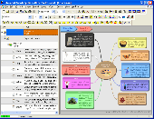
MindMaple is an effective software method for brainstorming, note taking, organizing, and managing projects by stimulating both sides of the brain through use of visual contents and maps. MindMaple is focused on improving user friendly interface to create maps. The interface allows the user to add topics by click-dragging from an existing topic box, so called the Drawing Interface, This feature...
Category: Business & Finance / MS Office Addons
Publisher: MindMaple Inc., License: Freeware, Price: USD $0.00, File Size: 9.7 MB
Platform: Windows
The LookLOCAL Firefox Toolbar is a convenient extension to the Firefox browser that enables you to Map a location, get directions, or search for products and services from any web site or page you are on without first navigating to an online Mapping site. Highlight and right click on a search topic, an address in your browser window or type an address directly into the toolbar,...
Category: Business & Finance / MS Office Addons
Publisher: IDELIX Software Inc., License: Freeware, Price: USD $0.00, File Size: 29.0 KB
Platform: Windows
Freeware
Displacement Map is an amusing image distortion, Photoshop-compatible plug-in for Windows designed by ImageSkill Software. It allows a user to get a view of the geometrically distorted image. The user is free to choose any displacement Map which determines the shape of the image deformation and adjust its strength. The plugin leaves the center of an image unchanged while...
Category: Multimedia & Design / Image Plugins
Publisher: ImageSkill Software, License: Freeware, Price: USD $0.00, File Size: 3.7 MB
Platform: Windows
MICRODEM is a freeware microcomputer Mapping program written by Professor Peter Guth of the Oceanography Department, U.S. Naval Academy. It requires a 32 bit version of Windows (NT/2000/XP or 95/98/ME). You may freely use MICRODEM with no restrictions.
MICRODEM displays and merges
- digital elevation models
- satellite imagery
- scanned maps
...
Category: Multimedia & Design / Graphics Viewers
Publisher: Petmar Triilobite Breeding Ranch, License: Freeware, Price: USD $0.00, File Size: 84.9 MB
Platform: Windows
Freeware
Easy to create mind maps (graphical representations of thought processes) for brainstorming, problem solving, rational analysis, and decision marking. Easy to use drawing tools, many pre-drawn flowchart templates and more than 600 flowchart symbols and flowchart samples, drawing couldn't be easier! Why Choose Edraw Mind Map 1.Smart drawing guide can layout the mind Map shapes...
Category: Games / Tools & Editors
Publisher: EdrawSoft, License: Freeware, Price: USD $0.00, File Size: 28.6 MB
Platform: Windows
Representing a new concept in the field of Ham Maps, the Global Overlay Mapping System is packed full of features for all Ham Radio enthusiasts, including : 1 World Map, with specialised satellite images and world region-boundaries. 8 Continental Maps - Europe, Asia, Africa, North and South America, Oceania, Arctic, Antarctica. 29 Sub Continental Maps, with Single Click Navigation...
Category: Home & Education / Miscellaneous
Publisher: MapAbility, License: Freeware, Price: USD $0.00, File Size: 4.9 MB
Platform: Windows
iMindMap Basic is a Mind Mapping software which will get you Mind Mapping quickly and easily.
iMindMap Basic is a Mind Mapping software which will get you Mind Mapping quickly and easily. A simple tool to help you start thinking in a clear and creative way, iMindMap Basic uses a process that has been enhancing the way people think for decades. iMindMap Basic is completely free for life and is a great starter package for those who want to start exploring the uses of Mind...
Category: Home & Education / Teaching Tools
Publisher: Buzan Online, License: Freeware, Price: USD $0.00, File Size: 213.6 MB
Platform: Windows
FTPUSE enables you to easily map your FTP server folder as a drive on your PC.
FTPUSE enables you to easily Map your FTP server folder as a drive on your PC. After a drive is mapped, the drive letter that you assigned during the Mapping appears in Windows Explorer and Command-line console. The drive functions just like local hard drives and is available to Windows and all installed programs.
Category: Internet / FTP
Publisher: FERRO Software, License: Freeware, Price: USD $0.00, File Size: 482.0 KB
Platform: Windows
LookOUT is a great new add-in for Microsoft® Outlook® that streamlines your daily planning by eliminating the tedious task of copying addresses from your Outlook contacts and pasting them into an online Mapping application. LookOUT enables you to easily: · Map your contact's location,· find directions from one contact to another,· and book a lunch...
Category: Business & Finance / MS Office Addons
Publisher: IDELIX Software Inc., License: Freeware, Price: USD $0.00, File Size: 645.1 KB
Platform: Windows
QuakeMap is a powerful GPS/mapping program for your Windows computer.
QuakeMap is a powerful GPS/Mapping program for your Windows computer. It can be downloaded here for free. The trial mode allows you to use most features indefinitely. When you need to unlock certain powerful features, a License Key can be ordered here. QuakeMap is designed for ease of use. It eatures intuitive user interface, supports most popular Garmin and Magellan receivers, reads and...
Category: Utilities / Misc. Utilities
Publisher: quakemap.com, License: Freeware, Price: USD $0.00, File Size: 821.2 KB
Platform: Windows
The ARC3WMS client is an ArcView 3 extension (.
The ARC3WMS client is an ArcView 3 extension (.AVX) that provides access to data sets stored on a Web Map Server (WMS). WMS is an internet Mapping protocol published by the OpenGIS Consortium. WMS servers publish Map images to remote clients using standard internet technologies. There are WMS servers for LandSat data, USGS DOQ photos, bathymetry, and many other data types.
Category: Multimedia & Design / Multimedia App's
Publisher: Refractions Research Inc, License: Freeware, Price: USD $0.00, File Size: 2.1 MB
Platform: Windows
Ekahau HeatMapper is a free software tool for quick and easy coverage mapping of Wi-Fi (802.
Ekahau HeatMapper is a free software tool for quick and easy coverage Mapping of Wi-Fi (802.11) networks. It's the only free, easy-to-use tool that shows, on a Map, the wireless network coverage in your home or small office. HeatMapper also locates all access points.
Category: Internet / Monitoring
Publisher: Ekahau Inc., License: Freeware, Price: USD $0.00, File Size: 94.6 MB
Platform: Windows
Freeware
An interactive Flash USA Map with all the features you need for your web site or project. This is the ideal solution for dealer maps, real-estate listings, or visualizing state statistics. Nearly every aspect of the Map is customizable. However, unlike competing products, our Map is very simple to install and edit. Just upload XML and SWF files and embed.
Category: Internet / Flash Tools
Publisher: http://www.flashusamap.com/trial/flashus, License: Freeware, Price: USD $0.00, File Size: 93.8 KB
Platform: Unknown
Map of Africa is one of the many maps created for GPS TrackMaker.
Map of Africa is one of the many maps created for GPS TrackMaker. You are able to download the installation package from the TrackMaker website. In order to preview the contents of this package, you need to install GPS TrackMaker.
Using the above mentioned application, you will be able to see the Map of Africa. Just click on the "Open Temporary...
Category: Home & Education / Miscellaneous
Publisher: Geo Studio Technology, License: Freeware, Price: USD $0.00, File Size: 18.3 MB
Platform: Windows
The Microdrone Airborne Mapping extension to Orbit GIS provides the tools required for automated flight and high precision Mapping. It contains a Waypoint Generator, a Microdrone in-flight tracker, and a captation tool. Further image-, stereoprocessing and orthorectification can be executed using the Strabo Photogrammetry extension to Orbit GIS.
Category: Multimedia & Design / Multimedia App's
Publisher: Orbit GeoSpatial Technologies, License: Freeware, Price: USD $0.00, File Size: 30.0 MB
Platform: Windows
Spatial Workshop is Mapping software used for spatial information integration, query, analysis and reporting.
You build spatial applications with a few clicks or support complex business processes with geospatial and business data from Oracle, Smallworld, ESRI, maps, files, spreadsheets and other sources.
You can combine and model geospatial data, services and...
Category: Multimedia & Design / Multimedia App's
Publisher: Spatial Eye bv, License: Freeware, Price: USD $0.00, File Size: 176.7 MB
Platform: Windows
Program shows you an actual X3 sector-map, with detailed information about most in-game objects.
Program shows you an actual X3 sector-Map, with detailed information about most in-game objects. The Map is based on a log-file that is created with an in-game script (by Andrei[<>Ace]). If you just want to view the standard Map (or if you don’t have the game) the program will work with the included default Map, which was created with an English X3 game...
Category: Games / Misc. Games
Publisher: SUU Design, License: Freeware, Price: USD $0.00, File Size: 1.4 MB
Platform: Windows
New Zealand Map Reference Converter (NZMapConv) is software that LINZ provides to convert Map references between the old NZMS260 Map series and the new NZTopo50 Map series.NZMapConv is a Windows programme designed to convert individual coordinates entered manually.
Category: Multimedia & Design / Media Management
Publisher: Land Information New Zealand, License: Freeware, Price: USD $0.00, File Size: 2.4 MB
Platform: Windows
When the XMAP software is communicating with an XEDE via the comms cable each Map will show, at the top of the Map display, an RPM and load value (x and y axis for the Map) in real time. Also in each Map a yellow highlighted block will show the current position within the Map. Beside the real-time display on each Map are the undo and redo buttons which...
Category: Home & Education / Miscellaneous
Publisher: ChipTorque, License: Freeware, Price: USD $0.00, File Size: 1.7 MB
Platform: Windows
Sig Panama Has :
Digital maps of Panama, Digital Map of Panama-City, digital Map of Taboga, digital Map of Bocas del Toro, digital Map of Colon and Free Zone, digital Map of Contadora Island, digital Map of Coronado, Panama, Zona Libre, Map of Panama, Map of Panama City, Map of Colon, Map of Zona Libre, Map of...
Category: Internet / Misc. Plugins
Publisher: DP Imperial, LLC., License: Freeware, Price: USD $0.00, File Size: 44.9 MB
Platform: Windows
GPS Egypt brings you the best GPS Mapping and navigation package on the Egyptian market today with over 55,000 km of road coverage. The package offers the best Map coverage available in Egypt, in addition to a cutting-edge software package for voice-based routing and navigation.
Category: Internet / Communications
Publisher: GPS Egypt, License: Freeware, Price: USD $0.00, File Size: 135.6 MB
Platform: Windows
Micr8 is a plugin for Microsoft Office that allows you to do more with Loc8 Codes which appears in text on a Map.
After installation, by highlighting what appears to be a Loc8 Code and right clicking, a new option showing "Loc8" with the Loc8 Icon will be shown in the option box. By selecting this and if the text selected is a genuine Loc8 Code, the user will be taken to...
Category: Utilities / System Utilities
Publisher: Loc8 Code Ltd., License: Freeware, Price: USD $0.00, File Size: 323.0 KB
Platform: Windows
Freeware
Arm Map Explorer recreates all the functionalities of Google Maps on your desktop while expanding them with new extras. Map Explorer lets you locate and view any place on the planet using dynamic interactive maps. These maps are draggable, which means there is no need for you to click and wait for graphics to reload each time you want to view adjacent parts of a Map....
Category: Internet / Flash Tools
Publisher: ArmCode, License: Freeware, Price: USD $0.00, File Size: 5.5 MB
Platform: Windows
The Coverage Calculator software is used to configure EAW Commercial loudspeaker systems listed within the program in a distributed layout using SPL (sound pressure level) Mapping as the primary criteria.
FEATURES:
-User-adjustable layout density.
-SPL Map of listening area with adjustable resolution and frequency.
-Database of measured loudspeaker data...
Category: Audio / Utilities & Plug-Ins
Publisher: EAW, License: Freeware, Price: USD $0.00, File Size: 3.9 MB
Platform: Windows
ArcReader is a free, easy-to-use desktop Mapping application that allows users to view, explore, and print maps and globes. Anyone with ArcReader can view high-quality interactive maps authored by a high-level ArcGIS Desktop product and published with the ArcGIS Publisher extension.
ArcReader is a free and easy-to-use application that allows users to view and print maps that...
Category: Desktop Enhancements / Shell & Desktop Managers
Publisher: Environmental System Research Institute, Inc., License: Freeware, Price: USD $0.00, File Size: 499.2 MB
Platform: Windows
Freeware
Free MyNet Toolset from AdRem Software scans the local network and automatically creates graphical network Map of the discovered devices, including their IP address, MAC address, DNS Name, Location, Node Name or Type, as well as Operation System and Network Services running on the node. MyNet Toolset network Map can be used as multiple network tool organizer. By right-clicking on...
Category: Utilities / Network
Publisher: AdRem Software, Inc., License: Freeware, Price: USD $0.00, File Size: 25.6 MB
Platform: Windows
The easiest way to get a paper map with MapPlot is the Plot Map menu.
The easiest way to get a paper Map with MapPlot is the Plot Map menu.
On the following dialog, simply paper size and scale have to be chosen - the result is ready to be printed directly, edited (e.g. for additional entries) or to be displayed as a preview.
Category: Utilities / Misc. Utilities
Publisher: AGIS GmbH, License: Freeware, Price: USD $0.00, File Size: 5.4 MB
Platform: Windows
The OSTN02 extension for ArcPad is a FREE tool that automatically transforms GPS data and aligns it with Ordnance Survey (OS) background Map. This easy-to-use extension removes the need to manually post-process GPS data by providing’ on the fly’ transformation of WGS84 latitude and longitude into OSTN02 corrected British National Grid coordinate. Data capture using GPS and...
Category: Home & Education / Miscellaneous
Publisher: ESRI (UK) Ltd, License: Freeware, Price: USD $0.00, File Size: 8.0 MB
Platform: Windows
Tibia Map Viewer is a useful freeware and Open Source application that allows you to view maps generated by Tibia game client and create or edit Map symbols.
You can view the entire Tibia Map you have explored, both upper and lower levels of the Map, with zoom ratio from 25 to 400 percents. It also allows you to export to BMP file.
Category: Games / Tools & Editors
Publisher: Yury Sidorov, License: Freeware, Price: USD $0.00, File Size: 193.7 KB
Platform: Windows
InfoRapid KnowledgeMap is a free mind mapping program and knowledge management system.
InfoRapid KnowledgeMap is a free mind Mapping program and knowledge management system. InfoRapid KnowledgeMap can be used to draw knowledge maps, organizational charts, decision trees and work breakdown structures, taking down your ideas when brainstorming, or generating structure diagrams from XML files. Knowledge maps can be published on the Web or your intranet, can be added to...
Category: Business & Finance
Publisher: Ingo Straub Softwareentwicklung, License: Freeware, Price: USD $0.00, File Size: 5.1 MB
Platform: Windows
Spinning Gobe Sample demonstrates how to manipulate the navigation, Map style, Map font size, and view of the Map programmatically through the MapPoint ActiveX Control. Using this simple Visual Basic project, you will learn the objects, methods, and properties that are used to navigate a MapPoint Map or change how it looks.
Category: Home & Education / Miscellaneous
Publisher: Microsoft, License: Freeware, Price: USD $0.00, File Size: 3.4 MB
Platform: Windows
CopanMobile for Palm OS is a very functional and easy-to-use geomatics engineering tool for computing and managing plane surveying and Mapping coordinates. It does numerous coordinate geometry (COGO) calculations, processes and adjusts raw field survey data, computes and adjusts Map traverse data, performs Map or deed checks, calculates curves, areas and perimeters,...
Category: Multimedia & Design / Multimedia App's
Publisher: Underhill Geomatics Ltd., License: Freeware, Price: USD $0.00, File Size: 341.0 KB
Platform: Palm
The C-Map Chart Catalog allows you to view, navigate, select and order C-Map electronic charts, or various weather options, in an interactive way. After selection of required items is completed, simply press the 'E-mail order' button, and enter the address of your local C-Map distributor.
Category: Home & Education / Hobbies
Publisher: Jeppesen Marine, License: Freeware, Price: USD $0.00, File Size: 6.1 MB
Platform: Windows
CopanMobile for Pocket PC is a very functional and easy-to-use geomatics engineering tool for computing and managing plane surveying and Mapping coordinates. It does numerous coordinate geometry (COGO) calculations, processes and adjusts raw field survey data, computes and adjusts Map traverse data, performs Map or deed checks, calculates curves, areas and perimeters,...
Category: Business & Finance / Applications
Publisher: Underhill Geomatics Ltd., License: Freeware, Price: USD $0.00, File Size: 341.0 KB
Platform: Windows
C&C 3 Map Manager streamlines the process of installing custom maps for C&C 3: Tiberium Wars and Kane's Wrath. Now you can install fan maps from C&C fansites without having to delve into your computer's folders to find the right place to put them: Map Manager handles this for you. Map Manager also allows you to delete fan maps after you get sick of...
Category: Games / Tools & Editors
Publisher: CNC Generals World, License: Freeware, Price: USD $0.00, File Size: 612.3 KB
Platform: Windows
Karnaugh map minimalizator - for minimalize logical functions for 3-8 variables.
Karnaugh Map minimalizator - for minimalize logical functions for 3-8 variables. This program help you safe logical circuits. This program is special for students. On left you can see a full Map of your function. Negation of variable is big capital.
Category: Home & Education / Mathematics
Publisher: Vaclav Kozak, License: Freeware, Price: USD $0.00, File Size: 253.0 KB
Platform: Windows
The D2D Map Editor enables the rapid creation of multilayered tile based map grids.
The D2D Map Editor enables the rapid creation of multilayered tile based Map grids. It’s easy to learn and can be used by programmers and non-programmers alike. The maps generated can be deployed in games and applications developed in C++, C#, Actionscript and XML.
D2D Map Editor has been developed in C# and is currently released as a Beta version.
Category: Games / Tools & Editors
Publisher: D2D Map Editor, License: Freeware, Price: USD $0.00, File Size: 2.5 MB
Platform: Windows
Copan for Pocket PC is a very functional and easy-to-use geomatics engineering tool for computing and managing plane surveying and Mapping coordinates.
It does numerous coordinate geometry (COGO) calculations, processes and adjusts raw field survey data, computes and adjusts Map traverse data, performs Map or deed checks, calculates curves, areas and perimeters,...
Category: Multimedia & Design / Multimedia App's
Publisher: Underhill Geomatics Ltd, License: Freeware, Price: USD $0.00, File Size: 662.0 KB
Platform: Windows
Copan for Mobile 6 is a very functional and easy-to-use geomatics engineering tool for computing and managing plane surveying and Mapping coordinates.
It does numerous coordinate geometry (COGO) calculations, processes and adjusts raw field survey data, computes and adjusts Map traverse data, performs Map or deed checks, calculates curves, areas and perimeters,...
Category: Multimedia & Design / Multimedia App's
Publisher: Underhill Geomatics Ltd, License: Freeware, Price: USD $0.00, File Size: 662.0 KB
Platform: Windows
Character Map displays all of the characters for a selected font.
Character Map displays all of the characters for a selected font. Features:
- Pastes any character into your current document.
- Special characters can be translated into their HTML-equivalents.
- More than a replacement for the Windows (9x/NT) character Map "charmap".
- Many additional features
- Ready for €
- Uncrippled...
Category: Utilities / Misc. Utilities
Publisher: Thomas Bigler, License: Freeware, Price: USD $0.00, File Size: 88.5 KB
Platform: Windows
With links and additional information on important topics for geography lessons.
With links and additional information on important topics for geography lessons. 3D-view of atlas (book) maps on a virtual globe, high resolution physical Map, political Map, satellite images, land coverage and earth-at-night Map. Create your own Map legend, use the drawing tool, move and insert atlas symbols and much more.
Category: Multimedia & Design / Fonts
Publisher: Imagon GmbH, License: Freeware, Price: USD $0.00, File Size: 6.1 MB
Platform: Windows

The free AvisMap Viewer opens most GIS/CAD and raster image file types and most ArcView, ArcExplorer, and MapInfo projects. Besides just opening and viewing files, the Viewer supports an extensive list of features including visual layer properties control, legend control, thematic Mapping, spatial and attribute querying, custom labeling, on-Map measurements, hyper-linking, PDF...
Category: Software Development / Components & Libraries
Publisher: AvisMap GIS Technologies, License: Freeware, Price: USD $0.00, File Size: 22.3 MB
Platform: Windows
So that you can identify the Mapping & GIS product that best suits your needs, use this simple Product Comparison. There are four main product types that you can use to create a GPS data collection and maintenance system, or mobile GIS solution. Use the links below to select a product group, and compare the features of each product within that group.
Category: Internet / Communications
Publisher: Trimble Navigation Limited, License: Freeware, Price: USD $0.00, File Size: 2.7 MB
Platform: Windows