Free Downloads: Mapping Maps
License: All | Free
Trizbort is a simple tool which can be used to create maps for interactive fiction.
Trizbort is a simple tool which can be used to create Maps for interactive fiction.
Over the years a number of styles have evolved for interactive fiction Mapping. Trizbort focuses on creating Maps in only one of these styles, as popularised by Infocom: labelled boxes for rooms, with lines connecting them.
Whether you're playing or writing interactive...
Category: Multimedia & Design / Digital Media Editors
Publisher: Genstein, License: Freeware, Price: USD $0.00, File Size: 596.2 KB
Platform: Windows
Live Satellite Maps or Google maps is a web server mapping applications.
Live Satellite Maps or Google Maps is a web server Mapping applications.Provides scrolling map images and satellite photos around the earth and even the route between different places.Since 6 October 2005, live satellite Maps is part of local Google.Google live satellite Map provides the ability to zoom in or zoom out to show the map.The user can control the map with...
Category: Home & Education / Science
Publisher: www.satelliteview-of-my-house.com, License: Freeware, Price: USD $0.00, File Size: 643.0 KB
Platform: Windows
Nokia Maps 3D browser plugin is a free Mapping product and service by Nokia for its mobile phones and for internet browsers. Nokia Maps includes voice guided navigation for both pedestrians and drivers for 74 countries in 46 different languages and there are Maps for over 180 countries.
See the world in high-resolution 3D. Everything from the sky to the street....
Category: Internet / Browser Accessories
Publisher: Nokia, License: Freeware, Price: USD $0.00, File Size: 9.8 MB
Platform: Windows
 Freeware
MindMaple is an effective software method for brainstorming, note taking, organizing, and managing projects by stimulating both sides of the brain through use of visual contents and Maps. MindMaple is focused on improving user friendly interface to create Maps. The interface allows the user to add topics by click-dragging from an existing topic box, so called the Drawing...
Category: Business & Finance / MS Office Addons
Publisher: MindMaple Inc., License: Freeware, Price: USD $0.00, File Size: 9.7 MB
Platform: Windows
Free Satellite Maps is a free tool from Google which offers a satellite mapping service worldwide.
Free Satellite Maps is a free tool from Google which offers a satellite Mapping service worldwide.These are accompanied by a street service, a route planner and information about business in almost all countries.In this way we can fly the world from satellite view or in birds eye.The level of detail is different depending on where you are located.Major cities have a very excellent...
Category: Home & Education / Science
Publisher: www.satelliteview-of-my-house.com, License: Freeware, Price: USD $0.00, File Size: 612.0 KB
Platform: Windows
This software development kit (SDK) provides the binaries and programming reference for the Bing Maps Silverlight Control. You can use this control to build your own web sites that use Bing Maps.
The Bing Maps Silverlight Control combines the power of Silverlight and Bing Maps to provide an enhanced Mapping experience. Developers can use the Bing...
Category: Utilities / Misc. Utilities
Publisher: Microsoft, License: Freeware, Price: USD $0.00, File Size: 3.8 MB
Platform: Windows
Spatial Workshop is Mapping software used for spatial information integration, query, analysis and reporting.
You build spatial applications with a few clicks or support complex business processes with geospatial and business data from Oracle, Smallworld, ESRI, Maps, files, spreadsheets and other sources.
You can combine and model geospatial data,...
Category: Multimedia & Design / Multimedia App's
Publisher: Spatial Eye bv, License: Freeware, Price: USD $0.00, File Size: 176.7 MB
Platform: Windows
CacheMaps retreives a variety of maps for your caches from the Internet.
CacheMaps retreives a variety of Maps for your caches from the Internet.
CacheMaps uses the Geocaching loc- or gpx-files as input. Directely from the Geocaching site or as exported from GSAK.CacheMaps v4 has been designed to be used next to GSAK. A lot of the functionality that was available in previous versions of CacheMaps, is available in GSAK now in a much better form. What...
Category: Audio / Utilities & Plug-Ins
Publisher: BigBird Productions, License: Freeware, Price: USD $0.00, File Size: 153.2 KB
Platform: Windows
Representing a new concept in the field of Ham Maps, the Global Overlay Mapping System is packed full of features for all Ham Radio enthusiasts, including : 1 World Map, with specialised satellite images and world region-boundaries. 8 Continental Maps - Europe, Asia, Africa, North and South America, Oceania, Arctic, Antarctica. 29 Sub Continental Maps, with Single...
Category: Home & Education / Miscellaneous
Publisher: MapAbility, License: Freeware, Price: USD $0.00, File Size: 4.9 MB
Platform: Windows
Easily create HTML image/photo Maps with this free friendly image Mapping utility from the authors of the best free photo editing software - Photo Pos Pro photo editor . Pos HTML Image Mapper includes WYSIWYG interface allowing you Mapping images and photos fast and easy. Using the software you can easily create graphic toolbars to your website; you can easily link...
Category: Web Authoring / HTML Color Pickers
Publisher: PowerOfSoftware Ltd., License: Freeware, Price: USD $0.00, File Size: 7.9 MB
Platform: Windows
ArcReader is a free, easy-to-use desktop Mapping application that allows users to view, explore, and print Maps and globes. Anyone with ArcReader can view high-quality interactive Maps authored by a high-level ArcGIS Desktop product and published with the ArcGIS Publisher extension.
ArcReader is a free and easy-to-use application that allows users to view and...
Category: Desktop Enhancements / Shell & Desktop Managers
Publisher: Environmental System Research Institute, Inc., License: Freeware, Price: USD $0.00, File Size: 499.2 MB
Platform: Windows
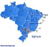
Dongsoft Interactive Brazil Flash Maps for websites, interactive map applications, presentations, and more.
The innovation of this fully-clickable map will revolutionize your website navigation and provide visitors with a simple and seamless method of accessing information. Using the map as a central navigation tool, information can be accessed with greater speed, enhanced...
Category: Software Development / Help File Utilities
Publisher: maps flash, License: Freeware, Price: USD $0.00, File Size: 156.0 KB
Platform: Windows
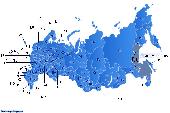
Dongsoft Interactive Russia Flash Maps for websites, interactive map applications, presentations, and more.
The innovation of this fully-clickable map will revolutionize your website navigation and provide visitors with a simple and seamless method of accessing information. Using the map as a central navigation tool, information can be accessed with greater speed, enhanced...
Category: Software Development / Help File Utilities
Publisher: clickable map, License: Freeware, Price: USD $0.00, File Size: 156.0 KB
Platform: Windows

FSS Google Maps Downloader is a tool that can download the Google Maps images to your PC. This is a clearly free program. There is no spyware or adware. It's absolutely safe to install and to run. The interface is very simple and self explaining. It runs low on system resources consumption and is supported on all Windows versions. It can save them to your hard disk,...
Category: Internet / Download Managers
Publisher: FreeSmartSoft, License: Freeware, Price: USD $0.00, File Size: 874.0 KB
Platform: Windows
The LookLOCAL Firefox Toolbar is a convenient extension to the Firefox browser that enables you to map a location, get directions, or search for products and services from any web site or page you are on without first navigating to an online Mapping site. Highlight and right click on a search topic, an address in your browser window or type an address directly into the toolbar, click...
Category: Business & Finance / MS Office Addons
Publisher: IDELIX Software Inc., License: Freeware, Price: USD $0.00, File Size: 29.0 KB
Platform: Windows
MICRODEM is a freeware microcomputer Mapping program written by Professor Peter Guth of the Oceanography Department, U.S. Naval Academy. It requires a 32 bit version of Windows (NT/2000/XP or 95/98/ME). You may freely use MICRODEM with no restrictions.
MICRODEM displays and merges
- digital elevation models
- satellite imagery
- scanned...
Category: Multimedia & Design / Graphics Viewers
Publisher: Petmar Triilobite Breeding Ranch, License: Freeware, Price: USD $0.00, File Size: 84.9 MB
Platform: Windows
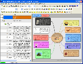
InfoRapid KnowledgeMap is a free mind mapping program and knowledge management system.
InfoRapid KnowledgeMap is a free mind Mapping program and knowledge management system. InfoRapid KnowledgeMap can be used to draw knowledge Maps, organizational charts, decision trees and work breakdown structures, taking down your ideas when brainstorming, or generating structure diagrams from XML files. Knowledge Maps can be published on the Web or your intranet, can...
Category: Business & Finance
Publisher: Ingo Straub Softwareentwicklung, License: Freeware, Price: USD $0.00, File Size: 5.1 MB
Platform: Windows
Diffuse maps represent the absorption of light.
Diffuse Maps represent the absorption of light. Diffuse Maps are what people call "textures". They are the color textures or photographic textures usually applied to 3d models.
ShaderMap creates displacement Maps using the light data stored inside of diffuse Maps. Evenly lit diffuse Maps generally create better quality Maps with ShaderMap.
Category: Home & Education / Miscellaneous
Publisher: Rendering Systems Inc., License: Freeware, Price: USD $0.00, File Size: 4.0 MB
Platform: Windows
TetraploidMap is a graphical user interface for calculating linkage Maps for autotetraploid populations. It is suitable for handling markers scored on two parents and the full-sib offspring of a cross between them. TetraploidMap handles both codominant and dominant molecular markers, in all possible configurations, and takes into account the presence of null alleles in the analysis. It...
Category: Business & Finance / Calculators
Publisher: Biomathematics & Statistics Scotland, License: Freeware, Price: USD $0.00, File Size: 16.9 MB
Platform: Windows
Ais Decoder accepts AIS data from an AIS Receiver, the Internet or a Local Network connection, decodes the data and presents the decoded data in a form suitable for display and analysis by Mapping program (eg Google Earth or Google Maps), or for analysis using Excel, or by a database (eg MySql).
The decoder will decode all the NMEA content of all 27 AIS mesage types. The...
Category: Business & Finance / Business Finance
Publisher: Neal Arundale, License: Freeware, Price: USD $0.00, File Size: 2.8 MB
Platform: Windows
InfoRapid KnowledgeMap is a free mind mapping program and knowledge management system.
InfoRapid KnowledgeMap is a free mind Mapping program and knowledge management system. InfoRapid KnowledgeMap can be used to draw knowledge Maps, organizational charts, decision trees and work breakdown structures, taking down your ideas when brainstorming, or generating structure diagrams from XML files. Knowledge Maps can be published on the Web or your intranet, can be...
Category: Business & Finance / Project Management
Publisher: Ingo Straub Softwareentwicklung, License: Freeware, Price: USD $0.00, File Size: 5.1 MB
Platform: Windows
MapComp is a powerful and free Windows Software for drawing images of linkage Maps and to compare linkage Maps and indicate common markers.
MapInspect can display, print and save images, and has no limit to the number of Maps it can compare (but only neighbouring Maps are compared). Maps can be flipped within MapINspect, an the on-screen order of...
Category: Multimedia & Design / Multimedia App's
Publisher: MapInspect, License: Freeware, Price: USD $0.00, File Size: 616.7 KB
Platform: Windows
iMindMap Basic is a Mind Mapping software which will get you Mind Mapping quickly and easily.
iMindMap Basic is a Mind Mapping software which will get you Mind Mapping quickly and easily. A simple tool to help you start thinking in a clear and creative way, iMindMap Basic uses a process that has been enhancing the way people think for decades. iMindMap Basic is completely free for life and is a great starter package for those who want to start exploring the uses of Mind...
Category: Home & Education / Teaching Tools
Publisher: Buzan Online, License: Freeware, Price: USD $0.00, File Size: 213.6 MB
Platform: Windows
DIVA-GIS is a free computer program for Mapping and geographic data analysis (a geographic information system (GIS). With DIVA-GIS you can make Maps of the world, or of a very small area, using, for example, state boundaries, rivers, a satellite image, and the locations of sites where an animal species was observed.
Category: Business & Finance / Applications
Publisher: diva-gis, License: Freeware, Price: USD $0.00, File Size: 3.8 MB
Platform: Windows
Freeware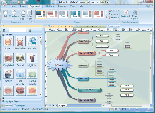
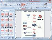
Easy to create mind Maps (graphical representations of thought processes) for brainstorming, problem solving, rational analysis, and decision marking. Easy to use drawing tools, many pre-drawn flowchart templates and more than 600 flowchart symbols and flowchart samples, drawing couldn't be easier! Why Choose Edraw Mind Map 1.Smart drawing guide can layout the mind map shapes...
Category: Games / Tools & Editors
Publisher: EdrawSoft, License: Freeware, Price: USD $0.00, File Size: 28.6 MB
Platform: Windows
Freeware
OzGIS is an extensive system for the analysis and display of geographically referenced data. About 150 menus provide an enormous range of options for: . importing data from databases, spreadsheets and Geographic Information Systems (GISs) or downloaded from Census Bureaux or Mapping agencies. . processing data in preparation for display and analysis . display of data as...
Category: Home & Education / Mathematics
Publisher: OzGIS, License: Freeware, Price: USD $0.00, File Size: 313.0 KB
Platform: Windows
Freeplane is a free mind mapping software and knowledge management software.
Freeplane is a free mind Mapping software and knowledge management software.
Freeplane is a powerful and free software for building mind Maps. It is a redesigned version of the well known FreeMind. The software is written in Java, and supports any platform capable of running current versions of Java, including:
- Microsoft Windows
- Mac OS X
- Linux...
Category: Home & Education / Miscellaneous
Publisher: Volker Boerchers, Dimitry Polivaev, License: Freeware, Price: USD $0.00, File Size: 16.4 MB
Platform: Windows
Water Point Mapping is a process for monitoring the distribution and status of water points in rural and urban areas. It supports local level planning and can improve accountability for water sector performance at local and national levels.
It uses the Google Earth application to visualise data. Once Google Earth has been installed, it can be run offline.
...
Category: Home & Education / Miscellaneous
Publisher: WaterAid, License: Freeware, Price: USD $0.00, File Size: 880.0 KB
Platform: Windows
SensAct -SENSORS CONVERSION Maps AND ACTUATORS COMMAND Maps
This software pack contents the sensors conversion Maps and the actuators command Maps like motorized throttles, gasoline injectors corrections, ...
It is mandatory to install it to select the type of sensor and actuators that are equiping the ECUs, because these Maps are no longer...
Category: Business & Finance / Applications
Publisher: Skynam, License: Freeware, Price: USD $0.00, File Size: 3.4 MB
Platform: Windows
PlanetGIS Explorer is a free viewer for PlanetGIS maps and GIS exchange files.
PlanetGIS Explorer is a free viewer for PlanetGIS Maps and GIS exchange files. PlanetGIS Explorer allows you to navigate through Maps, query map elements and view attribute information from linked database tables. Also PlanetGIS Explorer allows you to customize the appearance of Maps for purposes of creating hardcopy printouts, but does not allow you to save any changes to...
Category: Multimedia & Design / Graphics Viewers
Publisher: Planet GIS, License: Freeware, Price: USD $0.00, File Size: 5.4 MB
Platform: Windows
Easy to create mind Maps (graphical representations of thought processes) for brainstorming, problem solving, rational analysis, and decision marking. Easy to use drawing tools, many pre-drawn flowchart templates and more than 600 flowchart symbols and flowchart samples, drawing couldn't be easier!
Category: Games / Tools & Editors
Publisher: EdrawSoft, License: Freeware, Price: USD $0.00, File Size: 20.9 MB
Platform: Windows
FlamMap is a fire behavior Mapping and analysis program that computes potential fire behavior characteristics (spread rate, flame length, fireline intensity, etc.) over an entire FARSITE landscape for constant weather and fuel moisture conditions. For more information, look under National Systems in the menu at the top of each page.
The FlamMap software creates raster...
Category: Business & Finance / Business Finance
Publisher: SEM, License: Freeware, Price: USD $0.00, File Size: 6.2 MB
Platform: Windows
The Microdrone Airborne Mapping extension to Orbit GIS provides the tools required for automated flight and high precision Mapping. It contains a Waypoint Generator, a Microdrone in-flight tracker, and a captation tool. Further image-, stereoprocessing and orthorectification can be executed using the Strabo Photogrammetry extension to Orbit GIS.
Category: Multimedia & Design / Multimedia App's
Publisher: Orbit GeoSpatial Technologies, License: Freeware, Price: USD $0.00, File Size: 30.0 MB
Platform: Windows
The world's first dynamic travel guides. Schmap 2.0 opens a new world of flexibility for browsing, searching and customizing travel guide content (reviews, photos and Maps). Once installed, simply choose from Schmap's rapidly growing series of US, European and Canadian destination guides, each with zooming, panning Maps, useful links, playable virtual tours, top picks, plus...
Category: Home & Education
Publisher: Schmap, License: Freeware, Price: USD $0.00, File Size: 1.5 MB
Platform: Windows
When you are looking for a powerful tool to satisfy various needs regarding vectors, raster and satellite imagery, you will find ILWIS Academic an efficient application. The program comes with such useful features as points to create Maps, lines for segment Maps, closed area segments for polygon Maps, spatial operations for raster Maps and so on. Whilst using images...
Category: Home & Education / Miscellaneous
Publisher: ITC, License: Freeware, Price: USD $0.00, File Size: 19.4 MB
Platform: Unknown
GDS Images and Document Maps is a unique document search utility.
GDS Images and Document Maps is a unique document search utility. GDS Images and Document Maps is a rather unique application that will enable you to store all your documents and images alongside other important files and folders right on your desktop so that you can use it straight from there, without the need to bother around with looking with looking for every single file...
Category: Utilities / Misc. Utilities
Publisher: toggle, License: Freeware, Price: USD $0.00, File Size: 558.8 KB
Platform: Windows
Link Explorer is a desktop software application that allows you to apply powerful query and analysis techniques to your data, presenting the answers in a range of visualisations such as link charts, time lines, Maps and reports. Link Explorer expands the analytical environment by its integration with two Microsoft tools widely used by analysts and investigators – Bing...
Category: Utilities / Misc. Utilities
Publisher: Xanalys, License: Freeware, Price: USD $0.00, File Size: 23.7 MB
Platform: Windows
Freeware
Displacement Map is an amusing image distortion, Photoshop-compatible plug-in for Windows designed by ImageSkill Software. It allows a user to get a view of the geometrically distorted image. The user is free to choose any displacement map which determines the shape of the image deformation and adjust its strength. The plugin leaves the center of an image unchanged while increasing the...
Category: Multimedia & Design / Image Plugins
Publisher: ImageSkill Software, License: Freeware, Price: USD $0.00, File Size: 3.7 MB
Platform: Windows
MapCreator combines a cartography and a graphics programme.
MapCreator combines a cartography and a graphics programme. The software is designed to create Maps and animated Maps of the highest quality as often required for presentations. For example, this could be Maps needed for a travel presentation. But also in
Category: Multimedia & Design
Publisher: primap.com, License: Freeware, Price: USD $0.00, File Size: 103.3 MB
Platform: Windows, Vista

OkMap is a GPS and map software that:
-Works with vectorial Maps and calibrates raster Maps
-Organizes paths by creating waypoints, routes and tracks
-Uploads/downloads data to/from your GPS
-Uses altitude DEM data
-Supports GPS real-time navigation
-Sends/receives vehicles position and display tracks on Maps in real time
-Provides autorouting and...
Category: Business & Finance / Applications
Publisher: Gian Paolo Saliola, License: Freeware, Price: USD $0.00, File Size: 20.2 MB
Platform: Windows
You can use your existing digital (vector) Maps in Autodesk MapGuide® software by converting them to Spatial Data Files (SDF). SDF is a special data format for delivering large amounts of data quickly over an intranet or the Internet. The SDF Loader is a utility used to create Spatial Data Files (SDF) and their accompanying Spatial Index Files (SIF) from a variety of GIS data...
Category: Multimedia & Design / Multimedia App's
Publisher: Autodesk, Inc., License: Freeware, Price: USD $0.00, File Size: 54.6 MB
Platform: Windows
With MapAuthor you can create, print and save desktop Maps, using data that you obtain from commercial sources or perhaps your in-hous GIS department as shapefiles (shapefiles are a very common GIS exchange format.) You can also produce internet-based Maps based on Google Maps, for use on your web site.
MapAuthor allows you to link your own data to Maps, for...
Category: Internet / Misc. Plugins
Publisher: MapAuthor.com, License: Freeware, Price: USD $0.00, File Size: 6.3 MB
Platform: Windows
Download, View, and Print Maps with the MrSID Viewer.
Download, View, and Print Maps with the MrSID Viewer.
To download and view Maps offline you need a special viewer. Maps are stored in MrSID format. The MRSID Viewer is a freeware tool. This library provides access to the MrSID viewer developed by LizardTech.
NOTE:
LizardTech dropped the link for that stand-alone viewer download from...
Category: Multimedia & Design / Graphics Viewers
Publisher: Lizardtech, License: Freeware, Price: USD $0.00, File Size: 2.0 MB
Platform: Windows
Freeware
Free standalone software DataPult Desktop creates heat Maps from your data quickly and efficiently. Key features: Direct data import from MS Excel with one click. The ability to create animated Maps of data over several years. Interactive Maps and diagrams. 39 map colorings for making heat Maps. Intelligent identification of input...
Category: Business & Finance / MS Office Addons
Publisher: DataPult, License: Freeware, Price: USD $0.00, File Size: 21.0 MB
Platform: Windows
The View software provides an excellent starting point for reading and writing job data to popular precision farming devices.
The free software can read data from a wide range of precision farming devices in order to display and print yield Maps, as-applied Maps, coverage Maps, and more. Other features of View include the ability to build a list of clients, farms, and...
Category: Business & Finance / MS Office Addons
Publisher: Farm Works Software, License: Freeware, Price: USD $0.00, File Size: 59.4 MB
Platform: Windows
So that you can identify the Mapping & GIS product that best suits your needs, use this simple Product Comparison. There are four main product types that you can use to create a GPS data collection and maintenance system, or mobile GIS solution. Use the links below to select a product group, and compare the features of each product within that group.
Category: Internet / Communications
Publisher: Trimble Navigation Limited, License: Freeware, Price: USD $0.00, File Size: 2.7 MB
Platform: Windows
You will either mess up your work place with huge Maps and travel guides or just switch on to Schmap Player to guide you for your travel.
This amazing travel guide with elaborated Maps and destinations can be downloaded and used for free. The main interface of this application comprises the guide menu with: European guides, US guides, Canadian guides, Australian guides, and...
Category: Internet / Web Search Utilities
Publisher: Schmap, Inc., License: Freeware, Price: USD $0.00, File Size: 2.0 MB
Platform: Windows
PMapServer7 is a free add-on for UI-View32.
PMapServer7 is a free add-on for UI-View32. To use it, first download and register a copy of UI-View32. There are versions of PMapServer that will work with with Precision Mapping V5, V6 and V7.UI-View32 street level Mapping of the whole of the USA. To support Precision Mapping, UI-View32 uses a plug-in map server (PMapServer) that integrates seamlessly into the program....
Category: Home & Education / Miscellaneous
Publisher: Bill Diaz, License: Freeware, Price: USD $0.00, File Size: 5.4 MB
Platform: Windows
W4MapLauncher is a free software application that contains more than 85 standard maps of W4.
W4MapLauncher is a free software application that contains more than 85 standard Maps of W4.This software application allows you to play on the new Maps in multiplayer or on-line.This launcher has also an aspect mode of 4:3 and 16:10, it is easy to install and to use
Category: Games / Misc. Games
Publisher: AlexBond, License: Freeware, Price: USD $0.00, File Size: 23.8 MB
Platform: Windows
Pie chart symbols for use as location markers on maps.
Pie chart symbols for use as location markers on Maps. There are three full sets of pies in the font. One is mapped to the upper-case letters A-U, and one to the lower case a-u . The third set is mapped to the number keys: the unshifted keys ` 1 2 3 4 5 6 7 8 9 0 represent 0%, 10%, 20%, 30%, 40%, 50%, 60%, 70%, 80%, 90%, and 100%, and their shifted counterparts ~ ! @ # $ % ^ & * (...
Category: Multimedia & Design / Multimedia App's
Publisher: Curtis Clark, License: Freeware, Price: USD $0.00, File Size: 12.5 KB
Platform: Windows