Free Downloads: Mio Map Data Tele Atlas
License: All | Free
EZ-Locate is an Internet-based geocoding service that provides real-time access to the Tele Atlas address database and geocoding technology. It is designed to let users enjoy the benefits of high volume batch geocoding without the hassles or high price.
EZ-Locate geocoding client software allows you to access our high-performance batch geocoding engine from your...
Category: Internet / Misc. Plugins
Publisher: Tele Atlas, License: Freeware, Price: USD $0.00, File Size: 31.5 MB
Platform: Windows
With links and additional information on important topics for geography lessons.
With links and additional information on important topics for geography lessons. 3D-view of Atlas (book) maps on a virtual globe, high resolution physical Map, political Map, satellite images, land coverage and earth-at-night Map. Create your own Map legend, use the drawing tool, move and insert Atlas symbols and much more.
Category: Multimedia & Design / Fonts
Publisher: Imagon GmbH, License: Freeware, Price: USD $0.00, File Size: 6.1 MB
Platform: Windows
Electronic World atlas for Radio Amateurs.
Electronic World Atlas for Radio Amateurs. Scrollable World Map with smooth zoom, DXCC territories, province/state prefixes, Grid Squares, CQ and ITU Zones in the rectangular, azimuthal and Globe projections, 3D relief, Gray Line, city and island index, unique hierarchical prefix database, local time with DST for all cities, islands and call areas, unique ionospheric maps.
Category: Home & Education / Miscellaneous
Publisher: Afreet Software, Inc., License: Freeware, Price: USD $0.00, File Size: 7.6 MB
Platform: Windows
MioTransfer is a neat, simple and handy freeware utility that helps you get your MP3s organized on your device.
Using this tool you can manage and update your storage card and PC conveniently.
Mio C250 Mio Transfer is also freeware.
Category: Audio / Utilities & Plug-Ins
Publisher: MiTAC Intl., License: Freeware, Price: USD $0.00, File Size: 2.9 MB
Platform: Windows
Atlas Timesheet Software Atlas Timesheet Software® is a powerful client-server application for workgroups, using the Corel Paradox relational database. With all major features available off-the-shelf, Atlas provides the most complete, ready-to-run timesheet management solution for your company. Atlas timesheets eliminates the time wasted, and inaccuracies of...
Category: Business & Finance
Publisher: Atlas Business Software Ltda, License: Freeware, Price: USD $0.00, File Size: 30.8 MB
Platform: Windows
Scopri da solo questo screen saver "Non toccare il mio computer!
Scopri da solo questo screen saver "Non toccare il Mio computer!" che avvisera' i malintenzionati quando sarai lontani dal tuo pc...
Category: Desktop Enhancements / Screensavers
Publisher: Info2000, License: Freeware, Price: USD $0.00, File Size: 1.0 MB
Platform: Windows
Create clips using a virtual camera: ClipFactory is composed of a resizable view-finder and a preview window from where you can add a MP3 file, save or re-open your clips, set the playback speed. You can explort your creation in JPG, HTML or Mio. Mio file are usefull to keep your clips over your desktop, change zoom using mouse wheel or vertical arrow keys, or send them to your...
Category: Multimedia & Design
Publisher: Mioplanet, License: Freeware, Price: USD $0.00, File Size: 708.0 KB
Platform: Windows
This is a software designed for Pyronix Atlas and Matrix Control Panels.
This is a software designed for Pyronix Atlas and Matrix Control Panels. Pyronix is a globally recognised manufacturer of Security Equipment. This Pyronix Atlas is a fully backlit external sounder which maximises security as it can be seen night and day.
Category: Security & Privacy / Other
Publisher: Pyronix Ltd, License: Freeware, Price: USD $0.00, File Size: 23.2 MB
Platform: Windows
Virtual Moon Atlas Expert is a program that allows us to observe and study the moon and its surface.
Virtual Moon Atlas Expert is a program that allows us to observe and study the moon and its surface. It was developed by Christian Legrand and Patrick Chevalley, and is offered at no cost at their website. This program is of special interest for astronomers, amateurs, and all those interested in exploring the Earth’s natural satellite. Due to its precision and detail of its...
Category: Home & Education / Science
Publisher: Christian Legrand and Patrick Chevalley, License: Freeware, Price: USD $0.00, File Size: 0
Platform: Windows
View a fully interactive version of the Allen Human Brain Atlas in 3D.
View a fully interactive version of the Allen Human Brain Atlas in 3D.
Brain Explorer 2 is a desktop software application for viewing the human brain anatomy and gene expression Data in 3D. Using Brain Explorer 2, you can:
View gene expression Data in 3D: inflated cortical surfaces are colored by gene expression values of nearby samples.
View expression...
Category: Desktop Enhancements / Shell & Desktop Managers
Publisher: Allen Institute for Brain Science, License: Freeware, Price: USD $0.00, File Size: 2.6 MB
Platform: Windows
Create state-of-the-art touch panel interfaces for AMX G4 Touch Panels and the Mio-R4 Remote using the TPDesign4 application. TPDesign4 features enhanced ease of use, speed and functionality, as well as the ability to edit touch panel projects generated by VisualArchitect templates.
TPDesign4 supports the Mio R-4 Remote and AMX G4 touch panels.
Category: Multimedia & Design / Digital Media Editors
Publisher: AMX Corporation, License: Freeware, Price: USD $0.00, File Size: 57.3 MB
Platform: Windows
GeoEdu is an atlas and an educational game that everyone can learn from and enjoy.
GeoEdu is an Atlas and an educational game that everyone can learn from and enjoy.
You will find all the countries in the world, their dependencies, divisions, islands and all the oceans, seas and gulfs.
GeoEdu allows you to find out hundreds of Data you are interested in or want to learn about, in just a few clicks.
Category: Home & Education / Miscellaneous
Publisher: GeoEdu, License: Freeware, Price: USD $0.00, File Size: 35.7 MB
Platform: Windows
Virtual Moon Atlas Light is a program that allows you to explore and analyze the Moon.
Virtual Moon Atlas Light is a program that allows you to explore and analyze the Moon. This is a premier application for amateur astronomers interested in the moon. The interface of the program is very simple. You can see the Moon there and in the sidebar you have different visualization options. So, you can select interesting locations, see the exact coordinates for the selected...
Category: Home & Education / Astrology & Numerology
Publisher: Christian Legrand and Patrick Chevalley, License: Freeware, Price: USD $0.00, File Size: 99.4 MB
Platform: Windows
Tele-Prompt LE is fully functional in all respects, except that the interface cannot be customised, it will only operate in the default layout and screen resolution of 1024 x 768 pixels, the length of the script available for scrolling in the teleprompter area is limited and the total recording time of the built in audio recorder is restricted to 30 seconds.
Category: Utilities / Misc. Utilities
Publisher: ProSoft Digital Ltd, License: Freeware, Price: USD $0.00, File Size: 7.9 MB
Platform: Windows
HistorAtlas: free historical atlas.
HistorAtlas: free historical Atlas. World history
HistorAtlas is a free software that you can download and install on your computer. It has 168 historical maps with their description and a timeline that helps you on navigation. You find also an illustrated chronology and animated maps.
Category: Home & Education / Miscellaneous
Publisher: romano.mazzini, License: Freeware, Price: USD $0.00, File Size: 4.9 MB
Platform: Windows
Use the easy-to-use palette to choose colors, draw your tag over the desktop and save it as a Mio file. Send your tags to your friends or publish them on Internet.
Category: Home & Education / Miscellaneous
Publisher: mioplanet.com, License: Freeware, Price: USD $0.00, File Size: 495.0 KB
Platform: Windows, Mac, 2K
Use the easy-to-use palette to choose colors, draw your tag over the desktop and save it as a Mio file. Send your tags to your friends or publish them on Internet.
Category: Multimedia & Design / Multimedia App's
Publisher: Mioplanet, License: Freeware, Price: USD $0.00, File Size: 483.0 KB
Platform: Windows
GoArrow displays an arrow on your screen that points towards coordinates that you specify.
GoArrow displays an arrow on your screen that points towards coordinates that you specify. This is very handy if you have to run to coordinates with obstacles in the way (like mountains), or if you're just directionally-challenged.
GoArrow has the ability to find a route between any two locations in Dereth, as well as look up locations' details from either the Crossroads of...
Category: Home & Education / Miscellaneous
Publisher: Digero of Leafcull, License: Freeware, Price: USD $0.00, File Size: 7.7 MB
Platform: Windows
APRS SA does most of the functions of the original APRS(tm) with a big difference: The maps it uses to plot the locations are Street Atlas 4.0 or 5.0 Maps. This allows great precision in locating objects and stations. This program track a moving vehicle and do it at the street level.
Category: Home & Education / Miscellaneous
Publisher: Brent Hildebrand, KH2Z, License: Freeware, Price: USD $0.00, File Size: 2.0 MB
Platform: Windows
Tele Screen enables iPhone/iPod Touch to view the entire desktop of a remote PC in real time.
Tele Screen enables iPhone/iPod Touch to view the entire desktop of a remote PC in real time. Your device will become a small PC monitor and provides a quick and simple solution to peek what's going on your PC. It works on Windows XP, Windows Vista, Windows Server.
Category: Desktop Enhancements / Shell & Desktop Managers
Publisher: Phantombility, License: Freeware, Price: USD $0.00, File Size: 2.5 MB
Platform: Windows
AZMap is a freeware Windows program which will generate, and display an Azimuthal-Equidistance Map of the world, centered on any point on the surface of the earth (except very near the poles). The A-E Map is also known as a Great Circle Map since straight lines from the center point to any other point always fall along a great circle path and represent the shortest distance...
Category: Home & Education / Miscellaneous
Publisher: Paul Burton, License: Freeware, Price: USD $0.00, File Size: 1.1 MB
Platform: Windows


 Freeware
Convert ESRI ShapeFiles (.SHP) geolocation Data into AnyMap format to be used with AnyChart. AnyChart Flash Map Converter allows making use of a wide choice of maps with AnyChart Flash Component, a GIS visualization system that recognizes Map Data in AnyMap format only. AnyChart Flash Map Converter makes it easy to visualize any geolocation Data without...
Category: Web Authoring / Image Mapping Tools
Publisher: AnyChart.Com, License: Freeware, Price: USD $0.00, File Size: 1.6 MB
Platform: Windows
NetBrain Map Edition Lite is a free software designed to help network professionals to learn network skills easier and faster. For instance, you can use this software to document your learning process toward CCIE, CCNP or CCNA with a Data-driven Map. Using NetBrain Map Edition Lite, dynamic network diagrams can be created instantly in many different ways. For...
Category: Internet / News Applications
Publisher: NetBrain Technologies,Inc., License: Freeware, Price: USD $0.00, File Size: 53.0 MB
Platform: Windows


 Freeware
An interactive Flash USA Map with all the features you need for your web site or project. This is the ideal solution for dealer maps, real-estate listings, or visualizing state statistics. Nearly every aspect of the Map is customizable. However, unlike competing products, our Map is very simple to install and edit. Just upload XML and SWF files and embed.
Category: Internet / Flash Tools
Publisher: http://www.flashusamap.com/trial/flashus, License: Freeware, Price: USD $0.00, File Size: 93.8 KB
Platform: Unknown
Map of Africa is one of the many maps created for GPS TrackMaker.
Map of Africa is one of the many maps created for GPS TrackMaker. You are able to download the installation package from the TrackMaker website. In order to preview the contents of this package, you need to install GPS TrackMaker.
Using the above mentioned application, you will be able to see the Map of Africa. Just click on the "Open Temporary...
Category: Home & Education / Miscellaneous
Publisher: Geo Studio Technology, License: Freeware, Price: USD $0.00, File Size: 18.3 MB
Platform: Windows
Program shows you an actual X3 sector-map, with detailed information about most in-game objects.
Program shows you an actual X3 sector-Map, with detailed information about most in-game objects. The Map is based on a log-file that is created with an in-game script (by Andrei[<>Ace]). If you just want to view the standard Map (or if you don’t have the game) the program will work with the included default Map, which was created with an English X3 game...
Category: Games / Misc. Games
Publisher: SUU Design, License: Freeware, Price: USD $0.00, File Size: 1.4 MB
Platform: Windows
New Zealand Map Reference Converter (NZMapConv) is software that LINZ provides to convert Map references between the old NZMS260 Map series and the new NZTopo50 Map series.NZMapConv is a Windows programme designed to convert individual coordinates entered manually.
Category: Multimedia & Design / Media Management
Publisher: Land Information New Zealand, License: Freeware, Price: USD $0.00, File Size: 2.4 MB
Platform: Windows
When the XMAP software is communicating with an XEDE via the comms cable each Map will show, at the top of the Map display, an RPM and load value (x and y axis for the Map) in real time. Also in each Map a yellow highlighted block will show the current position within the Map. Beside the real-time display on each Map are the undo and redo buttons which...
Category: Home & Education / Miscellaneous
Publisher: ChipTorque, License: Freeware, Price: USD $0.00, File Size: 1.7 MB
Platform: Windows
Sig Panama Has :
Digital maps of Panama, Digital Map of Panama-City, digital Map of Taboga, digital Map of Bocas del Toro, digital Map of Colon and Free Zone, digital Map of Contadora Island, digital Map of Coronado, Panama, Zona Libre, Map of Panama, Map of Panama City, Map of Colon, Map of Zona Libre, Map of...
Category: Internet / Misc. Plugins
Publisher: DP Imperial, LLC., License: Freeware, Price: USD $0.00, File Size: 44.9 MB
Platform: Windows
The Atlas of Agrobiological Resources of Russia and Neighbouring Countries (hereunder the
Agroatlas) contains descriptive and cartographic information about agroecological conditions, main
cultivated crops and their wild congeners, diseases, pests and weeds of the territory of the former
USSR. The readers of the Agroatlas belong to the following target groups: research...
Category: Business & Finance / MS Office Addons
Publisher: Vadim Shumilin / Yurij Li, License: Freeware, Price: USD $0.00, File Size: 492.8 MB
Platform: Windows


 Freeware
Arm Map Explorer recreates all the functionalities of Google Maps on your desktop while expanding them with new extras. Map Explorer lets you locate and view any place on the planet using dynamic interactive maps. These maps are draggable, which means there is no need for you to click and wait for graphics to reload each time you want to view adjacent parts of a Map....
Category: Internet / Flash Tools
Publisher: ArmCode, License: Freeware, Price: USD $0.00, File Size: 5.5 MB
Platform: Windows


 Freeware
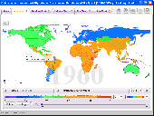
Free standalone software DataPult Desktop creates heat maps from your Data quickly and efficiently. Key features: Direct Data import from MS Excel with one click. The ability to create animated maps of Data over several years. Interactive maps and diagrams. 39 Map colorings for making heat maps. Intelligent identification of input...
Category: Business & Finance / MS Office Addons
Publisher: DataPult, License: Freeware, Price: USD $0.00, File Size: 21.0 MB
Platform: Windows
The easiest way to get a paper map with MapPlot is the Plot Map menu.
The easiest way to get a paper Map with MapPlot is the Plot Map menu.
On the following dialog, simply paper size and scale have to be chosen - the result is ready to be printed directly, edited (e.g. for additional entries) or to be displayed as a preview.
Category: Utilities / Misc. Utilities
Publisher: AGIS GmbH, License: Freeware, Price: USD $0.00, File Size: 5.4 MB
Platform: Windows
Nokia Map Manager is a program that allows you to manage and transfer GPS maps to mobile phone.
Nokia Map Manager is a program that allows you to manage and transfer GPS maps to mobile phone. The Map Manager is for the 6110 Navigator only. The program is provided with scan function to search maps on the computer and DVD. Nokia Map Manager is an additional application and is used together with Nokia PC Suite 6.86 and later versions.
Nokia Map Manager helps...
Category: Internet / Communications
Publisher: Nokia, License: Freeware, Price: USD $0.00, File Size: 0
Platform: Windows
Gismaps Viewer is a GIS viewer that can be used for geospatial analysis and map production.
Gismaps Viewer is a GIS viewer that can be used for geospatial analysis and Map production.
The main features are:
- read Shape files using geographic coordinate system
- view satellite images (MrSid, jpeg, bmp and tiff file formats)
- generate thematic maps, queries and labels
- export do Google Earth KML (shp2kml)
- configure Map colors...
Category: Multimedia & Design / Graphics Viewers
Publisher: Gismaps Sistemas Ltda., License: Freeware, Price: USD $0.00, File Size: 10.2 MB
Platform: Windows
Tibia Map Viewer is a useful freeware and Open Source application that allows you to view maps generated by Tibia game client and create or edit Map symbols.
You can view the entire Tibia Map you have explored, both upper and lower levels of the Map, with zoom ratio from 25 to 400 percents. It also allows you to export to BMP file.
Category: Games / Tools & Editors
Publisher: Yury Sidorov, License: Freeware, Price: USD $0.00, File Size: 193.7 KB
Platform: Windows
Spinning Gobe Sample demonstrates how to manipulate the navigation, Map style, Map font size, and view of the Map programmatically through the MapPoint ActiveX Control. Using this simple Visual Basic project, you will learn the objects, methods, and properties that are used to navigate a MapPoint Map or change how it looks.
Category: Home & Education / Miscellaneous
Publisher: Microsoft, License: Freeware, Price: USD $0.00, File Size: 3.4 MB
Platform: Windows
The C-Map Chart Catalog allows you to view, navigate, select and order C-Map electronic charts, or various weather options, in an interactive way. After selection of required items is completed, simply press the 'E-mail order' button, and enter the address of your local C-Map distributor.
Category: Home & Education / Hobbies
Publisher: Jeppesen Marine, License: Freeware, Price: USD $0.00, File Size: 6.1 MB
Platform: Windows
CPM is a method for analyzing Data about respondent perceptions and preferences to produce a "product Map". A product Map is a graphic representation of the ways people perceive products in terms of underlying attributes, as well as an aid in understanding their preferences.
Category: Multimedia & Design / Multimedia App's
Publisher: Sawtooth Software, Inc., License: Freeware, Price: USD $0.00, File Size: 3.9 MB
Platform: Windows
The OSTN02 extension for ArcPad is a FREE tool that automatically transforms GPS Data and aligns it with Ordnance Survey (OS) background Map. This easy-to-use extension removes the need to manually post-process GPS Data by providing’ on the fly’ transformation of WGS84 latitude and longitude into OSTN02 corrected British National Grid coordinate. Data...
Category: Home & Education / Miscellaneous
Publisher: ESRI (UK) Ltd, License: Freeware, Price: USD $0.00, File Size: 8.0 MB
Platform: Windows
C&C 3 Map Manager streamlines the process of installing custom maps for C&C 3: Tiberium Wars and Kane's Wrath. Now you can install fan maps from C&C fansites without having to delve into your computer's folders to find the right place to put them: Map Manager handles this for you. Map Manager also allows you to delete fan maps after you get sick of...
Category: Games / Tools & Editors
Publisher: CNC Generals World, License: Freeware, Price: USD $0.00, File Size: 612.3 KB
Platform: Windows
When developing programs, programs crashing is a hazard all developers face.
When developing programs, programs crashing is a hazard all developers face. No matter how hard you try, and how good your quality assurance is, sooner or later a bug will get past your own testing standards and end up revealing itself to a customer. Often when this happens the customer does not have the source code, debugging symbols or any other Data.
The Map File...
Category: Utilities / Misc. Utilities
Publisher: Object Media Limited, License: Freeware, Price: USD $0.00, File Size: 321.5 KB
Platform: Windows
Karnaugh map minimalizator - for minimalize logical functions for 3-8 variables.
Karnaugh Map minimalizator - for minimalize logical functions for 3-8 variables. This program help you safe logical circuits. This program is special for students. On left you can see a full Map of your function. Negation of variable is big capital.
Category: Home & Education / Mathematics
Publisher: Vaclav Kozak, License: Freeware, Price: USD $0.00, File Size: 253.0 KB
Platform: Windows
The D2D Map Editor enables the rapid creation of multilayered tile based map grids.
The D2D Map Editor enables the rapid creation of multilayered tile based Map grids. It’s easy to learn and can be used by programmers and non-programmers alike. The maps generated can be deployed in games and applications developed in C++, C#, Actionscript and XML.
D2D Map Editor has been developed in C# and is currently released as a Beta version.
Category: Games / Tools & Editors
Publisher: D2D Map Editor, License: Freeware, Price: USD $0.00, File Size: 2.5 MB
Platform: Windows
Character Map displays all of the characters for a selected font.
Character Map displays all of the characters for a selected font. Features:
- Pastes any character into your current document.
- Special characters can be translated into their HTML-equivalents.
- More than a replacement for the Windows (9x/NT) character Map "charmap".
- Many additional features
- Ready for €
- Uncrippled...
Category: Utilities / Misc. Utilities
Publisher: Thomas Bigler, License: Freeware, Price: USD $0.00, File Size: 88.5 KB
Platform: Windows
Management-Ware Craigslist Emails Extractor software is a newCraigslist Classified Leads Finder.
Management-Ware Craigslist Emails Extractor software is a newCraigslist Classified Leads Finder. Internet has many sources of free leads that you can use to market your product or service. The Craigslist Contacts Finder is a powerful contact extraction tool that can provide you with professional and targeted contacts that are directly related to your business since it operates according to your...
Category: Internet / Email
Publisher: Management-Ware Solutions, License: Freeware, Price: USD $0.00, File Size: 21.8 MB
Platform: Windows
If you don't have internet access on your phone, or you want to self-select a larger region of mapping, then the Map Chooser tool can be used to make Map tile selections. Choose your own mapping areas with the flexible select tool that lets you select unlimited areas of mapping. Based on a grid, you can choose any grid squares you like - so you can pick an area in Sussex and...
Category: Home & Education / Miscellaneous
Publisher: ViewRanger, License: Freeware, Price: USD $0.00, File Size: 213.2 MB
Platform: Windows
DigiMap is a graphical program for simple digitization of Map Data to create ASCI files of ordered x,y,z triplets. It is a quick and easy alternative to expensive digitizing tablets and software. Maps (such as geological, topographic, structural, or isopach) in common Windows file formats (JPEG, PNG, TIFF, PCX, TGA, BMP, WMF, EMF, PSD, GIF) can be opened or scanned in DigiMap and...
Category: Multimedia & Design / Fonts
Publisher: KWare (Ken Wohletz), License: Freeware, Price: USD $0.00, File Size: 8.4 MB
Platform: Windows
The ARC3WMS client is an ArcView 3 extension (.
The ARC3WMS client is an ArcView 3 extension (.AVX) that provides access to Data sets stored on a Web Map Server (WMS). WMS is an internet mapping protocol published by the OpenGIS Consortium. WMS servers publish Map images to remote clients using standard internet technologies. There are WMS servers for LandSat Data, USGS DOQ photos, bathymetry, and many other...
Category: Multimedia & Design / Multimedia App's
Publisher: Refractions Research Inc, License: Freeware, Price: USD $0.00, File Size: 2.1 MB
Platform: Windows
USAPhotoMaps downloads USGS aerial photo and topo map data from Microsoft?
USAPhotoMaps downloads USGS aerial photo and topo Map Data from Microsoft?s free TerraServer Web site, saves it on your hard drive, and creates seamless maps from it.
Category: Home & Education / Miscellaneous
Publisher: jdmcox.com, License: Freeware, Price: USD $0.00, File Size: 598.4 KB
Platform: Windows, Mac, 2K, 2K3, Vista

