Free Downloads: Mud Mapping
License: All | Free
Mudsplat is a completely audio-based game where the player defends the Earth from Mud-throwing monsters. In this arcade-style game, there are 25 different levels as well as bosses, power-ups and lots of action!
The city is under attack. Mud throwing monsters have invaded the city and they will not rest until everything is covered with Mud. The people are...
Category: Games / Arcade
Publisher: Dominique.Archambault, License: Freeware, Price: USD $0.00, File Size: 112.8 MB
Platform: Windows
All the fun of motocross without all of the mud!
All the fun of motocross without all of the Mud! Ride the cliffs and ridges, jump across the chasms and try to beat the top times.
Super Motocross Deluxe is an exciting game
You can play Super Motocross Deluxe together with your family
Super Motocross Deluxe is a simulator
Category: Games / Simulations
Publisher: gametop.com, License: Freeware, Price: USD $0.00, File Size: 33.5 MB
Platform: Windows
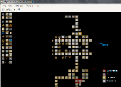
Mud Map Designer is a tool that was developed for Mud programmers that wish to make maps for plotting or simply beneficial reasons. All files can be exported to several different image types. You can create your own setup files and map icons to use to customize each game!
Here are some key features:
-You can save, load, or export maps. You can export maps into one of the...
Category: Software Development / Help File Utilities
Publisher: Stonefall Studios, License: Freeware, Price: USD $0.00, File Size: 455.0 KB
Platform: Windows
TinTin , aka tt , is a free MUD client for Mac OS X, Linux, and Windows.
TinTin , aka tt , is a free Mud client for Mac OS X, Linux, and Windows. The Windows port named WinTin (using the PuTTY derived mintty terminal) is available for those who do not use Cygwin (A Linux/Unix emulator for Windows) and runs on Windows Xp, Windows Vista, and Windows 7. Besides MUDs, TinTin also works well with MUSH, Rogue, BBS, and Linux servers.
Category: Games / Misc. Games
Publisher: TinTin++ development team, License: Freeware, Price: USD $0.00, File Size: 1.4 MB
Platform: Windows
This Game have many Features :
-71 tracks
-2 new cars TC6, NS
-Graphics
-Proper shadows (depth/self shadows, terrain lightmap on car, road, trees...)
-Improved shader effects (powered by a dynamic material & shader generator)
-Car fresnel effect, reflectivity/specular maps
-New effects "Screen Space Ambient Occlusion" and -Antialiasing...
Category: Games / Arcade
Publisher: Crystal Hammer, License: Freeware, Price: USD $0.00, File Size: 0
Platform: Windows
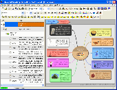
iMindMap Basic is a Mind Mapping software which will get you Mind Mapping quickly and easily.
iMindMap Basic is a Mind Mapping software which will get you Mind Mapping quickly and easily. A simple tool to help you start thinking in a clear and creative way, iMindMap Basic uses a process that has been enhancing the way people think for decades. iMindMap Basic is completely free for life and is a great starter package for those who want to start exploring the uses of Mind...
Category: Home & Education / Teaching Tools
Publisher: Buzan Online, License: Freeware, Price: USD $0.00, File Size: 213.6 MB
Platform: Windows
Fast Freeware MUD/MUSH/MUCK/MOO client for Windows.
Fast Freeware Mud/MUSH/MUCK/MOO client for Windows. Written in C++ for high speed. Has 500,000 line scrollback buffer, remembers last 5,000 commands entered (can be recalled sequentially or by searching), aliases, triggers, timers, keypad-navigation, speed-walking, auto-say, scripting, ANSI color supported, user-defined font and size, user-defined macros, spell checking, built-in editor,...
Category: Games / Misc. Games
Publisher: Gammon Software Solutions, License: Freeware, Price: USD $0.00, File Size: 2.0 MB
Platform: Windows
A MUD client geared toward MOOs and MOO programming and development.
A Mud client geared toward MOOs and MOO programming and development. Features: * Dynamic Graphics Support w/GraphicMacros * Local Editing (with Stop/Cancel) * File uploading/logging * ESC-w connection switch * Custom Color Settings for Input Area, Output Area, and File Editor * Custom Font Settings for Input Area, Output Area, and File Editor *...
Category: Internet
Publisher: Twyst.org, License: Freeware, Price: USD $0.00, File Size: 2.0 MB
Platform: Windows
New Zealand is a country of exceptional beauty: glacial mountains, fast-flowing rivers, deep, clear lakes, hissing geysers and boiling Mud. In addition you can find abundant native forests, long, deserted beaches and a variety of fauna, such as the kiwi, endemic to its shores. Our screensaver gives you some impressions of this wonderful country. Enjoy it.
Category: Desktop Enhancements / Screensavers
Publisher: Neuseeland, License: Freeware, Price: USD $0.00, File Size: 2.6 MB
Platform: Windows
Offroad, mud, dirt, and rocket launchers.
Offroad, Mud, dirt, and rocket launchers. Tracks or wheels - speed counts and so does armor in this suspension bridge over canyon battleground. This is no humans' game. This is a job for steel muscled robots that can (and will) hold 200 pound titanium munching chainsaws out of a window and won't drop them when hit by a bullet. Pitch your skills against human and alien robot masters, join...
Category: Games / Sports
Publisher: congador, License: Freeware, Price: USD $0.00, File Size: 2.1 MB
Platform: Windows
The Microdrone Airborne Mapping extension to Orbit GIS provides the tools required for automated flight and high precision Mapping. It contains a Waypoint Generator, a Microdrone in-flight tracker, and a captation tool. Further image-, stereoprocessing and orthorectification can be executed using the Strabo Photogrammetry extension to Orbit GIS.
Category: Multimedia & Design / Multimedia App's
Publisher: Orbit GeoSpatial Technologies, License: Freeware, Price: USD $0.00, File Size: 30.0 MB
Platform: Windows
LogEdit allows the user to edit ANSI documents from mud clients and silmilar.
LogEdit allows the user to edit ANSI documents from Mud clients and silmilar. RegEx Filters and custom color filters can then be applied to the document. The document can be saved as HTML, Rich Text (RTF), Ansi text, and pure text.Features:Paste colored text from zMUD Paste rtf from rtf editorsPaste text from any sourceOpen ansi,text,rtf filesSave to RTF,HTML,ANSI and textCustom...
Category: Games / Tools & Editors
Publisher: Espen Austad, License: Freeware, Price: USD $0.00, File Size: 259.0 KB
Platform: Windows
Sharune Multi-User Dungeon is a multiplayer interactive fantasy game (a Mud or MMORPG) allowing thousands of players to enjoy the world simultaneously while adventuring, talking to NPCS or even fight one another. Emphasis on text and simple graphics allow
Category: Games / Adventure & RPG
Publisher: sharune.com, License: Freeware, Price: USD $0.00, File Size: 11.4 MB
Platform: Unknown
So that you can identify the Mapping & GIS product that best suits your needs, use this simple Product Comparison. There are four main product types that you can use to create a GPS data collection and maintenance system, or mobile GIS solution. Use the links below to select a product group, and compare the features of each product within that group.
Category: Internet / Communications
Publisher: Trimble Navigation Limited, License: Freeware, Price: USD $0.00, File Size: 2.7 MB
Platform: Windows
PMapServer7 is a free add-on for UI-View32.
PMapServer7 is a free add-on for UI-View32. To use it, first download and register a copy of UI-View32. There are versions of PMapServer that will work with with Precision Mapping V5, V6 and V7.UI-View32 street level Mapping of the whole of the USA. To support Precision Mapping, UI-View32 uses a plug-in map server (PMapServer) that integrates seamlessly into the program....
Category: Home & Education / Miscellaneous
Publisher: Bill Diaz, License: Freeware, Price: USD $0.00, File Size: 5.4 MB
Platform: Windows
Trizbort is a simple tool which can be used to create maps for interactive fiction.
Trizbort is a simple tool which can be used to create maps for interactive fiction.
Over the years a number of styles have evolved for interactive fiction Mapping. Trizbort focuses on creating maps in only one of these styles, as popularised by Infocom: labelled boxes for rooms, with lines connecting them.
Whether you're playing or writing interactive fiction,...
Category: Multimedia & Design / Digital Media Editors
Publisher: Genstein, License: Freeware, Price: USD $0.00, File Size: 596.2 KB
Platform: Windows
Pueblo is a multi-media client designed to play Multi-User Dungeons, also called MUDs.
Pueblo is a multi-media client designed to play Multi-User Dungeons, also called MUDs. A Mud is a text-based online role-playing game, predecessor of MMORPGs. There was a time when Pueblo was the most popular client for MUDs, and although developement stopped for a while, Ultra Enterprises took over the client to upgrade it. The client is one of the few available that allow multimedia...
Category: Games / Misc. Games
Publisher: Ultra Enterprises, License: Freeware, Price: USD $0.00, File Size: 0
Platform: Windows
If you don't have internet access on your phone, or you want to self-select a larger region of Mapping, then the Map Chooser tool can be used to make map tile selections. Choose your own Mapping areas with the flexible select tool that lets you select unlimited areas of Mapping. Based on a grid, you can choose any grid squares you like - so you can pick an area in...
Category: Home & Education / Miscellaneous
Publisher: ViewRanger, License: Freeware, Price: USD $0.00, File Size: 213.2 MB
Platform: Windows
Easily create HTML image/photo maps with this free friendly image Mapping utility from the authors of the best free photo editing software - Photo Pos Pro photo editor . Pos HTML Image Mapper includes WYSIWYG interface allowing you Mapping images and photos fast and easy. Using the software you can easily create graphic toolbars to your website; you can easily link desired...
Category: Web Authoring / HTML Color Pickers
Publisher: PowerOfSoftware Ltd., License: Freeware, Price: USD $0.00, File Size: 7.9 MB
Platform: Windows
MICRODEM is a freeware microcomputer Mapping program written by Professor Peter Guth of the Oceanography Department, U.S. Naval Academy. It requires a 32 bit version of Windows (NT/2000/XP or 95/98/ME). You may freely use MICRODEM with no restrictions.
MICRODEM displays and merges
- digital elevation models
- satellite imagery
- scanned maps
...
Category: Multimedia & Design / Graphics Viewers
Publisher: Petmar Triilobite Breeding Ranch, License: Freeware, Price: USD $0.00, File Size: 84.9 MB
Platform: Windows
Thoughtograph is simple, effective and rewarding to use.
Thoughtograph is simple, effective and rewarding to use.
A Thot is a Thoughtograph document, it is a visual representation of your thoughts taking shape.
For those familiar with mind Mapping, spider diagrams and concept Mapping the interface will feel familiar and intuitive.
For those new to laying out their thoughts visually it will liberate...
Category: Home & Education / Miscellaneous
Publisher: 3MRT Limited, License: Freeware, Price: USD $0.00, File Size: 15.5 MB
Platform: Windows
Codus is a comprehensive code generation tool for object-relational mapping.
Codus is a comprehensive code generation tool for object-relational Mapping. For a given database it automatically generates a full data access layer, web services for distributed programming, strongly-typed collections, and a full set of unit tests.
Category: Software Development / Misc. Programming
Publisher: intesar66, License: Freeware, Price: USD $0.00, File Size: 4.4 MB
Platform: Windows
PCM SurveyCERT makes pipe mapping easier for surveyors in the field.
PCM SurveyCERT makes pipe Mapping easier for surveyors in the field. Survey data may either be viewed in real time or be saved within the PCM to be reviewed later.The PCM SurveyCERT installation bundle includes both PC and PDA versions of the application.
Category: Software Development / Misc. Programming
Publisher: Radiodetection Ltd, License: Freeware, Price: USD $0.00, File Size: 5.7 MB
Platform: Windows
This is a Windows utility for those Tengwar fonts that use the key mapping invented by Daniel S.
This is a Windows utility for those Tengwar fonts that use the key Mapping invented by Daniel S. Smith. The program allows you to write text in Roman letters (the ones most Europeans and Americans use), select a Tengwar mode, and have the text transcribed to Tengwar.
Category: Utilities / System Utilities
Publisher: Mans Bjorkman, License: Freeware, Price: USD $0.00, File Size: 2.2 MB
Platform: Windows
Cincom includes Cincom® ObjectStudio® as part of Cincom Smalltalk™.
Cincom includes Cincom® ObjectStudio® as part of Cincom Smalltalk™. ObjectStudio is the first—and only—Compatible with Windows 7 Smalltalk environment. For customers needing to build applications that cleanly fold into a Microsoft-centric infrastructure, ObjectStudio is the best choice. ObjectStudio is a Windows-specific platform that is oriented toward building client...
Category: Software Development / Misc. Programming
Publisher: Cincom Systems Inc., License: Freeware, Price: USD $0.00, File Size: 4.1 MB
Platform: Windows
The Mapping and GIS License Manager software allows you to manage multiple licenses for the GPS Pathfinder Office software. Using the GPS Pathfinder Office License Administrator software, users of the GPS Pathfinder Office software can choose either a single use or a floating license.
Category: Business & Finance / Business Finance
Publisher: Trimble, License: Freeware, Price: USD $0.00, File Size: 26.8 MB
Platform: Windows
Water Point Mapping is a process for monitoring the distribution and status of water points in rural and urban areas. It supports local level planning and can improve accountability for water sector performance at local and national levels.
It uses the Google Earth application to visualise data. Once Google Earth has been installed, it can be run offline.
...
Category: Home & Education / Miscellaneous
Publisher: WaterAid, License: Freeware, Price: USD $0.00, File Size: 880.0 KB
Platform: Windows
EntityDAC Express is a free ORM for Delphi with LINQ support. It provides a powerful framework that allows performing object-relational Mapping of database objects to Delphi classes with full support for encapsulation, inheritance, polymorphism and other OOP features. To retrieve data from a database, LINQ is used as a database independent query engine. In addition, there is a...
Category: Software Development / Databases & Networks
Publisher: Devart, License: Freeware, Price: USD $0.00, File Size: 111.5 MB
Platform: Windows
 Freeware
MindMaple is an effective software method for brainstorming, note taking, organizing, and managing projects by stimulating both sides of the brain through use of visual contents and maps. MindMaple is focused on improving user friendly interface to create maps. The interface allows the user to add topics by click-dragging from an existing topic box, so called the Drawing Interface, This feature...
Category: Business & Finance / MS Office Addons
Publisher: MindMaple Inc., License: Freeware, Price: USD $0.00, File Size: 9.7 MB
Platform: Windows
Tune your bike to the Nth degree and get the better of some fierce competition.
Tune your bike to the Nth degree and get the better of some fierce competition. Developed in association with professional Grand Prix Motorcross Teams. This is one of the most technically true-to-life motocross games on the market. This is the dirtiest you can get without taking a Mud bath !
Features:
-Developed in association professional GRAND PRIX MOTOCROSS teams....
Category: Games / Misc. Games
Publisher: Gorinzonta, License: Freeware, Price: USD $0.00, File Size: 25.0 MB
Platform: Windows
QuakeMap is a powerful GPS/mapping program for your Windows computer.
QuakeMap is a powerful GPS/Mapping program for your Windows computer. It can be downloaded here for free. The trial mode allows you to use most features indefinitely. When you need to unlock certain powerful features, a License Key can be ordered here. QuakeMap is designed for ease of use. It eatures intuitive user interface, supports most popular Garmin and Magellan receivers, reads and...
Category: Utilities / Misc. Utilities
Publisher: quakemap.com, License: Freeware, Price: USD $0.00, File Size: 821.2 KB
Platform: Windows
The LaCie IP configurator is an easy tool for Mapping and configuring the LaCie Ethernet Disks on the network. Designed for Ethernet Disk (rack), Ethernet Disk mini and Ethernet Big Disk. It stated in the latest log you may not apply configuration when change static to DHCP
Category: Internet / Misc. Plugins
Publisher: LACIE GROUP, License: Freeware, Price: USD $0.00, File Size: 1.8 MB
Platform: Windows
Ekahau HeatMapper is a free software tool for quick and easy coverage mapping of Wi-Fi (802.
Ekahau HeatMapper is a free software tool for quick and easy coverage Mapping of Wi-Fi (802.11) networks. It's the only free, easy-to-use tool that shows, on a map, the wireless network coverage in your home or small office. HeatMapper also locates all access points.
Category: Internet / Monitoring
Publisher: Ekahau Inc., License: Freeware, Price: USD $0.00, File Size: 94.6 MB
Platform: Windows
DIVA-GIS is a free computer program for Mapping and geographic data analysis (a geographic information system (GIS). With DIVA-GIS you can make maps of the world, or of a very small area, using, for example, state boundaries, rivers, a satellite image, and the locations of sites where an animal species was observed.
Category: Business & Finance / Applications
Publisher: diva-gis, License: Freeware, Price: USD $0.00, File Size: 3.8 MB
Platform: Windows
This project has as objective the analysis of interactions between the protein motifs in molecular docking with the Mapping of protein surfaces.
With this aim in mind the first phase of the project was to develop the MSProt - Viewer. An open-source software able to visualize protein structures in 3D.
The MSProt - Viewer was developed with the programming...
Category: Home & Education / Science
Publisher: UNIFESP, License: Freeware, Price: USD $0.00, File Size: 4.4 MB
Platform: Windows
This software tool is a professional astronomy planetarium and star Mapping program specially designed for Windows 9x/ME/NT/2000/XP. StarCalc illustrates the star positions at any instance of the day as observed from any geographic location on Earth. The star positions can be viewed and presented as images in a hemispherical whole sky or in any of the user-defined sub-areas.
Category: Home & Education / Astrology & Numerology
Publisher: Alexander E. Zavalishin, License: Freeware, Price: USD $0.00, File Size: 753.4 KB
Platform: Windows
The Coverage Calculator software is used to configure EAW Commercial loudspeaker systems listed within the program in a distributed layout using SPL (sound pressure level) Mapping as the primary criteria.
FEATURES:
-User-adjustable layout density.
-SPL map of listening area with adjustable resolution and frequency.
-Database of measured loudspeaker data used...
Category: Audio / Utilities & Plug-Ins
Publisher: EAW, License: Freeware, Price: USD $0.00, File Size: 3.9 MB
Platform: Windows
Utilizing the latest Geo-Mapping technology, PhotoTrackr allows you to precisely record and review your trip no matter where you have traveled. If you took pictures on your trip, it will show you the exact location and time of your pictures. Furthermore, if you loved sharing, PhotoTrackr will enable you to share your whole vacation experience with others.
Category: Home & Education / Miscellaneous
Publisher: GiSTEQ, License: Freeware, Price: USD $0.00, File Size: 17.0 MB
Platform: Windows
Free Satellite Maps is a free tool from Google which offers a satellite mapping service worldwide.
Free Satellite Maps is a free tool from Google which offers a satellite Mapping service worldwide.These are accompanied by a street service, a route planner and information about business in almost all countries.In this way we can fly the world from satellite view or in birds eye.The level of detail is different depending on where you are located.Major cities have a very excellent level...
Category: Home & Education / Science
Publisher: www.satelliteview-of-my-house.com, License: Freeware, Price: USD $0.00, File Size: 612.0 KB
Platform: Windows
HydroSHEDS is a Mapping product that provides hydrographic information for regional and global-scale applications in a consistent format. It offers a suite of geo-referenced data sets (vector and raster) at various scales, including river networks, watershed boundaries, drainage directions, and flow accumulations. HydroSHEDS is based on high-resolution elevation data obtained during a...
Category: Home & Education / Miscellaneous
Publisher: WWF-CSP, License: Freeware, Price: USD $0.00, File Size: 1.7 MB
Platform: Windows
Westfront PC is a large adventure game similar to Zork and other text adventures.
Westfront PC is a large adventure game similar to Zork and other text adventures. The game features a Mud-like battle engine, complete with bodyguards, spells, magic, and 'intelligent' equipment. With five continents, a myriad of quests and enemies to battle, and a strange gaming environment, the Trials of Guilder will keep you laughing for hours.
Category: Games / Arcade
Publisher: Paul Panks, License: Freeware, Price: USD $0.00, File Size: 1.2 MB
Platform: Windows
The LookLOCAL Firefox Toolbar is a convenient extension to the Firefox browser that enables you to map a location, get directions, or search for products and services from any web site or page you are on without first navigating to an online Mapping site. Highlight and right click on a search topic, an address in your browser window or type an address directly into the toolbar, click...
Category: Business & Finance / MS Office Addons
Publisher: IDELIX Software Inc., License: Freeware, Price: USD $0.00, File Size: 29.0 KB
Platform: Windows
RD8000 SurveyCERT makes cable & pipe mapping easier for surveyors in the field.
RD8000 SurveyCERT makes cable & pipe Mapping easier for surveyors in the field. Survey data may either be viewed in real time or be saved within the RD8000 to be reviewed later.
An useful software that you can easy get it on your computers. The RD8000 can pass survey data to a compatible PDA or PC in real time using Bluetooth® wireless technology.
Category: Multimedia & Design / Multimedia App's
Publisher: Radiodetection Ltd., License: Freeware, Price: USD $0.00, File Size: 5.9 MB
Platform: Windows
Freeplane is a free mind mapping software and knowledge management software.
Freeplane is a free mind Mapping software and knowledge management software.
Freeplane is a powerful and free software for building mind maps. It is a redesigned version of the well known FreeMind. The software is written in Java, and supports any platform capable of running current versions of Java, including:
- Microsoft Windows
- Mac OS X
- Linux / BSD /...
Category: Home & Education / Miscellaneous
Publisher: Volker Boerchers, Dimitry Polivaev, License: Freeware, Price: USD $0.00, File Size: 16.4 MB
Platform: Windows
InfoRapid KnowledgeMap is a free mind mapping program and knowledge management system.
InfoRapid KnowledgeMap is a free mind Mapping program and knowledge management system. InfoRapid KnowledgeMap can be used to draw knowledge maps, organizational charts, decision trees and work breakdown structures, taking down your ideas when brainstorming, or generating structure diagrams from XML files. Knowledge maps can be published on the Web or your intranet, can be added to...
Category: Business & Finance
Publisher: Ingo Straub Softwareentwicklung, License: Freeware, Price: USD $0.00, File Size: 5.1 MB
Platform: Windows
DVEditor 2.2 is provided with English Mapping for all the Malayalam characters in a unique pattern which is really easy to follow it up. With the new design, user doesn't have to memorize any English map for a Malayalam character. DVEditor's Quick Map watch window, monitors your typing activities and display all the combination of the Malayalam character and its English...
Category: Utilities / Misc. Utilities
Publisher: Deshavani, License: Freeware, Price: USD $0.00, File Size: 743.1 KB
Platform: Windows
Nokia Maps 3D browser plugin is a free Mapping product and service by Nokia for its mobile phones and for internet browsers. Nokia Maps includes voice guided navigation for both pedestrians and drivers for 74 countries in 46 different languages and there are maps for over 180 countries.
See the world in high-resolution 3D. Everything from the sky to the street. Plan the perfect...
Category: Internet / Browser Accessories
Publisher: Nokia, License: Freeware, Price: USD $0.00, File Size: 9.8 MB
Platform: Windows
GPSeismic® is a suite of survey, Mapping, and data management applications to support geophysical exploration.
GPSeismic applications offer advanced functionality to assist
the GNSS, INS, and conventional surveyor with a variety of tasks including the following:
-A wide range of both graphical, numeric and SQL based controller upload point selection methods and...
Category: Business & Finance / Applications
Publisher: Dynamic Survey Solutions, Inc., License: Freeware, Price: USD $0.00, File Size: 162.8 MB
Platform: Windows
Spatial Workshop is Mapping software used for spatial information integration, query, analysis and reporting.
You build spatial applications with a few clicks or support complex business processes with geospatial and business data from Oracle, Smallworld, ESRI, maps, files, spreadsheets and other sources.
You can combine and model geospatial data, services and...
Category: Multimedia & Design / Multimedia App's
Publisher: Spatial Eye bv, License: Freeware, Price: USD $0.00, File Size: 176.7 MB
Platform: Windows
GPS Egypt brings you the best GPS Mapping and navigation package on the Egyptian market today with over 55,000 km of road coverage. The package offers the best map coverage available in Egypt, in addition to a cutting-edge software package for voice-based routing and navigation.
Category: Internet / Communications
Publisher: GPS Egypt, License: Freeware, Price: USD $0.00, File Size: 135.6 MB
Platform: Windows