Free Downloads: Shape Mapping
License: All | Free
Thoughtograph is simple, effective and rewarding to use.
Thoughtograph is simple, effective and rewarding to use.
A Thot is a Thoughtograph document, it is a visual representation of your thoughts taking Shape.
For those familiar with mind Mapping, spider diagrams and concept Mapping the interface will feel familiar and intuitive.
For those new to laying out their thoughts visually it will...
Category: Home & Education / Miscellaneous
Publisher: 3MRT Limited, License: Freeware, Price: USD $0.00, File Size: 15.5 MB
Platform: Windows
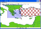
Shape Viewer is a free tool, which you can use to view ESRI Shape files.
Shape Viewer is a free tool, which you can use to view ESRI Shape files.
Shape Viewer can open (.shp) files that contain the geometry information of the Shape file.With Shape Viewer you can also create new (.shx) file, and new empty (.dbf) file for your Shape file.
If you have hundreds of Shape files, and you want to view their...
Category: Multimedia & Design / Graphics Viewers
Publisher: Mohammed Hammoud, License: Freeware, Price: USD $0.00, File Size: 35.0 KB
Platform: Windows
iMindMap Basic is a Mind Mapping software which will get you Mind Mapping quickly and easily.
iMindMap Basic is a Mind Mapping software which will get you Mind Mapping quickly and easily. A simple tool to help you start thinking in a clear and creative way, iMindMap Basic uses a process that has been enhancing the way people think for decades. iMindMap Basic is completely free for life and is a great starter package for those who want to start exploring the uses of Mind...
Category: Home & Education / Teaching Tools
Publisher: Buzan Online, License: Freeware, Price: USD $0.00, File Size: 213.6 MB
Platform: Windows
Water Point Mapping is a process for monitoring the distribution and status of water points in rural and urban areas. It supports local level planning and can improve accountability for water sector performance at local and national levels.
It uses the Google Earth application to visualise data. Once Google Earth has been installed, it can be run offline.
...
Category: Home & Education / Miscellaneous
Publisher: WaterAid, License: Freeware, Price: USD $0.00, File Size: 880.0 KB
Platform: Windows
In this game there will be a random shape placed in the middle of the screen.
In this game there will be a random Shape placed in the middle of the screen. Small tiles of different shapes will appear from the bottom of the screen, you need to drag these tiles to fill up the Shape. You can press the spacebar to rotate the dragging p
Category: Games / Puzzles
Publisher: novelgames.com, License: Freeware, Price: USD $0.00, File Size: 259.0 KB
Platform: Windows, Vista, 7 (32-Bit, 64-Bit)
The Shape Name Utility is a freeware open source utility that allows a user to examine and edit the names of shapes in Microsoft MapPoint. It is possible to give Microsoft MapPoint shapes their own identifying names or labels using the programming interface, but MapPoint does not make this functionality available to the end user. Instead, third party programs (eg. our MPSuperShape)...
Category: Multimedia & Design / Authoring Tools
Publisher: Winwaed Software Technology LLC, License: Freeware, Price: USD $0.00, File Size: 1.2 MB
Platform: Windows
The Microdrone Airborne Mapping extension to Orbit GIS provides the tools required for automated flight and high precision Mapping. It contains a Waypoint Generator, a Microdrone in-flight tracker, and a captation tool. Further image-, stereoprocessing and orthorectification can be executed using the Strabo Photogrammetry extension to Orbit GIS.
Category: Multimedia & Design / Multimedia App's
Publisher: Orbit GeoSpatial Technologies, License: Freeware, Price: USD $0.00, File Size: 30.0 MB
Platform: Windows
 Freeware
MindMaple is an effective software method for brainstorming, note taking, organizing, and managing projects by stimulating both sides of the brain through use of visual contents and maps. MindMaple is focused on improving user friendly interface to create maps. The interface allows the user to add topics by click-dragging from an existing topic box, so called the Drawing Interface, This feature...
Category: Business & Finance / MS Office Addons
Publisher: MindMaple Inc., License: Freeware, Price: USD $0.00, File Size: 9.7 MB
Platform: Windows
An easy to use GPS downloading utility that lets you download your GPS waypoints easily and export them into a variety of formats useful for editing, display and importing into many different Mapping programs.
Use Lobal to save GPS waypoints as:
- Text Files
- HTML Tables
- Shape Files
- Google Earth KML
- DBase Files.
Category: Utilities / Misc. Utilities
Publisher: Ecological Software Solutions, License: Freeware, Price: USD $0.00, File Size: 2.2 MB
Platform: Windows
This jigsaw puzzle package delivers beautiful Easter puzzles.
*Beginner* - Very simple, standard Shape, 24 pieces, preview; *Intermediate* - 50% deformed Shape, 54 pieces, preview; *Expert* - 100% deformed Shape, 104 pieces, preview; * Guru* - 100% deformed Shape, random rotation, 160 pieces, preview; *Maniac* - 100% deformed Shape, random rotation, 216 pieces, no preview. This free application is part of a series of...
Category: Games / Puzzles
Publisher: silvia eschen creative.solutions, License: Freeware, Price: USD $0.00, File Size: 2.8 MB
Platform: Windows, Linux, Unix
This jigsaw puzzle package delivers beautiful Winter puzzles.
*Beginner* - Very simple, standard Shape, 24 pieces, preview; *Intermediate* - 50% deformed Shape, 54 pieces, preview; *Expert* - 100% deformed Shape, 104 pieces, preview; * Guru* - 100% deformed Shape, random rotation, 160 pieces, preview; *Maniac* - 100% deformed Shape, random rotation, 216 pieces, no preview. This free application is part of a series of...
Category: Games / Puzzles
Publisher: silvia eschen creative.solutions, License: Freeware, Price: USD $0.00, File Size: 3.0 MB
Platform: Windows, Linux, Unix
Filter Shape looks at how the Shape of the two-dimensional cross-section of a filter affects the results generated when it is used to scale an image. Users are able to sketch and resize their own filters or use previously generated filters and see how each filter affects the scaling of a subregion of an image.
Category: Multimedia & Design / Multimedia App's
Publisher: Brown University, License: Freeware, Price: USD $0.00, File Size: 497.0 KB
Platform: Windows
This jigsaw puzzle package delivers beautiful Valentine Day puzzles.
*Beginner* - Very simple, standard Shape, 24 pieces, preview; *Intermediate* - 50% deformed Shape, 54 pieces, preview; *Expert* - 100% deformed Shape, 104 pieces, preview; * Guru* - 100% deformed Shape, random rotation, 160 pieces, preview; *Maniac* - 100% deformed Shape, random rotation, 216 pieces, no preview. This free application is part of a series of...
Category: Games / Puzzles
Publisher: silvia eschen creative.solutions, License: Freeware, Price: USD $0.00, File Size: 2.8 MB
Platform: Windows, Linux, Unix
This jigsaw puzzle package delivers the most downloaded Webetiser puzzles of 2004 in one package.
*Beginner* - Very simple, standard Shape, 24 pieces, preview; *Intermediate* - 50% deformed Shape, 54 pieces, preview; *Expert* - 100% deformed Shape, 104 pieces, preview; * Guru* - 100% deformed Shape, random rotation, 160 pieces, preview; *Maniac* - 100% deformed Shape, random rotation, 216 pieces, no preview. This free application is part of a series of...
Category: Games / Puzzles
Publisher: silvia eschen creative.solutions, License: Freeware, Price: USD $0.00, File Size: 3.1 MB
Platform: Windows, Linux, Unix
So that you can identify the Mapping & GIS product that best suits your needs, use this simple Product Comparison. There are four main product types that you can use to create a GPS data collection and maintenance system, or mobile GIS solution. Use the links below to select a product group, and compare the features of each product within that group.
Category: Internet / Communications
Publisher: Trimble Navigation Limited, License: Freeware, Price: USD $0.00, File Size: 2.7 MB
Platform: Windows
PMapServer7 is a free add-on for UI-View32.
PMapServer7 is a free add-on for UI-View32. To use it, first download and register a copy of UI-View32. There are versions of PMapServer that will work with with Precision Mapping V5, V6 and V7.UI-View32 street level Mapping of the whole of the USA. To support Precision Mapping, UI-View32 uses a plug-in map server (PMapServer) that integrates seamlessly into the program....
Category: Home & Education / Miscellaneous
Publisher: Bill Diaz, License: Freeware, Price: USD $0.00, File Size: 5.4 MB
Platform: Windows
Trizbort is a simple tool which can be used to create maps for interactive fiction.
Trizbort is a simple tool which can be used to create maps for interactive fiction.
Over the years a number of styles have evolved for interactive fiction Mapping. Trizbort focuses on creating maps in only one of these styles, as popularised by Infocom: labelled boxes for rooms, with lines connecting them.
Whether you're playing or writing interactive fiction,...
Category: Multimedia & Design / Digital Media Editors
Publisher: Genstein, License: Freeware, Price: USD $0.00, File Size: 596.2 KB
Platform: Windows
If you don't have internet access on your phone, or you want to self-select a larger region of Mapping, then the Map Chooser tool can be used to make map tile selections. Choose your own Mapping areas with the flexible select tool that lets you select unlimited areas of Mapping. Based on a grid, you can choose any grid squares you like - so you can pick an area in...
Category: Home & Education / Miscellaneous
Publisher: ViewRanger, License: Freeware, Price: USD $0.00, File Size: 213.2 MB
Platform: Windows
Shape Collage is a free automatic photo collage maker that lets you create picture collages in less than a minute with just a few mouse clicks. Shape Collage creates collages using an intelligent machine learning algorithm that automatically places the photos in the collage and can arrange the photos to form different shapes. You can even save the collage as an Adobe Photoshop PSD...
Category: Multimedia & Design / Image Editing
Publisher: VincentCheung.ca, License: Freeware, Price: USD $0.00, File Size: 292.0 KB
Platform: Windows
The RCF Shape Designer software is the perfect tool to determine the configuration of your TT+ system setup at any given venue place.
The software helps to get the best vertical performance and to calculate the result of the complete setup performance.RCF Shape Designer software requires an IBM compatible PC with Windows operation systems: 98, 98SE, 2000, ME, XP or...
Category: Utilities / Misc. Utilities
Publisher: RCF, License: Freeware, Price: USD $0.00, File Size: 3.9 MB
Platform: Windows
Easily create HTML image/photo maps with this free friendly image Mapping utility from the authors of the best free photo editing software - Photo Pos Pro photo editor . Pos HTML Image Mapper includes WYSIWYG interface allowing you Mapping images and photos fast and easy. Using the software you can easily create graphic toolbars to your website; you can easily link desired...
Category: Web Authoring / HTML Color Pickers
Publisher: PowerOfSoftware Ltd., License: Freeware, Price: USD $0.00, File Size: 7.9 MB
Platform: Windows
MICRODEM is a freeware microcomputer Mapping program written by Professor Peter Guth of the Oceanography Department, U.S. Naval Academy. It requires a 32 bit version of Windows (NT/2000/XP or 95/98/ME). You may freely use MICRODEM with no restrictions.
MICRODEM displays and merges
- digital elevation models
- satellite imagery
- scanned maps
...
Category: Multimedia & Design / Graphics Viewers
Publisher: Petmar Triilobite Breeding Ranch, License: Freeware, Price: USD $0.00, File Size: 84.9 MB
Platform: Windows
Shape sorters: Any instead toy that depends upon your baby to sort through shapes and produce problems will be very well received Shape sorters: Any instead toy that depends upon your baby to sort through shapes and produce problems will be very well received. These will occupy your baby for hours on end and teach important skills for differentiating shapes and colors and hone...
Category: Home & Education / Genealogy
Publisher: healthsoul.info, License: Freeware, Price: USD $0.00, File Size: 532.5 KB
Platform: Windows
Shape sorters: Any instead toy that requires your baby to sort through shapes and dispatch problems will be very well received Shape sorters: Any instead toy that requires your baby to sort through shapes and dispatch problems will be very well received. These will engage your baby for hours on end and teach important skills for differentiating shapes and colors and hone...
Category: Home & Education / Miscellaneous
Publisher: helpdesigns.info, License: Freeware, Price: USD $0.00, File Size: 532.5 KB
Platform: Windows
Codus is a comprehensive code generation tool for object-relational mapping.
Codus is a comprehensive code generation tool for object-relational Mapping. For a given database it automatically generates a full data access layer, web services for distributed programming, strongly-typed collections, and a full set of unit tests.
Category: Software Development / Misc. Programming
Publisher: intesar66, License: Freeware, Price: USD $0.00, File Size: 4.4 MB
Platform: Windows
PCM SurveyCERT makes pipe mapping easier for surveyors in the field.
PCM SurveyCERT makes pipe Mapping easier for surveyors in the field. Survey data may either be viewed in real time or be saved within the PCM to be reviewed later.The PCM SurveyCERT installation bundle includes both PC and PDA versions of the application.
Category: Software Development / Misc. Programming
Publisher: Radiodetection Ltd, License: Freeware, Price: USD $0.00, File Size: 5.7 MB
Platform: Windows
Plingme is a 3d interface designer & player all in one.
Plingme is a 3d interface designer & player all in one.
Features :
- organize your bookmarks, system resources and links on a cool 3d Shape on your desktop
- download complete and unique 3d launchers and interfaces that other users have created
- use a Shape to store thumbnails of your favourite pictures
Category: Utilities / Launchers
Publisher: mrpling, License: Freeware, Price: USD $0.00, File Size: 3.6 MB
Platform: Windows
This is a Windows utility for those Tengwar fonts that use the key mapping invented by Daniel S.
This is a Windows utility for those Tengwar fonts that use the key Mapping invented by Daniel S. Smith. The program allows you to write text in Roman letters (the ones most Europeans and Americans use), select a Tengwar mode, and have the text transcribed to Tengwar.
Category: Utilities / System Utilities
Publisher: Mans Bjorkman, License: Freeware, Price: USD $0.00, File Size: 2.2 MB
Platform: Windows
Freeware
Displacement Map is an amusing image distortion, Photoshop-compatible plug-in for Windows designed by ImageSkill Software. It allows a user to get a view of the geometrically distorted image. The user is free to choose any displacement map which determines the Shape of the image deformation and adjust its strength. The plugin leaves the center of an image unchanged while increasing...
Category: Multimedia & Design / Image Plugins
Publisher: ImageSkill Software, License: Freeware, Price: USD $0.00, File Size: 3.7 MB
Platform: Windows
The Shape Name Utility is a simple add-in utility for Microsoft MapPoint, that allows a user to view and edit the names of shapes. Note that Shape names are normal hidden from users and only visible to third party programs.
It is possible to give Microsoft MapPoint shapes their own identifying names or labels using the programming interface, but MapPoint does not make this...
Category: Business & Finance / MS Office Addons
Publisher: Winwaed Software Technology LLC, License: Freeware, Price: USD $0.00, File Size: 1.2 MB
Platform: Windows
RapidDrawing is an outline sketch program that enables you to create the Shape of a curve you want more precisely than existing methods (e.g. Illustrator pentool, nurbs curve, spline). The Illustrator pentool has two control points whereas RapidDrawing has four more controls. RapidDrawing let you create the Shape of a curve you want more easily.
Category: Multimedia & Design / Image Editing
Publisher: RapidDrawing, License: Freeware, Price: USD $0.00, File Size: 0
Platform: Windows
Cincom includes Cincom® ObjectStudio® as part of Cincom Smalltalk™.
Cincom includes Cincom® ObjectStudio® as part of Cincom Smalltalk™. ObjectStudio is the first—and only—Compatible with Windows 7 Smalltalk environment. For customers needing to build applications that cleanly fold into a Microsoft-centric infrastructure, ObjectStudio is the best choice. ObjectStudio is a Windows-specific platform that is oriented toward building client...
Category: Software Development / Misc. Programming
Publisher: Cincom Systems Inc., License: Freeware, Price: USD $0.00, File Size: 4.1 MB
Platform: Windows
The Mapping and GIS License Manager software allows you to manage multiple licenses for the GPS Pathfinder Office software. Using the GPS Pathfinder Office License Administrator software, users of the GPS Pathfinder Office software can choose either a single use or a floating license.
Category: Business & Finance / Business Finance
Publisher: Trimble, License: Freeware, Price: USD $0.00, File Size: 26.8 MB
Platform: Windows
It`s a FREE ESRI Shape files (*.shp), MapInfo interchange (*.mif) and AutoCAD *.dxf viewer. Using this utility you can view *.shp files (ESRI Shape files), *.mif files (MapInfo interchange) and AutoDesk AutoCAD *.dxf. No other files are needed.
Category: Multimedia & Design
Publisher: Avangardo, License: Freeware, Price: USD $0.00, File Size: 420.9 KB
Platform: Windows
EntityDAC Express is a free ORM for Delphi with LINQ support. It provides a powerful framework that allows performing object-relational Mapping of database objects to Delphi classes with full support for encapsulation, inheritance, polymorphism and other OOP features. To retrieve data from a database, LINQ is used as a database independent query engine. In addition, there is a...
Category: Software Development / Databases & Networks
Publisher: Devart, License: Freeware, Price: USD $0.00, File Size: 111.5 MB
Platform: Windows
This small program allows you to take a digital image and digitise a curve or shape on it.
This small program allows you to take a digital image and digitise a curve or Shape on it. You do this by clicking on the image, along the line of the curve of interest. As you do so, the program records the co-ordinates of each point, and marks it with a dot.
Category: Multimedia & Design / Multimedia App's
Publisher: SHUMaths, License: Freeware, Price: USD $0.00, File Size: 1.6 MB
Platform: Windows
In this game you will be given a picture of the Shape to make, and then you will need to make it using the Rubik?s Snake. To twist the snake, move your mouse over the snake and then press one of the arrows. You can also drag the snake to rotate it so that
Category: Games / Puzzles
Publisher: novelgames.com, License: Freeware, Price: USD $0.00, File Size: 259.6 KB
Platform: Windows, Vista, 7 (32-Bit, 64-Bit)
QuakeMap is a powerful GPS/mapping program for your Windows computer.
QuakeMap is a powerful GPS/Mapping program for your Windows computer. It can be downloaded here for free. The trial mode allows you to use most features indefinitely. When you need to unlock certain powerful features, a License Key can be ordered here. QuakeMap is designed for ease of use. It eatures intuitive user interface, supports most popular Garmin and Magellan receivers, reads and...
Category: Utilities / Misc. Utilities
Publisher: quakemap.com, License: Freeware, Price: USD $0.00, File Size: 821.2 KB
Platform: Windows
The LaCie IP configurator is an easy tool for Mapping and configuring the LaCie Ethernet Disks on the network. Designed for Ethernet Disk (rack), Ethernet Disk mini and Ethernet Big Disk. It stated in the latest log you may not apply configuration when change static to DHCP
Category: Internet / Misc. Plugins
Publisher: LACIE GROUP, License: Freeware, Price: USD $0.00, File Size: 1.8 MB
Platform: Windows
Ekahau HeatMapper is a free software tool for quick and easy coverage mapping of Wi-Fi (802.
Ekahau HeatMapper is a free software tool for quick and easy coverage Mapping of Wi-Fi (802.11) networks. It's the only free, easy-to-use tool that shows, on a map, the wireless network coverage in your home or small office. HeatMapper also locates all access points.
Category: Internet / Monitoring
Publisher: Ekahau Inc., License: Freeware, Price: USD $0.00, File Size: 94.6 MB
Platform: Windows
DIVA-GIS is a free computer program for Mapping and geographic data analysis (a geographic information system (GIS). With DIVA-GIS you can make maps of the world, or of a very small area, using, for example, state boundaries, rivers, a satellite image, and the locations of sites where an animal species was observed.
Category: Business & Finance / Applications
Publisher: diva-gis, License: Freeware, Price: USD $0.00, File Size: 3.8 MB
Platform: Windows
This project has as objective the analysis of interactions between the protein motifs in molecular docking with the Mapping of protein surfaces.
With this aim in mind the first phase of the project was to develop the MSProt - Viewer. An open-source software able to visualize protein structures in 3D.
The MSProt - Viewer was developed with the programming...
Category: Home & Education / Science
Publisher: UNIFESP, License: Freeware, Price: USD $0.00, File Size: 4.4 MB
Platform: Windows
This software tool is a professional astronomy planetarium and star Mapping program specially designed for Windows 9x/ME/NT/2000/XP. StarCalc illustrates the star positions at any instance of the day as observed from any geographic location on Earth. The star positions can be viewed and presented as images in a hemispherical whole sky or in any of the user-defined sub-areas.
Category: Home & Education / Astrology & Numerology
Publisher: Alexander E. Zavalishin, License: Freeware, Price: USD $0.00, File Size: 753.4 KB
Platform: Windows
The Coverage Calculator software is used to configure EAW Commercial loudspeaker systems listed within the program in a distributed layout using SPL (sound pressure level) Mapping as the primary criteria.
FEATURES:
-User-adjustable layout density.
-SPL map of listening area with adjustable resolution and frequency.
-Database of measured loudspeaker data used...
Category: Audio / Utilities & Plug-Ins
Publisher: EAW, License: Freeware, Price: USD $0.00, File Size: 3.9 MB
Platform: Windows
Utilizing the latest Geo-Mapping technology, PhotoTrackr allows you to precisely record and review your trip no matter where you have traveled. If you took pictures on your trip, it will show you the exact location and time of your pictures. Furthermore, if you loved sharing, PhotoTrackr will enable you to share your whole vacation experience with others.
Category: Home & Education / Miscellaneous
Publisher: GiSTEQ, License: Freeware, Price: USD $0.00, File Size: 17.0 MB
Platform: Windows
Free Satellite Maps is a free tool from Google which offers a satellite mapping service worldwide.
Free Satellite Maps is a free tool from Google which offers a satellite Mapping service worldwide.These are accompanied by a street service, a route planner and information about business in almost all countries.In this way we can fly the world from satellite view or in birds eye.The level of detail is different depending on where you are located.Major cities have a very excellent level...
Category: Home & Education / Science
Publisher: www.satelliteview-of-my-house.com, License: Freeware, Price: USD $0.00, File Size: 612.0 KB
Platform: Windows

Best way to lose weight; Fat Burning Exercises That can Assist You Lose Weight Are you wanting to get into Shape this year? If so then you've undoubtedly come to the right location as we are going to reveal what a few of the very best fat burning exercises are. Most of us tend to want to lose weight whenever a new year approaches. Click Here
It really is not hard to lose weight;...
Category: Games / Puzzles
Publisher: Best Way To Lose Weight, License: Freeware, Price: USD $0.00, File Size: 705.0 KB
Platform: Windows
TerraExplorer allows users to shape their own digital world.
TerraExplorer allows users to Shape their own digital world.
By editing and annotating geo-referenced 3D terrain databases created through TerraBuilder, users can customize the experience to highlight specific geographic content. By overlaying unique or proprietary information onto a 3D map, the user creates an exciting, interactive application that can highlight specific...
Category: Home & Education / Miscellaneous
Publisher: Skyline Software Systems, Inc., License: Freeware, Price: USD $0.00, File Size: 29.5 MB
Platform: Windows
HydroSHEDS is a Mapping product that provides hydrographic information for regional and global-scale applications in a consistent format. It offers a suite of geo-referenced data sets (vector and raster) at various scales, including river networks, watershed boundaries, drainage directions, and flow accumulations. HydroSHEDS is based on high-resolution elevation data obtained during a...
Category: Home & Education / Miscellaneous
Publisher: WWF-CSP, License: Freeware, Price: USD $0.00, File Size: 1.7 MB
Platform: Windows
The LookLOCAL Firefox Toolbar is a convenient extension to the Firefox browser that enables you to map a location, get directions, or search for products and services from any web site or page you are on without first navigating to an online Mapping site. Highlight and right click on a search topic, an address in your browser window or type an address directly into the toolbar, click...
Category: Business & Finance / MS Office Addons
Publisher: IDELIX Software Inc., License: Freeware, Price: USD $0.00, File Size: 29.0 KB
Platform: Windows