Free Downloads: Spherical Coordinates
License: All | Free
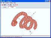
Archim is a program for drawing the graphs of all kinds of functions. You can define a graph explicitly and parametrically, in polar and Spherical Coordinates, on a plane and in space (surface). Archim will be useful for teachers and students, as well as for everyone who is interested min geometry. With Archim, you will draw the graph of any function and form, just use your...
Category: Home & Education
Publisher: Stochastic Lab, License: Freeware, Price: USD $0.00, File Size: 479.6 KB
Platform: Windows
You have the choice of spherical, cylindrical, Lambert and Mercator projections.
You have the choice of Spherical, cylindrical, Lambert and Mercator projections.
All Coordinates are precessed to the nearest Julian day at which the sky is being viewed. If proper motions are available then these are used to correct star positions. Planet positions are accurate to 30 arcseconds over the next 180 years.
Main Features:
- Creates...
Category: Home & Education / Astrology & Numerology
Publisher: Marc R. Baril, License: Freeware, Price: USD $0.00, File Size: 18.5 MB
Platform: Windows
'Spherical' is a free screensaver by Martin Mayer - media composer.
'Spherical' is a free screensaver by Martin Mayer - media composer. Martin Mayer composes music for the media. He produces soundtracks for animation, video games, television and film. 'Spherical' screensaver features 'Water's Edge': an original production music track by Martin Mayer and Sounds That Soothe Production Music. Brightly coloured spheres bounce around the screen at...
Category: Desktop Enhancements / Screensavers
Publisher: Martin Mayer - media composer, License: Freeware, Price: USD $0.00, File Size: 2.0 MB
Platform: Windows
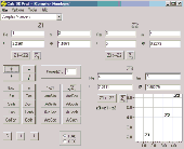
Calc 3D is a collection of mathematical tools for highschool and university. The calculator can do statistics, best fits, function plotting, integration. It handles vectors, matrices, complex numbers, Coordinates, regular polygons and intersections. For objects ( like point, line, plane and sphere) distances and intersections are calculated. Cartesian, Spherical and cylindrical...
Category: Home & Education
Publisher: Greuer Andreas, License: Freeware, Price: USD $0.00, File Size: 4.1 MB
Platform: Windows
DXF2XYZ converts a DXF file to an XYZ file, ie a comma delimited text file containing just xyz Coordinates. It can be useful for extracting the raw XYZ Coordinates from a DXF file containing say contours or other elevation entities.
This utility it limited to extracting the XYZ Coordinates from the following DXF entity types:
POINT, LINE, POLYLINE /...
Category: Business & Finance / Calculators
Publisher: H. Wind, License: Freeware, Price: USD $0.00, File Size: 657.6 KB
Platform: Windows
GoArrow displays an arrow on your screen that points towards coordinates that you specify.
GoArrow displays an arrow on your screen that points towards Coordinates that you specify. This is very handy if you have to run to Coordinates with obstacles in the way (like mountains), or if you're just directionally-challenged.
GoArrow has the ability to find a route between any two locations in Dereth, as well as look up locations' details from either the...
Category: Home & Education / Miscellaneous
Publisher: Digero of Leafcull, License: Freeware, Price: USD $0.00, File Size: 7.7 MB
Platform: Windows
PresbyLite II software computes the correct parameters after you fill in the K's, RX and add power.
PresbyLite II software computes the correct parameters after you fill in the K's, RX and add power.
The Presbylite II™ bifocal is a translating design that has a Spherical base curve so the design is fit like any Spherical gas permeable lens. The fluorescein pattern should show an alignment fit. Corneas with more than 3 diopters of corneal cylinder are...
Category: Business & Finance / Applications
Publisher: Procornea Nederland B.V., License: Freeware, Price: USD $0.00, File Size: 1024.0 KB
Platform: Windows
Microsoft Mathematics Add-in for Word and OneNote makes it easy to plot graphs in 2D and 3D, calculate numerical results, solve equations or inequalities, and simplify algebraic expressions in your Word documents and OneNote notebooks.
The Microsoft Mathematics Add-in can help you with the following tasks:
Compute standard mathematical functions, such as roots and...
Category: Home & Education / Mathematics
Publisher: Microsoft, License: Freeware, Price: USD $0.00, File Size: 6.6 MB
Platform: Windows
Do you have coordinates for some places of interest?
Do you have Coordinates for some places of interest? Do you want to find them on Earth's surface? There are more than 2,000 coordinate systems available to make Google Earth follow your interests! Plex.Mark! simply placemarks your world!
Have you found a place in Google Earth and you would like to have the Coordinates in your coordinate system? Plex.Mark! will now make...
Category: Internet / Browser Accessories
Publisher: Plexscape, License: Freeware, Price: USD $0.00, File Size: 601.9 KB
Platform: Windows
This program calculates the location of almost any tipe of locator.
This program calculates the location of almost any tipe of locator. It also calculates the distance, azimuth, longitude and latitude betweent two locators. The software converts latitude/longitude Coordinates to Maidenhead locators and vice versa. It converts IARU locator and longitude/latitude Coordinates ti UI-View format Coordinates.
Category: Home & Education / Miscellaneous
Publisher: ON6MU Group, License: Freeware, Price: USD $0.00, File Size: 367.8 KB
Platform: Windows
The Balloon Browser recognizes and highlights geo-coordinates in web pages.
The Balloon Browser recognizes and highlights geo-Coordinates in web pages. Hovering over a recognized location advises another application to show a map of the corresponding area. For now the only program Balloon Browser can interact with is Google Earth.
Instead of waiting for the one true geo-notation and markup standard, Balloon Browser tries to parse a variety of common...
Category: Internet / Browsers
Publisher: Michael Krause, License: Freeware, Price: USD $0.00, File Size: 5.6 MB
Platform: Windows
In TruView, users can extract real 3D coordinates and accurately measure distances.
In TruView, users can extract real 3D Coordinates and accurately measure distances. Results appear right on the point cloud image. Markups are also easy to create, save and share with your peers, your service provider, or with clients for more effective communications.
Category: Audio / Utilities & Plug-Ins
Publisher: Leica Geosystems, License: Freeware, Price: USD $0.00, File Size: 7.9 MB
Platform: Windows
A new touchscreen interface, called the NASA Science Explorer, drives the Spherical display, allowing users full control over the content while learning about a wide range of remote sensing data. This exhibit is freely available to all organizations that currently have, or will be purchasing, a Magic Planet™ system.
Category: Home & Education / Miscellaneous
Publisher: NASA, License: Freeware, Price: USD $0.00, File Size: 244.3 MB
Platform: Windows
Free automated mouse clicking on your screen by Coordinates or wherever you decide to leave your mouse. Also includes a screen coordinate finder.
Category: Desktop Enhancements / Misc. Themes
Publisher: Mofiki Software, License: Freeware, Price: USD $0.00, File Size: 1.0 MB
Platform: Windows
Aten is a tool to create, edit, and visualise coordinates.
Aten is a tool to create, edit, and visualise Coordinates. It was written primarily to be of use to people performing simulations of condensed matter, but it may very well be useful to others out there dealing with non-periodic systems.
In brief, Aten can:
Provide a GUI for editing atomic Coordinates
Create models, even periodic ones, from...
Category: Software Development / Misc. Programming
Publisher: T Youngs, License: Freeware, Price: USD $0.00, File Size: 5.6 MB
Platform: Windows
 Freeware
Arm Map Explorer recreates all the functionalities of Google Maps on your desktop while expanding them with new extras. Map Explorer lets you locate and view any place on the planet using dynamic interactive maps. These maps are draggable, which means there is no need for you to click and wait for graphics to reload each time you want to view adjacent parts of a map. Basically, viewing...
Category: Internet / Flash Tools
Publisher: ArmCode, License: Freeware, Price: USD $0.00, File Size: 5.5 MB
Platform: Windows
The Geometric Correction Tool 4 (hereafter called " the software ") corrects geometrical distortion of an image projected onto a special shaped screen such as a cylindrical screen, and a Spherical screen from an NEC projector.
This program allows you to control the projector via a computer (hereafter called " PC ").
Category: Audio / Utilities & Plug-Ins
Publisher: NEC Display Solutions, Ltd., License: Freeware, Price: USD $0.00, File Size: 8.4 MB
Platform: Windows
The OSTN02 extension for ArcPad is a FREE tool that automatically transforms GPS data and aligns it with Ordnance Survey (OS) background map. This easy-to-use extension removes the need to manually post-process GPS data by providing’ on the fly’ transformation of WGS84 latitude and longitude into OSTN02 corrected British National Grid coordinate. Data capture using GPS and ArcPad is...
Category: Home & Education / Miscellaneous
Publisher: ESRI (UK) Ltd, License: Freeware, Price: USD $0.00, File Size: 8.0 MB
Platform: Windows
Freeware
With this tool you can add GPS Coordinates to vCards - elektronic business cards - that you have previously exported from e. g. Microsoft Outlook. Therefore the tool uses the address data contained within the vCards and adds the exact GPS position on that basis to the vCard. This way you can use these vCards for example in compatible car navigation systems. Among others...
Category: Home & Education / Home Inventory
Publisher: AB-Tools.com, License: Freeware, Price: USD $0.00, File Size: 1.9 MB
Platform: Windows
Astro Helper will tell you the angle of elevation above the horizon (altitude) and the direction in degrees from North (Azimuth) of the selected objects. It will simultaneously display the Coordinates of 22 objects from a database of over 22,000 objects. With these Coordinates you can point your Dobsonian mounted telescope or other "Alt/Az" mounted scope. If you have an...
Category: Home & Education / Astrology & Numerology
Publisher: Mark Casazza Consulting, License: Freeware, Price: USD $0.00, File Size: 3.3 MB
Platform: Windows
Displays lines and surfaces defined algebraically in 3D space in many forms, including z=f(x,y), cylindrical polar Coordinates, and parametric definitions with one (giving a line) and two (surface) parameters. View controls move the viewpoint through 3D space, using keyboard and mouse. There are options to display a surface, a mesh or a combination. The number of 'steps' on each edge...
Category: Home & Education / Mathematics
Publisher: Walter Milner, License: Freeware, Price: USD $0.00, File Size: 962.0 KB
Platform: Windows
SkySolve it is an application which is supplied an image and with no prior knowledge of where in the sky it was taken, it uses a star pattern matching algorithm and reference database to locate the correct image Coordinates. This makes it especially useful for remote imaging observatories, where the mount pointing may become incorrect. The remote operator can simply take an image...
Category: Software Development / Help File Utilities
Publisher: John Winfield, License: Freeware, Price: USD $0.00, File Size: 371.6 KB
Platform: Windows
Sudoku.gs is a flash sudoku puzzle with pencil mark and other features. Please visit also www.sudoku-ball.com for Sudoku-Ball(R). The unique challenge of Sudoku-Ball is to solve a 14 Samurai Sudoku network on a Spherical object such that the entire network is closed in all directions. The game is powered by Java3D.
Category: Games / Misc. Games
Publisher: Mobile Excellence B.V. & Lensoft Int'l Ltd., License: Freeware, Price: USD $0.00, File Size: 36.0 KB
Platform: Windows
Never again forget which picture belongs to which place.
Never again forget which picture belongs to which place. Picopolo, the innovative software for travel and GPS, not only organises digital images but also links them to the exact place where they were taken and assigns them to own or provided maps. Coordinates can be allocated either manually or via direct data upload from GPS receivers. Picopolo easily integrates recorded routes or...
Category: Multimedia & Design / Media Catalogers
Publisher: GDMcom mbH, License: Freeware, Price: USD $0.00, File Size: 61.6 MB
Platform: Windows
With this FREE AutoCAD add-on you can create terrain sections
from geodetic points(heights) in the drawing. You can also
specify position of pipe(cable, road, ...) or set auxiliary
marks in the section.
Text settings, scale in X,Y axis, height of the reference
plane and type of the terrain section can be set at start-up.
There are two ways how you can create terrain...
Category: Multimedia & Design / Multimedia App's
Publisher: Cadhedral, License: Freeware, Price: USD $0.00, File Size: 69.0 KB
Platform: Windows
I have always believed that out of an infinite number of possible, playable chess variants that could be invented, a single, best, perfect game existed in the imaginary-yet-real, theoretical realm of perfection, waiting to be discovered. Of course, it would never permit itself to be discovered via semi-random searching. At some point within the last 8 years, I ascertained that this ?holy grail?...
Category: Games / Misc. Games
Publisher: Derek Nalls, License: Freeware, Price: USD $0.00, File Size: 1.9 MB
Platform: Windows
Freeware
GPS Converter will convert GPS coordinates between three different formats: 34. 26965, -116.
76783; N 34° 16. 179', W 116° 46. 07'; and N 34° 16' 10.
Category: Home & Education / Sports
Publisher: ALMSys, Inc., License: Freeware, Price: USD $0.00, File Size: 929.9 KB
Platform: Windows
Immageo is all about making your photos as memorable as when you took them, by geotagging each photo. Immageo is a truly exciting example of what you can and should do with your photo collections. Its more than an album organiser, it embeds map locations and notes into your photos. And when you come to review them Immageo displays them all in context of when and where in the Immageo map,...
Category: Multimedia & Design / Media Catalogers
Publisher: Immageo, License: Freeware, Price: USD $0.00, File Size: 11.0 MB
Platform: Windows
PHOTOMOD GeoCalculator is the software for points Coordinates transformation, included in the PHOTOMOD system, as well as a stand-alone free application.
Its installation package includes databases of reference systems used in the world and in Russia (approximately 1500 reference systems). User can also add reference systems on his own by specifying:
-units...
Category: Business & Finance / Applications
Publisher: Racurs, License: Freeware, Price: USD $0.00, File Size: 7.6 MB
Platform: Windows
The Grid InQuest software provides a means for transforming Coordinates between ETRS89 (WGS84) and the National coordinate systems of Great Britain, Northern Ireland and the Republic of Ireland. It provides a fully three dimensional transformation incorporating the latest geoid model and is the nationally recognised software for performing these conversions.
In conjunction...
Category: Home & Education / Miscellaneous
Publisher: Quest Geo Solutions Ltd, License: Freeware, Price: USD $0.00, File Size: 0
Platform: Windows
To learn AutoFEM Tutorial, the presence of AutoCAD and AutoFEM Analysis is not necessary, although it is desirable. Force, pressure, rotation, acceleration, bearing load, hydrostatic pressure, torque, and temperature can be applied to the structure as external loads. To fix the structure, complete restriction of movement can be used, as well as partial restriction concerning the axes (in...
Category: Multimedia & Design / Image Editing
Publisher: AutoFEM Software, License: Freeware, Price: USD $0.00, File Size: 88.6 MB
Platform: Windows
With Fob Watch Screen Saver you know what time is it with a classic fob watch display.
With Fob Watch Screen Saver you know what time is it with a classic fob watch display.
The watch was first created in the 16th century, initially in Spherical (Pomander) or cylindrical cases, when the spring driven clock was invented. These watches were at first quite big and boxy and were worn around the neck. It was not for another century that it became common to wear a watch in...
Category: Desktop Enhancements / Screensavers
Publisher: SoftSpot Software, License: Freeware, Price: USD $0.00, File Size: 717.1 KB
Platform: Windows
faceAPI provides a suite of image-processing modules created specifically for tracking and understanding faces and facial features. These powerful tracking modules are combined into a complete API toolkit that delivers a rich stream of information that you can incorporate into your own products or services.
Main features:
- Highly robust, real-time, automatic monocular 3D face...
Category: Multimedia & Design / Multimedia App's
Publisher: Seeing Machines, License: Freeware, Price: USD $0.00, File Size: 152.0 MB
Platform: Windows
CopanMobile for Palm OS is a very functional and easy-to-use geomatics engineering tool for computing and managing plane surveying and mapping Coordinates. It does numerous coordinate geometry (COGO) calculations, processes and adjusts raw field survey data, computes and adjusts map traverse data, performs map or deed checks, calculates curves, areas and perimeters, performs coordinate...
Category: Multimedia & Design / Multimedia App's
Publisher: Underhill Geomatics Ltd., License: Freeware, Price: USD $0.00, File Size: 341.0 KB
Platform: Palm
Plot Digitizer is a great piece of software developed by Joseph A.
Plot Digitizer is a great piece of software developed by Joseph A. Huwaldt. The main goal of the program is to extract information from two-dimensional plots or graphs. It is very common to find information the form of a plot or graph, showing the relation between two variables. However, this information will not be useful until data is converted to standard x-y values (table format). Once...
Category: Multimedia & Design / Multimedia App's
Publisher: Joseph A. Huwaldt, License: Freeware, Price: USD $0.00, File Size: 4.4 MB
Platform: Windows
CopanMobile for Pocket PC is a very functional and easy-to-use geomatics engineering tool for computing and managing plane surveying and mapping Coordinates. It does numerous coordinate geometry (COGO) calculations, processes and adjusts raw field survey data, computes and adjusts map traverse data, performs map or deed checks, calculates curves, areas and perimeters, performs coordinate...
Category: Business & Finance / Applications
Publisher: Underhill Geomatics Ltd., License: Freeware, Price: USD $0.00, File Size: 341.0 KB
Platform: Windows
TCDView is a composite document viewer.
TCDView is a composite document viewer. It allows to collect a set of raster or ector documents into a single composite document. Individual drawings in the omposite document can be selected to allow changing of their parameters, their osition in common world Coordinates and their visible areas (viewports).
Category: Utilities / System Utilities
Publisher: Tessel Systems, License: Freeware, Price: USD $0.00, File Size: 7.8 MB
Platform: Windows
Panoramas can be created with any digital camera by shooting a series of images that all have a small overlapping vertical border, which can then be stitched together by some applications like CodedColor PhotoStudio. Through Spherical distortion and animation of the image, a threedimensional effect is simulated.
The CodedColor PanoramaViewer is a simple application, which allows...
Category: Multimedia & Design / Graphics Viewers
Publisher: 1STEIN Coorp., License: Freeware, Price: USD $0.00, File Size: 44.2 MB
Platform: Windows
Copan for Pocket PC is a very functional and easy-to-use geomatics engineering tool for computing and managing plane surveying and mapping Coordinates.
It does numerous coordinate geometry (COGO) calculations, processes and adjusts raw field survey data, computes and adjusts map traverse data, performs map or deed checks, calculates curves, areas and perimeters, performs...
Category: Multimedia & Design / Multimedia App's
Publisher: Underhill Geomatics Ltd, License: Freeware, Price: USD $0.00, File Size: 662.0 KB
Platform: Windows
Copan for Mobile 6 is a very functional and easy-to-use geomatics engineering tool for computing and managing plane surveying and mapping Coordinates.
It does numerous coordinate geometry (COGO) calculations, processes and adjusts raw field survey data, computes and adjusts map traverse data, performs map or deed checks, calculates curves, areas and perimeters, performs...
Category: Multimedia & Design / Multimedia App's
Publisher: Underhill Geomatics Ltd, License: Freeware, Price: USD $0.00, File Size: 662.0 KB
Platform: Windows
The Environmental Fluid Dynamics Code (EFDC) is a multifunctional surface water modeling system, which includes hydrodynamic, sediment-contaminant, and eutrophication components. EFDC has been applied to over 100 water bodies including rivers, lakes, reservoirs, wetlands, estuaries, and coastal ocean regions in support of environmental assessment and management and regulatory requirements.
Category: Software Development / Misc. Programming
Publisher: US Environmental Protection Agency, License: Freeware, Price: USD $0.00, File Size: 58.3 MB
Platform: Windows
Particly Screensaver displays system time or user?
Particly Screensaver displays system time or user?s text. Each symbol consists of set of particles which Coordinates are defined randomly.
Category: Desktop Enhancements / Screensavers
Publisher: bogorisoft.narod.ru, License: Freeware, Price: USD $0.00, File Size: 464.0 KB
Platform: Windows

Pearlscale Goldfish Wallpaper is an interactive and smoothly desktop background which let you click of your mouse to guide Pearlscale Goldfish fish in any given direction. Pearlscale Goldfish is a very gracious and beautiful aquarium fish of the goldfish species. The pearlscale goldfish is a Spherical-bodied fancy goldfish with finnage similar to the fantail. It is the only Goldfish type...
Category: Desktop Enhancements / Misc. Themes
Publisher: digiaquascr, License: Freeware, Price: USD $0.00, File Size: 3.3 MB
Platform: Windows
Mob Tracker is a Decal plugin for Asheron’s Call.
Mob Tracker is a Decal plugin for Asheron’s Call.Mob Tracker provides the user with a handy way to hunt down rare spawns and other desired monsters. When a monster is detected that matches the name on the mob list, its name and Coordinates will be shown in the chat window.
Category: Multimedia & Design / Graphics Viewers
Publisher: Yews Plugins, License: Freeware, Price: USD $0.00, File Size: 1.5 MB
Platform: Windows
- Optional TomTom waypoint integration for instance locations.
- Optional TomTom waypoint integration for instance locations.
- Self-refreshing tooltip, if you happen to have it open while traveling.
- Collapsible tooltip sections.
- LDB datafeed for zone/subzone names.
- LDB datafeed for Coordinates.
- Minimap button for those who want it or don't have an LDB display.
Category: Home & Education / Miscellaneous
Publisher: WowAce & Curse, Inc., License: Freeware, Price: USD $0.00, File Size: 197.2 KB
Platform: Windows
PL-photo3D is a Freeware dedicated to Non-Linear Photogrammetry.
PL-photo3D is a Freeware dedicated to Non-Linear Photogrammetry.
Photogrammetry is the technique of measuring objects (3D) from photographs.
Only pairs of photographs taken with the same cam (same settings) are required to calculate the 3D-space Coordinates of objects in a scene.
The optical parameters of the cam (Focal distance, Distortion...
Category: Multimedia & Design / Fonts
Publisher: Pierre Lemerle, License: Freeware, Price: USD $0.00, File Size: 2.3 MB
Platform: Windows
Given a certain acquaintance with the Metaphysics of Spirals, it is possible to represent a landscape using one single continuous line.
The height Coordinates for the terrain are generated in real-time using fractal noise which can produce a unique configuration for each "seed" number (e.g. 12345678 for the landscape represented here...)
Category: Multimedia & Design / Multimedia App's
Publisher: chronotext, License: Freeware, Price: USD $0.00, File Size: 748 B
Platform: Windows
Stellarium is a useful and free GPL software that renders realistic skies in real time with openGL.
Stellarium is a useful and free GPL software that renders realistic skies in real time with openGL. It is available for Linux/Unix, Windows and MacOSX. With Stellarium, you really see what you can see with your eyes, binoculars or a small telescope. Here are some key features of "Stellarium": · Over 120000 stars from the Hipparcos Catalogue with name and infos for the brightest...
Category: Home & Education / Science
Publisher: Fabien Chéreau, License: Freeware, Price: USD $0.00, File Size: 34.0 MB
Platform: Windows, All
GPS Sway is a simple coordinate conversion program.
GPS Sway is a simple coordinate conversion program. It handles all forms of latitude and longitude (degrees, degrees minutes, degrees minutes seconds) as well as UTM Coordinates and will convert from any form to another. It also handles signs or character direction.
Category: Multimedia & Design / Media Management
Publisher: GPSFileDepot, License: Freeware, Price: USD $0.00, File Size: 154.2 KB
Platform: Windows
Like any client/server system, the server provides data services to the client.
Like any client/server system, the server provides data services to the client. Based on the requirement of the Wish Tree, we define two services provided by the server: getAllStars and saveStar.
The first one getAllStars is for the client to retrieve the data of all the stars(wishes) in the database. The data of a star contains its (x,y) Coordinates on the screen and its color.
Category: Games / Arcade
Publisher: JavaFX Games, License: Freeware, Price: USD $0.00, File Size: 825 B
Platform: Windows