Free Downloads: Splitting Img File Garmin Map
License: All | Free
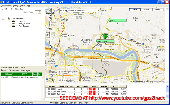
Free Fleet Management Windows-Desktop standalone application work with Garmin and A1.
Free Fleet Management Windows-Desktop standalone application work with Garmin and A1.You can send messages and STOPs (destinations on Garmin Map) with short message to driver, direct to his Garmin navigation device.Driver can send message to you using touch-screen keyboard. Ideal for taxi / delivery dispatch. Lowest communication cost by GPRS. Tracking vehicles at...
Category: Security & Privacy / Other
Publisher: Clarion LLC, License: Freeware, Price: USD $0.00, File Size: 3.4 MB
Platform: Windows
This software will not work unless you already own a MapSource product.
This software will not work unless you already own a MapSource product.
Main Features:
- Improved memory issues when running on Windows 7.
- Improved Map projection for many Map products.
- Changed mouse-wheel functionality to zoom in and out.
- Added support for enhanced Map security.
- Fixed...
Category: Home & Education / Miscellaneous
Publisher: Garmin Ltd or its subsidiaries, License: Freeware, Price: USD $0.00, File Size: 8.4 MB
Platform: Windows
Garmin nRoute is the popular piece of software that allows for auto-routing on a laptop computer with a Garmin GPS unit.
Category: Internet / Misc. Plugins
nRoute is a powerful and feature-rich tool that supports waypoints, tracks, points of interest, addresses and more, but is primarily for navigating and tracking in real time.
nRoute is also compatible with most Garmin units.
Publisher: Garmin Ltd or its subsidiaries, License: Freeware, Price: USD $0.00, File Size: 105.4 MB
Platform: Windows
The Garmin Communicator Plugin is a free Internet browser plugin that transfers data between your Garmin GPS device and your computer.
For example, with the Garmin Communicator Plugin you can add the maps you purchase at Garmin.com to your device. Or, you can upload your training data from your Garmin fitness device to Garmin Connect™.
Category: Internet / Communications
Publisher: Garmin Ltd or its subsidiaries, License: Freeware, Price: USD $0.00, File Size: 14.2 MB
Platform: Windows
AdriaROUTE Lite version of Map is made without Garmin NT technology so users with older device can use AdriaROUTE Map. Some of devices that not support NT technology are: (eTrex Legend, eTrex Vista, eTrex LegendC, eTrex VistaC, GPSMAP 60C, GPSMAP 60CS, CPSMAP 76C, GPSMAP 76CS, iQue3600; iQue M4; iQue M5..).
Category: Utilities / Misc. Utilities
Publisher: Navigo Sistem d.o.o., License: Freeware, Price: USD $0.00, File Size: 149.6 MB
Platform: Windows
Keep track of discount Garmin GPS deals on with this Firefox toolbar.
Keep track of discount Garmin GPS deals on with this Firefox toolbar.compare and buy all the latest Garmin satellite navigation systems. If you want a discount Garmin GPS system this is the Firefox toolbar to use. We also provide information on the latest offers, price cuts and discount voucher codes to help you buy the latest Garmin GPS at the cheapest price...
Category: Internet / Browsers
Publisher: Discount Garmin GPS, License: Freeware, Price: USD $0.00, File Size: 1.1 MB
Platform: Windows

OkCustomMap is a software to produce Garmin Custom Maps.
OkCustomMap is a software to produce Garmin Custom Maps.
Supports many Map formats:
- OkMap
- Ecw
- GeoTiff
- World files
- OziExplorer
- GpsTuner
You can customize:
- The quality of the output JPEG images (0=Bad, 100=Good)
- The KML transparency (0=Transparent, 255=Opaque)
- The KML draw order (0=Invisible, 1-49=Under the vectorial...
Category: Business & Finance / Applications
Publisher: Gian Paolo Saliola, License: Freeware, Price: USD $0.00, File Size: 3.2 MB
Platform: Windows
Upgrading software for your Garmin GPS just got easier thanks to WebUpdater—Garmin's free new application that automatically detects and installs the most recent version of operating software for your compatible Garmin GPS. WebUpdater's simple interface makes it easy to upgrade your operating software. Just connect your Garmin GPS to your computer,...
Category: Utilities / Misc. Utilities
Publisher: Garmin Ltd or its subsidiaries, License: Freeware, Price: USD $0.00, File Size: 7.2 MB
Platform: Windows
Turtle Sport is a free software developed to communicate with Garmin fitness products (forerunner and edge).
Turtle Sport retrieves yours training sessions from your Garmin and it makes diagram. You can also order your training sessions by category and training mode. With Turtle Sport, it is also possible to Map your GPS training paths in Google Earth.
...
Category: Home & Education / Miscellaneous
Publisher: TurtleSport, License: Freeware, Price: USD $0.00, File Size: 6.9 MB
Platform: Windows
MarineUpdater is a Windows-based PC application which works in conjunction with a Garmin USB card reader, a Garmin data card, and an Internet connection to generate software update cards for your fixed-mount Garmin marine products. Products which support MarineUpdater will program a data card with information about your Garmin marine product and other Garmin...
Category: Home & Education / Miscellaneous
Publisher: Garmin Ltd or its subsidiaries, License: Freeware, Price: USD $0.00, File Size: 2.0 MB
Platform: Windows
Northwest Trails is a mapset of trails designed for upload to any map-enabled Garmin GPS receiver.
Northwest Trails is a mapset of trails designed for upload to any Map-enabled Garmin GPS receiver. It is more than just a mapset, though; it is also a community effort initiated to record and collect GPS data for trails in the Northwest (Washington, Idaho, Oregon, Montana, Wyoming, Alaska, British Columbia and Alberta) and provide that data for general public use.
The...
Category: Internet / Misc. Plugins
Publisher: Jon F. Stanley, License: Freeware, Price: USD $0.00, File Size: 31.7 MB
Platform: Windows
GeoVisu is a program that displays georeferenced data (images, graphics) and downloads data recorded by some GPS devices.
GeoVisu has a "Moving Map" navigation function, which can be used with any NMEA 0183 compatible or Garmin USB GPS device.
Main features:
- Displays georeferenced image formats : GeoTiff, ECW and ECWP, MrSID,...
Category: Multimedia & Design / Graphics Viewers
Publisher: GeoVisu, License: Freeware, Price: USD $0.00, File Size: 1.7 MB
Platform: Windows
Img to ISO is a free small software utility, that, as its name suggests, can convert Img image files into ISO image files.
The ISO format File that is created by this program can conform to the standard ISO-9660 format. You can also use this software to open ima files.
Category: Utilities / Misc. Utilities
Publisher: imgtoiso, License: Freeware, Price: USD $0.00, File Size: 1.3 MB
Platform: Windows
With DESK-IMG you can automatically zoom your images to fit on desktop’s height or width.
With DESK-Img you can automatically zoom your images to fit on desktop’s height or width. DESK-Img can remember your last choice.
You can also automatically change your desktop wallpaper after a specified time and simply take control over your desktop wallpapers.
Category: Desktop Enhancements / Shell & Desktop Managers
Publisher: DESK-IMG Project Team, License: Freeware, Price: USD $0.00, File Size: 418.5 KB
Platform: Windows
 Freeware
org, uses file and position names that suit to the display of the TomTom Rider, uses file, route and position names that suit to the display of the Map&Guide Motorrad Tourenplaner, remembers language, paths, window size and position. . .
Category: Business & Finance / Conversion Applications
Publisher: Christian Pesch, License: Freeware, Price: USD $0.00, File Size: 6.6 MB
Platform: Windows, Mac, Linux, Solaris, FreeBSD, OpenBSD, Java
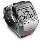
Screensaver with a Garmin Forerunner theme. .
Screensaver with a Garmin Forerunner theme.
Category: Desktop Enhancements / Screensavers
Publisher: Garmin Forerunner 305, License: Freeware, Price: USD $0.00, File Size: 1.5 MB
Platform: Windows
DNRGarmin is a smart tool used to directly transfer data between Garmin GPS handheld receivers and various GIS software packages.
DNRGarmin was built to provide users the ability to directly transfer data between Garmin GPS handheld receivers and various GIS software packages. Using DNRGarmin a user can use point features (graphics or shapefile) and upload them to the...
Category: Utilities / Misc. Utilities
Publisher: GIS Section, Minnesota Department of Natural Resources, License: Freeware, Price: USD $0.00, File Size: 11.3 MB
Platform: Windows
FREE GPS Software for your Garmin, Magellan or Lowrance GPS.
FREE GPS Software for your Garmin, Magellan or Lowrance GPS.
EasyGPS is the fast and easy way to upload and download waypoints, routes, and tracks between your Windows computer and your Garmin, Magellan, or Lowrance GPS. EasyGPS lists all of your waypoints on the left side of the screen, and shows a plot of your GPS data on the right. Use EasyGPS to back up and organize...
Category: Internet / Communications
Publisher: TopoGrafix, License: Freeware, Price: USD $0.00, File Size: 3.9 MB
Platform: Windows
KMLCSV Converter is a tool that enables you to convert the KML File generated from Google Earth (free version) into a formatted CSV File (and vice versa). This CSV File can then be uploaded into your Garmin GPS by using Garmin POI Loader, which can be downloaded for free. This allows you to plot all the custom point of interests (POI) with Google Earth first....
Category: Business & Finance / Calculators
Publisher: Choon-Chern Lim, License: Freeware, Price: USD $0.00, File Size: 2.3 MB
Platform: Windows
GPS Send Map is a Windows interface program which uses (sendmap.
GPS Send Map is a Windows interface program which uses (sendmap.exe) to load the Img maps to the GPS.This program works well and setup is easy, although there seams to be minor issues in some windows OS.The GPS acted as usual and my maps appeared on the screen as usual. NICE.
Category: Security & Privacy / Other
Publisher: DougsBrat, License: Freeware, Price: USD $0.00, File Size: 1.5 MB
Platform: Windows
Garmin MapConverter was developed to be a tool that will allow you to convert maps and unlock codes on your Windows PC to the Macintosh format. Transferred maps will remain fully accessible on your Windows PC. It works on Windows XP, Windows Vista, Windows 7.
Category: Utilities / Misc. Utilities
Publisher: Garmin Ltd or its subsidiaries, License: Freeware, Price: USD $0.00, File Size: 2.6 MB
Platform: Windows
Palm Desktop for Garmin iQue 3600 is one of the first PDAs to offer built-in GPS, as opposed to the jackets often used with other models.
Mapping integrates well - you can add a location to any address book entry, for example - but you can only route to an address from your present location, not from one distant one to another.
Category: Multimedia & Design / Multimedia App's
Publisher: Garmin Ltd or its subsidiaries, License: Freeware, Price: USD $0.00, File Size: 11.7 MB
Platform: Windows
This tool massively automatically sets and updates the height and width attributes of Img tags of HTML documents based on the original height and width of the source image. It is a good practice to set the height and width of Img tags to allow the browser to display the webpage more smoothly while the webpage is being loaded. With this tool you do not need to find and set the...
Category: Internet / Misc. Plugins
Publisher: 4dots Software, License: Freeware, Price: USD $0.00, File Size: 135.0 KB
Platform: Windows
GeePeeEx Editor is specifically designed to produce and edit GPX files destined for Garmin's® Automotive Satnav (GPSr) systems. These files can be used as input to Garmin's® POI Loader to produce enhanced Custom POI's (Points of Interest).
Convert CSV files to GPX. Optionally and uniquely, GeePeeEx Editor will search for valid telephone numbers...
Category: Audio / Rippers & Encoders
Publisher: Them, License: Freeware, Price: USD $0.00, File Size: 2.6 MB
Platform: Windows
Convert IMG is an image converter.
Convert Img is an image converter. It currently can convert .gif to .bmp (bitmap) and the reverse.
Category: Utilities / File Compression
Publisher: sourceforge.net, License: Freeware, Price: USD $0.00, File Size: 2.0 KB
Platform: Windows, Mac, 2K, 2K3
Program shows you an actual X3 sector-map, with detailed information about most in-game objects.
Program shows you an actual X3 sector-Map, with detailed information about most in-game objects. The Map is based on a log-File that is created with an in-game script (by Andrei[<>Ace]). If you just want to view the standard Map (or if you don’t have the game) the program will work with the included default Map, which was created with an English X3...
Category: Games / Misc. Games
Publisher: SUU Design, License: Freeware, Price: USD $0.00, File Size: 1.4 MB
Platform: Windows
SuperGlue is A great tool for splitting files to fit onto disks or use in emails.
SuperGlue is A great tool for Splitting files to fit onto disks or use in emails. Can't send a File through email without your account timing out? Split it with superglue and send it in chunks. superglue Has settings for Splitting for floppies, small email, good size email and big files. Or you can choose your custom size. After Splitting you just click superglue...
Category: Utilities / File Compression
Publisher: eliminate credit card debt inc., License: Freeware, Price: USD $0.00, File Size: 27.0 KB
Platform: Windows
Slice-n-Save is our award-winning file splitting program.
Slice-n-Save is our award-winning File Splitting program. With Slice-n-Save, files can be easily split into separate smaller files for storage. Slice-n-Save's one-click restore technology makes File Splitting fast, easy and reliable. Using Slice-n-Save's flexible Restorer, you have total control over the restoration process. Try Slice-n-Save for free today!
Category: Utilities / System Utilities
Publisher: RTSoftware, License: Freeware, Price: USD $0.00, File Size: 475.0 KB
Platform: Windows
Img To Html easily can convert any of your image files to complete html source.
Img To Html easily can convert any of your image files to complete html source. You can choose to either convert your imageto a sequence of chars or to a table. You can also grayscale your images, chose the fonts and even let them internally be compressed by JavaScript.
Category: Utilities / System Utilities
Publisher: Alpha Interactive, License: Freeware, Price: USD $0.00, File Size: 798.7 KB
Platform: Windows
Flooring In London super file splitter.
Flooring In London super File splitter. Solve the problem of large File transfer. A great tool for Splitting files to fit onto disks or use in emails. Can't send a File through email without your account timing out? Split it with File Splitter and send it in chunks. Has settings for Splitting for floppies, small email, good size email and big files. Or...
Category: Utilities / File & Disk Management
Publisher: Flooring In London, License: Freeware, Price: USD $0.00, File Size: 630.0 KB
Platform: Windows
This application was written for importing .
This application was written for importing .Map files created with editors such as Hammer into Cartography Shop. It will scan a .Map File and generate a .CSM File with all dependent textures required by the .CSM File. All brushes are separated for easier level modification.
Category: Utilities / Misc. Utilities
Publisher: Apex, License: Freeware, Price: USD $0.00, File Size: 1.4 MB
Platform: Windows
Freeware
Arm Map Explorer recreates all the functionalities of Google Maps on your desktop while expanding them with new extras. Map Explorer lets you locate and view any place on the planet using dynamic interactive maps. These maps are draggable, which means there is no need for you to click and wait for graphics to reload each time you want to view adjacent parts of a Map....
Category: Internet / Flash Tools
Publisher: ArmCode, License: Freeware, Price: USD $0.00, File Size: 5.5 MB
Platform: Windows
Freeware
An interactive Flash USA Map with all the features you need for your web site or project. This is the ideal solution for dealer maps, real-estate listings, or visualizing state statistics. Nearly every aspect of the Map is customizable. However, unlike competing products, our Map is very simple to install and edit. Just upload XML and SWF files and embed.
Category: Internet / Flash Tools
Publisher: http://www.flashusamap.com/trial/flashus, License: Freeware, Price: USD $0.00, File Size: 93.8 KB
Platform: Unknown
Tibia Map Viewer is a useful freeware and Open Source application that allows you to view maps generated by Tibia game client and create or edit Map symbols.
You can view the entire Tibia Map you have explored, both upper and lower levels of the Map, with zoom ratio from 25 to 400 percents. It also allows you to export to BMP File.
Category: Games / Tools & Editors
Publisher: Yury Sidorov, License: Freeware, Price: USD $0.00, File Size: 193.7 KB
Platform: Windows
Map of Africa is one of the many maps created for GPS TrackMaker.
Map of Africa is one of the many maps created for GPS TrackMaker. You are able to download the installation package from the TrackMaker website. In order to preview the contents of this package, you need to install GPS TrackMaker.
Using the above mentioned application, you will be able to see the Map of Africa. Just click on the "Open Temporary...
Category: Home & Education / Miscellaneous
Publisher: Geo Studio Technology, License: Freeware, Price: USD $0.00, File Size: 18.3 MB
Platform: Windows
New Zealand Map Reference Converter (NZMapConv) is software that LINZ provides to convert Map references between the old NZMS260 Map series and the new NZTopo50 Map series.NZMapConv is a Windows programme designed to convert individual coordinates entered manually.
Category: Multimedia & Design / Media Management
Publisher: Land Information New Zealand, License: Freeware, Price: USD $0.00, File Size: 2.4 MB
Platform: Windows
When the XMAP software is communicating with an XEDE via the comms cable each Map will show, at the top of the Map display, an RPM and load value (x and y axis for the Map) in real time. Also in each Map a yellow highlighted block will show the current position within the Map. Beside the real-time display on each Map are the undo and redo buttons which...
Category: Home & Education / Miscellaneous
Publisher: ChipTorque, License: Freeware, Price: USD $0.00, File Size: 1.7 MB
Platform: Windows
Sig Panama Has :
Digital maps of Panama, Digital Map of Panama-City, digital Map of Taboga, digital Map of Bocas del Toro, digital Map of Colon and Free Zone, digital Map of Contadora Island, digital Map of Coronado, Panama, Zona Libre, Map of Panama, Map of Panama City, Map of Colon, Map of Zona Libre, Map of...
Category: Internet / Misc. Plugins
Publisher: DP Imperial, LLC., License: Freeware, Price: USD $0.00, File Size: 44.9 MB
Platform: Windows
When developing programs, programs crashing is a hazard all developers face.
When developing programs, programs crashing is a hazard all developers face. No matter how hard you try, and how good your quality assurance is, sooner or later a bug will get past your own testing standards and end up revealing itself to a customer. Often when this happens the customer does not have the source code, debugging symbols or any other data.
The Map File...
Category: Utilities / Misc. Utilities
Publisher: Object Media Limited, License: Freeware, Price: USD $0.00, File Size: 321.5 KB
Platform: Windows
QuakeMap is a powerful GPS/mapping program for your Windows computer.
QuakeMap is a powerful GPS/mapping program for your Windows computer. It can be downloaded here for free. The trial mode allows you to use most features indefinitely. When you need to unlock certain powerful features, a License Key can be ordered here. QuakeMap is designed for ease of use. It eatures intuitive user interface, supports most popular Garmin and Magellan receivers, reads and...
Category: Utilities / Misc. Utilities
Publisher: quakemap.com, License: Freeware, Price: USD $0.00, File Size: 821.2 KB
Platform: Windows
The easiest way to get a paper map with MapPlot is the Plot Map menu.
The easiest way to get a paper Map with MapPlot is the Plot Map menu.
On the following dialog, simply paper size and scale have to be chosen - the result is ready to be printed directly, edited (e.g. for additional entries) or to be displayed as a preview.
Category: Utilities / Misc. Utilities
Publisher: AGIS GmbH, License: Freeware, Price: USD $0.00, File Size: 5.4 MB
Platform: Windows
software tool for Splitting fixed or delimited text files into specified number of text files with the same structure. Features include defining number of files to split into based on number of lines each File should contain or fixed number of files regardless of the size. Each File can have header carried over if so required. Destination directory as well as File...
Category: Utilities / File & Disk Management
Publisher: EXNP Inc., License: Freeware, Price: USD $0.00, File Size: 354.0 KB
Platform: Windows
FileCommander is a very powerful File explorer with lots of tools in it (for example: File Splitting). You can include you own tools and open them of open a File with them. With this tool you will not lose overview over you hard disk(s)! Several fast acti
Category: Utilities / File & Disk Management
Publisher: godlikesoft.de.vu, License: Freeware, Price: USD $0.00, File Size: 2.2 MB
Platform: Windows, Mac, 2K, 2K3
Northwest Topos is a mapset containing contours, hydrology, roads, trails, points of interest and more for the State of Washington and adjoining regions. It is designed for upload to any Map-enabled Garmin GPS receiver.
As of this release, it covers all of the State of Washington along with the North Idaho Panhandle, much of northern and western Oregon, the areas...
Category: Home & Education / Miscellaneous
Publisher: Jon F. Stanley, License: Freeware, Price: USD $0.00, File Size: 820.2 MB
Platform: Windows
Spinning Gobe Sample demonstrates how to manipulate the navigation, Map style, Map font size, and view of the Map programmatically through the MapPoint ActiveX Control. Using this simple Visual Basic project, you will learn the objects, methods, and properties that are used to navigate a MapPoint Map or change how it looks.
Category: Home & Education / Miscellaneous
Publisher: Microsoft, License: Freeware, Price: USD $0.00, File Size: 3.4 MB
Platform: Windows
The C-Map Chart Catalog allows you to view, navigate, select and order C-Map electronic charts, or various weather options, in an interactive way. After selection of required items is completed, simply press the 'E-mail order' button, and enter the address of your local C-Map distributor.
Category: Home & Education / Hobbies
Publisher: Jeppesen Marine, License: Freeware, Price: USD $0.00, File Size: 6.1 MB
Platform: Windows
Freeware
The DMG Extractor can extract DMG files as used by Apple computers on a Windows PC. The software works with all types of DMG files including Raw, Zlib, Bzip2, and Zero block type DMG files. The DMG Extractor can open and extract files from a wide variety of Mac OS X Disk Image files, without having to first convert them to ISO or Img files first. Other benefits are: Easy to use...
Category: Utilities / File Compression
Publisher: Reincubate Ltd, License: Freeware, Price: USD $24.95, GBP15, File Size: 1.7 MB
Platform: Windows
The Windows PC shareware program for Garmin and Magellan GPS receivers.
The Windows PC shareware program for Garmin and Magellan GPS receivers.
Main Features:
- transfer your waypoints, routes, and tracks from and to the GPS receiver, and save it on your computer disk
- review your waypoints
- enter and edit your waypoints
- define your routes and get the estimated traveling time
- review and edit your...
Category: Home & Education / Miscellaneous
Publisher: Heinrich Pfeifer, License: Freeware, Price: USD $0.00, File Size: 2.9 MB
Platform: Windows
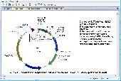
BVTech Plasmid can draw circle or linear plasmid map with double strands or single strand.
BVTech Plasmid can draw circle or linear plasmid Map with double strands or single strand. You can label the plasmid with genes and restriction sites in different colors, text, and styles. Plasmid Map can be highly customized by drag-droping or directly setting properties. BVTech Plasmid provides many drawing objects, includs lines, arrows, rectangles, circles, and text boxes....
Category: Home & Education / Science
Publisher: BV Tech, Inc., License: Freeware, Price: USD $0.00, File Size: 2.5 MB
Platform: Windows
This tool is used for splitting a file into multiple parts.
This tool is used for Splitting a File into multiple parts. There are two ways to split a File using this: split into a fixed number of files or split into files of a specific size each.
Category: Utilities / File & Disk Management
Publisher: splitmerge.duplicatechecker.com, License: Freeware, Price: USD $0.00, File Size: 911.0 KB
Platform: Windows, Mac, Vista