Free Downloads: Tomtom Radar Map
License: All | Free
TomTom HOME is the easiest way to manage content on your TomTom device.
Tomtom HOME is the easiest way to manage content on your Tomtom device. Downloading and installing HOME is easy and quick. Once installed, simply connect your Tomtom device to your computer by using your USB cable and get started.
Every time you start up Tomtom HOME, it will automatically detect if your Tomtom device is connected and offer you...
Category: Home & Education / Miscellaneous
Publisher: TomTom International BV, License: Freeware, Price: USD $0.00, File Size: 19.5 MB
Platform: Windows
Lightning Radar Map Maker is program that was designed for those that are interested in weather programs and especially program about lightning.Lightning Radar allow you to see where there lightning strike took place.Its a cool and interesting program.
Category: Home & Education / Science
Publisher: Nova Cygny 75, License: Freeware, Price: USD $0.00, File Size: 10.6 MB
Platform: Windows
"In 100 meters, turn left" "You have reached your destination" "At the end of the road, Take the ferry" For any new driver these things just seem to become a background noise after much use. But what if you could change those voices, What if you could Make your own voice. Well you can with iFX Tomtom Voice Changer. The name says it all. Change and create...
Category: Internet / Communications
Publisher: iFX Sound Software Inc, License: Freeware, Price: USD $0.00, File Size: 7.1 MB
Platform: Windows

photo radar bugging me toolbar for internet explorer.
photo Radar bugging me toolbar for internet explorer. find help for fighting photo Radar tickets and speeding tickets. alo find thoughts and reviews on music, cars, redlight cameras and everyday life. not just about photo Radar but also music and the world as i see it bugging me
Category: Internet / Browsers
Publisher: photo radar, License: Freeware, Price: USD $0.00, File Size: 1.1 MB
Platform: Windows
Traffic radar verification and calibration software.
Traffic Radar verification and calibration software.
Features:
-Works just like a tuning fork, but utilizes the PC Speakers
-Works for all Radar bands (even European) Selectable frequencies.
-Settings for MPH or KPH units
-Verifies calibration of both stationary and moving-mode Radar
-Accurate to < 1Hz (less than .05...
Category: Home & Education / Miscellaneous
Publisher: Jim Mitchell, License: Freeware, Price: USD $0.00, File Size: 1.6 MB
Platform: Windows
The Basic Radar Altimetry Toolbox is a tool designed to use radar altimetry data.
The Basic Radar Altimetry Toolbox is a tool designed to use Radar altimetry data.
Main features:
- to read all altimetry data from official data centres, from ERS-1 and 2, Topex/Poseidon, Geosat Follow-on, Jason-1, Envisat, Jason-2 and Cryosat, from Sensor Geophysical Data Record to gridded merged data
- to do some processing and computations
...
Category: Home & Education / Science
Publisher: BitRock SL, License: Freeware, Price: USD $0.00, File Size: 27.5 MB
Platform: Windows
spWZTools is an utility that resolve the problem of backlight using TomTom Mobile 5.
spWZTools is an utility that resolve the problem of backlight using Tomtom Mobile 5.20 on some smartphone (see HTC s710).
There are other utilities to show your DeviceID, set auto switch-off time and force a soft-reset.
Next release will contain more utility for change some default settings.
Category: Utilities / Misc. Utilities
Publisher: Wizard Software, License: Freeware, Price: USD $0.00, File Size: 48.0 KB
Platform: Windows
The Weather Radar Toolkit features -national weather Radar, all local Radar sites in the US with six different images: Composite, Base, Storm Motion, Relative Motion & Precipitation Totals. Includes satellite images for the eastern and westest United Stat
Category: Home & Education / Miscellaneous
Publisher: astroscan.net, License: Freeware, Price: USD $0.00, File Size: 2.3 MB
Platform: Windows, Mac, 2K, 2K3
- Optional TomTom waypoint integration for instance locations.
- Optional Tomtom waypoint integration for instance locations.
- Self-refreshing tooltip, if you happen to have it open while traveling.
- Collapsible tooltip sections.
- LDB datafeed for zone/subzone names.
- LDB datafeed for coordinates.
- Minimap button for those who want it or don't have an LDB display.
Category: Home & Education / Miscellaneous
Publisher: WowAce & Curse, Inc., License: Freeware, Price: USD $0.00, File Size: 197.2 KB
Platform: Windows
 Freeware
org, uses file and position names that suit to the display of the TomTom Rider, uses file, route and position names that suit to the display of the Map&Guide Motorrad Tourenplaner, remembers language, paths, window size and position. . .
Category: Business & Finance / Conversion Applications
Publisher: Christian Pesch, License: Freeware, Price: USD $0.00, File Size: 6.6 MB
Platform: Windows, Mac, Linux, Solaris, FreeBSD, OpenBSD, Java
Hotel World Map is search software for people looking for a hotel anywhere in the world.
Hotel World Map is search software for people looking for a hotel anywhere in the world. It lets you find and book 60.000 hotels worldwide on an interactive globe. It is the easiest, most intuitive way to find a hotel on the planet. The secure booking engine is powered by Hotels.com, the worlds leading travel portal. And this software is completely free to use. You can also find 150.000...
Category: Business & Finance / Applications
Publisher: Hotel World Map, License: Freeware, Price: USD $0.00, File Size: 3.1 MB
Platform: Windows
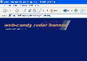
Radar Banner is a flash scanning web banner advert (468x60 px), with green characters on a Radar display screen, parameters give you the ability to change the display text and destination URL, designed for your website by www.web-candy.co.uk, designed to be easily installed free.
Category: Web Authoring / Web Design Utilities
Publisher: www.web-candy.co.uk, License: Freeware, Price: USD $0.00, File Size: 20.0 KB
Platform: Unknown
Holdem Radar is an award winning FREEWARE No Limit Texas Hold'em Winning Strategy Calculator.
Holdem Radar is an award winning FREEWARE No Limit Texas Hold'em Winning Strategy Calculator.
It automatically analyzes your cards and your opponent's moves while you play and provides you with wealth of information and accurate poker strategy advice in real time based on exact odds calculation.
Use Holdem Radar to gain a competitive advantage...
Category: Games / Cards, Casino, Lottery
Publisher: HoldemRadar, License: Freeware, Price: USD $0.00, File Size: 62.0 KB
Platform: Windows
Freeware
AirGrab WiFi Radar is a tool to display information about Apple Airport base stations and other WiFi (802.11b/g/n) wireless access points. Using AirGrab WiFi Radar you can determine most popular WiFi channels and select optimal channel for your WiFi network. Signal level and Noise level helps to diagnose common wireless network problems and optimally position your base station and...
Category: Internet / Monitoring
Publisher: AirGrab, License: Freeware, Price: USD $0.00, File Size: 3.1 MB
Platform: Mac
Main Features:
- 3D and 2D Map based user interface
- Units are individual, section, or platoon/battery sized units
- Click on the 3D Map to issue unit movement waypoints
- Multiple players over LAN and Internet, each controlling specific forces
- Real time with 30 second time steps, time compression adjustable up to x1,000
- Detailed...
Category: Games / Strategy & War
Publisher: Historical Software Corporation, License: Freeware, Price: USD $0.00, File Size: 173.0 MB
Platform: Windows
Basestation application provides an on-screen virtual radar display.
Basestation application provides an on-screen virtual Radar display. This powerful application provides functionality including identification of aircraft by callsign, altitude, speed and other parameters where such information is transmitted. All flights and sessions are recorded in a database, which can be separately browsed (and reported on) by a new application, the BaseStation...
Category: Business & Finance / Business Finance
Publisher: Kinetic Avionics Products Ltd, License: Freeware, Price: USD $0.00, File Size: 24.8 MB
Platform: Windows
This little program displays LIVE radar images from a different number of countries.
This little program displays LIVE Radar images from a different number of countries. The way of viewing is provided by the included VNC VIEWER software. The program is simple to use: you just click those 1st three buttons and you're ready to go. In a couple of seconds you'll see live streaming
Category: Utilities / Misc. Utilities
Publisher: Hakkie, License: Freeware, Price: USD $0.00, File Size: 1.6 MB
Platform: Windows
vSTARS is an air traffic control radar simulation program for use on the VATSIM network.
vSTARS is an air traffic control Radar simulation program for use on the VATSIM network. It is a high-fidelity simulation of the real ATC system used in many approach control facilities in the United States.
vSTARS aims to be a high-fidelity simulation of the real-world STARS system. Technical limitations of the VATSIM infrastructure limit the number of real-world STARS features...
Category: Business & Finance / Applications
Publisher: Metacraft, License: Freeware, Price: USD $0.00, File Size: 5.3 MB
Platform: Windows
Freeware
An interactive Flash USA Map with all the features you need for your web site or project. This is the ideal solution for dealer maps, real-estate listings, or visualizing state statistics. Nearly every aspect of the Map is customizable. However, unlike competing products, our Map is very simple to install and edit. Just upload XML and SWF files and embed.
Category: Internet / Flash Tools
Publisher: http://www.flashusamap.com/trial/flashus, License: Freeware, Price: USD $0.00, File Size: 93.8 KB
Platform: Unknown
Map of Africa is one of the many maps created for GPS TrackMaker.
Map of Africa is one of the many maps created for GPS TrackMaker. You are able to download the installation package from the TrackMaker website. In order to preview the contents of this package, you need to install GPS TrackMaker.
Using the above mentioned application, you will be able to see the Map of Africa. Just click on the "Open Temporary...
Category: Home & Education / Miscellaneous
Publisher: Geo Studio Technology, License: Freeware, Price: USD $0.00, File Size: 18.3 MB
Platform: Windows
The Virtual CHILL, or VCHILL system allows remote users to display data both from the CHILL archives as well as from realtime operations. Users with sufficient permissions may even control the Radar operation.
The Java VCHILL display client software is a cross-platform tool to allow Radar access from a variety of computer systems running various operating systems....
Category: Business & Finance / Business Finance
Publisher: Colorado State University, License: Freeware, Price: USD $0.00, File Size: 1.3 KB
Platform: Windows
FREE Definitive Desktop Weather Manager with hourly weather updates, daily, weekend and extended weather forecasts, dopplar Radar and forecast maps. Store multiple cities with detailed weather conditions. Condtions available via system tray ToolTip. Weather history records weather conditions for reference. Radar display includes optional animation. Friendly and customizable user...
Category: Utilities / Network
Publisher: TPA Software, License: Freeware, Price: USD $0.00, File Size: 6.2 MB
Platform: Windows
Program shows you an actual X3 sector-map, with detailed information about most in-game objects.
Program shows you an actual X3 sector-Map, with detailed information about most in-game objects. The Map is based on a log-file that is created with an in-game script (by Andrei[<>Ace]). If you just want to view the standard Map (or if you don’t have the game) the program will work with the included default Map, which was created with an English X3 game...
Category: Games / Misc. Games
Publisher: SUU Design, License: Freeware, Price: USD $0.00, File Size: 1.4 MB
Platform: Windows
New Zealand Map Reference Converter (NZMapConv) is software that LINZ provides to convert Map references between the old NZMS260 Map series and the new NZTopo50 Map series.NZMapConv is a Windows programme designed to convert individual coordinates entered manually.
Category: Multimedia & Design / Media Management
Publisher: Land Information New Zealand, License: Freeware, Price: USD $0.00, File Size: 2.4 MB
Platform: Windows
When the XMAP software is communicating with an XEDE via the comms cable each Map will show, at the top of the Map display, an RPM and load value (x and y axis for the Map) in real time. Also in each Map a yellow highlighted block will show the current position within the Map. Beside the real-time display on each Map are the undo and redo buttons which...
Category: Home & Education / Miscellaneous
Publisher: ChipTorque, License: Freeware, Price: USD $0.00, File Size: 1.7 MB
Platform: Windows
Sig Panama Has :
Digital maps of Panama, Digital Map of Panama-City, digital Map of Taboga, digital Map of Bocas del Toro, digital Map of Colon and Free Zone, digital Map of Contadora Island, digital Map of Coronado, Panama, Zona Libre, Map of Panama, Map of Panama City, Map of Colon, Map of Zona Libre, Map of...
Category: Internet / Misc. Plugins
Publisher: DP Imperial, LLC., License: Freeware, Price: USD $0.00, File Size: 44.9 MB
Platform: Windows
MyRouteOnline is an easy to use route planner that that allows you to plan routes from Excel spreadsheet. Excel Add-in that uploads addresses and saves time, fuel and money by helping you Map multiple locations and find the best route. Online route planning goes far beyond paper maps or a GPS system, it is the only way to find the optimal route for your needs, giving your business a...
Category: Business & Finance / Business Finance
Publisher: MyRouteOnline, License: Freeware, Price: USD $0.00, File Size: 3.1 MB
Platform: Windows
This program works 'under the radar' and programs your mind for immense success.
This program works 'under the Radar' and programs your mind for immense success. It is really easy to install and use it, there is no effort needed from the user, it works with any of the windows operative systems. It sends positive subliminal messages to the brain, so the users will attract success into their lives.
Category: Home & Education / Miscellaneous
Publisher: VXite Inc., License: Freeware, Price: USD $0.00, File Size: 1.5 MB
Platform: Windows
Freeware
Arm Map Explorer recreates all the functionalities of Google Maps on your desktop while expanding them with new extras. Map Explorer lets you locate and view any place on the planet using dynamic interactive maps. These maps are draggable, which means there is no need for you to click and wait for graphics to reload each time you want to view adjacent parts of a Map....
Category: Internet / Flash Tools
Publisher: ArmCode, License: Freeware, Price: USD $0.00, File Size: 5.5 MB
Platform: Windows
The easiest way to get a paper map with MapPlot is the Plot Map menu.
The easiest way to get a paper Map with MapPlot is the Plot Map menu.
On the following dialog, simply paper size and scale have to be chosen - the result is ready to be printed directly, edited (e.g. for additional entries) or to be displayed as a preview.
Category: Utilities / Misc. Utilities
Publisher: AGIS GmbH, License: Freeware, Price: USD $0.00, File Size: 5.4 MB
Platform: Windows
Tibia Map Viewer is a useful freeware and Open Source application that allows you to view maps generated by Tibia game client and create or edit Map symbols.
You can view the entire Tibia Map you have explored, both upper and lower levels of the Map, with zoom ratio from 25 to 400 percents. It also allows you to export to BMP file.
Category: Games / Tools & Editors
Publisher: Yury Sidorov, License: Freeware, Price: USD $0.00, File Size: 193.7 KB
Platform: Windows
Spinning Gobe Sample demonstrates how to manipulate the navigation, Map style, Map font size, and view of the Map programmatically through the MapPoint ActiveX Control. Using this simple Visual Basic project, you will learn the objects, methods, and properties that are used to navigate a MapPoint Map or change how it looks.
Category: Home & Education / Miscellaneous
Publisher: Microsoft, License: Freeware, Price: USD $0.00, File Size: 3.4 MB
Platform: Windows
The C-Map Chart Catalog allows you to view, navigate, select and order C-Map electronic charts, or various weather options, in an interactive way. After selection of required items is completed, simply press the 'E-mail order' button, and enter the address of your local C-Map distributor.
Category: Home & Education / Hobbies
Publisher: Jeppesen Marine, License: Freeware, Price: USD $0.00, File Size: 6.1 MB
Platform: Windows
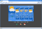
AniWeather animates weather in vivid animations for worldwide locations worldwide.
AniWeather animates weather in vivid animations for worldwide locations worldwide. It switches different locations in one click. Aniweather provides flexible weather reports, from real time current condition, Radar/satellite Map, to 5-day forecast, and to more detailed hourly report. It is quite customizable to fit your preference (temperature unit, location list, animation...
Category: Internet / Browsers
Publisher: AniWeather, License: Freeware, Price: USD $0.00, File Size: 101.0 KB
Platform: Windows
The WVLT Volunteer TV online station provides interactive weather maps, regional Radar weather information, State Radar, and an 8 Day Weather Forecast as well as State Satellite weather information, covering the communities of Tennessee and the wider region. This important coverage enables WVLT-TV to provide up to the minute severe weather alerts about tornados, hurricanes, flood,...
Category: Home & Education / Miscellaneous
Publisher: BIA Information Network, License: Freeware, Price: USD $0.00, File Size: 0
Platform: Windows
New features in latest version :
- Works with Aurora Virtual Radar 3D!
New features in latest version :
- Works with Aurora Virtual Radar 3D!
- IP address database changed to new server.
- Uses less conection to the database.
- Decodes more hits to the database.
To install the software make sure that any older Mysql Connector software is removed. You can remove older MySql Connector Software via Control Panel,...
Category: Business & Finance / Business Finance
Publisher: live military mode, License: Freeware, Price: USD $0.00, File Size: 6.1 MB
Platform: Windows
SiiTech AIS Server is a software solution that collects AIS, ARPA (Automatic Radar Plotting Aid) and satellite (e.g. Inmarsat, Iridium) messages, redistributes them, decodes and stores AIS and ARPA data in the database.
AIS Server supports radars with Automatic Radar Plotting Aid (ARPA) capability. AIS Server may be used as a single program or as a component of a scalable...
Category: Business & Finance / Database Management
Publisher: SiiTech, License: Freeware, Price: USD $0.00, File Size: 1.7 MB
Platform: Windows

Importation/Exportation: Import/export trails to gpx file. Unlimited number of trails, and TrackPoints. Export to gpx, Excel, PDF, XPS and KML/KMZ. Data table: Very flexible data table that allows sorting by columns, with inheritance of data, attributes, etc. Presentation on Map: View on Map in accordance with the active trail, which comes from providers of maps, as in...
Category: Home & Education / Miscellaneous
Publisher: Aplicaciones Topográficas S.L., License: Freeware, Price: USD $0.00, File Size: 27.0 MB
Platform: Windows
National Interactive Real Time Weather Screen Saver Delta Version.
National Interactive Real Time Weather Screen Saver Delta Version.
View Real Time Travel Weather Images designed specially for the pilots of the Delta Air lines MEC that displays Airmets / Sigmets, Radar With Cloud Tops, 12 Hour Forecast, and Looping Radar! Also Dig Into The Images on the Screensaver!
Category: Desktop Enhancements / Screensavers
Publisher: Proactive Information Corporation, License: Freeware, Price: USD $0.00, File Size: 745.2 KB
Platform: Windows
C&C 3 Map Manager streamlines the process of installing custom maps for C&C 3: Tiberium Wars and Kane's Wrath. Now you can install fan maps from C&C fansites without having to delve into your computer's folders to find the right place to put them: Map Manager handles this for you. Map Manager also allows you to delete fan maps after you get sick of...
Category: Games / Tools & Editors
Publisher: CNC Generals World, License: Freeware, Price: USD $0.00, File Size: 612.3 KB
Platform: Windows
Karnaugh map minimalizator - for minimalize logical functions for 3-8 variables.
Karnaugh Map minimalizator - for minimalize logical functions for 3-8 variables. This program help you safe logical circuits. This program is special for students. On left you can see a full Map of your function. Negation of variable is big capital.
Category: Home & Education / Mathematics
Publisher: Vaclav Kozak, License: Freeware, Price: USD $0.00, File Size: 253.0 KB
Platform: Windows
An advanced simulation of the Saab 35 Draken jet fighter featuring realistic hydraulic, electrical, navigation, Radar and weapons systems. Animated drop tanks and functional drag chute, afterburner visual fx, authentic sounds and full Virtual Cockpit are all part if this freeware aircraft.
Category: Games / Simulations
Publisher: Bookmark Digital Graphics, License: Freeware, Price: USD $0.00, File Size: 9.8 MB
Platform: Windows
The D2D Map Editor enables the rapid creation of multilayered tile based map grids.
The D2D Map Editor enables the rapid creation of multilayered tile based Map grids. It’s easy to learn and can be used by programmers and non-programmers alike. The maps generated can be deployed in games and applications developed in C++, C#, Actionscript and XML.
D2D Map Editor has been developed in C# and is currently released as a Beta version.
Category: Games / Tools & Editors
Publisher: D2D Map Editor, License: Freeware, Price: USD $0.00, File Size: 2.5 MB
Platform: Windows
Character Map displays all of the characters for a selected font.
Character Map displays all of the characters for a selected font. Features:
- Pastes any character into your current document.
- Special characters can be translated into their HTML-equivalents.
- More than a replacement for the Windows (9x/NT) character Map "charmap".
- Many additional features
- Ready for €
- Uncrippled...
Category: Utilities / Misc. Utilities
Publisher: Thomas Bigler, License: Freeware, Price: USD $0.00, File Size: 88.5 KB
Platform: Windows
With links and additional information on important topics for geography lessons.
With links and additional information on important topics for geography lessons. 3D-view of atlas (book) maps on a virtual globe, high resolution physical Map, political Map, satellite images, land coverage and earth-at-night Map. Create your own Map legend, use the drawing tool, move and insert atlas symbols and much more.
Category: Multimedia & Design / Fonts
Publisher: Imagon GmbH, License: Freeware, Price: USD $0.00, File Size: 6.1 MB
Platform: Windows
If you don't have internet access on your phone, or you want to self-select a larger region of mapping, then the Map Chooser tool can be used to make Map tile selections. Choose your own mapping areas with the flexible select tool that lets you select unlimited areas of mapping. Based on a grid, you can choose any grid squares you like - so you can pick an area in Sussex and...
Category: Home & Education / Miscellaneous
Publisher: ViewRanger, License: Freeware, Price: USD $0.00, File Size: 213.2 MB
Platform: Windows
"WebtoWall is an Active Desktop wallpaper changer on steroids. WebtoWall grabs its images off of the Internet. You can add your own selection of web cams, radars and pictures. Plays animated images such as Radar loops, has a customizable refresh rate for image retrieval, will rotate between the selected images, has the ability to display the current image in a separate sizeable window...
Category: Multimedia & Design
Publisher: Business Technology Solved, License: Freeware, Price: USD $0.00, File Size: 1.1 MB
Platform: Windows
MapCreator 2.0 is a software to create maps and animated maps with a good quality.
MapCreator can be used in presentations because is versatile and can be adequate for any kind of presentation, from travel presentations to professional presentations.
MapCreator is geo-referenced so any Map or portion of the Map will have the exactly portions of latitude and longitude,...
Category: Home & Education / Miscellaneous
Publisher: primap software, License: Freeware, Price: USD $0.00, File Size: 103.3 MB
Platform: Windows
Nokia Map Manager is a program that allows you to manage and transfer GPS maps to mobile phone.
Nokia Map Manager is a program that allows you to manage and transfer GPS maps to mobile phone. The Map Manager is for the 6110 Navigator only. The program is provided with scan function to search maps on the computer and DVD. Nokia Map Manager is an additional application and is used together with Nokia PC Suite 6.86 and later versions.
Nokia Map Manager helps...
Category: Internet / Communications
Publisher: Nokia, License: Freeware, Price: USD $0.00, File Size: 0
Platform: Windows
This package includes the DC-6 in its earliest form with short nose (no weather Radar) and round-tipped Curtiss Electric propellers as delivered to the first DC-6 customers in 1946-48. The later aircraft had the more well-known, square-tipped 'paddle' propellers, and this version is included as well.
Category: Games / Misc. Games
Publisher: Jens B. Kristensen, License: Freeware, Price: USD $0.00, File Size: 19.0 MB
Platform: Windows