Free Downloads: Wms To Vts
License: All | Free
The ARC3WMS client is an ArcView 3 extension (.
The ARC3WMS client is an ArcView 3 extension (.AVX) that provides access to data sets stored on a Web Map Server (Wms). Wms is an internet mapping protocol published by the OpenGIS Consortium. Wms servers publish map images to remote clients using standard internet technologies. There are Wms servers for LandSat data, USGS DOQ photos, bathymetry, and many other data...
Category: Multimedia & Design / Multimedia App's
Publisher: Refractions Research Inc, License: Freeware, Price: USD $0.00, File Size: 2.1 MB
Platform: Windows
myWMS LOS is an open source ready-to-use Warehouse Management System (Wms) designed for the special needs of manual operated warehouses. All basic processes for managing a warehouse are supported, i.e. incoming goods, picking with mobile terminals, stock taking, shipping.
Category: Business & Finance / Business Finance
Main Features:
- Multi Client Wms
- Managing lots/batches and minimum durability
Publisher: Linogistix, License: Freeware, Price: USD $0.00, File Size: 125.2 MB
Platform: Windows
VobBlanker is a tool able to blank, replace, cut and strip titles, more specifically, program chains. From release VobBlanker is able to work (blank, preview, delete..) also in menu domain. A DVD is composed by several Video Title Sets (Vts), and each one can contain one or more Program Chains (PGCs). A Vts is a collection of Titles, which are composed by one or more PGC. One...
Category: Audio / Rippers & Encoders
Publisher: jsoto, License: Freeware, Price: USD $0.00, File Size: 1024.0 KB
Platform: Windows, All
You can use the program's reports as a comprehensive first draft that can be customized with information derived from the assessment process. In addition to simplifying the scoring and reporting process, the software offers alternative clinical interpretive considerations and provides clients and/or guardians with a description of test performance in everyday language.
Category: Audio / Utilities & Plug-Ins
Publisher: The Psychological Corporation, License: Freeware, Price: USD $0.00, File Size: 7.4 MB
Platform: Windows
Demonstrates high resolution imagery (0.
Demonstrates high resolution imagery (0.2 meters per pixel) and elevation data (1.6 meters per pixel) served by the World Wind Wms, and visualized by the World Wind Java client. You can launch this application by using Java Web Start. It is a useful program for visualizing high resolution photos.
Category: Home & Education / Miscellaneous
Publisher: goworldwind, License: Freeware, Price: USD $0.00, File Size: 1.1 KB
Platform: Windows
Geosoft Plug-In for ER Viewer enables users to view and use Geosoft grid (.
Geosoft Plug-In for ER Viewer enables users to view and use Geosoft grid (.grd) and map (.map) files in the ER Viewer application.
This plug-in use a globe explorer, to find, view, and extract data from a variety of data servers. You can use internal servers as well as public servers including DAP servers, Wms servers, ArcIMS servers, and Tile Servers.
Category: Home & Education / Miscellaneous
Publisher: Geosoft Inc., License: Freeware, Price: USD $0.00, File Size: 50.3 MB
Platform: Windows
SiiTech AIS Server is a software solution that collects AIS, ARPA (Automatic Radar Plotting Aid) and satellite (e.g. Inmarsat, Iridium) messages, redistributes them, decodes and stores AIS and ARPA data in the database.
AIS Server supports radars with Automatic Radar Plotting Aid (ARPA) capability. AIS Server may be used as a single program or as a component of a scalable AIS network...
Category: Business & Finance / Database Management
Publisher: SiiTech, License: Freeware, Price: USD $0.00, File Size: 1.7 MB
Platform: Windows
MCL-Designer creates intelligent, multimodal applications that run on mobile computers and barcode printers. Designed to create robust, industrial use applications, MCL-Designer is a rapid application development tool for making data capture applications in a very short time.
MCL-Designer help you create the application that runs a device, it also includes features to help accelerate the...
Category: Software Development / Help File Utilities
Publisher: MCL Technologies, License: Freeware, Price: USD $0.00, File Size: 4.5 MB
Platform: Windows
TerraVisionTM is an Open Source distributed, interactive terrain visualization system developed by SRI International. It allows users to navigate, in real time, through a 3-D graphical representation of a real landscape created from elevation data and aerial images of that landscape. There are many terrain visualization tools on the market, but here are some of the features that make...
Category: Multimedia & Design / Graphics Viewers
Publisher: SRI International, License: Freeware, Price: USD $0.00, File Size: 2.1 MB
Platform: Windows
Dapple is a global data explorer designed to provide an open and optimal environment for visualizing, presenting and sharing massive quantities of geoscientific data on desktop computers. Dapple lets you browse, discover and display graphically rich data from global and corporate spatial servers – Geosoft DAP servers, NASA servers, USGS servers, and the many, many Wms servers...
Category: Desktop Enhancements / Shell & Desktop Managers
Publisher: Geosoft Inc., License: Freeware, Price: USD $0.00, File Size: 38.0 MB
Platform: Windows
 Freeware
VSceneGIS Desktop. (GIS) Analysis, Computing and Editing. Customer Project Development, Analysis, Computing and GIS editing. VSceneGIS Desktop applies the concept of Tree and Graph Topology to implement the data model in a GIS. Validation, Editing and Topological Behavior Export and import of data sources: PostgreSQL / PostGIS, Oracle, MySQL, SQLite / SpatiaLite, ShapeFile. Connection to...
Category: Home & Education / Science
Publisher: vscenegis.com, License: Freeware, Price: USD $0.00, File Size: 118.4 MB
Platform: Windows
The DVD-lab PRO version is a next step in DVD authoring for advanced users who need accessible and easy to learn tool with full range of DVD features. Most of the existing tools are either very expensive and hard to master or are limited in implementing DVD specifications. Many tools that are often marketed as advanced or for professional use are actually only more expensive consumer...
Category: DVD & Video / DVD
Publisher: Mediachance, License: Freeware, Price: USD $0.00, File Size: 3.0 MB
Platform: Windows, All
Freeware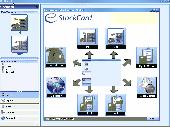
Chronos e-StockCard v2.1.7 is an inventory software for small and medium businesses. Chronos e-StockCard has been widely used in many different industries worldwide and it covers small, medium & large business entities as well as non-profit organizations. Chronos e-StockCard can help to track inventory in detail, create sales orders and picking lists, print delivery orders, invoices, cash sales...
Category: Business & Finance / Inventory Systems
Publisher: Chronos Process Integration Sdn Bhd, License: Freeware, Price: USD $0.00, File Size: 121.9 MB
Platform: Windows

AIOCP (All In One Control Panel) is a free Open Source Content Management System (CMS), a professional platform-independent all-inclusive solution to completely manage a website or portal through a user friendly web-interface (Wms - Website Management System). Based on PHP/MySQL and open standard technologies, AIOCP is also an Internet/Intranet framework for web application development...
Category: Internet
Publisher: Tecnick.com S.r.l., License: Freeware, Price: USD $0.00, File Size: 11.2 MB
Platform: Unknown

Importation/Exportation: Import/export trails to gpx file. Unlimited number of trails, and TrackPoints. Export to gpx, Excel, PDF, XPS and KML/KMZ. Data table: Very flexible data table that allows sorting by columns, with inheritance of data, attributes, etc. Presentation on map: View on map in accordance with the active trail, which comes from providers of maps, as in 'Satellite' mode...
Category: Home & Education / Miscellaneous
Publisher: Aplicaciones Topográficas S.L., License: Freeware, Price: USD $0.00, File Size: 27.0 MB
Platform: Windows