Free Downloads: Apr File Format Gis
AEGIS– the leading GIS software in UK secondary schools.
AEGIS– the leading Gis software in UK secondary schools.
One-off software purchase and free upgrades – no subscriptions.
Brings industry-standard Gis maps to the classroom – Goad town plans, large-scale OS MasterMaps.
Try before you buy with the free AEGIS Viewer download.
Free materials: resources, help sheets,...
Category: Home & Education / Miscellaneous
Publisher: AU Enterprises Limited, License: Shareware, Price: USD $0.00, File Size: 0
Platform: Windows
My World Gis™ is a Geographic Information System (Gis) designed specifically for use in middle school through college classrooms. It has been developed by the GEODE Initiative at Northwestern University as part of a research program on the adaptation of scientific visualization and data analysis tools to support inquiry-based learning.
My World gives learners...
Category: Home & Education / Miscellaneous
Publisher: Northwestern University, License: Shareware, Price: USD $59.00, File Size: 100.2 MB
Platform: Windows
ArcGIS Explorer is a free, downloadable Gis viewer that gives you an easy way to explore, visualize and share Gis information. ArcGIS Explorer adds value to any Gis because it helps you deliver your authoritative data to a broad audience.
The ArcGIS Explorer Desktop Current User setup is intended for users who do not have administrator access on their computers and...
Category: Desktop Enhancements / Shell & Desktop Managers
Publisher: Environmental Systems Research Institute, Inc., License: Freeware, Price: USD $0.00, File Size: 94.0 MB
Platform: Windows

The free AvisMap Viewer opens most Gis/CAD and raster image File types and most ArcView, ArcExplorer, and MapInfo projects. Besides just opening and viewing files, the Viewer supports an extensive list of features including visual layer properties control, legend control, thematic mapping, spatial and attribute querying, custom labeling, on-map measurements, hyper-linking, PDF...
Category: Software Development / Components & Libraries
Publisher: AvisMap GIS Technologies, License: Freeware, Price: USD $0.00, File Size: 22.3 MB
Platform: Windows
NexGeo Office™ provides all of the functionality needed to organize a data collection project and manage data collected from Nexteq GPS/Gis handhelds. It provides tools for viewing, editing and exporting data to a Format suitable for your existing Gis and CAD infrastructure.
Category: Multimedia & Design / Image Editing
Publisher: Nexteq Navigation, License: Freeware, Price: USD $0.00, File Size: 7.4 MB
Platform: Windows
Cityvu is a 3D GIS data viewer able to load CityGML data format from any compatible data source.
Cityvu is a 3D Gis data viewer able to load CityGML data Format from any compatible data source.
Cityvu features 3D hardware rendering using OpenGL with a complete navigation system that allows automated tour of the rendered scene. It has been designed to be used to develop customized software solutions, built on the specific needs. Cityvu supports in addition to...
Category: Multimedia & Design / Graphics Viewers
Publisher: 3D GIS Cityvu, License: Freeware, Price: USD $0.00, File Size: 9.9 MB
Platform: Windows
Christine-GIS is a useful, easy-to-use tool that brings geographic information to your desktop.
Christine-Gis is a useful, easy-to-use tool that brings geographic information to your desktop. Christine gives you the power to visualize, explore, query and analyze data spatially. A key feature of Christine is that it's easy to load tabular data, such as dBASE files and data from database servers.
Category: Home & Education / Miscellaneous
Publisher: christine-gis.com, License: Shareware, Price: USD $0.00, File Size: 0
Platform: Windows
 Freeware
Convert ESRI ShapeFiles (.SHP) geolocation data into AnyMap Format to be used with AnyChart. AnyChart Flash Map Converter allows making use of a wide choice of maps with AnyChart Flash Component, a Gis visualization system that recognizes map data in AnyMap Format only. AnyChart Flash Map Converter makes it easy to visualize any geolocation data without hefty expenses...
Category: Web Authoring / Image Mapping Tools
Publisher: AnyChart.Com, License: Freeware, Price: USD $0.00, File Size: 1.6 MB
Platform: Windows
Software development kit for CAD/CAM/ GIS and graphic software developers.
Software development kit for CAD/CAM/ Gis and graphic software developers. Converts from raster to vector and refines architect, mechanical, tech drawing, maps, math graphs, graphics for books and journals and more. ActiveX and Com Component are also available. Refines vector graphics, creates fine lines and shapes. Scanned drawings are recognized and represented in a vector...
Category: Software Development / Tools & Editors
Publisher: AlgoLab Inc., License: Shareware, Price: USD $0.00, File Size: 2.7 MB
Platform: Windows
Quantum Gis provides a continously growing number of capabilities provided by core functions and plugins. You can visualize, manage, edit, analyse data, and compose printable maps. QGIS is an official project of the Open Source Geospatial Foundation (OSGeo). It runs on Linux, Unix, Mac OSX, and Windows and supports numerous vector, raster, and database formats and functionalities.
Category: Home & Education / Miscellaneous
Publisher: qgis.org, License: Freeware, Price: USD $0.00, File Size: 92.2 MB
Platform: Windows
Shareware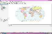
AvisMap Desktop Professional 5 is a professional desktop Gis software for map editing, managing, analysis attribute data, aid decision-making transactions and output map, print tables, 3D modeling, and other functions. As a complete analysis management tool, AvisMap Despro 5 is applicable in land management, forestry, electric power, telecom, traffic, city pipe network, resource...
Category: Multimedia & Design / Graphics Viewers
Publisher: AvisMap GIS Technologies, License: Shareware, Price: USD $499.00, File Size: 22.2 MB
Platform: Windows
ArcGIS Explorer Desktop is a free Gis viewer that gives you an easy way to explore, visualize, and share Gis information. ArcGIS Explorer adds value to any Gis because it helps you deliver your authoritative data to a broad audience.
Easy and intuitive to use it's easy for anyone to begin working with ArcGIS Explorer, with its intuitive and easy to use...
Category: Home & Education / Miscellaneous
Publisher: Environmental Systems Research Institute, Inc., License: Freeware, Price: USD $0.00, File Size: 100.5 MB
Platform: Windows
GISConnect adds several menus and toolbars to your AutoCAD application, so you can use native AutoCAD commands to create, edit and visualize Gis features in their native Format.
Adding data - Choose datasets based on spatial coordinates, using a window, or using a query builder.
Category: Multimedia & Design / Image Editing
Publisher: Bentley Systems, License: Demo, Price: USD $0.00, File Size: 250.0 MB
Platform: Windows
MapObjects—Java Edition 2 is the newest version of Esri's pure Java solution for the Gis Java developer.Support for additional File formats such as MrSID, CAD (DGN, DXG, and DWG), SDC, military formats, and much more.Support for Mac OS X and IBM AIX operating systems in addition to continued support for HP-UX, Linux, Solaris, and Windows.
MapObjects—Java...
Category: Software Development / Misc. Programming
Publisher: ESRI, License: Demo, Price: USD $0.00, File Size: 2.2 MB
Platform: Windows
Apr-5000-XLS Array Package Rework System
System provides board capability with small board precision. This system performs precise, cost effective rework of the widest range of PCBs and component types, from large boards up to 24.5" x 24.5" (622mm x 622mm) to components down to 0.020" x 0.010" (0.5mm x 0.25mm).
Category: Business & Finance / Business Finance
Publisher: OK International, License: Freeware, Price: USD $0.00, File Size: 29.0 MB
Platform: Windows
InstantAtlas™ DeskTop, a product developed by GeoWise and which you can buy from ESRI (UK), enables information analysts and Gis professionals to create highly-interactive web solutions that combine statistics and Gis data to improve visualisation, enhance communication, and engage people in more informed decision making.
InstantAtlas DeskTop is quick and easy...
Category: Multimedia & Design / Multimedia App's
Publisher: GeoWise, License: Demo, Price: USD $0.00, File Size: 552.0 KB
Platform: Windows
GeoMedia Viewer is an easy to use, FREE Gis software application for desktop viewing and distribution of geospatial data.It allows an organization to maximize the value of its geospatial data by extending availability to novice users who wouldn’t otherwise have access because of the barriers of purchasing and learning how to use a full Gis software application.
Category: Multimedia & Design / Graphics Viewers
Publisher: Intergraph Corporation, License: Freeware, Price: USD $0.00, File Size: 115.0 MB
Platform: Windows
PocketGIS is a powerful mobile Geographical Information System (Gis) for field data capture which can display and edit map geometry and attributes. PocketGIS brings real Gis functionality to highly portable handheld devices which are lightweight, convenient and have a long battery life.
Category: Utilities / Misc. Utilities
Publisher: Pocket Systems Ltd, License: Shareware, Price: USD $499.00, File Size: 42.8 MB
Platform: Windows
WinTopo Pro converts images from scanners and other digital sources into vector data suitable for CAD, Gis and CNC systems. You can scan old plans, archive drawings, or even photos and convert them into useful CAD data. Any image which is stored in TIFF, GIF, JPEG, PNG or BMP Format can be processed by WinTopo Pro into DXF and other vector File formats.
Category: Multimedia & Design / Media Management
Publisher: SoftSoft Ltd., License: Shareware, Price: USD $0.00, File Size: 2.1 MB
Platform: Windows
GenesisIV understands GIS concepts like layers, shape objects and georeferencing.
GenesisIV understands Gis concepts like layers, shape objects and georeferencing. It interfaces to industry standard Gis systems such as MapInfo and ArcView so you can use your existing data without having to learn new concepts or perform difficult manipulations.
GenesisIV is the only landscape product designed specifically to help teach geographical concepts....
Category: Multimedia & Design / Multimedia App's
Publisher: Geomantics, License: Freeware, Price: USD $0.00, File Size: 17.6 MB
Platform: Windows
The Microdrone Airborne Mapping extension to Orbit Gis provides the tools required for automated flight and high precision mapping. It contains a Waypoint Generator, a Microdrone in-flight tracker, and a captation tool. Further image-, stereoprocessing and orthorectification can be executed using the Strabo Photogrammetry extension to Orbit Gis.
Category: Multimedia & Design / Multimedia App's
Publisher: Orbit GeoSpatial Technologies, License: Freeware, Price: USD $0.00, File Size: 30.0 MB
Platform: Windows
AutoDEM (aka as AutoMNT) is a freeware Gis software to create Digital Elevation Models (DEM) from scanned topographic maps for Windows.
Through different data layers (map, contours, DEM, etc.), AutoDEM provides many tools for :
-Topographic map analysis
-Contour lines extraction and reconstruction
-Contours to DEM interpolation and DEM analysis
-DEM to TIN...
Category: Multimedia & Design / Animation
Publisher: Joachim Pouderoux, License: Freeware, Price: USD $0.00, File Size: 27.6 MB
Platform: Windows
The Keymap SDK is a set of C classes designed with the purpose of simplifying the development process of Gis applications for programmers. It supports a wide range of Gis features, include built-in GPS support, symbology and advanced road styles. Unlike other Gis products which are usually shipped as ActiveX components, Keymap SDK is a set of C classes that can be easily...
Category: Software Development / Misc. Programming
Publisher: 17 Degree Inc., License: Demo, Price: USD $0.00, File Size: 0
Platform: Windows
OpenJUMP is an open source Geographic Information System (Gis), it can read and write shapefiles and simple GML files. It has limited support for the display of images and good support for showing data retrieved from WFS and WMS web-services. So you can use it as Gis Data Viewer.OpenJUMP has limits in reading very large data files and has limited support for cartographic projections.
Category: Home & Education / Miscellaneous
Publisher: Jump Pilot Project, License: Shareware, Price: USD $0.00, File Size: 0
Platform: Windows
Shareware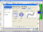
Vextractor is a vectorizer program for transforming raster images into vector formats by building centerlines and outlines. This tool could be used for the vectorizing photo, logotypes and other line art images for use in Vector Graphics Design software. You can also vectorize charts, drawings, maps and schemes for input to CAD or Gis systems. Main features of Vextractor: Input...
Category: Multimedia & Design / Image Editing
Publisher: VextraSoft, License: Shareware, Price: USD $99.95, File Size: 3.0 MB
Platform: Windows