Free Downloads: Arcgis Api
The Infrastructure Mobile Map template is an Arcgis Mobile application that can be used by field operations and maintenance staff in a water utility or public works department. This mobile application includes two multi-scale mobile maps (daytime and nighttime) that can be used in a disconnected network environment, two online basemaps that were authored from the Local Government Basemap...
Category: Internet / Communications
Publisher: ESRI, License: Freeware, Price: USD $0.00, File Size: 515.4 MB
Platform: Windows
GeoLabel Pro™ is a high-quality integrated text placement software for GeoMedia Professional and Arcgis.MapText has selected important capabilities of its flagship multi-GIS text placement product, Label-EZ, and created GeoLabel Pro, an easy-to- use and fully integrated software package for GeoMedia Professional and Arcgis users to display or print high-quality maps.
Category: Business & Finance / Business Finance
Publisher: MapText, License: Shareware, Price: USD $1995.00, File Size: 46.1 MB
Platform: Windows
Geosoft's Target™ for Arcgis software, built on Geosoft's industry-leading Oasis montaj™ software, simplifies the visualization and analysis of subsurface drillhole and borehole geology data within your ESRI GIS environment.
Target for Arcgis processes large volume drillhole data with ease and generates professional-quality maps for presentation,...
Category: Software Development / Misc. Programming
Publisher: Geosoft Inc., License: Shareware, Price: USD $0.00, File Size: 0
Platform: Windows
ET GeoTools is a set of tools for Arcgis which purpose is to increase the editing productivity in ArcMap, give enhanced editing functionality to the ArcView users and enable them to create and maintain topologically correct datasets.
- Identifying topology errors – draw nodes and duplicates for polyline layers, gaps and overlaps for polygon layers
-Offers usage of...
Category: Business & Finance / Business Finance
Publisher: ET SpatialTechniques, License: Shareware, Price: USD $245.00, File Size: 3.2 MB
Platform: Windows
EV8 software was created for ArcGIS 8.
EV8 software was created for Arcgis 8.x or 9.x. EV8 has : Clean and Build (Polylines to Polygons), Clean and Build: Polygons, Polylines, with intersection and dangle nodes, Automate CAD to GIS: rapidly convert CAD layers to shapefiles, Reverse Engineering: a method to control removal of gaps and slivers.
Category: Multimedia & Design / Multimedia App's
Publisher: Geokinetic Systems Inc., License: Shareware, Price: USD $98.00, File Size: 4.5 MB
Platform: Windows
SmartExporter.DXF for Arcgis/ArcMap:
- Seamless integration in Arcgis/ArcMap - adds a DXF export filter easily accessible through the ArcMap export dialog.
- Creates well-formatted DXF files, which can be opened or imported in most CAD, GIS and drawing packages.
- Complete support for all native ArcMap geo types, labels, layout elements, etc.
- Export in...
Category: Utilities / Misc. Utilities
Publisher: GIS Expert Solutions, License: Shareware, Price: USD $595.00, File Size: 874.5 KB
Platform: Windows
ArcReader is a free, easy-to-use desktop mapping application that allows users to view, explore, and print maps and globes. Anyone with ArcReader can view high-quality interactive maps authored by a high-level Arcgis Desktop product and published with the Arcgis Publisher extension.
ArcReader is a free and easy-to-use application that allows users to view and print...
Category: Desktop Enhancements / Shell & Desktop Managers
Publisher: Environmental System Research Institute, Inc., License: Freeware, Price: USD $0.00, File Size: 499.2 MB
Platform: Windows
ET GeoTools is a set of tools for Arcgis which purpose is to increase the editing productivity in ArcMap, give enhanced editing functionality to the ArcView users and enable them to create and maintain topologically correct datasets.The tools are designed mainly for users with ArcView license, but will be asset for ArcEditor & ArcInfo license holders as well.
Category: Audio / Utilities & Plug-Ins
Publisher: ET SpatialTechniques, License: Shareware, Price: USD $245.00, File Size: 4.8 MB
Platform: Windows
SWATeditor is a companion software to ArcSWAT.
SWATeditor is a companion software to ArcSWAT. SWATeditor reads the project database generated by ArcSWAT interface to edit swat input files, execute SWAT, perform sensitivity, autocalibration and uncertainty analysis. This is a standalone program and does not require Arcgis, thus helping users of ArcSWAT to share their project with others that do not have Arcgis or much...
Category: Business & Finance / Applications
Publisher: Grassland, Soil & Water Research Laboratory, USDA-ARS, License: Freeware, Price: USD $0.00, File Size: 15.6 MB
Platform: Windows

Lychee Project is a premium Api service that provides 100% up-time for dedicated Facebook marketers. Due to it don't fuss with Facebook's plethora of updates, now more and more social marketing application(based on Facebook Api) using this project. What problems does the Lychee Api solved? - Facebook Api update proof. - Exclusive network with over 2000+ IP's so...
Category: Internet / Flash Tools
Publisher: Lychee API, License: Shareware, Price: USD $19.00, File Size: 2.8 MB
Platform: Windows
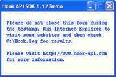
Hook Api SDK is a Software Development Kit for easy and quickly develop Windows system wide Api Hooking Applications. It helps you hooking Windows system functions or functions in 3rd applications, this means you can call your own functions instead of some Windows system APIs or functions of other appliction, intercepts Windows system or 3rd application's functions and re-writing...
Category: Software Development
Publisher: Hooking Software, License: Shareware, Price: USD $280.00, File Size: 259.2 KB
Platform: Windows
WellTracking is an Arcgis based solution for effective management and visualization of 3D spatial well drilling data on a corporate level.
The program automates all spatial data management processes related to the life-cycle of the well allowing monitoring and controlling all stages of the drilling process.
Category: Utilities / Misc. Utilities
Publisher: DataEast, LLC, License: Shareware, Price: USD $3905.06, File Size: 55.4 MB
Platform: Windows
Isoliner is the Arcgis extension for make grids and points theme with interpolate by Kriging's and triangulation method. Last version of extension include Slide Analyst as free function.
Isoliner include additional 3D functions, interpolation by features, generation of random points.
Category: Multimedia & Design / Multimedia App's
Publisher: GIS Planet, License: Shareware, Price: USD $0.00, File Size: 0
Platform: Windows
Google stopped issuing API keys for their API in 2006.
Google stopped issuing Api keys for their Api in 2006. This rendered that large parts of functionality for many tools fell away. SensePost Unified Data Api (SPUD) will help get those tools working again. SPUD also integrates seemlessly with BiDiBLAH and Wikto. Best of all, SPUD is free.
Category: Internet / Web Search Utilities
Publisher: SensePost, License: Freeware, Price: USD $0.00, File Size: 2.5 MB
Platform: Windows
KMLer is the ArcGIS extension for professional work with Google Earth.
KMLer is the Arcgis extension for professional work with Google Earth. We recommend using this module and our free Typeconvert extension. KMLer Plus also supports additional functionality at description building.
KMLer Pro also supports additional 3d features, LOD, Fade in Google Earth. Create overlays function in KMLer Pro supports Superoverlay projects creation now...
Category: Multimedia & Design / Media Management
Publisher: GIS Center, License: Shareware, Price: USD $0.00, File Size: 584.6 KB
Platform: Windows
This is an unofficial API reference documentation for the Appcelerator Titanium™ Mobile platform.
This is an unofficial Api reference documentation for the Appcelerator Titanium™ Mobile platform. It currently supports the latest Mobile Api version: 1.7.0. You now have the posibility to browse between the 1.6.2 Titanium Api version and the 1.7.0. Titanium Api. The developers will keep updating the app as more updates from Appcelerator are coming.
Category: Internet / Misc. Plugins
Publisher: Codeboxed, License: Freeware, Price: USD $0.00, File Size: 17.2 MB
Platform: Windows
This utility scans exe or dll files of your choosing and detects usage of .
This utility scans exe or dll files of your choosing and detects usage of .NET types released by ESRI. It then generates a report of this usage for your review.
Among other things, you can use the information provided to verify that you are not using types from assemblies that require licenses beyond your target license level or to generate a list of types that you can compare...
Category: Utilities / Misc. Utilities
Publisher: Environmental Systems Research Institute, Inc., License: Freeware, Price: USD $0.00, File Size: 743.3 KB
Platform: Windows
It's a car, it's a train.... No, it's a programming tool! That's right, POST IT is an Api that any Windows programmer can use. With the POST IT Api it is easy to Email enable any of your custom Windows program, script or a macro code. POST IT Api is perfect to use in C/C , VB, Powerbuilder, Foxpro, Delphi code. You can also use POST IT Api within...
Category: Utilities / Misc. Utilities
Publisher: Jason Weiss, License: Shareware, Price: USD $75.00, File Size: 350.6 KB
Platform: Windows
The first product from WebBridge series for operation with Internet tiles maps in the environment of Arcgis. The program allows to connect directly in project ArcMap the raster layer linked to one of Internet services, to display depending on scale appropriate level of an Internet map. The program does not demand usage Arcgis Server/ImageServer or access to Virtual Earth through...
Category: Internet / Misc. Plugins
Publisher: MitrichTools, License: Demo, Price: USD $0.00, File Size: 581.5 KB
Platform: Windows
Api Monitor is a software that allows you to spy and display Win32 Api calls made by applications. It can trace any exported APIs and display wide range of information, including function name, call sequence, input and output parameters, function return value and more. A useful developer tool for seeing how win32 applications work and learn their tricks.
Category: Software Development
Publisher: APIMonitor.com, License: Shareware, Price: USD $99.00, File Size: 3.8 MB
Platform: Windows
With the LINDO API, you can easily create your own optimization applications.
With the LINDO Api, you can easily create your own optimization applications. It allows you to plug the power of the LINDO solvers right into customized applications and mathematical programs that you have written. The recently released LINDO Api 7.0 includes a number of significant enhancements and new features.
Category: Audio / Utilities & Plug-Ins
Publisher: Lindo Systems, Inc, License: Demo, Price: USD $0.00, File Size: 18.5 MB
Platform: Windows
The 1-Wire SDK Beta is divided into 3 sections, each representing a unique Applications Programmer Interface (Api). The first focuses on the 1-Wire .NET J# libraries and is called OW.NET Api. The second section focuses on a second Api (pretty much a subset of OW.NET Api) called Compact.NET Api. This is a limited port of OW.NET to C# and is focused on Windows...
Category: Software Development / Misc. Programming
Publisher: Maxim Integrated Products, License: Shareware, Price: USD $0.00, File Size: 23.5 MB
Platform: Windows
ET Surface is a set of tools for Arcgis that enable the users to create surfaces and perform surface analysis without the need of 3D or Spatial Analyst extensions. The only requirement is an Arcgis license (ArcView, ArcEditor or ArcInfo).
ET Surface 2.0 introduces ET TerrainViewer which allows 3D visualization of surfaces (PolygonZ TINs and Rasters) as well as features...
Category: Multimedia & Design / Image Editing
Publisher: ET Spatial Techniques, License: Shareware, Price: USD $295.00, File Size: 11.0 MB
Platform: Windows
Formulator Api is an equation rendering component that satisfies a need for windowless control in web applications.
It is a COM component that works as a wrapper for the similar Api as one within Formulator ActiveX Control . You can create on the server side the corresponding Formulator Api object and use its methods to convert MathML text into an image.
Category: Business & Finance / Business Finance
Publisher: Hermitech Laboratory, License: Shareware, Price: USD $425.00, File Size: 5.0 MB
Platform: Windows
This program allows connections to personal geodatabases and multi-user geodatabases using the 2-tier connect architecture (direct-connect). To install this little program, first you need to have on your computer Arcgis Explorer software. The software is easy to install and easy to manipulate.
Category: Multimedia & Design / Image Editing
Publisher: Environmental Systems Research Institute, Inc., License: Freeware, Price: USD $0.00, File Size: 47.6 MB
Platform: Windows