Free Downloads: Arcview View
The ARC3WMS client is an ArcView 3 extension (.
The ARC3WMS client is an Arcview 3 extension (.AVX) that provides access to data sets stored on a Web Map Server (WMS). WMS is an internet mapping protocol published by the OpenGIS Consortium. WMS servers publish map images to remote clients using standard internet technologies. There are WMS servers for LandSat data, USGS DOQ photos, bathymetry, and many other data types.
Category: Multimedia & Design / Multimedia App's
Publisher: Refractions Research Inc, License: Freeware, Price: USD $0.00, File Size: 2.1 MB
Platform: Windows
ET GeoTools is a set of tools for ArcGIS which purpose is to increase the editing productivity in ArcMap, give enhanced editing functionality to the Arcview users and enable them to create and maintain topologically correct datasets.The tools are designed mainly for users with Arcview license, but will be asset for ArcEditor & ArcInfo license holders as well.
Category: Audio / Utilities & Plug-Ins
Publisher: ET SpatialTechniques, License: Shareware, Price: USD $245.00, File Size: 4.8 MB
Platform: Windows
ET GeoWizards is a set of powerful functions that will help the ArcGIS users to manipulate data with ease. It enables the ArcGIS users with Arcview licenses to perform some data processing tasks standardly possible only in ArcEditor and ArcInfo. The surface functions make possible to do 3D analysis in ArcMap with no need of 3D Analyst.
The main target of the software are the...
Category: Business & Finance / Business Finance
Publisher: ET SpatialTechniques, License: Shareware, Price: USD $0.00, File Size: 6.6 MB
Platform: Windows
DNRGarmin is a smart tool used to directly transfer data between Garmin GPS handheld receivers and various GIS software packages.
DNRGarmin was built to provide users the ability to directly transfer data between Garmin GPS handheld receivers and various GIS software packages. Using DNRGarmin a user can use point features (graphics or shapefile) and upload them to the GPS as...
Category: Utilities / Misc. Utilities
Publisher: GIS Section, Minnesota Department of Natural Resources, License: Freeware, Price: USD $0.00, File Size: 11.3 MB
Platform: Windows
ET GeoWizards is a set of powerful functions that will help the ArcGIS users to manipulate data with ease. It enables the ArcGIS users with Arcview licenses to perform some data processing tasks standardly possible only in ArcEditor and ArcInfo. The surface functions make possible to do 3D analysis in ArcMap with no need of 3D Analyst.
The main target of the software are the...
Category: Software Development / Misc. Programming
Publisher: ET SpatialTechniques, License: Shareware, Price: USD $245.00, File Size: 7.1 MB
Platform: Windows
Using Arcview, you can understand the geographic context of your data, allowing you to see relationships and identify patterns in new ways.
Main features:
- Author maps and interact with your data by generating reports and charts and printing and embedding your maps in other documents and applications.
- Save time using map templates to create consistent...
Category: Home & Education / Teaching Tools
Publisher: Environmental Systems Research Institute, Inc., License: Shareware, Price: USD $1.50, File Size: 0
Platform: Windows
Oasis montaj Viewer is a easy-to-use program that allows anyone to View, share, and print published Geosoft grid (.grd) and database (.gdb) files. The viewer can also be used to convert grids and images to a variety of supported data formats, including AutoCAD, Arcview, ER Mapper, TIF, and many more.
Category: Multimedia & Design / Graphics Viewers
Publisher: GEOSoft, License: Freeware, Price: USD $0.00, File Size: 137.4 MB
Platform: Windows
Shape Viewer is a free tool, which you can use to view ESRI Shape files.
Shape Viewer is a free tool, which you can use to View ESRI Shape files.
Shape Viewer can open (.shp) files that contain the geometry information of the shape file.With Shape Viewer you can also create new (.shx) file, and new empty (.dbf) file for your shape file.
If you have hundreds of shape files, and you want to View their contents rapidly, and you don't...
Category: Multimedia & Design / Graphics Viewers
Publisher: Mohammed Hammoud, License: Freeware, Price: USD $0.00, File Size: 35.0 KB
Platform: Windows
Point Analyst is an extension to the Arcview® GIS designed for the exploratory analysis of spatial sampling and analysis methods.
New users should read the concepts section to understand the motivation and principles behind the stratified interpolation function provided in the extension.
-Stratified interpolation: Point interpolation using ordinary point...
Category: Software Development / Misc. Programming
Publisher: Dr. Rob Rempel, License: Demo, Price: USD $0.00, File Size: 739.8 KB
Platform: Windows
Superoverlay software is a Google Earth application for tiling raster datasets and creating View based regions in KML or KMZ files.
Also Superoverlay can generate world files for all images in Arcview style (jgw, tfw,...). It helps you put large image overlays into Google Earth (for example alternative maps or aerial photography). GE Sky mode is supported.
Category: Home & Education / Miscellaneous
Publisher: GIS Center, License: Shareware, Price: USD $0.00, File Size: 0
Platform: Windows
ET GeoTools is a set of tools for ArcGIS which purpose is to increase the editing productivity in ArcMap, give enhanced editing functionality to the Arcview users and enable them to create and maintain topologically correct datasets.
- Identifying topology errors – draw nodes and duplicates for polyline layers, gaps and overlaps for polygon layers
-Offers usage of...
Category: Business & Finance / Business Finance
Publisher: ET SpatialTechniques, License: Shareware, Price: USD $245.00, File Size: 3.2 MB
Platform: Windows
ArcReader is a free, easy-to-use desktop mapping application that allows users to View, explore, and print maps and globes. Anyone with ArcReader can View high-quality interactive maps authored by a high-level ArcGIS Desktop product and published with the ArcGIS Publisher extension.
ArcReader is a free and easy-to-use application that allows users to View and...
Category: Desktop Enhancements / Shell & Desktop Managers
Publisher: Environmental System Research Institute, Inc., License: Freeware, Price: USD $0.00, File Size: 499.2 MB
Platform: Windows
With HD View, you can view and interact with very large images on the Web.
With HD View, you can View and interact with very large images on the Web. HD View supports smooth panning and zooming, as well as appropriate viewing perspectives as you zoom in and out. HD View also makes creating and hosting your own HD View images easy. HD View is available as a plug-in for Windows-based browsers, including Internet Explorer and...
Category: Internet / Browser Accessories
Publisher: Microsoft Research, License: Shareware, Price: USD $0.00, File Size: 0
Platform: Windows
ET GeoWizards is a set of powerful functions that will help the ArcGIS users to manipulate data with ease. It enables the ArcGIS users with Arcview licenses to perform some data processing tasks standardly possible only in ArcEditor and ArcInfo. The surface functions make possible to do 3D analysis in ArcMap with no need of 3D Analyst.
Category: Multimedia & Design / Multimedia App's
Publisher: Environmental Systems Research Institute, Inc, License: Shareware, Price: USD $60.00, File Size: 5.9 MB
Platform: Windows
You know X-Tools? Grid Machine is X-Tools for grid themes. In ArcViews Spatial Analyst the options to work with grids are very limited, especially if you have requests for multiple grids. Even simple actions (like copy, rename, import, export) are only provided for single grids. Gridmachine offers a lot of helpful tools for the work with Arcview/Spatial Analyst, like the above...
Category: Business & Finance / Database Management
Publisher: ECOGIS Geomatics, License: Shareware, Price: USD $199.00, File Size: 736.2 KB
Platform: Windows
GenesisIV understands GIS concepts like layers, shape objects and georeferencing.
GenesisIV understands GIS concepts like layers, shape objects and georeferencing. It interfaces to industry standard GIS systems such as MapInfo and Arcview so you can use your existing data without having to learn new concepts or perform difficult manipulations.
GenesisIV is the only landscape product designed specifically to help teach geographical concepts. You're up...
Category: Multimedia & Design / Multimedia App's
Publisher: Geomantics, License: Freeware, Price: USD $0.00, File Size: 17.6 MB
Platform: Windows
With HD View, you can view and interact with very large images on the Web.
With HD View, you can View and interact with very large images on the Web. HD View supports smooth panning and zooming, as well as appropriate viewing perspectives as you zoom in and out. HD View also makes creating and hosting your own HD View images easy. HD View is available as a plug-in for Windows-based browsers.Recent advances in camera and sensor...
Category: Audio / Utilities & Plug-Ins
Publisher: Microsoft Research, License: Freeware, Price: USD $0.00, File Size: 1.2 MB
Platform: Windows
Know how to View SQL database and View SQL db elements from corrupted SQL Server by using View SQL server software. Solve the query of SQL server corruption with the help of SQL DB viewer. This is free tool View DB SQL database as it is View SQL DB software which helps to View SQL Server database from corruption situation. If you want to fix the...
Category: Utilities / File Compression
Publisher: Tool View DB SQL, License: Freeware, Price: USD $0.00, File Size: 1.6 MB
Platform: Windows, Other
It is a very good tool which helps you to better understand how ASP.
It is a very good tool which helps you to better understand how ASP.NET works.
Understanding ASP.NET View State looks at how an ASP.NET page maintains its state changes across postbacks, examining:
- The ASP.NET Page Life Cycle
- The Role of View State
- The Cost of View State
- How View State is Serialized/Deserialized
-...
Category: Home & Education / Teaching Tools
Publisher: Scott Mitchell, License: Freeware, Price: USD $0.00, File Size: 159.0 KB
Platform: Windows
Oracle Hyperion Smart View for Office (Smart View) is a component of Hyperion Foundation Services.
Oracle Hyperion Smart View for Office (Smart View) is a component of Hyperion Foundation Services. Smart View provides a common Microsoft Office interface designed specifically for Oracle's Enterprise Performance Management (EPM) and Business Intelligence (BI). Using Smart View, you can View, import, manipulate, distribute and share data in Microsoft...
Category: Utilities / System Utilities
Publisher: Oracle, License: Demo, Price: USD $0.00, File Size: 67.5 MB
Platform: Windows
CPC View ax is an ActiveX control encapsulating Cartesian's popular CPC View document image viewer.
CPC View ax is an ActiveX control encapsulating Cartesian's popular CPC View document image viewer. With CPC View ax you can embed and control a high performance for documents stored in a variety of document image formats, including TIFF, CALS, JEDMICS, JFAX, and CPC.
The viewer supports sophisticated, best-of-breed features such as document navigation, scaling,...
Category: Multimedia & Design / Digital Media Editors
Publisher: Cartesian Products, Inc., License: Shareware, Price: USD $29.95, File Size: 652.5 KB
Platform: Windows
The free AvisMap Viewer opens most GIS/CAD and raster image file types and most Arcview, ArcExplorer, and MapInfo projects. Besides just opening and viewing files, the Viewer supports an extensive list of features including visual layer properties control, legend control, thematic mapping, spatial and attribute querying, custom labeling, on-map measurements, hyper-linking, PDF export...
Category: Software Development / Components & Libraries
Publisher: AvisMap GIS Technologies, License: Freeware, Price: USD $0.00, File Size: 22.3 MB
Platform: Windows


 Freeware
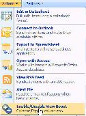
SharePoint View Boost : a free SharePoint View web part enables users to collapse and expand SharePoint columns in SharePoint Standard List Views. Collapse SharePoint columns on SharePoint list View; Expand SharePoint columns on SharePoint list View. SharePoint View Boost is a free tool to enhance user experience on SharePoint list View....
Category: Business & Finance / Business Finance
Publisher: SharePointBoost Co., Ltd, License: Freeware, Price: USD $0.00, File Size: 290.5 KB
Platform: Windows
Chips, the Copenhagen Image Processing System, is a general-purpose software package for remote sensing image processing and spatial data analysis with extensive support for NOAA AVHRR data.
Chips can be used both as a stand-alone system, as well as a powerful supplemental image-processing tool for GIS products like MapInfo™ and Arcview™.
Category: Multimedia & Design / Multimedia App's
Publisher: Chips Development Team, License: Freeware, Price: USD $0.00, File Size: 5.9 MB
Platform: Windows
SHPTRANS is a fast, high-precision NTv2 datum transformation and projection utility which reads and writes shapefiles. SHPTRANS is intended to complement, not replace, existing projection tools such as those within Arcview GIS 3.x and ArcGIS 8.x.SHPTRANS supports the following projections: UTM (tested for North America; intended to support all 60 zones in both hemispheres), MTM 3-degree...
Category: Utilities / Misc. Utilities
Publisher: Bruce Dodson, License: Shareware, Price: USD $0.00, File Size: 335.0 KB
Platform: Windows


