Free Downloads: Cad To Gis Conversion Free
AvisMap Gis Engine is the basic development platform for AvisMap Gis suites, which is a new generation component Gis development platform for Gis application developers.AvisMap Gis Engine Sample Projects is a bundle of sample of different projects that you can see how they work.
Category: Software Development / Misc. Programming
Publisher: AvisMap GIS Technologies, License: Shareware, Price: USD $0.00, File Size: 30.9 MB
Platform: Windows
 Shareware
AvisMap Gis Engine is a comprehensive SDK for the development of custom Gis applications and solutions. This SDK provides several ActiveX (OCX) controls which support Visual Basic, VB.NET, C#, Visual C++ and other ActiveX compatible programming languages, with Microsoft Visual Studio versions 6, 2003, 2005, and Express. Supports .NET via COM. While the SDK is excellent for desktop...
Category: Software Development / Components & Libraries
Publisher: AvisMap GIS Technologies, License: Shareware, Price: USD $1199.00, File Size: 57.8 MB
Platform: Windows
EV8 software was created for ArcGIS 8.
EV8 software was created for ArcGIS 8.x or 9.x. EV8 has : Clean and Build (Polylines to Polygons), Clean and Build: Polygons, Polylines, with intersection and dangle nodes, Automate Cad to Gis: rapidly convert Cad layers to shapefiles, Reverse Engineering: a method to control removal of gaps and slivers.
Category: Multimedia & Design / Multimedia App's
Publisher: Geokinetic Systems Inc., License: Shareware, Price: USD $98.00, File Size: 4.5 MB
Platform: Windows
AccuGlobe Desktop 2007,a standardized platform for delivering solutions to the global Gis community, offers even more of what you demand in a desktop Gis application. Combining user-friendly design with significantly increased functionality, AccuGlobe Desktop 2007 gives you greater freedom in analyzing spatial data. In addition to functioning as the core engine behind many...
Category: Multimedia & Design / Multimedia App's
Publisher: Digital Data Technologies, Inc., License: Freeware, Price: USD $0.00, File Size: 9.8 MB
Platform: Windows
AEGIS– the leading GIS software in UK secondary schools.
AEGIS– the leading Gis software in UK secondary schools.
One-off software purchase and Free upgrades – no subscriptions.
Brings industry-standard Gis maps to the classroom – Goad town plans, large-scale OS MasterMaps.
Try before you buy with the Free AEGIS Viewer download.
Free materials:...
Category: Home & Education / Miscellaneous
Publisher: AU Enterprises Limited, License: Shareware, Price: USD $0.00, File Size: 0
Platform: Windows
Visual3D Game Engine's All-in-One Development Tool enables live world building for C#/XNA-powered 3D games, multi-user training simulations, Gis/Cad visualizations, and online virtual worlds.
Visual3D accelerates development with built-in Terrain, Entity, Mission, Visual Scripting, Particle FX, IronPython, Conversation, Road, Decal, and Cinematic editing and ClickOnce...
Category: Software Development / Misc. Programming
Publisher: Realmware Corporation, License: Shareware, Price: USD $185.00, File Size: 356.1 MB
Platform: Windows
Shareware
Total Gis Converter is an affordable converter of Gis files. It converts AEP, GRD, ADF, E00, FLT, APR, SHP, DXF, BT, TOC, RT1, DEM, DLG, ECW, IMG, DGF, GML, SID, MIF, TAB, WOR, DNG, DDF, BIL, TIF, JPEG, TTKPS, TTKGP, TTKLS, LFT, PFT, and TFT files. The target formats are TIFF, PNG, JPEG, BMP. The program can scale your Gis files to optimize their size. Besides, it can slice...
Category: Multimedia & Design / Graphics Viewers
Publisher: Softplicity, License: Shareware, Price: USD $99.90, File Size: 7.6 MB
Platform: Windows
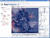
Develop high-performance mapping software with Gis.NET. This component uses state-of-the-art vector rendering technology to draw complicated maps of anywhere in the world. Supports desktops, PocketPC, Tablet PC, Smartphone, and Windows Mobile 5! Download a Free 30-day trial now and see just how fast Gis.NET can get your location-based software to market!...
Category: Software Development
Publisher: GeoFrameworks, LLC, License: Commercial, Price: USD $399.00, File Size: 10.9 MB
Platform: Windows
ArcGIS Explorer is a Free, downloadable Gis viewer that gives you an easy way to explore, visualize and share Gis information. ArcGIS Explorer adds value to any Gis because it helps you deliver your authoritative data to a broad audience.
The ArcGIS Explorer Desktop Current User setup is intended for users who do not have administrator access on their...
Category: Desktop Enhancements / Shell & Desktop Managers
Publisher: Environmental Systems Research Institute, Inc., License: Freeware, Price: USD $0.00, File Size: 94.0 MB
Platform: Windows
FlexGraphics - a vector graphics library for Borland Delphi (CAD, GIS, SCADA, VISIO)
FlexGraphics - is a set of components for creating vector graphics applications under Borland Delphi. FlexGraphics library can be used for creation of plots, drawings, electrical, concept and mnemonic charts as well as for creation of interactive plans with high level of detail for various facilities, buildings or their parts. FlexGraphics library can also be used for visualization of...
Category: Software Development
Publisher: FlexGraphics Software, Ltd., License: Shareware, Price: USD $299.00, File Size: 1.3 MB
Platform: Windows
P-CAD 2004 Libraries is part of the P-CAD 2004 Service Pack 4.
P-Cad 2004 Libraries is part of the P-Cad 2004 Service Pack 4. P-Cad 2004 Service Pack 4 (SP4) includes over 120 features and enhancements, further strengthening system performance and delivering increased stability. Any prior version of P-Cad 2004 can be upgraded directly to P-Cad 2004 SP4.
Category: Multimedia & Design / Image Editing
Publisher: Altium Limited, License: Freeware, Price: USD $0.00, File Size: 291.5 MB
Platform: Windows
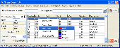
SuperGIS DataConvertor is a powerful data Conversion tool which is able to convert files between the common Gis formats to the SuperGeo self-defined formats. Therefore, your data can be used in SuperGeo series products, and also the SuperGeo self-defined formats can be used in other related platforms or systems. You will no longer need to worry the compatibility of Gis...
Category: Business & Finance / Calculators
Publisher: SuperGeo, License: Freeware, Price: USD $0.00, File Size: 3.2 MB
Platform: Windows
So that you can identify the Mapping & Gis product that best suits your needs, use this simple Product Comparison. There are four main product types that you can use to create a GPS data collection and maintenance system, or mobile Gis solution. Use the links below to select a product group, and compare the features of each product within that group.
Category: Internet / Communications
Publisher: Trimble Navigation Limited, License: Freeware, Price: USD $0.00, File Size: 2.7 MB
Platform: Windows
ArcGIS Explorer Desktop is a Free Gis viewer that gives you an easy way to explore, visualize, and share Gis information. ArcGIS Explorer adds value to any Gis because it helps you deliver your authoritative data to a broad audience.
Easy and intuitive to use it's easy for anyone to begin working with ArcGIS Explorer, with its intuitive and easy to...
Category: Home & Education / Miscellaneous
Publisher: Environmental Systems Research Institute, Inc., License: Freeware, Price: USD $0.00, File Size: 100.5 MB
Platform: Windows

Cad-COMPO is a combo of popular Cad plug-ins for Illustrator. Your Illustrator will turn into a professional Cad software! Contained plugins: BPT-Pro: Adobe Illustrator becomes a highly functional 2D-Cad program with 8 kinds and 19 different tools, all accessible through Illustrator tool box and a convenient information palette. You can easily draw...
Category: Multimedia & Design / Graphics Viewers
Publisher: Baby Universe, License: Shareware, Price: USD $150.00, File Size: 3.0 MB
Platform: Mac
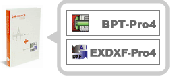
Cad-COMPO is a combo of popular Cad plug-ins for Illustrator. Your Illustrator will turn into a professional Cad software! Contained plugins: BPT-Pro: Adobe Illustrator becomes a highly functional 2D-Cad program with 8 kinds and 19 different tools, all accessible through Illustrator tool box and a convenient information palette. You can easily draw...
Category: Multimedia & Design / Graphics Viewers
Publisher: Baby Universe, License: Shareware, Price: USD $150.00, File Size: 3.0 MB
Platform: Windows
GeoSurveillance is software that combines spatial statistical routines with some basic Geographic Information Systems (Gis) functions to carry out retrospective and prospective statistical tests for the detection of geographic clustering. In this software, the focus is primarily on the spatial statistical analysis. Consequently, full Gis functionality is not provided. Gis...
Category: Home & Education / Miscellaneous
Publisher: NCGIA, License: Freeware, Price: USD $0.00, File Size: 2.4 MB
Platform: Windows
TerraSync is designed for fast and efficient field GIS data collection.
TerraSync is designed for fast and efficient field Gis data collection.Trimble® TerraSync™ software is designed for fast and efficient field Gis data collection and maintenance.
Integrating all the ways you collect data—with a GNSS handheld computer, laser rangefinder, or centimeter-grade equipment—it's a powerful system for the collection...
Category: Utilities / Misc. Utilities
Publisher: Trimble, License: Shareware, Price: USD $7000.00, File Size: 20.6 MB
Platform: Windows
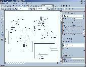
SceneDraw is an investigative tool, for police and private investigators that need to survey and diagram scenes for criminal and civil litigation. Scene Draw is not a Cad program nor is it a drawing program, it is a Data Driven Diagram software program for your reconstruction purposes. It is the complete data measurement collection software tool for Microsoft Windows 98 to XP. Whether...
Category: Multimedia & Design
Publisher: DeliCAD and AK Corp, License: Commercial, Price: USD $149.99, File Size: 2.6 MB
Platform: Windows
Freeware
VSceneGIS Desktop. (Gis) Analysis, Computing and Editing. Customer Project Development, Analysis, Computing and Gis editing. VSceneGIS Desktop applies the concept of Tree and Graph Topology to implement the data model in a Gis. Validation, Editing and Topological Behavior Export and import of data sources: PostgreSQL / PostGIS, Oracle, MySQL, SQLite / SpatiaLite,...
Category: Home & Education / Science
Publisher: vscenegis.com, License: Freeware, Price: USD $0.00, File Size: 118.4 MB
Platform: Windows
GeoMedia Viewer is an easy to use, Free Gis software application for desktop viewing and distribution of geospatial data.It allows an organization to maximize the value of its geospatial data by extending availability to novice users who wouldn’t otherwise have access because of the barriers of purchasing and learning how to use a full Gis software application.
Category: Multimedia & Design / Graphics Viewers
Publisher: Intergraph Corporation, License: Freeware, Price: USD $0.00, File Size: 115.0 MB
Platform: Windows

NewCAD.NET is industrial grade 3D component for C#,VB. NET .NewCAD.NET is a collection of 3D modeling, rendering light and shade, simulation and many other powerful features as one of 3D Cad components. It is convenient to apply to DotNet, can be used to Cad,CAM,CAE, scientific computing program development. NewCAD.NET 3D control in addition to support for basic Cad...
Category: Software Development
Publisher: RPW Sofware, License: Shareware, Price: USD $549.00, EUR455, File Size: 36.0 MB
Platform: Windows
The CANVAS 9 Advanced Gis Mapping Edition adds native support for Geographic Information System (Gis) data to Canvas. You can take measurements in geographic coordinates, import industry standard SHAPE and GeoTIFF files into unlimited numbers of automatically aligned overlapping layers and choose among the following options:2,104 Coordinate Reference Systems67 Operation Methods...
Category: Multimedia & Design / Multimedia App's
Publisher: ACD Systems, License: Shareware, Price: USD $999.95, File Size: 54.2 MB
Platform: Windows
TrueDTP is a professional and precise converter for every kind of CAD and DTP files.
TrueDTP is a professional and precise converter for every kind of Cad and DTP files. It enables DXF, DWG, DGN, DWF, HPGL and PDF files Conversion into many vector and raster formats.
Batch Conversion, path directory, Conversion on a scale of 1:1 and many other Conversion parameters make Conversion flexible and adjusted to the user’s needs....
Category: Multimedia & Design / Media Management
Publisher: dubiel&polok Ing. Buero GbR, License: Demo, Price: USD $0.00, File Size: 29.4 MB
Platform: Windows
Freeware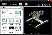
Mini Cad Viewer is a compact Free Cad viewer.It is designed to be easy to use, even for those with no prior Cad experience. It allows you to move and zoom in/out drawing view at will. It carries "thumbnail" view, which allows users quickly perform search on task folders. It supports DWG, DXF formats. It allows drawing file to be saved as image file.
Category: Multimedia & Design / Graphics Viewers
Publisher: zxt2007.com, License: Freeware, Price: USD $0.00, File Size: 8.6 MB
Platform: Windows