Free Downloads: Calculate Area Gps Coordinates
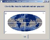
Have a Gps and a laptop? Use this to find your way. Make patterns or a trail to share with others. When the application starts, you may pick your Area of operations - be it North America, South America, Europe and Asia, or Australia. Your quadrant is determined by where you are in relation to the Equator and the Prime Meridian. Tracking of your position is automatically enabled...
Category: Home & Education / Miscellaneous
Publisher: LogicAll Solutions, LLC, License: Freeware, Price: USD $0.00, File Size: 4.6 MB
Platform: Windows

Gps Navigator with using a scanned maps and possibility to open a lot of maps together. - you can show a current Gps data (Speed, Direction, Longitude, Latitude, Time, Date, Height); - you can open any of scanned maps (in a "bmp" or "dib" format); - you can calibrate the scanned maps yourself by two calibration points only (left-top and right-bottom); - calibrations are...
Category: Home & Education
Publisher: Valeri Vlassov, License: Demo, Price: USD $19.00, File Size: 4.6 MB
Platform: Windows
 Demo
Demo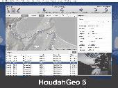
HoudahGeo is a photo geocoding and geotagging tool for Mac. Use HoudahGeo to attach Gps Coordinates and location names to your photos. HoudahGeo writes EXIF and XMP geotags to JPEG and RAW image files. This creates a permanent record of where a photo was taken. Just like a Gps-enabled camera. HoudahGeo is the only application that can both write future-proof...
Category: Multimedia & Design / Media Catalogers
Publisher: Houdah Software s.à r.l, License: Demo, Price: USD $39.00, File Size: 22.9 MB
Platform: Mac
Shareware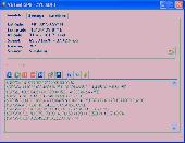
Virtual Gps is a Gps simulator software. You can use it to simulate a Gps receiver unit connected to your system. It's ideal when you need Gps input, but you have no signal or for development purposes. It supports various NMEA sentences, so it can be used with any Gps mapping software. You can use it using a null-modem cable connected to two physical serial...
Category: Internet / RSS & Web Blog Tools
Publisher: Zyl Soft, License: Shareware, Price: USD $39.99, File Size: 856.0 KB
Platform: Windows
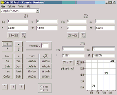
Data Doctor-Length and Area Convertor is a software utility that convert Area in to/from square meter inches yards centimeter acres feet and Calculate the price of your property. The calculator program with advanced features useful for real estate and rapidly converts Area from one unit to another Area of land.
Category: Business & Finance / Calculators
Publisher: Pro Data Doctor Pvt. Ltd., License: Freeware, Price: USD $0.00, File Size: 754.5 KB
Platform: Windows
The program accepts NMEA GPS sentences from most GPS receivers that connect to a USB port.
The program accepts NMEA Gps sentences from most Gps receivers that connect to a USB port.
The program can display satellite images of waypoint locations on the track plotter.
Is a free software for recording , monitoring and plotting Gps data, very useful and very easy.
Category: Home & Education / Miscellaneous
Publisher: Club Cruceros de La Paz A.C., License: Freeware, Price: USD $0.00, File Size: 10.6 MB
Platform: Windows
Golf GPS Devices toolbar for internet explorer.
Golf Gps Devices toolbar for internet explorer. Find golf Gps devices are great bargain prices. We have all the latest golf Gps devices for sale both new and used. Whether you're looking for the iGolf, Golf Buddy, GolfLogix, SonoCaddie, or SkyCaddie, you can find it here along with their accessories. We are always searching our networks to bring you the best deals on golf...
Category: Internet / Browsers
Publisher: Golf GPS Devices, License: Freeware, Price: USD $0.00, File Size: 1.1 MB
Platform: Windows
InnerSoft CAD is a add-on component for AutoCAD that allows you to Export the values of an Area/ Length property or Coordinates to an Excel Sheet.
Take measurements on AutoCAD for construction project budgets.
Create, open or save different libraries, which contain a series of AutoCAD drawings (*.dxf or *.dwg) organized by books.
Category: Multimedia & Design / Image Editing
Publisher: InnerSoft, License: Shareware, Price: USD $70.00, File Size: 2.9 MB
Platform: Windows

Gps Clock Software is a freeware utility that runs on any Windows NT/2000/XP/2003 workstation or server. The software polls time from a standard NMEA Gps time receiver connected to the host PC's serial port and optionally allows time to be synchronised on the host PC. The Gps clock utility polls GPRMC messages from a standard NMEA Gps time receiver. Information...
Category: Utilities
Publisher: ntp time server, License: Freeware, Price: USD $0.00, File Size: 1.9 MB
Platform: Windows
Ink usage is usually described by the printer manufactures as so many pages of A4 using 5% coverage. This software helps you Calculate ink, toner coverage on page before printing expressed as a percentage. So you will be able to estimate cost price of the page to a first approximation Main features: -color coverage measuring of the selected Area of the screen; -color coverage...
Category: Multimedia & Design
Publisher: AVPSoft, License: Shareware, Price: USD $99.00, File Size: 2.7 MB
Platform: Windows
With PixGPS it's easy to track the exact positioin where you took your photos.
With PixGPS it's easy to track the exact positioin where you took your photos. You need a Gps Receiver. All you need to do is to have the Gps turned on when you ake the photos. After your photo session, download the photos from your camera and the track file from the Gps. PixGPS will Calculate the position of each photo and insert this in the EXIF data of each...
Category: Multimedia & Design / Multimedia App's
Publisher: BR Software, License: Shareware, Price: USD $0.00, File Size: 1.5 MB
Platform: Windows
The leading GPS interface tool for Windows!
The leading Gps interface tool for Windows! Gps answers the significant world demand for accurate, viable and cost effective positioning systems. The Geographic Tracker delivers all of the power and utility of Gps to the Windows environment by allowing you to link a Gps receiver to other Microsoft Windows applications through standard Windows DDE messaging.
Category: Home & Education / Miscellaneous
Publisher: Bluemarble Geographics, License: Shareware, Price: USD $0.00, File Size: 0
Platform: Windows
Eye4Software Gps Mapping is a professional Gps mapping software tool that can be used in numerous applications. Use the software to load, view and edit your maps, display your position realtime and record all your movements.
The software will work with almost any Gps and can be used on any desktop, laptop or needbook computer running Windows XP or higher. The...
Category: Home & Education / Miscellaneous
Publisher: Eye4Software B.V., License: Shareware, Price: USD $130.61, File Size: 14.6 MB
Platform: Windows
Are you looking for a Gps tracking system or a Gps tracker but haven't found the one that is ideal for you? Then, look no further as our site has the best deals and information about the kind of Gps tracker you should buy.
Category: Security & Privacy / Other
Publisher: Top GPS Tracking Srl., License: Freeware, Price: USD $0.00, File Size: 722.0 KB
Platform: Windows
System ForAnn GPS allows tracking and location of your phone or phone of your friends / family.
System ForAnn Gps allows tracking and location of your phone or phone of your friends / family. You can watch real-time position of many phones simultaneously.
You can run it even on the cheapest phones with Bluetooth port, which allows the connection of a Gps device.
FAGPS program, in addition to transfer your current position, shows the basic parameters of the route...
Category: Home & Education / Miscellaneous
Publisher: ForAnn Inc., License: Freeware, Price: USD $0.00, File Size: 58.0 KB
Platform: Windows
Calc 3D is a collection of mathematical tools for highschool and university. The calculator can do statistics, best fits, function plotting, integration. It handles vectors, matrices, complex numbers, Coordinates, regular polygons and intersections. For objects ( like point, line, plane and sphere) distances and intersections are calculated. Cartesian, spherical and cylindrical...
Category: Home & Education
Publisher: Greuer Andreas, License: Freeware, Price: USD $0.00, File Size: 4.1 MB
Platform: Windows
Gps Software for Garmin. Download waypoints, routes and tracks from Garmin Gps. Upload waypoints, routes and tracks to Garmin Gps. Excel and Text files supported! This software is very easy to use!
Category: Utilities / System Utilities
Publisher: Oy Frontbase Ltd, License: Shareware, Price: USD $29.95, File Size: 1.4 MB
Platform: Windows
Immageo is all about making your photos as memorable as when you took them, by geotagging each photo. Immageo is a truly exciting example of what you can and should do with your photo collections. Its more than an album organiser, it embeds map locations and notes into your photos. And when you come to review them Immageo displays them all in context of when and where in the Immageo map,...
Category: Multimedia & Design / Media Catalogers
Publisher: Immageo, License: Freeware, Price: USD $0.00, File Size: 11.0 MB
Platform: Windows
This applications is the software for X-Guider, which is a multi-purpose handheld GPS receiver.
This applications is the software for X-Guider, which is a multi-purpose handheld Gps receiver.
This program will help you to set up a route, planning a trip and share it with your friends.
You can Calculate the distance between the points and even name the points.
Category: Home & Education / Miscellaneous
Publisher: unknown, License: Freeware, Price: USD $0.00, File Size: 6.1 MB
Platform: Windows
WinDowse is an extremely useful utility for obtaining necessary technical details about any window.
WinDowse is an extremely useful utility for obtaining necessary technical details about any window.Place a mouse cursor on a window, and WinDowse will show all parameters of the window and window class.
All parameters can be shown in hexadecimal, decimal or binary formats. Upon activation, Windowse displays a continous readout as the user moves the mouse about the screen -...
Category: Home & Education / Miscellaneous
Publisher: Greatis Software, License: Shareware, Price: USD $0.00, File Size: 639.7 KB
Platform: Windows
HsGpsDll is a Windows Dynamic Link Library which provides access to any NMEA-183 compliant Gps receiver via a serial communications port.
HsGpsDll is designed for use from Visual C, C++, Visual C Sharp .NET, Visual Basic or other programming languages, capable of calling DLL functions.
HsGpsDll allows a user application to easily read from a Gps device...
Category: Business & Finance / Business Finance
Publisher: Hillstone Software, License: Shareware, Price: USD $270.58, File Size: 700.6 KB
Platform: Windows
Portable GPS Navigation toolbar for Internet Explorer.
Portable Gps Navigation toolbar for Internet Explorer. Find portable Gps units for your car, truck or minvan from top name brands including Tom Tom, Magellan and Garmin. Discover the world of eBay and shop for portable Gps navigation systems directly from your browser toolbar.
Category: Internet / Browsers
Publisher: Portable GPS Navigation System, License: Freeware, Price: USD $0.00, File Size: 1.1 MB
Platform: Windows
The database tables contains geodata of the Federal Republic of Germany with geo referenced towns, municipalities, town quarters and other administrative units, postal codes, telephone preselections, nature areas, landscapes, climatic zones and official topographical cartographies. The data contain Coordinates for navigation and geo-coding, proximity searches and distance computations...
Category: Business & Finance / Database Management
Publisher: Killet GeoSoftware Ing.-GbR, License: Data Only, Price: USD $175.00, EUR150, File Size: 3.2 MB
Platform: Windows
Shareware
Gps SDK to add Gps and coordinate conversion functionality to your software and scripts). All NMEA0183 protocol versions are supported and can be filtered by NMEA sentence type and talker ID. Garmin USB PVT support. Information on Gps status can also be retrieved: Gps fix quality, satellites used in fix, satellites in view, satellite azimuth, elevation and signal...
Category: Software Development
Publisher: Eye4Software B.V., License: Shareware, Price: USD $99.00, EUR79, File Size: 2.3 MB
Platform: Windows
For the Area of the Federal Republic of Germany more than 2,7 million street Coordinates with a coverage of 100% are available. The geo data offered here are in high-precision quality and are present in different coordinate and reference systems. Street Coordinates or also called street section Coordinates are meaning the summary of several postal house addresses to...
Category: Business & Finance
Publisher: C. Killet Software Ing.-GbR, License: Demo, Price: USD $625.00, File Size: 68.4 KB
Platform: Unknown