Free Downloads: Circle Image Maps Programs
IconCur is a Professional Icon Cursor Editor, With an Extensive set of Tools to Manipulate the Images, Such as: Draw, Line, Circle, Rectangle, Fill, Rotate, Shift, Copy, Paste, Capture Image, Convert Image, Print, and More.
Icons Cursors can have the following Resolutions:
Sizes: 16x16, 24x24, 32x32, 48x48 Colors: 2, 16, 25
Category: Multimedia & Design / Digital Media Editors
Publisher: Gemacom.com, License: Freeware, Price: USD $0.00, File Size: 1.6 MB
Platform: Windows
Flash Circle TD is a game of skill available for free.
Flash Circle TD is a game of skill available for free. The aim of the game is to control the number of monsters in the maze at any one time by building towers which can stop them. To build a tower, simply click on its icon on the right of the screen then place it on the map by clicking again.
Towers can only be built on the raised ground around the paths. All towers can be...
Category: Games / Adventure & RPG
Publisher: NowStat, License: Freeware, Price: USD $0.00, File Size: 2.3 MB
Platform: Windows
SensAct -SENSORS CONVERSION Maps AND ACTUATORS COMMAND Maps
This software pack contents the sensors conversion Maps and the actuators command Maps like motorized throttles, gasoline injectors corrections, ...
It is mandatory to install it to select the type of sensor and actuators that are equiping the ECUs, because these Maps are no longer...
Category: Business & Finance / Applications
Publisher: Skynam, License: Freeware, Price: USD $0.00, File Size: 3.4 MB
Platform: Windows
PlanetGIS Explorer is a free viewer for PlanetGIS maps and GIS exchange files.
PlanetGIS Explorer is a free viewer for PlanetGIS Maps and GIS exchange files. PlanetGIS Explorer allows you to navigate through Maps, query map elements and view attribute information from linked database tables. Also PlanetGIS Explorer allows you to customize the appearance of Maps for purposes of creating hardcopy printouts, but does not allow you to save any changes to...
Category: Multimedia & Design / Graphics Viewers
Publisher: Planet GIS, License: Freeware, Price: USD $0.00, File Size: 5.4 MB
Platform: Windows
 Shareware
FPS Maps for WPF is a brand new component with a set of built-in country Maps. There are 15 Inbuilt Countries. FPS Maps for WPF contains samples of how to work with it and customize. Maps navigation can be performed via Navigation bar which supports Themes and mouse. You can pan with mouse or zoom in/out with mouse scroll. More options will be added in future...
Category: Software Development / Components & Libraries
Publisher: FPS Components, License: Shareware, Price: USD $199.00, File Size: 1.1 MB
Platform: Windows
With yalips maps you get 4 products in 1.
With yalips Maps you get 4 products in 1. You are more productive, more creative and perform better on your job when using visual software tools. With the resulting visualizations you can communicate more effectively and convincingly to your collegues, your boss, your customer or the chairman of the board. Therefore many companies spent a lot of money on such tools. Unfortunately, most...
Category: Business & Finance / Project Management
Publisher: yalips Software, License: Shareware, Price: USD $80.00, File Size: 29.6 MB
Platform: Windows
The Stakeholder Circle has been devised to offer a mechanism for assessing the relative influence of each of the key stakeholders and planning ways to engage with and manage their expectations/contributions. The benefit of using this tool is derived in part from the analysis process itself as well as from the ease with which the influence of key stakeholders on the project can be judged...
Category: Business & Finance / Small Business Tools
Publisher: Stakeholder Management Pty Ltd, License: Shareware, Price: USD $0.00, File Size: 190.4 KB
Platform: Windows
Shareware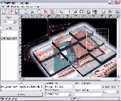
Create HTML Image Maps of any shape in just a few clicks! Map Designer automates the creation of HTML Image Maps, making it easy for designers and Web developers to specify hot-links and clickable areas within images. Map Designer helps Web developers specify rectangular, round or arbitrary-shape areas in a what-you-see-is-what-you-get mode. Specifying an active...
Category: Web Authoring / HTML Editors
Publisher: ForthTech Software, License: Shareware, Price: USD $23.00, File Size: 1.1 MB
Platform: Windows
Create Image Maps for your website with this easy-to-use tool from Multimedia Australia. Simply select the Image you want to use, choose a shape, then visually draw the Image map regions. The Image map coordinates can be copied to the clipboard for insertion into your favourite text editor.
Category: Web Authoring / Web Design Utilities
Publisher: Multimedia Australia, License: Shareware, Price: USD $24.95, File Size: 931.8 KB
Platform: Unknown
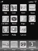
It looks like the iPhone, but it’s not ! However, it can do a few things that the iPhone can’t do. * Lock your screen and put it in your pocket without triggering unwanted actions * Launch commonly used Programs with the touch of your finger * Start Programs such as Pocket Outlook, Internet Explorer, MSN Messenger, Pocket Excel and Pocket Word and Skype. * Fully user...
Category: Utilities
Publisher: Mobile at Work, License: Shareware, Price: USD $12.95, File Size: 4.6 MB
Platform: Windows
TopoGun is a stand-alone resurfacing, and maps baking application.
TopoGun is a stand-alone resurfacing, and Maps baking application. The resurfacing functions in TopoGun will help you modify and/or recreate the edgeflow of your digital 3D models.
The Maps baking functions, will help you bake various types of texture Maps from your high resolution 3D models and then allow you to apply them to your newly created optimized...
Category: Multimedia & Design / Animation
Publisher: SC PIXELMACHINE SRL, License: Shareware, Price: USD $100.00, File Size: 55.5 MB
Platform: Windows
iMapBuilder Interactive Flash Map Builder creates interactive flash map and Image Maps, with clickable regions, editable points and icons. You can easily embed online Maps to your website for showing facts and figures interactively. It is easy to use and requires no coding or flash knowledge.
Map templates gallery are included for easy editing and instant usage...
Category: Multimedia & Design / Animation
Publisher: WebUnion Media Ltd., License: Shareware, Price: USD $0.00, File Size: 0
Platform: Windows
The „Spline Calculator“ “ software calculates inspection measurements of splines with straight-sided flanks and of involute gearing, both spur and helical.
It is very easy to enter gear parameters into the main menu. As soon as the software has been given enough information, all remaining parameters are calculated automatically. It is, for example, sufficient to...
Category: Business & Finance / Calculators
Publisher: FRENCO GmbH, License: Demo, Price: USD $0.00, File Size: 821.8 KB
Platform: Windows
You can create a backup of your maps with JaVaWa GMTK and restore these (e.
You can create a backup of your Maps with JaVaWa GMTK and restore these (e.g. on another computer) including unlock codes. Re-installing Maps is unnecessary.
Migration of your Garmin Maps from and old computer to a new one is straightforward with this application.
Category: Utilities / Backup
Publisher: JaVaWa GPS-tools, License: Shareware, Price: USD $0.00, File Size: 5.4 MB
Platform: Windows
TyphoonWand allows you launch any program or file, simply by moving your mouse in a specific pattern. For example, you could launch the Calculator by moving your mouse in a clock-wise Circle, or move in a counter-clock-wise Circle to launch Notepad. No keys or buttons need to be pressed, just move your mouse and TyphoonWand will automatically recognize your movements, and perform...
Category: Utilities / Launchers
Publisher: TyphoonTools, License: Freeware, Price: USD $0.00, File Size: 3.6 MB
Platform: Windows
Live Satellite Maps or Google maps is a web server mapping applications.
Live Satellite Maps or Google Maps is a web server mapping applications.Provides scrolling map images and satellite photos around the earth and even the route between different places.Since 6 October 2005, live satellite Maps is part of local Google.Google live satellite Map provides the ability to zoom in or zoom out to show the map.The user can control the map with your...
Category: Home & Education / Science
Publisher: www.satelliteview-of-my-house.com, License: Freeware, Price: USD $0.00, File Size: 643.0 KB
Platform: Windows
OziExplorer3D is an impeccable application for viewing map images in 3D, along with the options of rotating it in every possible direction, zoom in/out and lots more. The application actually creates grid of heights using the height data that has been obtained and writes it to a file, along with the other required information, loads the file and the map Image or the Image section...
Category: Multimedia & Design / Multimedia App's
Publisher: Des Newman, License: Shareware, Price: USD $30.00, File Size: 1.9 MB
Platform: Windows
Kid’s Abacus is a small and simple educational game.
Kid’s Abacus is a small and simple educational game. It is specifically designed for small kids of 2-5 year age group who want to learn counting. Kid’s Abacus has a simple interface with simple images which I think is better for small kids’ eyes of this age group. With Kid’s Abacus your kids can easily learn math counting, because it is a visual game and it teaches...
Category: Games / Kids
Publisher: Caltrox Educational Software, License: Freeware, Price: USD $0.00, File Size: 0
Platform: Windows
The Fugawi ADRG Viewer is licensed without charge to examine ADRG maps.
The Fugawi ADRG Viewer is licensed without charge to examine ADRG Maps.
This viewer has been tested with the ADRG CDs currently licensed by Natural Resources Canada.
An advantage of the ADRG format is that a single Image frequently includes multiple paper charts that have been stitched together to form a single ADRG Image.
Category: Multimedia & Design / Multimedia App's
Publisher: Northport Systems Inc, License: Freeware, Price: USD $0.00, File Size: 1.1 MB
Platform: Windows
Middle-School (grades 5 through 9) math program written to provide skills in context.
Middle-School (grades 5 through 9) math program written to provide skills in context. Given the radius or diameter of a Circle, and the measure of a central angle, students must find the following: the area of the Circle; the area of the sector defined by the central angle; the circumference of the Circle; the length of the arc defined by the central angle. All answers are...
Category: Home & Education / Miscellaneous
Publisher: Polymath Love, License: Freeware, Price: USD $0.00, File Size: 200.0 KB
Platform: Unknown
Gismaps Viewer is a GIS viewer that can be used for geospatial analysis and map production.
Gismaps Viewer is a GIS viewer that can be used for geospatial analysis and map production.
The main features are:
- read Shape files using geographic coordinate system
- view satellite images (MrSid, jpeg, bmp and tiff file formats)
- generate thematic Maps, queries and labels
- export do Google Earth KML (shp2kml)
- configure map colors and...
Category: Multimedia & Design / Graphics Viewers
Publisher: Gismaps Sistemas Ltda., License: Freeware, Price: USD $0.00, File Size: 10.2 MB
Platform: Windows
Nokia Maps 3D browser plugin is a free mapping product and service by Nokia for its mobile phones and for internet browsers. Nokia Maps includes voice guided navigation for both pedestrians and drivers for 74 countries in 46 different languages and there are Maps for over 180 countries.
See the world in high-resolution 3D. Everything from the sky to the street. Plan...
Category: Internet / Browser Accessories
Publisher: Nokia, License: Freeware, Price: USD $0.00, File Size: 9.8 MB
Platform: Windows
From the Sacre Coeur to the Arc de Triomphe, your holiday to Paris starts from the moment you open your guide, plus you get Paris Maps and transport Maps.
Discover the best cafe terraces, unmissable museums and galleries, loveliest parks and gardens, best areas to shop or browse, unforgettable shows and live music venues, most fun places for children, and best restaurants to...
Category: Internet / Communications
Publisher: Mobile Systems, License: Shareware, Price: USD $9.80, File Size: 0
Platform: Windows
Trellian Image Mapper is the quickest way to create image mapped images for your website.
Trellian Image Mapper is the quickest way to create Image mapped images for your website. Full support for hyperlinked rectangles, circles and even polygon regions is provided and you can import all your current Image Maps. After you have created your Image map, Trellian Image Mapper will generate the required HTML code ready to be pasted directly into...
Category: Multimedia & Design / Multimedia App's
Publisher: Trellian, License: Shareware, Price: USD $19.95, File Size: 1.8 MB
Platform: Windows
MapCreator combines a cartography and a graphics programme.
MapCreator combines a cartography and a graphics programme. The software is designed to create Maps and animated Maps of the highest quality as often required for presentations. For example, this could be Maps needed for a travel presentation. But also in
Category: Multimedia & Design
Publisher: primap.com, License: Freeware, Price: USD $0.00, File Size: 103.3 MB
Platform: Windows, Vista