Free Downloads: Climate Map
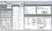
Climate charts with wave height, direction and period.
Climate charts with wave height, direction and period. Climate is by definition the synthesis of weather conditions in a given area, characterized by long-term statistics (mean values, standard deviations, etc.) of the meteorological elements in that area.
According to the World Meteorological Organization (WMO) it should preferably be based on 30 years of data. To...
Category: Business & Finance / Applications
Publisher: KNMI, License: Freeware, Price: USD $0.00, File Size: 17.7 MB
Platform: Windows
Cool Flash Map Maker is a powerful Flash Map software for developing interactive flash mapping solutions and products for Real Estate, Spacial Statistics, Business Locator Applications, Vector USA Map,World Map, Germany Map,ASIA Map, Canada Map, Europe Map, Australia Map, Austria Map, Africa Map, UK Map, South...
Category: Multimedia & Design / Multimedia App's
Publisher: Go2Share, License: Shareware, Price: USD $29.95, File Size: 17.9 MB
Platform: Windows
Climate Change: Energy & Environment software and VLE SCORM package provides a balanced cross-curricular view of the issues that are of concern to us all, encourages thought about life style choices and suggests ways in which we can all do our bit to conserve the Earths energy resources.
Perfect for whole class whiteboard teaching and as an individual study aid. This resource...
Category: Home & Education / Science
Publisher: Focus Educational Software, License: Shareware, Price: USD $47.00, File Size: 172.4 MB
Platform: Windows
This educational software is originally deviced for use in high schools as part of the french curriculum in Life and Earth Sciences.
It realises Climate simulations given user-chosen parameters.
Through a friendly interface, the user chooses the length of the simulation (from 100 years to a few billions years) and the initial conditions, and tests the influence...
Category: Home & Education / Miscellaneous
Publisher: Camille Risi et Nicolas Gama, License: Freeware, Price: USD $0.00, File Size: 7.8 MB
Platform: Windows
The Estimate Missing Climate Data Tool (EMCD) stands as a comprehensive solution designed to address and fill gaps in Climate data, ensuring a robust and accurate dataset for comprehensive analysis. EMCD incorporates advanced techniques to overcome missing values, utilizing neighboring stations and historical records of the target station. The tool employs a diverse set of...
Category: Home & Education / Science
Publisher: AgriMetSoft, License: Shareware, Price: USD $99.00, File Size: 11.6 MB
Platform: Windows
The TQC Ideal Finish Analysis Software is the most advanced coating Climate, coating cure and coating thickness monitoring software package available today. With two user levels Ideal Finish Analysis offers user friendly reporting functions for standard production work as well as advanced calculations for in depth analysis of the Climate parameters prior to coating, the curing...
Category: Business & Finance / MS Office Addons
Publisher: TQC, License: Shareware, Price: USD $0.00, File Size: 0
Platform: Windows
It is possible to define one's own climate zones and to store the corresponding data.
It is possible to define one's own Climate zones and to store the corresponding data.
Exchange of sensible heat and cold are calculated, for rotary heat exchangers also latente energy, recovery of moisture and dehumification.
You can make economy calculations for:
- recuperative Plate heat exchangers
- regenerative Rotary heat exchangers, designed as...
Category: Business & Finance / Calculators
Publisher: Klingenburg GmbH, License: Shareware, Price: USD $0.00, File Size: 0
Platform: Windows
Rittal Therm is a calculation program for the climate control of enclosures.
Rittal Therm is a calculation program for the Climate control of enclosures. All electric and electronic components lose a certain amount of energy in the form of heat discharged into the environment. As more and more components are crammed into smaller and smaller spaces nowadays, the heat produced rapidly reaches values that are harmful to the electronic components and can severely...
Category: Business & Finance / Calculators
Publisher: Rittal, License: Shareware, Price: USD $30.00, File Size: 119.4 MB
Platform: Unknown
Climate Control Sizing Software is a software for either cooling or heating of electrical/electronic enclosures.
Features:
-direct input of component losses or choose from a pre-loaded data base
-Select indoor, outdoor conditions with both Solar Loading and insulation installed
-View cooling options from drop down selection of filtered fans, air...
Category: Home & Education / Miscellaneous
Publisher: Hammond Manufacturing Ltd., License: Freeware, Price: USD $0.00, File Size: 966 B
Platform: Windows
The quick and easy design program for grid-connected photovoltaic systems.
The quick and easy design program for grid-connected photovoltaic systems.
PVSOL Express is the ideal choice for sales staff and trainee technicians who need a reliable tool to design grid-connected systems quickly and precisely.Choose from over 650 Climate data locations throughout Europe. Customers from outside Europe are sent Climate data for the country they are...
Category: Business & Finance / Applications
Publisher: Dr. Ing. Gerhard Valentin, License: Shareware, Price: USD $0.00, File Size: 0
Platform: Windows
The Home Energy Analysis System enables you to record electricity, gas and water bills. Also enter your own meter readings to produce a detailed database. A range of graphs is produced showing cost, consumption and CO2 emissions by week, month and year. The effect of alternative energy sources can be seen. Energy use can also be graphed against local Climate factors. See the effects of...
Category: Home & Education
Publisher: Marillack Pty Ltd, License: Shareware, Price: USD $19.95, File Size: 3.4 MB
Platform: Windows
Remere's Map Editor is a map editor for the OpenTibia Project which was created by Remere.
Remere's Map Editor is a Map editor for the OpenTibia Project which was created by Remere.
Remere's Map Editor is a Map editor coded in C to be used with OpenTibia. It supports many advanced features such as autobordering and placing of composite objects. Runs under both Linux and Windows using wxWidgets and OpenGL.
Category: Games / Tools & Editors
Publisher: Remere, License: Shareware, Price: USD $0.00, File Size: 4.2 MB
Platform: Windows
 Freeware
An interactive Flash USA Map with all the features you need for your web site or project. This is the ideal solution for dealer maps, real-estate listings, or visualizing state statistics. Nearly every aspect of the Map is customizable. However, unlike competing products, our Map is very simple to install and edit. Just upload XML and SWF files and embed.
Category: Internet / Flash Tools
Publisher: http://www.flashusamap.com/trial/flashus, License: Freeware, Price: USD $0.00, File Size: 93.8 KB
Platform: Unknown
Map of Africa is one of the many maps created for GPS TrackMaker.
Map of Africa is one of the many maps created for GPS TrackMaker. You are able to download the installation package from the TrackMaker website. In order to preview the contents of this package, you need to install GPS TrackMaker.
Using the above mentioned application, you will be able to see the Map of Africa. Just click on the "Open Temporary...
Category: Home & Education / Miscellaneous
Publisher: Geo Studio Technology, License: Freeware, Price: USD $0.00, File Size: 18.3 MB
Platform: Windows
Program shows you an actual X3 sector-map, with detailed information about most in-game objects.
Program shows you an actual X3 sector-Map, with detailed information about most in-game objects. The Map is based on a log-file that is created with an in-game script (by Andrei[<>Ace]). If you just want to view the standard Map (or if you don’t have the game) the program will work with the included default Map, which was created with an English X3 game...
Category: Games / Misc. Games
Publisher: SUU Design, License: Freeware, Price: USD $0.00, File Size: 1.4 MB
Platform: Windows
New Zealand Map Reference Converter (NZMapConv) is software that LINZ provides to convert Map references between the old NZMS260 Map series and the new NZTopo50 Map series.NZMapConv is a Windows programme designed to convert individual coordinates entered manually.
Category: Multimedia & Design / Media Management
Publisher: Land Information New Zealand, License: Freeware, Price: USD $0.00, File Size: 2.4 MB
Platform: Windows
When the XMAP software is communicating with an XEDE via the comms cable each Map will show, at the top of the Map display, an RPM and load value (x and y axis for the Map) in real time. Also in each Map a yellow highlighted block will show the current position within the Map. Beside the real-time display on each Map are the undo and redo buttons which...
Category: Home & Education / Miscellaneous
Publisher: ChipTorque, License: Freeware, Price: USD $0.00, File Size: 1.7 MB
Platform: Windows
Sig Panama Has :
Digital maps of Panama, Digital Map of Panama-City, digital Map of Taboga, digital Map of Bocas del Toro, digital Map of Colon and Free Zone, digital Map of Contadora Island, digital Map of Coronado, Panama, Zona Libre, Map of Panama, Map of Panama City, Map of Colon, Map of Zona Libre, Map of...
Category: Internet / Misc. Plugins
Publisher: DP Imperial, LLC., License: Freeware, Price: USD $0.00, File Size: 44.9 MB
Platform: Windows
Garden Planner is a great software , all you need is to :
- Upload a photo of your garden
- Define Climate and soil conditions
- Select your plants
- Create visualisations for 4 seasons
You can chose from a wide variaty of plants such as Long White, Radnor, Japanese Andromeda Debutante and Red Mill , Allegro and such much more.
Category: Home & Education / Miscellaneous
Publisher: GardenPuzzle, License: Shareware, Price: USD $19.00, File Size: 1019.3 KB
Platform: Windows
Freeware
Arm Map Explorer recreates all the functionalities of Google Maps on your desktop while expanding them with new extras. Map Explorer lets you locate and view any place on the planet using dynamic interactive maps. These maps are draggable, which means there is no need for you to click and wait for graphics to reload each time you want to view adjacent parts of a Map....
Category: Internet / Flash Tools
Publisher: ArmCode, License: Freeware, Price: USD $0.00, File Size: 5.5 MB
Platform: Windows
Time Zones Map is the flash world time Map featuring the time peculiarities of more then 50 cities all over the world. Its eye-catching but still pleasant design, varied functions and multiple application abilities combine everything the ultra-modern flash world time Map must have. You can put our Time Zone Map either on one of your website?s pages or put a banner,...
Category: Web Authoring / Flash Utilities
Publisher: USFlashMap.com, License: Shareware, Price: USD $249.00, File Size: 45.0 KB
Platform: Windows, Mac, Linux, Unix, MS-DOS, AS, 400
The easiest way to get a paper map with MapPlot is the Plot Map menu.
The easiest way to get a paper Map with MapPlot is the Plot Map menu.
On the following dialog, simply paper size and scale have to be chosen - the result is ready to be printed directly, edited (e.g. for additional entries) or to be displayed as a preview.
Category: Utilities / Misc. Utilities
Publisher: AGIS GmbH, License: Freeware, Price: USD $0.00, File Size: 5.4 MB
Platform: Windows
With LocationWizard you can easily map multiple addresses on a map.
With LocationWizard you can easily Map multiple addresses on a Map. LocationWizard helps you visualize the locations of customers or shops. LocationWizard supports the following database formats: MySQL, PostgreSQL, SQLite, FireBird, InterBase, Microsoft Access, Microsoft Excel and CSV.
Category: Business & Finance / Business Finance
Publisher: Location Wizard team, License: Shareware, Price: USD $85.00, File Size: 7.3 MB
Platform: Windows
OziExplorer3D is an impeccable application for viewing Map images in 3D, along with the options of rotating it in every possible direction, zoom in/out and lots more. The application actually creates grid of heights using the height data that has been obtained and writes it to a file, along with the other required information, loads the file and the Map image or the image section...
Category: Multimedia & Design / Multimedia App's
Publisher: Des Newman, License: Shareware, Price: USD $30.00, File Size: 1.9 MB
Platform: Windows
Tibia Map Viewer is a useful freeware and Open Source application that allows you to view maps generated by Tibia game client and create or edit Map symbols.
You can view the entire Tibia Map you have explored, both upper and lower levels of the Map, with zoom ratio from 25 to 400 percents. It also allows you to export to BMP file.
Category: Games / Tools & Editors
Publisher: Yury Sidorov, License: Freeware, Price: USD $0.00, File Size: 193.7 KB
Platform: Windows