Free Downloads: Color Maps Excel
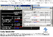
TableBuilder is designed to export AutoCAD table and the table drawn with lines and text in AutoCAD (LT)/MicroStation to Excel. Also you can convert the table drawn with lines and text to AutoCAD native table. == http://www.cadig.com == ======== Key Features ======== .Export the table drawn with lines and text in AutoCAD (LT) / MicroStation to Excel. .Export the...
Category: Multimedia & Design
Publisher: cadig.com, License: Shareware, Price: USD $99.00, File Size: 1.6 MB
Platform: Windows
SensAct -SENSORS CONVERSION Maps AND ACTUATORS COMMAND Maps
This software pack contents the sensors conversion Maps and the actuators command Maps like motorized throttles, gasoline injectors corrections, ...
It is mandatory to install it to select the type of sensor and actuators that are equiping the ECUs, because these Maps are no longer...
Category: Business & Finance / Applications
Publisher: Skynam, License: Freeware, Price: USD $0.00, File Size: 3.4 MB
Platform: Windows
ShaderMap™ converts existing maps to different formats.
ShaderMap™ converts existing Maps to different formats. Below is a list of conversions currently supported by ShaderMap Pro:
Category: Utilities / Misc. Utilities
- Diffuse & Color Map : Height, AO, DUDV, Normal, & Specular
- Displacement & Height : Normal, AO, DUDV, & Specular
- Dot3 Normal Maps : Height, Normal, AO, DUDV, & Specular
Features:
Publisher: Rendering Systems Inc., License: Shareware, Price: USD $19.95, File Size: 27.6 MB
Platform: Windows
PlanetGIS Explorer is a free viewer for PlanetGIS maps and GIS exchange files.
PlanetGIS Explorer is a free viewer for PlanetGIS Maps and GIS exchange files. PlanetGIS Explorer allows you to navigate through Maps, query map elements and view attribute information from linked database tables. Also PlanetGIS Explorer allows you to customize the appearance of Maps for purposes of creating hardcopy printouts, but does not allow you to save any changes to...
Category: Multimedia & Design / Graphics Viewers
Publisher: Planet GIS, License: Freeware, Price: USD $0.00, File Size: 5.4 MB
Platform: Windows
 Shareware
FPS Maps for WPF is a brand new component with a set of built-in country Maps. There are 15 Inbuilt Countries. FPS Maps for WPF contains samples of how to work with it and customize. Maps navigation can be performed via Navigation bar which supports Themes and mouse. You can pan with mouse or zoom in/out with mouse scroll. More options will be added in future...
Category: Software Development / Components & Libraries
Publisher: FPS Components, License: Shareware, Price: USD $199.00, File Size: 1.1 MB
Platform: Windows
With yalips maps you get 4 products in 1.
With yalips Maps you get 4 products in 1. You are more productive, more creative and perform better on your job when using visual software tools. With the resulting visualizations you can communicate more effectively and convincingly to your collegues, your boss, your customer or the chairman of the board. Therefore many companies spent a lot of money on such tools. Unfortunately, most...
Category: Business & Finance / Project Management
Publisher: yalips Software, License: Shareware, Price: USD $80.00, File Size: 29.6 MB
Platform: Windows
OfficeReports Link links data from Excel ranges to native PowerPoint tables, charts and shapes. This can be done in such a way, so backgroundcolors from Excel cells are shown as logos and icons in PowerPoint. The Excel ranges can have a variable number of rows and/or columns, and OfficeReports is integrated with Excels and PowerPoints Macro engine. Microsoft Office...
Category: Business & Finance / Business Finance
Publisher: OfficeReports, License: Shareware, Price: USD $39.00, File Size: 609.0 KB
Platform: Windows
Compare Spreadsheets for Excel is a powerful and convenient tool for comparison of files in Microsoft Excel. How it’s work: 1. Start the program (there is even no need to open the tables to be compared). 2. Specify the tables or ranges of cells to be compared. 3. Choose aligning parameters for comparison (by rows or columns). 4. Specify what you would like to compare:...
Category: Business & Finance
Publisher: Office Assistance LLC, License: Shareware, Price: USD $59.00, File Size: 8.4 MB
Platform: Windows
ExcelPacman is a software tool designed for MS Excel.
ExcelPacman is a software tool designed for MS Excel. It reproduces on MS Excel the video game named "Pacman". All actions are expressed by rewriting of a cell background Color. Each one of cells as a dot, and move it by make cell's background Color high-speed rewriting. The window zoom is 10%, so the each cell can not be seen. But it is A CELL.
Category: Games / Arcade
Publisher: Nobuya Chikada, License: Freeware, Price: USD $0.00, File Size: 290.7 KB
Platform: Windows
TopoGun is a stand-alone resurfacing, and maps baking application.
TopoGun is a stand-alone resurfacing, and Maps baking application. The resurfacing functions in TopoGun will help you modify and/or recreate the edgeflow of your digital 3D models.
The Maps baking functions, will help you bake various types of texture Maps from your high resolution 3D models and then allow you to apply them to your newly created optimized...
Category: Multimedia & Design / Animation
Publisher: SC PIXELMACHINE SRL, License: Shareware, Price: USD $100.00, File Size: 55.5 MB
Platform: Windows
You can create a backup of your maps with JaVaWa GMTK and restore these (e.
You can create a backup of your Maps with JaVaWa GMTK and restore these (e.g. on another computer) including unlock codes. Re-installing Maps is unnecessary.
Migration of your Garmin Maps from and old computer to a new one is straightforward with this application.
Category: Utilities / Backup
Publisher: JaVaWa GPS-tools, License: Shareware, Price: USD $0.00, File Size: 5.4 MB
Platform: Windows
Powerful, easy to use tool syncs data and tables between databases.
Powerful, easy to use tool syncs data and tables between databases. Converts between different database types Move from MS SQL, MS SQL Sever Express, MS Access, MySQL, Excel, Paradox, Foxpro, DBase to mySQL, MS SQL, MS SQL Express or MS Access. Wizard interface is simplifies the task of moving and managing data.Creates table and indexes automatically. You can clone and design new tables....
Category: Business & Finance / Database Management
Publisher: TheDevShop Ltd., License: Shareware, Price: USD $39.95, File Size: 5.3 MB
Platform: Windows
Imports gridded data into Microsoft MapPoint, to produce attractive data Maps that resemble contour Maps.
Can handle imperfect data, holes, re-gridding, etc. Can be used to import such attributes as pollution data, seismic hazard, geological information, customer/population distribution, etc.
Data can be interpolated to different grid spacings if required. Polygon...
Category: Business & Finance / Applications
Publisher: Winwaed Software Technology, License: Shareware, Price: USD $75.00, File Size: 2.2 MB
Platform: Windows
Live Satellite Maps or Google maps is a web server mapping applications.
Live Satellite Maps or Google Maps is a web server mapping applications.Provides scrolling map images and satellite photos around the earth and even the route between different places.Since 6 October 2005, live satellite Maps is part of local Google.Google live satellite Map provides the ability to zoom in or zoom out to show the map.The user can control the map with your...
Category: Home & Education / Science
Publisher: www.satelliteview-of-my-house.com, License: Freeware, Price: USD $0.00, File Size: 643.0 KB
Platform: Windows
Best Excel Repair is a tool which helps to fix the corrupt excel files.
Best Excel Repair is a tool which helps to fix the corrupt Excel files. The program recovers cell data, such as text and numbers, as well as formulas and formatting. At the same time, it restores structure of multi-sheet files. This application supports all modern file versions, including Excel 2007, Excel 2003, Excel XP, Excel 2000, Excel 97,...
Category: Utilities / Backup
Publisher: Best Reconver,Inc, License: Shareware, Price: USD $44.95, File Size: 533.0 KB
Platform: Windows
Effectbank is a free software download from Illusions.
Effectbank is a free software download from Illusions.hu.
Effectbank is a free software that lets you add mind exploding image effects to your photos with a few simple clicks.
Effect types
Greyscale effects
Dithering
Color effects
Color conversions
Color Maps
Morphological effects
Fluid effects
Histogram...
Category: Multimedia & Design / Image Editing
Publisher: illusions.hu, License: Freeware, Price: USD $0.00, File Size: 1.6 MB
Platform: Windows
MagicMap is a software for extracting color layers from scanned images - topo maps and logos. .
MagicMap is a software for extracting color layers from scanned images - topo maps and logos.
Category: Multimedia & Design / Image Editing
Publisher: Two Pilots, License: Demo, Price: USD $29.95, File Size: 3.4 MB
Platform: Windows
Excel Automated Grader is an automated grader/marker for use by instructors in Microsoft Excel and Microsoft Office application courses. Excel Grader performs static analysis on Microsoft Excel workbooks. The program compares a student workbook with the instructor's correct version of the workbook. The student workbook is marked and a grade report is embedded....
Category: Home & Education
Publisher: OfficeGrader.com, License: Shareware, Price: USD $69.95, File Size: 860.2 KB
Platform: Windows
Nokia Maps 3D browser plugin is a free mapping product and service by Nokia for its mobile phones and for internet browsers. Nokia Maps includes voice guided navigation for both pedestrians and drivers for 74 countries in 46 different languages and there are Maps for over 180 countries.
See the world in high-resolution 3D. Everything from the sky to the street. Plan...
Category: Internet / Browser Accessories
Publisher: Nokia, License: Freeware, Price: USD $0.00, File Size: 9.8 MB
Platform: Windows
From the Sacre Coeur to the Arc de Triomphe, your holiday to Paris starts from the moment you open your guide, plus you get Paris Maps and transport Maps.
Discover the best cafe terraces, unmissable museums and galleries, loveliest parks and gardens, best areas to shop or browse, unforgettable shows and live music venues, most fun places for children, and best restaurants to...
Category: Internet / Communications
Publisher: Mobile Systems, License: Shareware, Price: USD $9.80, File Size: 0
Platform: Windows
Conditionally select many cells at once in MS Excel.
Conditionally select many cells at once in MS Excel. Select all, some, only empty, non-empty, odd, even, Color, same, small, large, equal, not equal, greater than, less than, etc. Excel 2000 or higher required.
Category: Business & Finance / MS Office Addons
Publisher: Sobolsoft, License: Shareware, Price: USD $19.99, File Size: 890.9 KB
Platform: Windows
PowerBuilder library (component) for export to Excel format any data with cell's formatting (Color, font, data types, etc.). You can add multiple worksheets into a workbook. Component's source code can be easily integrated into your PB application. * Written completely in PowerBuilder * Cross-platform. You can use the same code without any changes on any platform supported by...
Category: Software Development
Publisher: Desta Ltd., License: Demo, Price: USD $24.95, File Size: 398.2 KB
Platform: Windows
Shareware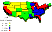
PolyMap is a desktop mapping program that lets you use your own data to customize the Maps supplied with the program. Use the built-in spreadsheet to enter data or paste it from other Windows applications. Alternatively, you can use the import feature to bring in data from external spreadsheets, text, or database files. The Map Presentation Wizard gives you a step-by-step process to...
Category: Web Authoring / Site Mapping Tools
Publisher: Ambiente Informatica Ltda, License: Shareware, Price: USD $89.95, BRL389, File Size: 7.4 MB
Platform: Windows
advanced listbox supports font and color.
Provides support for listbox containing checkboxes as well as the same control that is built into Microsoft Word and Excel. In this control, each items font, Color, enabled andchecked state can be individually modified. The control also support 3D look, picture items and custom check mark. This package includes samples written in Visual Basic 3.0, 4.0 and 5.0. CheckListBox is also...
Category: Software Development / ActiveX
Publisher: Zeal SoftStudio, License: Freeware, Price: USD $0.00, File Size: 282.0 KB
Platform: Unknown
When you are looking for a powerful tool to satisfy various needs regarding vectors, raster and satellite imagery, you will find ILWIS Academic an efficient application. The program comes with such useful features as points to create Maps, lines for segment Maps, closed area segments for polygon Maps, spatial operations for raster Maps and so on. Whilst using images...
Category: Home & Education / Miscellaneous
Publisher: ITC, License: Freeware, Price: USD $0.00, File Size: 19.4 MB
Platform: Unknown