Free Downloads: Convert Cvs To Shapefile
CAD2Shape converts AutoCAD DXF/DWG drawing files to ESRI shapefile format.
CAD2Shape converts AutoCAD DXF/DWG drawing files to ESRI Shapefile format. It can translate holes / islands /donuts from originating CAD drawing to Polygon Shapefile. It can translate 3D surfaces to MultiPatch Shapefile types.
The new version has MPolygon support and has additional XDATA types.
Category: Multimedia & Design / Image Editing
Publisher: Guthrie CAD/GIS Software Pty Ltd., License: Shareware, Price: USD $224.91, File Size: 10.7 MB
Platform: Windows
Free fast CVS client for Windows.
Free fast Cvs client for Windows. It has many small features that makes working with Cvs less painful. The UI is very thought through and everything is only a click away. Instead of focusing on making UI to cover all existing Cvs functions, I have focused
Category: Software Development / Misc. Programming
Publisher: fiffigt.com, License: Freeware, Price: USD $0.00, File Size: 576.0 KB
Platform: Windows
JD Rx Converter allows users to easily Convert Shapefile prescriptions into a format that is readable by the GreenStar 2 display.
Shapefiles can be dragged and dropped into JD Rx Converter, and batch exported out to the data card to be used in the GS2 display.
RX Converter is for Metric units only and may not operate correctly for U.S.
Category: Utilities / Misc. Utilities
Publisher: Deere & Company., License: Freeware, Price: USD $0.00, File Size: 27.9 MB
Platform: Windows
CS-CVS is a CVS client for Windows aimed at both the professional as well as the novice user.
CS-Cvs is a Cvs client for Windows aimed at both the professional as well as the novice user. With CS-Cvs, the complicated setup and resource demanding maintenance of classical Cvs clients is virtually gone. CS-Cvs is supplied as an add-on to CS-RCS Pro, ComponentSoftware's version control and configuration management solution for software development...
Category: Software Development / Management & Distribution
Publisher: ComponentSoftware Inc., License: Freeware, Price: USD $0.00, File Size: 125.0 KB
Platform: Windows
GeoMerge is a geoprocessing utility that allows you to merge two or more shapefiles or TAB files into a single Shapefile. Select two or more shapefiles or TAB files that are to be merged, and click the 'Merge Files' button. The files will be validated for a common schema. If all of the files selected have exactly the same column definitions in the .dbf file the records and...
Category: Utilities / File & Disk Management
Publisher: VDS Technologies, License: Freeware, Price: USD $0.00, File Size: 587.8 KB
Platform: Windows
CVS Tools Project provides utilities for users, project/build managers and system administrators.
Cvs Tools Project provides utilities for users, project/build managers and system administrators. The tools use platform independent languages like bash, Perl, Python or Java. Platforms supported are Win32/Cygwin and Linux. The utilities were written by the Maintainer while maintaining several Cvs projects. Some of the tools have also been rescued form various mailing lists and...
Category: Software Development / Tools & Editors
Publisher: Jari Aalto, License: Freeware, Price: USD $0.00, File Size: 23.7 KB
Platform: Windows
CVS Conflict Editor deals with conflict that occurs when merging file with CVS.
Cvs Conflict Editor deals with conflict that occurs when merging file with Cvs. This tool read this kind of file, and detect the conflicting block. The local file (the one you updated/merged into) is shown on the left window, the revision that was merged into the file is shown on the right window.
Category: Software Development / Misc. Programming
Publisher: Baptiste Lepilleur, License: Shareware, Price: USD $0.00, File Size: 0
Platform: Windows
gSpatial Toolbar allows you to import, display and manipulate ESRI shapefile data in Google Earth.
gSpatial Toolbar allows you to import, display and manipulate ESRI Shapefile data in Google Earth. Annotate your data and perform thematic queries on your Excel spreadsheet data or ODBC data sources, visualize results in Google Earth
Category: Multimedia & Design / Graphics Viewers
Publisher: gSpatial, License: Freeware, Price: USD $0.00, File Size: 686.1 KB
Platform: Windows
SmartCVS is a graphical CVS client.
SmartCVS is a graphical Cvs client. Its main purpose is to manage a number of related files in a directory structure, to control access in a multi-user environment and to track changes to the files and directories. Typical areas of application are software projects, documentation projects or website projects.
Don't waste time with learning command line options and installing...
Category: Utilities / Launchers
Publisher: SyntEvo GmbH, License: Shareware, Price: USD $79.00, File Size: 19.4 MB
Platform: Windows
TortoiseCVS will let you work with files under CVS version control directly from Windows Explorer.
TortoiseCVS will let you work with files under Cvs version control directly from Windows Explorer. With TortoiseCVS you can directly check out modules, update, commit and see differences by right clicking on files and folders within Explorer. You can see the state of a file with overlays on top of the normal icons within Explorer. It even works from within the file open dialog. You can...
Category: Software Development / Misc. Programming
Publisher: TortoiseCVS.org, License: Freeware, Price: USD $0.00, File Size: 15.0 MB
Platform: Windows, All
 Shareware
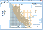
Manco Shapefile Editor is a powerful tool for creating and editing shapefiles, with easy, almost “on the flyâ€, geometry and data editing and possibility of direct creation of the shapefiles from the image files by image processing algorithms. This product is constantly developing and you will receive free updates just when they come. Since it’s only a start of the...
Category: Multimedia & Design / Image Editing
Publisher: Manco Software, License: Shareware, Price: USD $100.00, File Size: 6.1 MB
Platform: Windows
This Shell Extension integrates the CVS version control system into Windows Explorer.
This Shell Extension integrates the Cvs version control system into Windows Explorer. So you have version control right where you need it. There?s no need to use the command prompt or to search your files in an different application.
Category: Software Development / Misc. Programming
Publisher: cvs-ext.com, License: Freeware, Price: USD $0.00, File Size: 373.0 KB
Platform: Windows
TIGOR is an integrated data product that gives you all the layers of the 2006 First Edition TIGER/Line® in ESRI® Shapefile format! TIGOR files are regrouped in one database per state. Each database contains compressed version of TIGER/Lines data which can be viewed and exported as shapefiles (125,000 layers for all 56 databases). TIGOR Databases are: * Highly Compressed *...
Category: Home & Education / Miscellaneous
Publisher: Nextractor Inc., License: Shareware, Price: USD $39.99, File Size: 2.7 MB
Platform: Windows
Cvs Suite is a software application that allows you to browse CVSNT repositories in your workgroup and create workspaces from modules / projects or branches.You can create workspaces on your disk by dragging and dropping the other way.You can also browse the repository server including branches, tags, files and directories.
Category: Software Development / Misc. Programming
Publisher: March Hare Software, License: Shareware, Price: USD $133.00, File Size: 74.1 MB
Platform: Windows
Thuban is an Interactive Geographic Data Viewer with the following features:
- Vector Data Support: Shapefile, PostGIS Layer and OGR
- Raster Data Support: GeoTIFF Layer and GDAL
- Comfortable Map Navigation
- Object Identification and Annotation
- Legend Editor and Classification
- Table Queries and Joins
- Projection Support
- Printing...
Category: Utilities / Misc. Utilities
Publisher: Intevation, License: Shareware, Price: USD $0.00, File Size: 772.9 KB
Platform: Windows
cvschangelogbuilder is an Perl utility to generate ChangeLogs for a project hosted on a CVS server.
cvschangelogbuilder is an Perl utility to generate ChangeLogs for a project hosted on a Cvs server. The main goal is to provide a better output that the 'Cvs log' command, to permit to choose the sorting criteria, to add the status of the change (added,removed,modified) and to allow "differential" changelogs, between 2 versions, even when they are not in the main branch....
Category: Software Development / Misc. Programming
Publisher: Laurent Destailleur, License: Freeware, Price: USD $0.00, File Size: 125.0 KB
Platform: Windows, Linux, Mac
WinCVS is a Concurrent Versioning System (CVS) client.
WinCVS is a Concurrent Versioning System (Cvs) client.
This great Cvs client offers all the functionality to use Cvs protocol with a great GUI. It’s designed to offer a Cvs client for any user, from beginners to expert users. This Cvs tool allows adding / creating repositories even remote repositories. It also provides security using the SSH...
Category: Utilities / System Utilities
Publisher: CvsGui, License: Shareware, Price: USD $0.00, File Size: 3.5 MB
Platform: Windows
Code Historian performs file-differencing and code analysis, and assists with code reviewsusing information already present in your SourceSafe, Perforce, or Cvs version control system. There is no server installation, and Code Historian works with any Cvs or Perforce client software. These features are accessible through Visual Studio 6.0, Visual Studio .NET and 2003, the...
Category: Software Development / Tools & Editors
Publisher: Smart Bear, LLC, License: Shareware, Price: USD $99.95, File Size: 1.5 MB
Platform: Windows
SourceConneXion provides a Delphi, Borland Developer Studio and C Builder IDE integration for all SCC API compliant source control products (Including SourceOffSite, StarTeam, PVCS, Serena VM 8, Perforce, Surround SCM, Cvs (With PushOk Cvs Proxy), Subversion (with PushOk SVN Proxy), ClearCase, MKS Source Integrity, QVCS, CS-RCS and more) .
SourceConneXion is an integration...
Category: Internet / Misc. Servers
Publisher: EPocalipse Software, License: Shareware, Price: USD $0.00, File Size: 2.9 MB
Platform: Windows
Freeware
VSceneGIS Desktop. (GIS) Analysis, Computing and Editing. Customer Project Development, Analysis, Computing and GIS editing. VSceneGIS Desktop applies the concept of Tree and Graph Topology to implement the data model in a GIS. Validation, Editing and Topological Behavior Export and import of data sources: PostgreSQL / PostGIS, Oracle, MySQL, SQLite / SpatiaLite, Shapefile....
Category: Home & Education / Science
Publisher: vscenegis.com, License: Freeware, Price: USD $0.00, File Size: 118.4 MB
Platform: Windows
Virtual CV Builder produces CVs of a good standard that can assist in applying for employment.
Virtual CV Builder produces Cvs of a good standard that can assist in applying for employment.It allows the user to break down each section of the CV in to manageable bites, gives help and tips on completing a section and builds an effective final CV document. The program allows the CV building process to be easier whilst still providing the prospective employer with the information and...
Category: Business & Finance / Business Finance
Publisher: Lightning Ware Solutions, License: Shareware, Price: USD $5.99, File Size: 403.2 KB
Platform: Windows
EasyCVS is an easy,quick and safe solution.
EasyCVS is an easy,quick and safe solution.It stores your sourcecode in an Cvs Repository(Cvs is an open-source version control tool),so you needn't to worry about the database crashing.EasyCVS use the Microsoft Source Code Control Interface (MSSCCI ) of Visual Studio© to simplify the process of committing sourcecode. It's easy to use because it's integrated into Visual...
Category: Software Development / Tools & Editors
Publisher: EasyVCS, License: Shareware, Price: USD $39.95, File Size: 1.7 MB
Platform: Windows
FloppyGIS runs on Windows. It is a free compact Shapefile Viewer. It also supports image files that have geo-reference from ESRI World Files.
Category: Multimedia & Design / Graphics Viewers
Publisher: ldinakis.googlepages.com, License: Freeware, Price: USD $0.00, File Size: 619.0 KB
Platform: Windows, Vista
Eclipse IDE for Java has the essential tools for any Java developer, including a Java IDE, a Cvs client, XML Editor and Mylyn. Eclipse projects now cover runtimes; static and dynamic languages; thick-client, thin-client, and server-side frameworks; modeling and business reporting; embedded and mobile; and the best Java IDE.
Category: Web Authoring / JavaScript
Publisher: The Eclipse Foundation, License: Freeware, Price: USD $0.00, File Size: 99.5 MB
Platform: Windows
DNRGarmin is a smart tool used to directly transfer data between Garmin GPS handheld receivers and various GIS software packages.
DNRGarmin was built to provide users the ability to directly transfer data between Garmin GPS handheld receivers and various GIS software packages. Using DNRGarmin a user can use point features (graphics or Shapefile) and upload them to the GPS as...
Category: Utilities / Misc. Utilities
Publisher: GIS Section, Minnesota Department of Natural Resources, License: Freeware, Price: USD $0.00, File Size: 11.3 MB
Platform: Windows