Free Downloads: Convert From Kml To Mapinfo
NTF2MIF translates Ordnance Survey NTF data files to MapInfo MIF/MID format.
NTF2MIF translates Ordnance Survey NTF data files to Mapinfo MIF/MID format. This format can also be imported into many other GIS applications.
NTF2MIF translates the following data products:
Land-Line Plus; Meridian 2; Strategi; Landform Panorama Contour and DTM; Landform Profile Contour and DTM; OSCAR Traffic-Manager; OSCAR Asset-Manager; Code-Point NTF.
Category: Home & Education / Miscellaneous
Publisher: Nigel James, License: Shareware, Price: USD $0.00, File Size: 0
Platform: Windows
GlobeXplorer's ImageConnect for Mapinfo is a unique extension that instantly brings georeferenced satellite and aerial photos into your desktop or mobile project from our online database. ImageConnect takes away the time, cost and hassle of locating an image provider, waiting for delivery, and managing large image files.
Category: Internet / Misc. Plugins
Publisher: GlobeXplorer, LLC, License: Freeware, Price: USD $0.00, File Size: 2.0 MB
Platform: Windows
Superoverlay software is a Google Earth application for tiling raster datasets and creating view based regions in Kml or KMZ files.
Also Superoverlay can generate world files for all images in ArcView style (jgw, tfw,...). It helps you put large image overlays into Google Earth (for example alternative maps or aerial photography). GE Sky mode is supported.
Category: Home & Education / Miscellaneous
Publisher: GIS Center, License: Shareware, Price: USD $0.00, File Size: 0
Platform: Windows
 Demo
Demo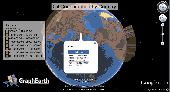
Visualize your data in 3D! Quick, easy and inexpensive. Graph Earth enables management, marketing and other business professionals to create stunning visual representations of their data, all without the time and costs associated with a full-featured GIS. Viewable by Everyone! Create one of a kind deliverables and distribute them to the world, recipients need only install Google Earth to view...
Category: Business & Finance / MS Office Addons
Publisher: Deer Creek Marketing LLC, License: Demo, Price: USD $24.95, File Size: 469.0 KB
Platform: Windows
EasyMap VCL is a Delphi/C++Builder components set for creating your own GIS-related solutions without Mapinfo, MapX, MapObjects, WinGIS and so on. EasyMap VCL allows to add following functionalities in Delphi/C++Builder application: - MIF/MID vector maps displaying in Longitude/Lantitude projection; - Map objects related data in grid or tabular controls displaying; -...
Category: Software Development / Tools & Editors
Publisher: MicroOLAP Technologies LTD, License: Shareware, Price: USD $79.95, File Size: 2.3 MB
Platform: Windows
Shareware
An add-on for AUTOCAD or BricsCAD, which makes the triangulation of a set of POINT entities, the intersection curves (isolines) between a set of 3DFACE entities and a set of equidistance plans, horizontally or vertically and the volume and center of gravity of a set of bodies or between surfaces composed of 3DFACE entities. You can also load and draw a file of points having the format: Number...
Category: Multimedia & Design / Graphics Viewers
Publisher: Rcad Software, License: Shareware, Price: USD $64.00, EUR59, File Size: 2.5 MB
Platform: Windows
Workspace Control software provides a range of powerful tools to simplify maintenance tasks and eliminates the guesswork when it comes to searching, editing, batching and reporting. Workspace Control software provides you with a suite of tools to perform a range of tasks simply, effectively and professionally. Mapinfo tables contain many properties that affect the way a workspace is...
Category: Business & Finance / Database Management
Publisher: 4thbeach Software, License: Shareware, Price: USD $70.00, File Size: 21.0 MB
Platform: Windows
Shareware
DrawStyles Library contains functions and resources for drawing lines and regions with use various styles of lines and brush pattern (as well as in Mapinfo). Library contains following components: TDSPatternStyleComboBox - intend for select pattern style of brush TDSLineStyleComboBox - intend for select line style TDSLineWidthComboBox - intend for select line width...
Category: Software Development / Components & Libraries
Publisher: Igor Ilyinsky software, License: Shareware, Price: USD $29.95, EUR24.95, File Size: 435.5 KB
Platform: Windows

The free AvisMap Viewer opens most GIS/CAD and raster image file types and most ArcView, ArcExplorer, and Mapinfo projects. Besides just opening and viewing files, the Viewer supports an extensive list of features including visual layer properties control, legend control, thematic mapping, spatial and attribute querying, custom labeling, on-map measurements, hyper-linking, PDF export...
Category: Software Development / Components & Libraries
Publisher: AvisMap GIS Technologies, License: Freeware, Price: USD $0.00, File Size: 22.3 MB
Platform: Windows

OkCustomMap is a software to produce Garmin Custom Maps.
OkCustomMap is a software to produce Garmin Custom Maps.
Supports many map formats:
- OkMap
- Ecw
- GeoTiff
- World files
- OziExplorer
- GpsTuner
You can customize:
- The quality of the output JPEG images (0=Bad, 100=Good)
- The Kml transparency (0=Transparent, 255=Opaque)
- The Kml draw order (0=Invisible, 1-49=Under the vectorial...
Category: Business & Finance / Applications
Publisher: Gian Paolo Saliola, License: Freeware, Price: USD $0.00, File Size: 3.2 MB
Platform: Windows

TRANSDAT geosoftware executes coordinate transformations and geodetic datum shifts between many coordinate and reference systems of America, Australasia, Europe, Germany special and world-wide, with high precision and high speed: 1.The current and historical coordinate and reference systems of all countries of the European Union (EU) including the eastern extensions and the systems of non-EU...
Category: Home & Education / Science
Publisher: Killet Software Ing.-GbR, License: Shareware, Price: USD $170.00, EUR160, File Size: 4.4 MB
Platform: Windows
Shareware
The Advanced points manager imports points to AutoCAD drawing from different data sources. OLE-DB database, SHP (ESRI shape file), GPX (GPS eXchange format), Kml (Keyhole Markup Language), GML (Geography Markup Language), TXT, CSV. Additional options: savable configurations, point coordinate transformation from/to any world coordinate system, point can be ACAD point or ACAD block with...
Category: Business & Finance / Vertical Markets
Publisher: CADdicted inc., License: Shareware, Price: USD $119.00, File Size: 609.8 KB
Platform: Windows
SWIFT WX Professional runs on any desktop or laptop computer and provides you with up-to-the-minute Radar, Satellite, Storm Warnings, and Hail Reports. It will even alert you up to an hour in advance of approaching rain or thunderstorms, and predict to the nearest minute when those storms will arrive. FEATURES & BENEFITS: - Track Hurricanes, Tornadoes, Flash Floods, and more- Choose from...
Category: Home & Education / Miscellaneous
Publisher: SWIFT Weather, License: Shareware, Price: USD $159.50, File Size: 20.4 MB
Platform: Windows
LocalConnect is the included application for converting and uploading Vectors, Images, Maps, and Elevation to GISRoam.
LocalConnect includes tools to automatically Convert your source data to GISRoam formats and projections in the following formats:
* Elevation in the form of DTED, DEM, ARCGrid, GEOTIFF, SRTM, XYZ Grid, and BIL.
* Imagery in the form of MRsid, ECW, IMG,...
Category: Internet / File Sharing
Publisher: Cogent3D, License: Freeware, Price: USD $0.00, File Size: 26.4 MB
Platform: Windows
Eye4Software Hydromagic is hydrographic survey software for Windows. It can be used to generare depth maps using a GPS or RTK receiver and an echosounder or fishfinder. After recording the sounding, you can generate DTM's (Digital Terrain Models), depth contours, 3D views and cross-sections. It offers various methods of calculating volumes of bassins, ponds, river sections and lakes....
Category: Home & Education / Mathematics
Publisher: Eye4Software B.V., License: Demo, Price: USD $1549.93, File Size: 83.0 MB
Platform: Windows
Shape2Earth leverages freely available and easy to use Geographic Information System (GIS) software to create professional visualizations for viewing in GoogleTM Earth.
Main features:
-Convert Any Shapefile to Kml - Shape2Earth reprojects your data on the fly
-Apply Thematic Symbology to your Data - Color code to display information
-Present Data in...
Category: Multimedia & Design / Image Editing
Publisher: Google, License: Demo, Price: USD $0.00, File Size: 9.5 MB
Platform: Windows
Live!Flight allows that everyone can track your flight in flight simulator in real-time, all over the world. Your aircraft is displayed as a 3D-model in a map of NASA World Wind.
For that purpose Live!Flight transmits position and flight attitude information. With a refreshing rate of 2 times per second you can see every aircraft's movement. A lot of more information like...
Category: Business & Finance / Business Finance
Publisher: Christoph Paulus, License: Shareware, Price: USD $29.00, File Size: 4.2 MB
Platform: Windows
ArBa3d is a 3D modeling software that allows to create a 3D model from a set of digital photos.
ArBa3d is a 3D modeling software that allows to create a 3D model from a set of digital photos. The tool takes as input a set of photos taken from different viewpoints. It tesselates the vertices and constraint edges from the user input to produce a 3D model that can then be exported to different 3D formats (vrml, obj, x, flt, x3d, Kml). The 3D models can also be displayed on the Web,...
Category: Multimedia & Design / Image Editing
Publisher: ArBa3d.com, License: Shareware, Price: USD $0.00, File Size: 5.3 MB
Platform: Windows
CoPilot Central is the desktop management software companion for CoPilot Live(Android and Windows Mobile). Buy additional map regions and other premium add-ons. Download maps for use with Android versions of CoPilot. Export trips to popular online mapping sites (using Kml format). Backup favorites and settings.
Category: Desktop Enhancements / Shell & Desktop Managers
Publisher: CoPilotLive, License: Freeware, Price: USD $0.00, File Size: 4.7 MB
Platform: Windows
The newest versions of ePubHub _require_ .
-Plain ASCII text files have the extension .txt
-Microsoft Word files have the extension .doc
-Adobe acrobat files have the extension .pdf
-Gemstar eBook files have the extension .prc
-Palm files have the extension .pdb or .prc
-Hiebook files have the extension .Kml
-Html files have the extension .html or .htm
-Adobe eBook files have the...
Category: Utilities / System Utilities
Publisher: ePubHub, License: Freeware, Price: USD $0.00, File Size: 483.5 KB
Platform: Windows
MapImagery Professional is an upgrade to MapImagery, that provides an advanced set of raster tools, usually only available in high cost dedicated image processing products. MapImagery Professional can be used for preparing, adjusting and enhancing imagery, for use within Mapinfo Professional based applications.
The additional features of MapImagery Professional can be...
Category: Business & Finance / Business Finance
Publisher: MapImagery Limited, License: Shareware, Price: USD $599.00, File Size: 11.6 MB
Platform: Windows
GenesisIV understands GIS concepts like layers, shape objects and georeferencing.
GenesisIV understands GIS concepts like layers, shape objects and georeferencing. It interfaces to industry standard GIS systems such as Mapinfo and ArcView so you can use your existing data without having to learn new concepts or perform difficult manipulations.
GenesisIV is the only landscape product designed specifically to help teach geographical concepts. You're up...
Category: Multimedia & Design / Multimedia App's
Publisher: Geomantics, License: Freeware, Price: USD $0.00, File Size: 17.6 MB
Platform: Windows

Geocode digital images with latitude, longitude, altitude, and direction information when collecting GIS field data. RoboGEO stamps this information onto the actual photo or writes it to the EXIF headers, allowing you to permanently geotag and link your photos to the GPS coordinates. All writing to the EXIF and IPTC headers is lossless and all of the existing comments (including the MakerNote...
Category: Multimedia & Design
Publisher: Pretek, Inc., License: Demo, Price: USD $34.95, File Size: 6.4 MB
Platform: Windows
AGIS for Windows is a mapping and simple GIS shareware package.
AGIS for Windows is a mapping and simple GIS shareware package. Plot your own geographic data on the map of the world provided without the high cost and steep learning curve usually associated with this kind of software. Create high resolution publication quality images that can be pasted into popular packages such as MS Word. Animation, web serving, distance measuring, searching, GPS and...
Category: Multimedia & Design / Multimedia App's
Publisher: AGIS Software Pty Ltd, License: Shareware, Price: USD $49.00, File Size: 3.6 MB
Platform: Windows
The best open-source Wi-Fi scanning software – for Free!
The best open-source Wi-Fi scanning software – for Free!
With Inssider you can :
– Inspect your Wi-Fi and surrounding networks
– Scan and filter hundreds of nearby access points
– Troubleshoot competing access points and clogged Wi-Fi channels
– Highlight access points for areas with high Wi-Fi concentration
...
Category: Internet / Monitoring
Publisher: MetaGeek, LLC, License: Freeware, Price: USD $0.00, File Size: 1.7 MB
Platform: Windows