Free Downloads: Converter Gis To Cad
EV8 software was created for ArcGIS 8.
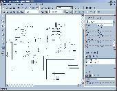
EV8 software was created for ArcGIS 8.x or 9.x. EV8 has : Clean and Build (Polylines to Polygons), Clean and Build: Polygons, Polylines, with intersection and dangle nodes, Automate Cad to Gis: rapidly convert Cad layers to shapefiles, Reverse Engineering: a method to control removal of gaps and slivers.
Category: Multimedia & Design / Multimedia App's
Publisher: Geokinetic Systems Inc., License: Shareware, Price: USD $98.00, File Size: 4.5 MB
Platform: Windows
Visual3D Game Engine's All-in-One Development Tool enables live world building for C#/XNA-powered 3D games, multi-user training simulations, Gis/Cad visualizations, and online virtual worlds.
Visual3D accelerates development with built-in Terrain, Entity, Mission, Visual Scripting, Particle FX, IronPython, Conversation, Road, Decal, and Cinematic editing and ClickOnce...
Category: Software Development / Misc. Programming
Publisher: Realmware Corporation, License: Shareware, Price: USD $185.00, File Size: 356.1 MB
Platform: Windows

The free AvisMap Viewer opens most Gis/Cad and raster image file types and most ArcView, ArcExplorer, and MapInfo projects. Besides just opening and viewing files, the Viewer supports an extensive list of features including visual layer properties control, legend control, thematic mapping, spatial and attribute querying, custom labeling, on-map measurements, hyper-linking, PDF...
Category: Software Development / Components & Libraries
Publisher: AvisMap GIS Technologies, License: Freeware, Price: USD $0.00, File Size: 22.3 MB
Platform: Windows
FlexGraphics - a vector graphics library for Borland Delphi (CAD, GIS, SCADA, VISIO)
FlexGraphics - is a set of components for creating vector graphics applications under Borland Delphi. FlexGraphics library can be used for creation of plots, drawings, electrical, concept and mnemonic charts as well as for creation of interactive plans with high level of detail for various facilities, buildings or their parts. FlexGraphics library can also be used for visualization of...
Category: Software Development
Publisher: FlexGraphics Software, Ltd., License: Shareware, Price: USD $299.00, File Size: 1.3 MB
Platform: Windows
P-CAD 2004 Libraries is part of the P-CAD 2004 Service Pack 4.
P-Cad 2004 Libraries is part of the P-Cad 2004 Service Pack 4. P-Cad 2004 Service Pack 4 (SP4) includes over 120 features and enhancements, further strengthening system performance and delivering increased stability. Any prior version of P-Cad 2004 can be upgraded directly to P-Cad 2004 SP4.
Category: Multimedia & Design / Image Editing
Publisher: Altium Limited, License: Freeware, Price: USD $0.00, File Size: 291.5 MB
Platform: Windows
So that you can identify the Mapping & Gis product that best suits your needs, use this simple Product Comparison. There are four main product types that you can use to create a GPS data collection and maintenance system, or mobile Gis solution. Use the links below to select a product group, and compare the features of each product within that group.
Category: Internet / Communications
Publisher: Trimble Navigation Limited, License: Freeware, Price: USD $0.00, File Size: 2.7 MB
Platform: Windows
Easy Cad to PDF Converter features DWG to PDF conversion, DXF to PDF conversion, and DWF to PDF conversion. It is more than a file format Converter, and you can even batch publish your DWG, DXF, DWF drawing files to PDF files of any size to answer your specific needs, such as to facilitate the readers of your Cad drawings who have no AutoCAD-based software products...
Category: Business & Finance / Calculators
Publisher: Benzsoft Corporation, License: Shareware, Price: USD $99.00, File Size: 3.2 MB
Platform: Windows
AccuGlobe Desktop 2007,a standardized platform for delivering solutions to the global Gis community, offers even more of what you demand in a desktop Gis application. Combining user-friendly design with significantly increased functionality, AccuGlobe Desktop 2007 gives you greater freedom in analyzing spatial data. In addition to functioning as the core engine behind many...
Category: Multimedia & Design / Multimedia App's
Publisher: Digital Data Technologies, Inc., License: Freeware, Price: USD $0.00, File Size: 9.8 MB
Platform: Windows
Scan2CAD is a 2-in-1 Raster to Vector and PDF to CAD conversion.
Scan2CAD is a 2-in-1 Raster to Vector and PDF to Cad conversion.
It converts scanned drawings (raster files including TIFF, JPEG, etc.) and PDF files (any type - raster, vector or hybrid) into DXF files you can edit in your PC Cad, CNC or Gis program (vector).
Scan2CAD contains comprehensive raster cleanup tools including tools for erasing areas of dirt,...
Category: Multimedia & Design / Image Editing
Publisher: Avia Systems Limited, License: Shareware, Price: USD $0.00, File Size: 0
Platform: Windows
GeoSurveillance is software that combines spatial statistical routines with some basic Geographic Information Systems (Gis) functions to carry out retrospective and prospective statistical tests for the detection of geographic clustering. In this software, the focus is primarily on the spatial statistical analysis. Consequently, full Gis functionality is not provided. Gis...
Category: Home & Education / Miscellaneous
Publisher: NCGIA, License: Freeware, Price: USD $0.00, File Size: 2.4 MB
Platform: Windows
TerraSync is designed for fast and efficient field GIS data collection.
TerraSync is designed for fast and efficient field Gis data collection.Trimble® TerraSync™ software is designed for fast and efficient field Gis data collection and maintenance.
Integrating all the ways you collect data—with a GNSS handheld computer, laser rangefinder, or centimeter-grade equipment—it's a powerful system for the collection...
Category: Utilities / Misc. Utilities
Publisher: Trimble, License: Shareware, Price: USD $7000.00, File Size: 20.6 MB
Platform: Windows
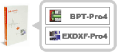
Cad-COMPO is a combo of popular Cad plug-ins for Illustrator. Your Illustrator will turn into a professional Cad software! Contained plugins: BPT-Pro: Adobe Illustrator becomes a highly functional 2D-Cad program with 8 kinds and 19 different tools, all accessible through Illustrator tool box and a convenient information palette. You can easily draw...
Category: Multimedia & Design / Graphics Viewers
Publisher: Baby Universe, License: Shareware, Price: USD $150.00, File Size: 3.0 MB
Platform: Mac
SceneDraw is an investigative tool, for police and private investigators that need to survey and diagram scenes for criminal and civil litigation. Scene Draw is not a Cad program nor is it a drawing program, it is a Data Driven Diagram software program for your reconstruction purposes. It is the complete data measurement collection software tool for Microsoft Windows 98 to XP. Whether...
Category: Multimedia & Design
Publisher: DeliCAD and AK Corp, License: Commercial, Price: USD $149.99, File Size: 2.6 MB
Platform: Windows
 Freeware
VSceneGIS Desktop. (Gis) Analysis, Computing and Editing. Customer Project Development, Analysis, Computing and Gis editing. VSceneGIS Desktop applies the concept of Tree and Graph Topology to implement the data model in a Gis. Validation, Editing and Topological Behavior Export and import of data sources: PostgreSQL / PostGIS, Oracle, MySQL, SQLite / SpatiaLite,...
Category: Home & Education / Science
Publisher: vscenegis.com, License: Freeware, Price: USD $0.00, File Size: 118.4 MB
Platform: Windows

NewCAD.NET is industrial grade 3D component for C#,VB. NET .NewCAD.NET is a collection of 3D modeling, rendering light and shade, simulation and many other powerful features as one of 3D Cad components. It is convenient to apply to DotNet, can be used to Cad,CAM,CAE, scientific computing program development. NewCAD.NET 3D control in addition to support for basic Cad...
Category: Software Development
Publisher: RPW Sofware, License: Shareware, Price: USD $549.00, EUR455, File Size: 36.0 MB
Platform: Windows
The CANVAS 9 Advanced Gis Mapping Edition adds native support for Geographic Information System (Gis) data to Canvas. You can take measurements in geographic coordinates, import industry standard SHAPE and GeoTIFF files into unlimited numbers of automatically aligned overlapping layers and choose among the following options:2,104 Coordinate Reference Systems67 Operation Methods...
Category: Multimedia & Design / Multimedia App's
Publisher: ACD Systems, License: Shareware, Price: USD $999.95, File Size: 54.2 MB
Platform: Windows
Develop high-performance mapping software with Gis.NET. This component uses state-of-the-art vector rendering technology to draw complicated maps of anywhere in the world. Supports desktops, PocketPC, Tablet PC, Smartphone, and Windows Mobile 5! Download a free 30-day trial now and see just how fast Gis.NET can get your location-based software to market! Gis.NET is...
Category: Software Development
Publisher: GeoFrameworks, LLC, License: Commercial, Price: USD $399.00, File Size: 10.9 MB
Platform: Windows
With this release, ArcGIS transforms the way you use GIS.
With this release, ArcGIS transforms the way you use Gis.Be more productive with your work and take advantage of Gis everywhere: via individual local desktops, across desktops and browsers leveraging central servers, and in the cloud.ArcGIS Desktop contains two applications: ArcMap and ArcCatalog. ArcMap provides data display, query, and analysis. ArcCatalog provides data management.
Category: Business & Finance / Business Finance
Publisher: Environmental Systems Research Institute, Inc., License: Demo, Price: USD $0.00, File Size: 2.0 GB
Platform: Windows
Cad Closure allows you to generate geometric closures from the dimension text (not line properties) in your Cad drawing. Works seamlessly with AutoCAD but it is not required as Cad Closure contains its own built-in viewer. The closure graphic is developed in real-time as you select the text. Cad Closure will compute area and check curves to see if they are...
Category: Business & Finance / Applications
Publisher: Gateway Software Productions, License: Shareware, Price: USD $400.00, File Size: 15.3 MB
Platform: Windows
The CANVAS 9 Advanced Gis Mapping Edition adds native support for Geographic Information System (Gis) data to Canvas. You can take measurements in geographic coordinates, import industry standard SHAPE and GeoTIFF files into unlimited numbers of automatically aligned overlapping layers and choose among the following options:·2,104 Coordinate Reference Systems·67...
Category: Multimedia & Design / Multimedia App's
Publisher: ACD Systems, License: Shareware, Price: USD $999.95, File Size: 51.9 MB
Platform: Mac, PPC
Map Suite Wpf Desktop Edition takes Gis application development for the Windows desktop to a whole new level.Using the intuitive object model, even developers inexperienced in Geographic Information Systems (Gis) can have fully functional maps working in minutes. With blazing fast rendering performance, powerful mapping features and support for the most popular data formats, Map...
Category: Internet / Misc. Plugins
Publisher: ThinkGeo, License: Shareware, Price: USD $4995.00, File Size: 69.1 MB
Platform: Windows
ArcGIS Workflow Manager (formerly Job Tracking for ArcGIS [JTX]) is an extension to ArcGIS Desktop and ArcGIS Server that lets organizations develop and enforce standard, repeatable Gis workflows across the enterprise.
Workflow Manager greatly improves the efficiency of Gis operations by organizing and automating the relationships between the activities in a Gis...
Category: Home & Education / Miscellaneous
Publisher: ESRI, License: Shareware, Price: USD $2500.00, File Size: 1.1 MB
Platform: Windows
Freeware
Convert ESRI ShapeFiles (.SHP) geolocation data into AnyMap format to be used with AnyChart. AnyChart Flash Map Converter allows making use of a wide choice of maps with AnyChart Flash Component, a Gis visualization system that recognizes map data in AnyMap format only. AnyChart Flash Map Converter makes it easy to visualize any geolocation data without hefty expenses...
Category: Web Authoring / Image Mapping Tools
Publisher: AnyChart.Com, License: Freeware, Price: USD $0.00, File Size: 1.6 MB
Platform: Windows
AEGIS– the leading GIS software in UK secondary schools.
AEGIS– the leading Gis software in UK secondary schools.
One-off software purchase and free upgrades – no subscriptions.
Brings industry-standard Gis maps to the classroom – Goad town plans, large-scale OS MasterMaps.
Try before you buy with the free AEGIS Viewer download.
Free materials: resources, help sheets,...
Category: Home & Education / Miscellaneous
Publisher: AU Enterprises Limited, License: Shareware, Price: USD $0.00, File Size: 0
Platform: Windows