Free Downloads: Coordinate Import
STL Import for Solid Edge is a Stereolithography (.stl) file Import add-in for Solid Edge®. This plug-in gives Solid Edge the ability to Import geometric data from ASCII and Binary STL files. STL Import for Solid Edge reads polygon mesh data stored in STL files and imports it into Solid Edge. A polygon mesh in a STL file is comprised of a set of triangular faces....
Category: Multimedia & Design
Publisher: SYCODE, License: Commercial, Price: USD $195.00, File Size: 1.3 MB
Platform: Windows
The AIC is an easy to use, stand-alone photogrammetry product designed to rectify, georeference, and mosaic aerial photographs, satellite images, or raster maps to a geographic Coordinate system. An unlimited number of images can be simultaneously rectified and joined to form a single image mosaic, all in the same process. The AIC can generate and efficiently handle output images of...
Category: Multimedia & Design / Multimedia App's
Publisher: TatukGIS, License: Shareware, Price: USD $290.00, File Size: 5.9 MB
Platform: Windows
You can use your existing digital (vector) maps in Autodesk MapGuide® software by converting them to Spatial Data Files (SDF). SDF is a special data format for delivering large amounts of data quickly over an intranet or the Internet. The SDF Loader is a utility used to create Spatial Data Files (SDF) and their accompanying Spatial Index Files (SIF) from a variety of GIS data formats. These...
Category: Multimedia & Design / Multimedia App's
Publisher: Autodesk, Inc., License: Freeware, Price: USD $0.00, File Size: 54.6 MB
Platform: Windows
Archimedes Grapher is a kind of powerful and convenient tool software which supports functional graph plotting, numerical calculation, unit conversion, and slide show. It can plot all kinds of graphs (functional graphs, table graphs, polar equation, parameter equation, inequation and etc.), implement all kinds of calculations (multivariable scientific calculation, generating numerical table,...
Category: Home & Education / Miscellaneous
Publisher: NewXor Software,Inc, License: Shareware, Price: USD $28.00, File Size: 2.1 MB
Platform: Windows
CoordTrans converts geographic coordinates between different coordinate systems.
CoordTrans converts geographic coordinates between different Coordinate systems.
CoordTrans is very easy to use, and full of Wizards to help you with more complex tasks.
Convert between UTM, WGS84 and NAD27 / NAD83, and more... almost all projections and datums on Earth are supported. See complete list..
You can convert single coordinates, or...
Category: Business & Finance / Business Finance
Publisher: Franson, License: Shareware, Price: USD $49.00, File Size: 6.5 MB
Platform: Windows
Pointor imports text files which are lists of points (2D or 3D) and saves them as a DXF file. The DXF file can then be read by other applications, for example AutoCAD, MicroStation or PaintShopPro. If you have a text file which is a list of geographical points simply open it using the file open menu item, or the open icon. You can also drag files into the Pointor window. If you have an Excel or...
Category: Audio
Publisher: Ransen Software, License: Shareware, Price: USD $59.95, File Size: 517.6 KB
Platform: Windows
The Geocentric Datum of Australia (GDA) is a Coordinate reference system that best fits the shape of the earth as a whole. It has an origin that coincides with the centre of mass of the earth, hence the term 'geocentric'.
The state datum in Queensland is the Geocentric Datum of Australia 1994 (GDA94) replacing the previously adopted Australian Geodetic Datum 1984 (AGD84).
Category: Home & Education / Miscellaneous
Publisher: Department of Natural Resources and Mines, License: Freeware, Price: USD $0.00, File Size: 7.7 MB
Platform: Windows
Asymptote is a powerful descriptive vector graphics language that provides a natural Coordinate-based framework for technical drawing. Labels and equations are typeset with LaTeX, for high-quality PostScript output.
A major advantage of Asymptote over other graphics packages is that it is a programming language, as opposed to just a graphics program.
Category: Multimedia & Design / Multimedia App's
Publisher: Andy Hammerlindl, John Bowman, Tom Prince, License: Freeware, Price: USD $0.00, File Size: 3.5 MB
Platform: Windows
The fGIS Editor is a multi-purpose, full-featured, powerful, and easy-to-use GIS application.
The fGIS Editor is a multi-purpose, full-featured, powerful, and easy-to-use GIS application. Created by the same technical expertise behind the popular freeware fGIS program, the fGIS Editor provides a clear, supported upgrade path for current users of fGIS. The fGIS Editor is built upon the TatukGIS Editor and combines the familiar features found in fGIS with the new, powerful features found...
Category: Multimedia & Design / Multimedia App's
Publisher: TatukGIS Consulting, License: Shareware, Price: USD $99.00, File Size: 4.8 MB
Platform: Windows
SEVENPAR is a tool for the calculation of highly exact transformation parameters for the Spatial Helmert and Molodensky Transformation, which make possible precise Coordinate transformations from one reference system into another. The determined transformation parameters can be entered directly into suitable transformation software, e.g. TRANSDAT Coordinate Transformations, or...
Category: Home & Education / Science
Publisher: Killet GeoSoftware Ing.-GbR, License: Shareware, Price: USD $285.00, EUR240, File Size: 7.6 MB
Platform: Windows
Rocanda Land Tracker software will allow you to convert any LSD location in Alberta, British Columbia, Saskatchewan or Manitoba into a corresponding latitude/longitude Coordinate. which you can then input into mapping software such as Garmin's Mapsource products, or OziExplorer.
Category: Business & Finance / MS Office Addons
Publisher: Rocanda, License: Shareware, Price: USD $179.00, File Size: 8.6 MB
Platform: Windows
The Grid InQuest software provides a means for transforming coordinates between ETRS89 (WGS84) and the National Coordinate systems of Great Britain, Northern Ireland and the Republic of Ireland. It provides a fully three dimensional transformation incorporating the latest geoid model and is the nationally recognised software for performing these conversions.
In conjunction...
Category: Home & Education / Miscellaneous
Publisher: Quest Geo Solutions Ltd, License: Freeware, Price: USD $0.00, File Size: 0
Platform: Windows
 Shareware
GPS SDK to add GPS and Coordinate conversion functionality to your software and scripts). All NMEA0183 protocol versions are supported and can be filtered by NMEA sentence type and talker ID. Garmin USB PVT support. Information on GPS status can also be retrieved: GPS fix quality, satellites used in fix, satellites in view, satellite azimuth, elevation and signal strengths. The...
Category: Software Development
Publisher: Eye4Software B.V., License: Shareware, Price: USD $99.00, EUR79, File Size: 2.3 MB
Platform: Windows
This applet constructs quadrilaterals from the x and y Coordinate values of four given points, and also determines the category of the constructed quadrilateral (rectangle, square etc.).
Category: Home & Education / Mathematics
Publisher: eridanus.info, License: Freeware, Price: USD $0.00, File Size: 10.6 KB
Platform: Linux, Windows
Shareware
Java toolkit to add Coordinate conversion functionality to your Java applications and applets. The toolkit offers functionality to perform map grid and datum transformations: latitude and longitude can be converted to various map grids, like Transverse Mercator (TM), Oblique Mercator, Mercator, Oblique Stereographic, Polar Stereographic, Cassini, Albers Equal Area Conal, Gauss Kruger or...
Category: Software Development / Components & Libraries
Publisher: Eye4Software B.V., License: Shareware, Price: USD $199.00, EUR179, File Size: 155.5 KB
Platform: Unknown
Shareware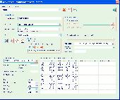
The Advanced points manager imports points to AutoCAD drawing from different data sources. OLE-DB database, SHP (ESRI shape file), GPX (GPS eXchange format), KML (Keyhole Markup Language), GML (Geography Markup Language), TXT, CSV. Additional options: savable configurations, point Coordinate transformation from/to any world Coordinate system, point can be ACAD point or ACAD block...
Category: Business & Finance / Vertical Markets
Publisher: CADdicted inc., License: Shareware, Price: USD $119.00, File Size: 609.8 KB
Platform: Windows
The MEP (Mechanical/Electrical/Plumbing) Modeler is an extension to ArchiCAD 14.
The MEP (Mechanical/Electrical/Plumbing) Modeler is an extension to ArchiCAD 14. Architectural practices and architectural departments of A/E firms using ArchiCAD can use MEP Modeler to create, edit or Import 3D MEP networks (ductwork, piping and cable trays) and Coordinate them with the ArchiCAD Virtual Building.
Category: Multimedia & Design / Image Editing
Publisher: Graphisoft, License: Freeware, Price: USD $0.00, File Size: 12.6 MB
Platform: Windows
Explain why and how a pinball shooter can be used to help understand ideas about reactions.
Explain why and how a pinball shooter can be used to help understand ideas about reactions.
Describe on a microscopic level what contributes to a successful reaction (with illustrations).
Describe how the reaction Coordinate can be used to predict whether a reaction will proceed or slow.
Use the potential energy diagram to determine: The activation energy for the...
Category: Home & Education / Science
Publisher: University of Colorado, Department of Physics, License: Freeware, Price: USD $0.00, File Size: 1.9 MB
Platform: Windows
COGO (COordinate GeOmetry) is an engineering tool used to determine geometric relationships.
COGO (Coordinate GeOmetry) is an engineering tool used to determine geometric relationships. There are a number of ways to create a geometric model. There is a command language that allows the user to define and solve geometric problems in engineering terms. There are Windows forms that you fill in to create the geometry. And you can execute COGO inside of AutoCAD using the Windows forms...
Category: Multimedia & Design / Image Editing
Publisher: Colorado DOT, License: Freeware, Price: USD $0.00, File Size: 3.5 MB
Platform: Windows
SharewareThe RouteWriter add-in imports and exports waypoints for Microsoft MapPoint routes whilst maintaining their route order. Although MapPoint can Import and export waypoints as pushpins, their order is usually re-arranged. RouteWriter exports waypoints and their matching pushpins to Excel with their waypoint distance, time, Coordinate, address data, and all available pushpin...
Category: Business & Finance / Document Management
Publisher: Winwaed Software Technology LLC, License: Shareware, Price: USD $75.00, File Size: 3.0 MB
Platform: Windows
Graphing Software without the Learning Curve
Whether graphing equations or making a Coordinate grid, HandyGraph helps you create attractive graphical images quickly.
This graphing program was designed for teaching math. We understand the work involved with teaching, and we created HandyGraph to make your job a bit easier. You can make accurate high-quality graph images...
Category: Business & Finance / MS Office Addons
Publisher: Del Rey, License: Shareware, Price: USD $59.00, File Size: 3.4 MB
Platform: Windows
CopanMobile for Palm OS is a very functional and easy-to-use geomatics engineering tool for computing and managing plane surveying and mapping coordinates. It does numerous Coordinate geometry (COGO) calculations, processes and adjusts raw field survey data, computes and adjusts map traverse data, performs map or deed checks, calculates curves, areas and perimeters, performs...
Category: Multimedia & Design / Multimedia App's
Publisher: Underhill Geomatics Ltd., License: Freeware, Price: USD $0.00, File Size: 341.0 KB
Platform: Palm
CopanMobile for Pocket PC is a very functional and easy-to-use geomatics engineering tool for computing and managing plane surveying and mapping coordinates. It does numerous Coordinate geometry (COGO) calculations, processes and adjusts raw field survey data, computes and adjusts map traverse data, performs map or deed checks, calculates curves, areas and perimeters, performs...
Category: Business & Finance / Applications
Publisher: Underhill Geomatics Ltd., License: Freeware, Price: USD $0.00, File Size: 341.0 KB
Platform: Windows
There has never been a more comprehensive, powerful, all-in-one software solution that provides an easy-to-use and intuitive user interface for digitizing, geographic referencing, reprojection, tiling, and mosaicking.
Didger solves the problem of combining data files in different Coordinate systems, by providing extensive tools to transform the data into one cohesive...
Category: Home & Education / Miscellaneous
Publisher: Golden Software, License: Shareware, Price: USD $0.00, File Size: 0
Platform: Windows
Freeware
A NetCDF file is a format of file that usually uses in climate data. NetCDF files usually has multi-dimension that each dimension is a separate variable. NetCDF variables that contain Coordinate data are referred to as Coordinate variables, scalar Coordinate variables, or multidimensional Coordinate variables. For example, if you want to save the rainfall data for a...
Category: Home & Education / Science
Publisher: AgriMetSoft, License: Freeware, Price: USD $0.00, File Size: 13.9 MB
Platform: Windows