Free Downloads: Create Image Maps Easily

FSS Google Maps Downloader is a tool that can download the Google Maps images to your PC. This is a clearly free program. There is no spyware or adware. It's absolutely safe to install and to run. The interface is very simple and self explaining. It runs low on system resources consumption and is supported on all Windows versions. It can save them to your hard disk,...
Category: Internet / Download Managers
Publisher: FreeSmartSoft, License: Freeware, Price: USD $0.00, File Size: 874.0 KB
Platform: Windows
Terrain Tools - Create maps quickly and easily!
Terrain Tools - Create Maps quickly and Easily!
Terrain Tools is the ideal tool for outdoor recreationists, real-estate professionals, farmers, ecologists, archaeologists and others who need to Create basic Maps, calculate areas, lengths, bearings and distances.
Overlay GPS tracks on scanned images such as USGS or Canadian NTS topos....
Category: Business & Finance / Applications
Publisher: Softree, License: Shareware, Price: USD $124.00, File Size: 15.0 MB
Platform: Windows
Easily Create HTML Image/photo Maps with this free friendly Image mapping utility from the authors of the best free photo editing software - Photo Pos Pro photo editor . Pos HTML Image Mapper includes WYSIWYG interface allowing you mapping images and photos fast and easy. Using the software you can Easily Create graphic toolbars to...
Category: Web Authoring / HTML Color Pickers
Publisher: PowerOfSoftware Ltd., License: Freeware, Price: USD $0.00, File Size: 7.9 MB
Platform: Windows
 Shareware
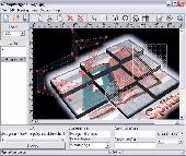
Create HTML Image Maps of any shape in just a few clicks! Map Designer automates the creation of HTML Image Maps, making it easy for designers and Web developers to specify hot-links and clickable areas within images. Map Designer helps Web developers specify rectangular, round or arbitrary-shape areas in a what-you-see-is-what-you-get mode. Specifying an...
Category: Web Authoring / HTML Editors
Publisher: ForthTech Software, License: Shareware, Price: USD $23.00, File Size: 1.1 MB
Platform: Windows
Diffuse maps represent the absorption of light.
Diffuse Maps represent the absorption of light. Diffuse Maps are what people call "textures". They are the color textures or photographic textures usually applied to 3d models.
ShaderMap creates displacement Maps using the light data stored inside of diffuse Maps. Evenly lit diffuse Maps generally Create better quality Maps with...
Category: Home & Education / Miscellaneous
Publisher: Rendering Systems Inc., License: Freeware, Price: USD $0.00, File Size: 4.0 MB
Platform: Windows
Shareware
Google Maps Terrain Downloader is a tool that can automatically download the google terrain Maps images to your PC. It can download the small tiles and save them to your hard disk. After downloading, you can view the Maps offline by its tool Maps Viewer, or you can combine the small images into one big map Image. If you want to make a map of your city by...
Category: Internet / Download Managers
Publisher: allmapsoft.com, License: Shareware, Price: USD $29.99, File Size: 305.3 MB
Platform: Windows
Shareware
Google Hybrid Maps Downloader is a tool that can automatically download the google hybrid Maps images to your PC. It can download the small tiles and save them to your hard disk. After downloading, you can view the Maps offline by its tool Maps Viewer, or you can combine the small images into one big map Image. If you want to make a map of your city by...
Category: Internet / Download Managers
Publisher: allmapsoft.com, License: Shareware, Price: USD $29.99, File Size: 30.6 MB
Platform: Windows
When you are looking for a powerful tool to satisfy various needs regarding vectors, raster and satellite imagery, you will find ILWIS Academic an efficient application. The program comes with such useful features as points to Create Maps, lines for segment Maps, closed area segments for polygon Maps, spatial operations for raster Maps and so on. Whilst using...
Category: Home & Education / Miscellaneous
Publisher: ITC, License: Freeware, Price: USD $0.00, File Size: 19.4 MB
Platform: Unknown
You can create a backup of your maps with JaVaWa GMTK and restore these (e.
You can Create a backup of your Maps with JaVaWa GMTK and restore these (e.g. on another computer) including unlock codes. Re-installing Maps is unnecessary.
Migration of your Garmin Maps from and old computer to a new one is straightforward with this application.
Category: Utilities / Backup
Publisher: JaVaWa GPS-tools, License: Shareware, Price: USD $0.00, File Size: 5.4 MB
Platform: Windows
With SMART Ideas, you can Create multilevel concept Maps that take students through concepts one step at a time for greater clarity. And you can Easily convert the Maps into a multipage website for everyone to share.
A bank of colorful and descriptive graphics helps teachers break down information in highly visual ways so students can understand each...
Category: Home & Education / Teaching Tools
Publisher: SMART Technologies Inc., License: Shareware, Price: USD $59.00, File Size: 39.5 MB
Platform: Windows
Region Map Generator is a tool to make region map with self-definition color. The original Maps in the software are blank political region ones for different countries or areas. You can color any region with whatever color as you like. By this software, you can Easily make lively Maps. These Maps can be used as data analysis charts, teaching materials, business...
Category: Business & Finance / Applications
Publisher: cciyy, License: Shareware, Price: USD $36.95, File Size: 1.3 MB
Platform: Windows
MapDesign offers a WYSIWYG (what-you-see-is-what-you-get) user interface, allowing you to visually Create simple or complex Image Maps for your website. In addition, MapDesign lets you add mouse-over and mouse-down effects using standards based CSS so you can Easily make your website stand out among your visitors.
Since MapDesign uses only HTML and CSS,...
Category: Multimedia & Design / Multimedia App's
Publisher: RAGE Software., License: Shareware, Price: USD $0.00, File Size: 0
Platform: Windows
HexDraw is an easy to use graphical editor for designing hexagon grid game maps.
HexDraw is an easy to use graphical editor for designing hexagon grid game Maps. With HexDraw you Create playing Maps with up to 200 x 200 hex fields or 67 x 67 inches (170 cm). HexDraw helps you to Easily Create different terrain features like roads and hexes in plain colours or textures. (Some textures are included but you may Create your own textures).
Category: Multimedia & Design / Digital Media Editors
Publisher: Joachim Bader Software Manufaktur, License: Shareware, Price: USD $53.95, File Size: 20.4 MB
Platform: Windows
With MapAuthor you can Create, print and save desktop Maps, using data that you obtain from commercial sources or perhaps your in-hous GIS department as shapefiles (shapefiles are a very common GIS exchange format.) You can also produce internet-based Maps based on Google Maps, for use on your web site.
MapAuthor allows you to link your own data to...
Category: Internet / Misc. Plugins
Publisher: MapAuthor.com, License: Freeware, Price: USD $0.00, File Size: 6.3 MB
Platform: Windows
Create Image Maps for your website with this easy-to-use tool from Multimedia Australia. Simply select the Image you want to use, choose a shape, then visually draw the Image map regions. The Image map coordinates can be copied to the clipboard for insertion into your favourite text editor.
Category: Web Authoring / Web Design Utilities
Publisher: Multimedia Australia, License: Shareware, Price: USD $24.95, File Size: 931.8 KB
Platform: Unknown
zMapper is general purpose Map database creation program.
zMapper is general purpose Map database creation program. Create your own Maps of games or real-life from scratch. Overlay your map database on any graphical Image. Enhance Maps with shapes, icons, and text. Supports Cartesian, hexagonal, or octagonal map layouts. Maps are compatible with zMUD and zExplorer. Windows 95, 98, ME, 2000, NT and XP.
Category: Audio / Music Creation
Publisher: Zugg Software, License: Shareware, Price: USD $20.00, File Size: 4.1 MB
Platform: Windows
Trellian Image Mapper is the quickest way to create image mapped images for your website.
Trellian Image Mapper is the quickest way to Create Image mapped images for your website. Full support for hyperlinked rectangles, circles and even polygon regions is provided and you can import all your current Image Maps. After you have created your Image map, Trellian Image Mapper will generate the required HTML code ready to be pasted...
Category: Multimedia & Design / Multimedia App's
Publisher: Trellian, License: Shareware, Price: USD $19.95, File Size: 1.8 MB
Platform: Windows
CompeGPS is an essential software to make the most of your GPS. With this PC software you will be able to download a wide variety of cartography from the internet and also analyse your routes. This software has been specially designed for free flight and motor flight pilots they use GPS and likes to Create and accomplish their own routes and then later on analyse. CompeGPS allows...
Category: Home & Education
Publisher: CompeGPS TEAM S.L., License: Shareware, Price: USD $106.00, File Size: 14.9 MB
Platform: Windows
Anychart is a flexible Macromedia Flash based-solution, which allows you to Easily display any sort of data dealing with geographical locations. It contains United States Maps with Counties, World Map, etc. XML data file and a set of customizable options make AnyChart Maps a universal solution for web developers. AnyChart allows you to Create superb, compact,...
Category: Software Development
Publisher: AnyChart.Com, License: Shareware, Price: USD $199.00, File Size: 2.8 MB
Platform: Windows, Mac, Linux, Palm,
Shareware
Google Satellite Maps Downloader is a cute tool that can automatically download Google Maps satellite tile images and then combine them into one big map Image. It supports multithreads, so the download speed is very fast. And it is very easy to use. All downloaded small images are saved on the disk. You can combine them after downloading or later. Isn't it very cool that...
Category: Internet / Download Managers
Publisher: allmapsoft.com, License: Shareware, Price: USD $39.00, File Size: 30.6 MB
Platform: Windows
NOVA Maps provides appraisers and appraisal users with complete, high-resolution location Maps (also known as “street Maps”) for forms and addenda in seconds. NOVA Maps even automatically places labels for subject properties and comparables.
For just pennies per map and with just a click of the mouse, users have access to the entire United...
Category: Home & Education / Miscellaneous
Publisher: Day One, License: Demo, Price: USD $0.00, File Size: 5.7 MB
Platform: Windows
The Creeper World Map Editor (CWME) allows you to create and edit maps for use in Creeper World.
The Creeper World Map Editor (CWME) allows you to Create and edit Maps for use in Creeper World. You can specify the terrain, change the background Image, and Create/edit Creeper emitters and spore waves. You can also specify the location and the number of totems, upgrades, survival pods, and artifacts. In short, you can Create nearly any map you can imagine.
Category: Games / Tools & Editors
Publisher: Knuckle Cracker, LLC, License: Freeware, Price: USD $0.00, File Size: 2.3 MB
Platform: Windows
Create GPS enabled geo Maps directly on the background of aereal photos and road Maps from the internet. Import geodata from Google-Earth, OpenStreetMap, GPS tracks and GPS logger. Map editor , manually digitizing. Specifical graphical objects (borderlines, borderareas) to guarantee exact same borders of neighbour areas..Screen calibration for true to display on the screnn.
Category: Multimedia & Design / Digital Media Editors
Publisher: GPSur Dr. Erhard Regener, License: Shareware, Price: USD $65.00, File Size: 6.4 MB
Platform: Windows
CompeGPS is an essential software to make the most of your GPS. With this PC software you will be able to download a wide variety of cartography from the internet and also analyse your routes. This software has been specially designed for 4x4 lovers, bike tourists, excursionists and, in general, everyone who uses GPS, likes to Create and accomplish their own routes and then later on...
Category: Home & Education
Publisher: CompeGPS TEAM S.L., License: Shareware, Price: USD $106.00, File Size: 14.9 MB
Platform: Windows
GDS Images and Document Maps is a unique document search utility.
GDS Images and Document Maps is a unique document search utility. GDS Images and Document Maps is a rather unique application that will enable you to store all your documents and images alongside other important files and folders right on your desktop so that you can use it straight from there, without the need to bother around with looking with looking for every single file...
Category: Utilities / Misc. Utilities
Publisher: toggle, License: Freeware, Price: USD $0.00, File Size: 558.8 KB
Platform: Windows