Free Downloads: Create Vector Maps
An exceptional tool for drawing publication and Vector catalog quality Maps and designing cloning experiments.
Whether you are a catalog company selling engineered plasmids or conducting restriction or recombinant cloning experiments, SimVector will help you simulate the experiments and Create publication quality Maps from start to finish. Use it to draw...
Category: Multimedia & Design / Digital Media Editors
Publisher: Biosoft Internationa, License: Shareware, Price: USD $885.00, File Size: 28.8 MB
Platform: Windows
SeeYou is a flight planning and analysis tool for glider pilots.
SeeYou is a flight planning and analysis tool for glider pilots. It is designed for both desktop and notebook PCs.
Main features:
- Vector Maps: Vector Maps are sharp, fast and accurate at all zoom settings. Objects are presented in the detail, that keeps the map readable.
- Raster Maps. They are bitmap files, useful for...
Category: Games / Simulations
Publisher: Naviter d.o.o., License: Shareware, Price: USD $167.22, File Size: 17.4 MB
Platform: Windows
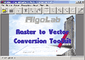
Vectorizer for CAD/CAM/GIS professionals, designers and illustrators. Available also as Raster to Vector SDK, ActiveX and Com Component. Converts, digitizes and refines architectural, mechanical, various technical drawings, Maps, math graphs, graphics for books and journals and more from raster to Vector. Digitizes math graphics. Also refines Vector graphics,...
Category: Multimedia & Design / Image Editing
Publisher: Algolab, License: Shareware, Price: USD $99.00, File Size: 1.7 MB
Platform: Windows
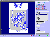
Vextractor Lite is an auto-tracing program for converting raster images into Vector formats by building centerlines and outlines. This tool could be used for the tracing photo, logotypes and other line art images for use in Vector Graphics Design software. You can also vectorize charts, drawings, Maps and schemes for input to CAD or GIS systems. Main features of...
Category: Multimedia & Design / Image Editing
Publisher: VextraSoft, License: Shareware, Price: USD $49.95, File Size: 13.2 MB
Platform: Windows

Raster to Vector is a stand-alone program that converts scanned drawings, Maps and raster images into accurate Vector files (such as DXF, HPGL, WMF, EMF, etc) for editing in any CAD application. Key Features: 1. Input image formats: BMP, JPG, TIF, GIF, PNG, PCX, TGA, RLE, JPE, J2K, JAS, JBG, MNG and more. 2. Output Vector formats: DXF, HPGL, EMF, WMF...
Category: Audio
Publisher: Raster to Vector, Inc., License: Shareware, Price: USD $99.00, File Size: 530.3 KB
Platform: Windows

Raster to Vector is a stand-alone program that converts scanned drawings, Maps and raster images into accurate Vector files (such as DXF, HPGL, WMF, EMF, etc) for editing in any CAD application. Key Features: 1. Input image formats: BMP, JPG, TIF, GIF, PNG, PCX, TGA, RLE, JPE, J2K, JAS, JBG, MNG and more. 2. Output Vector formats: DXF, HPGL, EMF, WMF...
Category: Multimedia & Design
Publisher: Raster to Vector, Inc., License: Shareware, Price: USD $99.00, File Size: 546.9 KB
Platform: Windows

Raster to Vector is a stand-alone program that converts scanned drawings, Maps and raster images into accurate Vector files (such as DXF, HPGL, WMF, EMF, etc) for editing in any CAD application. Key Features: 1. Input image formats: BMP, JPG, TIF, GIF, PNG, PCX, TGA, RLE, JPE, J2K, JAS, JBG, MNG and more. 2. Output Vector formats: DXF, HPGL, EMF, WMF...
Category: Audio
Publisher: Raster to Vector, Inc., License: Shareware, Price: USD $99.00, File Size: 546.9 KB
Platform: Windows
Raster to Vector Gold is a stand-alone program that converts scanned drawings, Maps and raster images into accurate Vector files (such as DXF, HPGL, WMF, EMF, etc) for editing in any CAD application. Key Features: 1. Input image formats: BMP, JPG, TIF, GIF, PNG, PCX, TGA, RLE, JPE, J2K, JAS, JBG, MNG and more. 2. Output Vector formats: DXF, HPGL, EMF,...
Category: Multimedia & Design
Publisher: Raster to Vector, Inc., License: Shareware, Price: USD $99.00, File Size: 530.3 KB
Platform: Windows
R2V is a tool for converting raster images to Vector by drawing centerlines and outlines. R2V converts architect, mechanical and various technical drawings, Maps and other types from raster to Vector format. A Vector format can be imported into your CAD/CAM or drawing program. R2V supports the Bmp and Jpeg raster format. The output Vector file can be saved in...
Category: Multimedia & Design
Publisher: MR Soft, License: Shareware, Price: USD $42.00, File Size: 1.6 MB
Platform: Windows
 Shareware
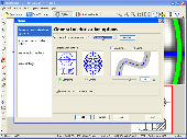
Vextractor is a vectorizer program for transforming raster images into Vector formats by building centerlines and outlines. This tool could be used for the vectorizing photo, logotypes and other line art images for use in Vector Graphics Design software. You can also vectorize charts, drawings, Maps and schemes for input to CAD or GIS systems. Main features of...
Category: Multimedia & Design / Image Editing
Publisher: VextraSoft, License: Shareware, Price: USD $99.95, File Size: 3.0 MB
Platform: Windows
Diffuse maps represent the absorption of light.
Diffuse Maps represent the absorption of light. Diffuse Maps are what people call "textures". They are the color textures or photographic textures usually applied to 3d models.
ShaderMap creates displacement Maps using the light data stored inside of diffuse Maps. Evenly lit diffuse Maps generally Create better quality Maps with...
Category: Home & Education / Miscellaneous
Publisher: Rendering Systems Inc., License: Freeware, Price: USD $0.00, File Size: 4.0 MB
Platform: Windows
Software development kit for CAD/CAM/ GIS and graphic software developers.
Software development kit for CAD/CAM/ GIS and graphic software developers. Converts from raster to Vector and refines architect, mechanical, tech drawing, Maps, math graphs, graphics for books and journals and more. ActiveX and Com Component are also available. Refines Vector graphics, creates fine lines and shapes. Scanned drawings are recognized and represented in a...
Category: Software Development / Tools & Editors
Publisher: AlgoLab Inc., License: Shareware, Price: USD $0.00, File Size: 2.7 MB
Platform: Windows
Shareware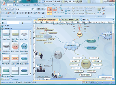
Edraw Max is a Vector-based diagramming software with rich examples and templates. Easy to Create flow charts, organizational charts, business process, UML diagrams, work flows, program structures, network diagrams, chart and graphics, mind map, directional Maps and database diagrams. With pre-drawn libraries and more than 4600 Vector symbols, drawing couldn't be...
Category: Multimedia & Design / Image Plugins
Publisher: Cucusoft Inc., License: Shareware, Price: USD $99.95, File Size: 6.1 MB
Platform: Windows
You can create a backup of your maps with JaVaWa GMTK and restore these (e.
You can Create a backup of your Maps with JaVaWa GMTK and restore these (e.g. on another computer) including unlock codes. Re-installing Maps is unnecessary.
Migration of your Garmin Maps from and old computer to a new one is straightforward with this application.
Category: Utilities / Backup
Publisher: JaVaWa GPS-tools, License: Shareware, Price: USD $0.00, File Size: 5.4 MB
Platform: Windows
Moagu: The Mother Of All GPS Utilities.
Moagu: The Mother Of All GPS Utilities.
You can convert USGS topographic Maps, aerial/satellite imagery, and any other raster map imagery for use on Garmin handled GPS units.
Garmin Maps have been in a "Vector" format; Moagu creates Maps using a "bitmap" format.
Category: Home & Education / Miscellaneous
Publisher: Moagu, License: Shareware, Price: USD $19.95, File Size: 38.2 MB
Platform: Windows
Shareware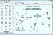
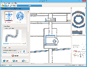
Create network maps with this powerful network diagrammer. Draw a LAN topology.
10-Strike Network Diagram is a powerful network diagrammer and mapper for the quick creation of visual local-area network Maps and diagrams, and exporting them to Microsoft Visio, or saving as charts, Vector, or raster images. The program will scan your managed switches via SNMP and discover the LAN topology automatically. It supports scanning via the ICMP, TCP, UPnP, SNMP, and...
Category: Software Development / Databases & Networks
Publisher: 10-Strike Software, License: Shareware, Price: USD $149.95, RUB3990, File Size: 5.3 MB
Platform: Windows

Raster to Vector is a stand-alone program that converts scanned drawings, Maps and raster images into accurate Vector files (such as DXF, HPGL, WMF, EMF, etc) for editing in any CAD application. Key Features: 1. Input image formats: BMP, JPG, TIF, GIF, PNG, PCX, TGA, RLE, JPE, J2K, JAS, JBG, MNG and more. 2. Output Vector formats: DXF, HPGL, EMF, WMF...
Category: Multimedia & Design
Publisher: Raster to Vector, License: Shareware, Price: USD $99.00, File Size: 530.3 KB
Platform: Windows
Vector Studio is an easy to use vector drawing program.
Vector Studio is an easy to use Vector drawing program. With an integrated button designer, you have the perfect tool for producing quick and easy buttons for use on your web pages or anywhere else you might need them.
In addition to powerful drawing tools that you don't have to be an expert to be able to use, Vector Studio includes access to rich resources like...
Category: Audio / Utilities & Plug-Ins
Publisher: Vector Studio, License: Shareware, Price: USD $39.99, File Size: 402.0 KB
Platform: Windows

Raster to Vector Normal is a stand-alone program that converts scanned drawings, Maps and raster images into accurate Vector files (such as DXF, HPGL, WMF, EMF, etc) for editing in any CAD application. Key Features: 1. Input image formats: BMP, JPG, TIF, GIF, PNG, PCX, TGA, RLE, JPE, J2K, JAS, JBG, MNG and more. 2. Output Vector formats: DXF, HPGL, EMF,...
Category: Multimedia & Design
Publisher: Raster to Vector, Inc., License: Shareware, Price: USD $99.00, File Size: 554.7 KB
Platform: Windows
In PIV, particle images are correlated to obtain vector displacement information.
In PIV, particle images are correlated to obtain Vector displacement information. Since the particle images themselves are random functions, the resulting correlation functions have random components which Create a finite probability of having erroneous measurements which must be removed before the dataset can be used.
Main features:
- provide an interactive display...
Category: Home & Education / Teaching Tools
Publisher: Steven M. Soloff ,Carl D. Meinhart, License: Freeware, Price: USD $0.00, File Size: 1.6 MB
Platform: Windows
Terrain Tools - Create maps quickly and easily!
Terrain Tools - Create Maps quickly and easily!
Terrain Tools is the ideal tool for outdoor recreationists, real-estate professionals, farmers, ecologists, archaeologists and others who need to Create basic Maps, calculate areas, lengths, bearings and distances.
Overlay GPS tracks on scanned images such as USGS or Canadian NTS topos. Import...
Category: Business & Finance / Applications
Publisher: Softree, License: Shareware, Price: USD $124.00, File Size: 15.0 MB
Platform: Windows

FSS Google Maps Downloader is a tool that can download the Google Maps images to your PC. This is a clearly free program. There is no spyware or adware. It's absolutely safe to install and to run. The interface is very simple and self explaining. It runs low on system resources consumption and is supported on all Windows versions. It can save them to your hard disk,...
Category: Internet / Download Managers
Publisher: FreeSmartSoft, License: Freeware, Price: USD $0.00, File Size: 874.0 KB
Platform: Windows
Shareware
Vectorize your images into scalable and clear art! Auto Vector converts photographs and images into scalable Vector files. Vector-based graphics appear smooth at any size or resolution. Auto Vector does the conversion automatically, you don't need to do any manual tracing. Just load an image, set the level of details globally and (optionally) locally and the...
Category: Multimedia & Design / Image Editing
Publisher: Caricature Software, License: Shareware, Price: USD $49.95, File Size: 2.1 MB
Platform: Windows
NOVA Maps provides appraisers and appraisal users with complete, high-resolution location Maps (also known as “street Maps”) for forms and addenda in seconds. NOVA Maps even automatically places labels for subject properties and comparables.
For just pennies per map and with just a click of the mouse, users have access to the entire United...
Category: Home & Education / Miscellaneous
Publisher: Day One, License: Demo, Price: USD $0.00, File Size: 5.7 MB
Platform: Windows
Create GPS enabled geo Maps directly on the background of aereal photos and road Maps from the internet. Import geodata from Google-Earth, OpenStreetMap, GPS tracks and GPS logger. Map editor , manually digitizing. Specifical graphical objects (borderlines, borderareas) to guarantee exact same borders of neighbour areas..Screen calibration for true to display on the screnn.
Category: Multimedia & Design / Digital Media Editors
Publisher: GPSur Dr. Erhard Regener, License: Shareware, Price: USD $65.00, File Size: 6.4 MB
Platform: Windows