Free Downloads: Cyberpunk Maps
CacheMaps retreives a variety of maps for your caches from the Internet.
CacheMaps retreives a variety of Maps for your caches from the Internet.
CacheMaps uses the Geocaching loc- or gpx-files as input. Directely from the Geocaching site or as exported from GSAK.CacheMaps v4 has been designed to be used next to GSAK. A lot of the functionality that was available in previous versions of CacheMaps, is available in GSAK now in a much better form. What...
Category: Audio / Utilities & Plug-Ins
Publisher: BigBird Productions, License: Freeware, Price: USD $0.00, File Size: 153.2 KB
Platform: Windows
MAPC2MAPC is a program to manipulate digital Maps,it loads map images and calibrate them,loads calibrations in many different formats and Datums,view the calibrated map,crop and rescale Maps whilst preserving the calibration,reproject Maps to 'Plate Carre' (Equirectangular),rotate Maps to true North.
Category: Multimedia & Design / Digital Media Editors
Publisher: Thorn, License: Shareware, Price: USD $0.00, File Size: 1.6 MB
Platform: Windows
Create GPS enabled geo Maps directly on the background of aereal photos and road Maps from the internet. Import geodata from Google-Earth, OpenStreetMap, GPS tracks and GPS logger. Map editor , manually digitizing. Specifical graphical objects (borderlines, borderareas) to guarantee exact same borders of neighbour areas..Screen calibration for true to display on the screnn.
Category: Multimedia & Design / Digital Media Editors
Publisher: GPSur Dr. Erhard Regener, License: Shareware, Price: USD $65.00, File Size: 6.4 MB
Platform: Windows
Terrain Tools - Create maps quickly and easily!
Terrain Tools - Create Maps quickly and easily!
Terrain Tools is the ideal tool for outdoor recreationists, real-estate professionals, farmers, ecologists, archaeologists and others who need to create basic Maps, calculate areas, lengths, bearings and distances.
Overlay GPS tracks on scanned images such as USGS or Canadian NTS topos. Import and export...
Category: Business & Finance / Applications
Publisher: Softree, License: Shareware, Price: USD $124.00, File Size: 15.0 MB
Platform: Windows
 Shareware
Offline Map Maker is a tool that help you to get offline tile images from Google Maps, Openstreetmap, Yandex Maps, Yahoo Maps, Mapquest, Gaode map, Tencent Maps, Baidu Maps, Tianditu, Arcgis Online, OneMap, Whereis, mapy.cz, Mappy, Waze, Sentinel-2 map, Strava Gloabal Heatmap, Wikimapia, GoMap.Az, Longdo Map, Bhuvan, National Map Australia, New Zealand...
Category: Internet / Download Managers
Publisher: allmapsoft.com, License: Shareware, Price: USD $79.00, File Size: 31.1 MB
Platform: Windows
With MapAuthor you can create, print and save desktop Maps, using data that you obtain from commercial sources or perhaps your in-hous GIS department as shapefiles (shapefiles are a very common GIS exchange format.) You can also produce internet-based Maps based on Google Maps, for use on your web site.
MapAuthor allows you to link your own data to Maps, for...
Category: Internet / Misc. Plugins
Publisher: MapAuthor.com, License: Freeware, Price: USD $0.00, File Size: 6.3 MB
Platform: Windows
Download, View, and Print Maps with the MrSID Viewer.
Download, View, and Print Maps with the MrSID Viewer.
To download and view Maps offline you need a special viewer. Maps are stored in MrSID format. The MRSID Viewer is a freeware tool. This library provides access to the MrSID viewer developed by LizardTech.
NOTE:
LizardTech dropped the link for that stand-alone viewer download from...
Category: Multimedia & Design / Graphics Viewers
Publisher: Lizardtech, License: Freeware, Price: USD $0.00, File Size: 2.0 MB
Platform: Windows
Freeware
Free standalone software DataPult Desktop creates heat Maps from your data quickly and efficiently. Key features: Direct data import from MS Excel with one click. The ability to create animated Maps of data over several years. Interactive Maps and diagrams. 39 map colorings for making heat Maps. Intelligent identification of input...
Category: Business & Finance / MS Office Addons
Publisher: DataPult, License: Freeware, Price: USD $0.00, File Size: 21.0 MB
Platform: Windows
PowerMapper allows information architects, usability analysts and web developers to create graphical site Maps with one click, providing site visualization and simple navigation. Maps show thumbnails of web pages and can be tailored using 11 different styles then printed or copied into another application. Key Features: Mapping - create Maps of any site on the World...
Category: Internet
Publisher: Electrum, License: Shareware, Price: USD $349.00, File Size: 1.3 MB
Platform: Windows
It Contains radius maps from modules 1-3 and runs from 1- 4.
It Contains radius Maps from modules 1-3 and runs from 1- 4. Creates random written exams to the same format as the PCO using WizAnn Radius Maps and automatically marks them. Drag and drop points onto the map and type in runs and compare with inbuilt runs. Perfect for Written test preparation.
Category: Multimedia & Design / Fonts
Publisher: WizAnn Publications Design, License: Shareware, Price: USD $0.00, File Size: 0
Platform: Windows
You will either mess up your work place with huge Maps and travel guides or just switch on to Schmap Player to guide you for your travel.
This amazing travel guide with elaborated Maps and destinations can be downloaded and used for free. The main interface of this application comprises the guide menu with: European guides, US guides, Canadian guides, Australian guides, and...
Category: Internet / Web Search Utilities
Publisher: Schmap, Inc., License: Freeware, Price: USD $0.00, File Size: 2.0 MB
Platform: Windows
Microsoft MapPoint software gives you the power to turn tabular data into informative Maps to communicate insights with instant impact. You can easily integrate Maps into your Office projects to show your business insights with clarity. Plus, get updated Maps of the US and Canada, with trip routing, turn-by-turn directions, and the ability to share routes with your GPS device.
Category: Business & Finance / MS Office Addons
Publisher: Microsoft, License: Shareware, Price: USD $0.00, File Size: 0
Platform: Windows
From Gothic St. Stephens Cathedral to the Imperial Palace - the 10 best of everything to see, buy, do, taste and avoid in Vienna, plus Maps and transport Maps.
Discover the best historic palaces and gardens, great walks and itineraries, most fun places for kids, venues for concerts and opera, liveliest beer halls, tastiest schnitzel and Viennese cakes, best hotels on every...
Category: Internet / Communications
Publisher: Mobile Systems, License: Shareware, Price: USD $9.80, File Size: 0
Platform: Windows
With SMART Ideas, you can create multilevel concept Maps that take students through concepts one step at a time for greater clarity. And you can easily convert the Maps into a multipage website for everyone to share.
A bank of colorful and descriptive graphics helps teachers break down information in highly visual ways so students can understand each element of a...
Category: Home & Education / Teaching Tools
Publisher: SMART Technologies Inc., License: Shareware, Price: USD $59.00, File Size: 39.5 MB
Platform: Windows
Aerial, topograhpic, and other types of Maps are an important resource in the visualization of your information. HuntSmart big game hunting software gives you the ability to view your information on Maps. Once you enter information with coordinates into the system, this information can be viewed on all available Maps that contain those coordinates. One thing to remember is...
Category: Multimedia & Design / Multimedia App's
Publisher: HuntingSouth, License: Shareware, Price: USD $0.00, File Size: 17.1 MB
Platform: Windows
From sailing along the Amsterdam's canals to enjoying the most comprehensive Van Gogh's collection in the Van Gogh Museum - the 10 best of everything to see, buy, do, taste and avoid in Amsterdam, plus Maps and transport Maps.
Discover the finest canals to explore on foot, best venues for music, dance and theater, most unmissable galleries and greatest Dutch...
Category: Internet / Communications
Publisher: Mobile Systems, License: Shareware, Price: USD $9.80, File Size: 0
Platform: Windows
From Gaudi's mind-boggling buildings to the Gothic Quarter, your holiday to Barcelona starts the moment you open the guide, plus Barcelona Maps and metro Maps.
Discover unmissable museums and galleries, walks and itineraries, fascinating modernist buildings and best tapas to suit every budget and much more. With this mobile travel guide you will save time, discover the...
Category: Internet / Communications
Publisher: Mobile Systems, License: Shareware, Price: USD $6.99, File Size: 0
Platform: Windows
SeeYou is a flight planning and analysis tool for glider pilots.
SeeYou is a flight planning and analysis tool for glider pilots. It is designed for both desktop and notebook PCs.
Main features:
- Vector Maps: Vector Maps are sharp, fast and accurate at all zoom settings. Objects are presented in the detail, that keeps the map readable.
- Raster Maps. They are bitmap files, useful for viewing your flight...
Category: Games / Simulations
Publisher: Naviter d.o.o., License: Shareware, Price: USD $167.22, File Size: 17.4 MB
Platform: Windows
W4MapLauncher is a free software application that contains more than 85 standard maps of W4.
W4MapLauncher is a free software application that contains more than 85 standard Maps of W4.This software application allows you to play on the new Maps in multiplayer or on-line.This launcher has also an aspect mode of 4:3 and 16:10, it is easy to install and to use
Category: Games / Misc. Games
Publisher: AlexBond, License: Freeware, Price: USD $0.00, File Size: 23.8 MB
Platform: Windows
CompeGPS is an essential software to make the most of your GPS. With this PC software you will be able to download a wide variety of cartography from the internet and also analyse your routes. This software has been specially designed for free flight and motor flight pilots they use GPS and likes to create and accomplish their own routes and then later on analyse. CompeGPS allows you to...
Category: Home & Education
Publisher: CompeGPS TEAM S.L., License: Shareware, Price: USD $106.00, File Size: 14.9 MB
Platform: Windows
Region Map Generator is a tool to make region map with self-definition color. The original Maps in the software are blank political region ones for different countries or areas. You can color any region with whatever color as you like. By this software, you can easily make lively Maps. These Maps can be used as data analysis charts, teaching materials, business chart, web...
Category: Business & Finance / Applications
Publisher: cciyy, License: Shareware, Price: USD $36.95, File Size: 1.3 MB
Platform: Windows
PowerMapper allows information architects, usability analysts and web developers to create graphical site Maps with one click, providing site visualization and simple navigation. Maps show thumbnails of web pages and can be tailored using 7 different styles then printed or copied into another application. Key Features: Mapping - create Maps of any site on the World...
Category: Internet
Publisher: Electrum, License: Shareware, Price: USD $149.00, File Size: 1.3 MB
Platform: Windows
From the top 10 ways to experience Royal London to the top 10 shops, pubs and hotels - this guide features the insider knowledge that every visitor needs, plus London Maps and metro Maps.
Capture the essence of London, from shopping in Harrods to the Changing of the Guard at Buckingham Palace. Discover the most fascinating buildings, beautiful parks and gardens, unmissable...
Category: Internet / Communications
Publisher: Mobile Systems, License: Shareware, Price: USD $9.80, File Size: 0
Platform: Windows
From gorgeous piazzas and stunning fountains to incredible ancient history, discover Rome with this mobile Eyewitness Travel Guide, plus get Rome Maps and transport Maps.
Discover the most beautiful churches, fascinating ancient sites and galleries, greatest Roman artists, fun places for children, and best restaurants to suit every budget and much more.
With included...
Category: Internet / Communications
Publisher: Mobile Systems, License: Shareware, Price: USD $9.80, File Size: 0
Platform: Windows

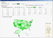
Commercial realtors require accurate and reliable tools to publish available properties online and show them on the website (specifying region, county, state, and city). We have created a unique Interactive Real Estate Map with all USA states and counties on it for real estate business. USA Real Estate Map is a unique and amazing vector-based tool that is very simple to use. We applied...
Category: Internet
Publisher: USFlashMap.com, License: Shareware, Price: USD $399.00, File Size: 3.9 MB
Platform: Windows, Mac, Linux, Unix, MS-DOS, AS/400, OS/2