Free Downloads: Digital Terrain Model
Introducing you AEC Terrain interface which is designed to simplify Terrain management and 3D-modeling. AEC Terrain creates Digital Elevation Model from multiple input point files on AutoCAD graphic editor. All purpose multi-level pads, road alignments, mining applications and airfields can be generated on the Terrain on different layers with different...
Category: Business & Finance / Project Management
Publisher: AEC Logic Private Limited, License: Shareware, Price: USD $750.00, File Size: 16.3 MB
Platform: Windows
Terrain Generator Terrain Generator allows you to generate terrain for specific games.
Terrain Generator Terrain Generator allows you to generate Terrain for specific games. You can specify almost everything when it's about creating a Terrain which then later can be used aside textures for a beautiful product. The program can export to different file formats for easy integration.
Category: Games / Tools & Editors
Publisher: Ryan Gregg, License: Freeware, Price: USD $0.00, File Size: 522.8 KB
Platform: Windows
GSI3D utilizes a Digital Terrain Model, surface geological linework and downhole borehole data to enable the geologist to construct cross sections by correlating boreholes and the outcrops to produce a geological fence diagram. Mathematical interpolation between the nodes along the drawn sections and the limits of the units produces a solid Model comprising a stack...
Category: Utilities / Misc. Utilities
Publisher: British Geological Survey - Insight, License: Shareware, Price: USD $0.00, File Size: 44.6 MB
Platform: Windows
FlashMNT is a program that allows the creation of a Digital Terrain Model and 3D computations, comprising the following functions: data verification, triangulation, 3D area computation, cut/fill quantities between 2 DTM’s, cross section, meshing, entities projection over a DTM, min and max Z values, 3D poly-lines offset, contour lines, and so on.
Category: Multimedia & Design / Image Editing
Publisher: DeliCAD, License: Shareware, Price: USD $0.00, File Size: 0
Platform: Windows
Terrain for Rhino is a terrain modeling plug-in for Rhinoceros (commonly known as Rhino).
Terrain for Rhino is a Terrain modeling plug-in for Rhinoceros (commonly known as Rhino). This plug-in gives Rhino the ability to create a Terrain mesh from a set of unordered points. The Terrain mesh is created as a Delaunay Triangulation, which is regarded as the best method to create a Terrain mesh from unorganized point data. Terrain for Rhino is...
Category: Multimedia & Design / Multimedia App's
Publisher: SYCODE, License: Commercial, Price: USD $95.00, File Size: 2.2 MB
Platform: Windows
Terrain for AutoCAD is a terrain modeling plug-in for AutoCAD.
Terrain for AutoCAD is a Terrain modeling plug-in for AutoCAD. This plug-in gives AutoCAD the ability to create a Terrain mesh from a set of unordered points, lines, polylines and splines. The Terrain mesh is created as a Delaunay Triangulation, which is regarded as the best method to create a Terrain mesh from unorganized point data. Terrain for...
Category: Multimedia & Design / Multimedia App's
Publisher: SYCODE, License: Commercial, Price: USD $195.00, File Size: 2.6 MB
Platform: Windows
ProJob is a free software utility supplied by Prolec for use with Digital Terrain Maps (DTM).
ProJob is a free software utility supplied by Prolec for use with Digital Terrain Maps (DTM). Its principle function is to take one of the many standard industry formats for these DTMs and convert it into a .tri file. A .tri file is the proprietary format used by Prolec's Digmaster Pro machine control product, and because of the way that Digmaster Pro and ProJob work...
Category: Multimedia & Design / Graphics Viewers
Publisher: Prolec Ltd, License: Freeware, Price: USD $0.00, File Size: 3.5 MB
Platform: Windows
With this FREE AutoCAD add-on you can create Terrain sections
from geodetic points(heights) in the drawing. You can also
specify position of pipe(cable, road, ...) or set auxiliary
marks in the section.
Text settings, scale in X,Y axis, height of the reference
plane and type of the Terrain section can be set at start-up.
There are two ways how you can create...
Category: Multimedia & Design / Multimedia App's
Publisher: Cadhedral, License: Freeware, Price: USD $0.00, File Size: 69.0 KB
Platform: Windows
In FastTerrain you are able to create, edit and visualize in 3D space digital terrain models.
In FastTerrain you are able to create, edit and visualize in 3D space Digital Terrain models. The program includes functionalities for break-lines and holes insertion as well as volume calculations and contours lines creation. With FastTerrain you can estimate excavation volumes by using Digital Terrain models (DTMs). Perfect choice for Civil Engineers, Surveyors,...
Category: Multimedia & Design / Image Editing
Publisher: Diolkos3D, License: Freeware, Price: USD $0.00, File Size: 30.4 MB
Platform: Windows
The Trimble Link Engine is the component that provides the Trimble Link functionality in the AutoCAD Civil/Civil 3D systems and in other products such as 12d Model, LSS Digital Terrain modelling software, Bentley GEOPAK, Bentley InRoads etc. If you have Trimble Access software and wish to use the data from it in a Trimble Link system, you can install this Trimble Link...
Category: Software Development / Components & Libraries
Publisher: Trimble Navigation Limited, License: Freeware, Price: USD $0.00, File Size: 16.8 MB
Platform: Windows
While the Terrain that ships out-of-the-box with FSX is much-improved over previous versions, the newly-enhanced Terrain engine still leaves much vacant capabilities to fill. So FSGenesis has bumped it up a notch, filling those capabilities while providing our most accurate and detailed Terrain yet, taking advantage of the efficiency of the new all-LODs-in-one-file format...
Category: Home & Education / Miscellaneous
Publisher: FSGenesis, License: Freeware, Price: USD $0.00, File Size: 28.0 MB
Platform: Windows
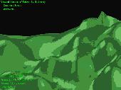
Visual Terrain Maker is a 3D-Modeling program allows visually create landscapes (maps) for games or other purposes. Works in XP/NT/2k. The program can export to Direct X file format(*.x). The program is not critical to the video adapters and drivers. Suitable for Dark Basic developers. No special software and hardware required (just OpenGL v1.1). Visual Terrain Maker can export to...
Category: Multimedia & Design
Publisher: UNGSoft Developers Group, License: Freeware, Price: USD $0.00, File Size: 321.2 KB
Platform: Windows
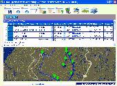
Importation/Exportation: Import/export trails to gpx file. Unlimited number of trails, and TrackPoints. Export to gpx, Excel, PDF, XPS and KML/KMZ. Data table: Very flexible data table that allows sorting by columns, with inheritance of data, attributes, etc. Presentation on map: View on map in accordance with the active trail, which comes from providers of maps, as in 'Satellite' mode...
Category: Home & Education / Miscellaneous
Publisher: Aplicaciones Topográficas S.L., License: Freeware, Price: USD $0.00, File Size: 27.0 MB
Platform: Windows


 Shareware
Google Maps Terrain Downloader is a tool that can automatically download the google Terrain maps images to your PC. It can download the small tiles and save them to your hard disk. After downloading, you can view the maps offline by its tool Maps Viewer, or you can combine the small images into one big map image. If you want to make a map of your city by yourself, it is very...
Category: Internet / Download Managers
Publisher: allmapsoft.com, License: Shareware, Price: USD $29.99, File Size: 305.3 MB
Platform: Windows
SurfMate is a Digital Terrain modelling and earthworks design solution giving the designer many enhanced features for use in Digital Terrain Modelling and Earthworks design completely integrated with AutoCAD.
TECHNoCAD have put great effort into packing as many useful options as possible into the software to make it the most valuable add-on to AutoCAD...
Category: Multimedia & Design / Image Editing
Publisher: TECHNoCAD, License: Demo, Price: USD $0.00, File Size: 78.5 MB
Platform: Windows
Terrain Tools - Create maps quickly and easily!
Terrain Tools - Create maps quickly and easily!
Terrain Tools is the ideal tool for outdoor recreationists, real-estate professionals, farmers, ecologists, archaeologists and others who need to create basic maps, calculate areas, lengths, bearings and distances.
Overlay GPS tracks on scanned images such as USGS or Canadian NTS topos. Import and export...
Category: Business & Finance / Applications
Publisher: Softree, License: Shareware, Price: USD $124.00, File Size: 15.0 MB
Platform: Windows
MicroPilot’s HORIZONmp Ground Control Station Software has the features you need to operate safe, repeatable missions.
HORIZONmp allows the operator to monitor the autopilot, change waypoints, upload new flight plans, initiate holding patterns and adjust feedback loop gains all while the UAV is flying.
Main features:
- Map annotation and user...
Category: Home & Education / Miscellaneous
Publisher: MicroPilot Inc., License: Shareware, Price: USD $0.00, File Size: 0
Platform: Windows
Oriantica is the new generation orienteering simulation software.
Oriantica is the new generation orienteering simulation software. Using a map and a compass you have to find your way through the Terrain to locate the controls as fast as possible.
In Oriantica it is possible to compete with other players over a network, or play against the computer.
The map and Terrain is much more flexible than in previous versions, with more...
Category: Games / Misc. Games
Publisher: Melin Software HB, License: Shareware, Price: USD $39.00, File Size: 16.5 MB
Platform: Windows
SC3K Map Editor is the fastest and most accurate Terrain editor currently available for SimCity 3000. It gives you the finest possible control over modifications to your Terrain.
With SC3K Map Editor you can use an interface very similar to that given by SimCity 3000 so that you can see exactly what your Terrain will look like as you create it.
Also you...
Category: Games / Tools & Editors
Publisher: Tenermerx Software, License: Freeware, Price: USD $0.00, File Size: 990.5 KB
Platform: Windows
UK Based Civil Engineering and Surveyor Software Developers, covering all aspects of surveying and engineering including Digital Terrain modeling.
- Reduce Traverse and Resection Observations?
- Reduce Field Observations?
- Reduce Levels?
- Compute Least Squares Solutions
Category: Home & Education / Miscellaneous
Publisher: NRG Surveys, License: Shareware, Price: USD $161.00, File Size: 17.6 MB
Platform: Windows
FSGenesis is your one-stop supplier for top-quality terrain mesh products for FS2004 and FSX.
FSGenesis is your one-stop supplier for top-quality Terrain mesh products for FS2004 and FSX. Since 1996 we have provided the world-wide flight simulator community with high-quality products at a low price. If you're looking for Terrain mesh for Microsoft Flight Simulator, look no further.
Category: Games / Simulations
Publisher: FSGenesis, License: Freeware, Price: USD $0.00, File Size: 116.0 MB
Platform: Windows
ProfLT is a program which offers functionalities for configuring, drawing and modifying longitudinal Terrain profiles and cross sections.
ProfLT application allows the insertion of points from a coordinates file, and based on the codes or on the 3D Model the program generates longitudinal or cross profiles. The configuration options allow the user customization of the...
Category: Multimedia & Design / Multimedia App's
Publisher: CADWARE Engineering, License: Shareware, Price: USD $365.08, File Size: 4.1 MB
Platform: Windows
TopoLT is an application offering tools for 2D and 3D aplications and functionalities useful for all those who design topographical or cadastral plans in Digital format, who develop 3D Terrain models and contours, fill and cut volumes calculation, raster image georeferencing and automatic printing.
Category: Multimedia & Design / Image Editing
Publisher: CADWARE Engineering, License: Shareware, Price: USD $481.82, File Size: 0
Platform: Windows
Creeper World 2 thrusts you into the 14th millennium fighting an enemy that flows and oozes through the Terrain. Employ advanced weapons, gravity manipulating repulsors, wormhole like rifts, and your own wit against this never yielding enemy.
Excavate Terrain, unearth techs, crystals, remnants and other artifacts. Face a new mechanical enemy that employs gravity manipulation...
Category: Games / Kids
Publisher: Knuckle Cracker, LLC, License: Shareware, Price: USD $9.95, File Size: 30.1 MB
Platform: Windows
ArBa3d is a 3D modeling software that allows to create a 3D model from a set of digital photos.
ArBa3d is a 3D modeling software that allows to create a 3D Model from a set of Digital photos. The tool takes as input a set of photos taken from different viewpoints. It tesselates the vertices and constraint edges from the user input to produce a 3D Model that can then be exported to different 3D formats (vrml, obj, x, flt, x3d, kml). The 3D models can also be displayed...
Category: Multimedia & Design / Image Editing
Publisher: ArBa3d.com, License: Shareware, Price: USD $0.00, File Size: 5.3 MB
Platform: Windows


