Free Downloads: Downloads Maps Point
SimpleDownload is an easy to use freeware download manager. Greatly speed up Downloads, download large files over poor internet connections, resume broken Downloads, pause Downloads or shut down and resume when it suits you, automatically organise new Downloads as you like and have complete control over the number of connections for each file. No ads to slow your...
Category: Internet
Publisher: Moog Software, License: Freeware, Price: USD $0.00, File Size: 12.2 MB
Platform: Windows
Nokia Maps 3D browser plugin is a free mapping product and service by Nokia for its mobile phones and for internet browsers. Nokia Maps includes voice guided navigation for both pedestrians and drivers for 74 countries in 46 different languages and there are Maps for over 180 countries.
See the world in high-resolution 3D. Everything from the sky to the street. Plan...
Category: Internet / Browser Accessories
Publisher: Nokia, License: Freeware, Price: USD $0.00, File Size: 9.8 MB
Platform: Windows
Heat Map Explorer's desktop editions are standalone Windows applications that enable you to visually analyze business data using intuitive "heat Maps".
Heat Maps use color and size to rapidly communicate complex information that is nearly impossible to see on a spreadsheet.
Import data from Excel, Access or a SQL database in a few easy steps, then use a...
Category: Software Development / Help File Utilities
Publisher: Lab Escape, Inc., License: Shareware, Price: USD $0.00, File Size: 39.1 MB
Platform: Windows
From the Sacre Coeur to the Arc de Triomphe, your holiday to Paris starts from the moment you open your guide, plus you get Paris Maps and transport Maps.
Discover the best cafe terraces, unmissable museums and galleries, loveliest parks and gardens, best areas to shop or browse, unforgettable shows and live music venues, most fun places for children, and best restaurants to...
Category: Internet / Communications
Publisher: Mobile Systems, License: Shareware, Price: USD $9.80, File Size: 0
Platform: Windows

Fire meditation. One method of visual hypnosis, is simply staring at a fixed Point for a while. A common one, is staring at a candle in a dark room. Or try our two computer graphic visual self hypnosis Downloads that work well for that same method also. Just click on the link, make sure there are no disturbances around you, and stare at the center of the picture. The longer you do...
Category: Home & Education
Publisher: ABC Meditation, License: Freeware, Price: USD $0.00, File Size: 18.0 KB
Platform: Windows, Mac
When you are looking for a powerful tool to satisfy various needs regarding vectors, raster and satellite imagery, you will find ILWIS Academic an efficient application. The program comes with such useful features as points to create Maps, lines for segment Maps, closed area segments for polygon Maps, spatial operations for raster Maps and so on. Whilst using images...
Category: Home & Education / Miscellaneous
Publisher: ITC, License: Freeware, Price: USD $0.00, File Size: 19.4 MB
Platform: Unknown
GDS Images and Document Maps is a unique document search utility.
GDS Images and Document Maps is a unique document search utility. GDS Images and Document Maps is a rather unique application that will enable you to store all your documents and images alongside other important files and folders right on your desktop so that you can use it straight from there, without the need to bother around with looking with looking for every single file...
Category: Utilities / Misc. Utilities
Publisher: toggle, License: Freeware, Price: USD $0.00, File Size: 558.8 KB
Platform: Windows
The View software provides an excellent starting Point for reading and writing job data to popular precision farming devices.
The free software can read data from a wide range of precision farming devices in order to display and print yield Maps, as-applied Maps, coverage Maps, and more. Other features of View include the ability to build a list of clients,...
Category: Business & Finance / MS Office Addons
Publisher: Farm Works Software, License: Freeware, Price: USD $0.00, File Size: 59.4 MB
Platform: Windows
MapCreator combines a cartography and a graphics programme.
MapCreator combines a cartography and a graphics programme. The software is designed to create Maps and animated Maps of the highest quality as often required for presentations. For example, this could be Maps needed for a travel presentation. But also in
Category: Multimedia & Design
Publisher: primap.com, License: Freeware, Price: USD $0.00, File Size: 103.3 MB
Platform: Windows, Vista
CacheMaps retreives a variety of maps for your caches from the Internet.
CacheMaps retreives a variety of Maps for your caches from the Internet.
CacheMaps uses the Geocaching loc- or gpx-files as input. Directely from the Geocaching site or as exported from GSAK.CacheMaps v4 has been designed to be used next to GSAK. A lot of the functionality that was available in previous versions of CacheMaps, is available in GSAK now in a much better form. What...
Category: Audio / Utilities & Plug-Ins
Publisher: BigBird Productions, License: Freeware, Price: USD $0.00, File Size: 153.2 KB
Platform: Windows
MAPC2MAPC is a program to manipulate digital Maps,it loads map images and calibrate them,loads calibrations in many different formats and Datums,view the calibrated map,crop and rescale Maps whilst preserving the calibration,reproject Maps to 'Plate Carre' (Equirectangular),rotate Maps to true North.
Category: Multimedia & Design / Digital Media Editors
Publisher: Thorn, License: Shareware, Price: USD $0.00, File Size: 1.6 MB
Platform: Windows
 Shareware
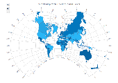
AnyMap JS Maps is an advanced JavaScript/HTML5 mapping library which makes you able to easily create interactive Maps that look great on any device including PCs, Macs, iPhones, iPads, Android devices and others - on any platform and in any browser. AnyMap JS is perfect for interactive dashboards and side-by-side reporting. You can use it to display sales by region, election...
Category: Web Authoring / JavaScript
Publisher: AnyChart JavaScript Charts, License: Shareware, Price: USD $49.00, File Size: 23.3 MB
Platform: Windows, Mac, Linux,
Create GPS enabled geo Maps directly on the background of aereal photos and road Maps from the internet. Import geodata from Google-Earth, OpenStreetMap, GPS tracks and GPS logger. Map editor , manually digitizing. Specifical graphical objects (borderlines, borderareas) to guarantee exact same borders of neighbour areas..Screen calibration for true to display on the screnn.
Category: Multimedia & Design / Digital Media Editors
Publisher: GPSur Dr. Erhard Regener, License: Shareware, Price: USD $65.00, File Size: 6.4 MB
Platform: Windows
AZMap is a freeware Windows program which will generate, and display an Azimuthal-Equidistance map of the world, centered on any Point on the surface of the earth (except very near the poles). The A-E map is also known as a Great Circle map since straight lines from the center Point to any other Point always fall along a great circle path and represent the shortest distance...
Category: Home & Education / Miscellaneous
Publisher: Paul Burton, License: Freeware, Price: USD $0.00, File Size: 1.1 MB
Platform: Windows
Terrain Tools - Create maps quickly and easily!
Terrain Tools - Create Maps quickly and easily!
Terrain Tools is the ideal tool for outdoor recreationists, real-estate professionals, farmers, ecologists, archaeologists and others who need to create basic Maps, calculate areas, lengths, bearings and distances.
Overlay GPS tracks on scanned images such as USGS or Canadian NTS topos. Import and export...
Category: Business & Finance / Applications
Publisher: Softree, License: Shareware, Price: USD $124.00, File Size: 15.0 MB
Platform: Windows
Versamap draws outline maps on 16 map projections.
Versamap draws outline Maps on 16 map projections. The program allows users to print publication quality Maps; and to export Maps in vector graphic (WMF, CGM, DXF, ASCII) and bitmapped (BMP) formats. Versamap is supplied with digital Maps from the Versamap Micro World Database, a world map with 220,000 points in 10 geographic features. Versamap may be ordered with...
Category: Home & Education / Genealogy
Publisher: Versamap, License: Shareware, Price: USD $30.00, File Size: 4.0 MB
Platform: Windows
Shareware
Offline Map Maker is a tool that help you to get offline tile images from Google Maps, Openstreetmap, Yandex Maps, Yahoo Maps, Mapquest, Gaode map, Tencent Maps, Baidu Maps, Tianditu, Arcgis Online, OneMap, Whereis, mapy.cz, Mappy, Waze, Sentinel-2 map, Strava Gloabal Heatmap, Wikimapia, GoMap.Az, Longdo Map, Bhuvan, National Map Australia, New Zealand...
Category: Internet / Download Managers
Publisher: allmapsoft.com, License: Shareware, Price: USD $79.00, File Size: 31.1 MB
Platform: Windows
With MapAuthor you can create, print and save desktop Maps, using data that you obtain from commercial sources or perhaps your in-hous GIS department as shapefiles (shapefiles are a very common GIS exchange format.) You can also produce internet-based Maps based on Google Maps, for use on your web site.
MapAuthor allows you to link your own data to Maps, for...
Category: Internet / Misc. Plugins
Publisher: MapAuthor.com, License: Freeware, Price: USD $0.00, File Size: 6.3 MB
Platform: Windows
Download, View, and Print Maps with the MrSID Viewer.
Download, View, and Print Maps with the MrSID Viewer.
To download and view Maps offline you need a special viewer. Maps are stored in MrSID format. The MRSID Viewer is a freeware tool. This library provides access to the MrSID viewer developed by LizardTech.
NOTE:
LizardTech dropped the link for that stand-alone viewer download from...
Category: Multimedia & Design / Graphics Viewers
Publisher: Lizardtech, License: Freeware, Price: USD $0.00, File Size: 2.0 MB
Platform: Windows
Advanced Internet Tool is powerfull download client with built in FTP client, Scheduler, HTML links extractor and Downloads manager. AIT can concurently download/upload unlimited number of files both from HTTP and FTP servers. Uploads/Downloads are bullet proof, start them and forget about them, If connection is broken ait will automaticaly resume your Downloads. Built in...
Category: Internet / Download Managers
Publisher: AndySoft, License: Shareware, Price: USD $25.00, File Size: 1.4 MB
Platform: Windows
Water Point Mapping is a process for monitoring the distribution and status of water points in rural and urban areas. It supports local level planning and can improve accountability for water sector performance at local and national levels.
It uses the Google Earth application to visualise data. Once Google Earth has been installed, it can be run offline.
...
Category: Home & Education / Miscellaneous
Publisher: WaterAid, License: Freeware, Price: USD $0.00, File Size: 880.0 KB
Platform: Windows
Freeware
Free standalone software DataPult Desktop creates heat Maps from your data quickly and efficiently. Key features: Direct data import from MS Excel with one click. The ability to create animated Maps of data over several years. Interactive Maps and diagrams. 39 map colorings for making heat Maps. Intelligent identification of input...
Category: Business & Finance / MS Office Addons
Publisher: DataPult, License: Freeware, Price: USD $0.00, File Size: 21.0 MB
Platform: Windows
FileOwner is an easy to use download manager that uses an Outlook user interface, allowing you to start and manage your Downloads. You can resume Downloads and split files for faster Downloads. It includes a web parser that lets you browse any website but viewing all files including internal files. FileOwner provides a history of your Downloads, a file drop window....
Category: Internet / Download Managers
Publisher: Ariel Selig, License: Shareware, Price: USD $24.95, File Size: 3.2 MB
Platform: Windows
PowerMapper allows information architects, usability analysts and web developers to create graphical site Maps with one click, providing site visualization and simple navigation. Maps show thumbnails of web pages and can be tailored using 11 different styles then printed or copied into another application. Key Features: Mapping - create Maps of any site on the World...
Category: Internet
Publisher: Electrum, License: Shareware, Price: USD $349.00, File Size: 1.3 MB
Platform: Windows
It Contains radius maps from modules 1-3 and runs from 1- 4.
It Contains radius Maps from modules 1-3 and runs from 1- 4. Creates random written exams to the same format as the PCO using WizAnn Radius Maps and automatically marks them. Drag and drop points onto the map and type in runs and compare with inbuilt runs. Perfect for Written test preparation.
Category: Multimedia & Design / Fonts
Publisher: WizAnn Publications Design, License: Shareware, Price: USD $0.00, File Size: 0
Platform: Windows