Free Downloads: Drawing Road Maps
DRPRO (Drawing Register Professional) is a computerized Drawing & Document Management System for use in a Drawing office environment. It is designed to do the tedious work of maintaining an accurate Drawing and document issue register in a multi-disciplinary Engineering, Architectural or Interior Design practice, or virtually any Drawing office.
Category: Multimedia & Design / Image Editing
Publisher: LDA Computing, License: Shareware, Price: USD $0.00, File Size: 0
Platform: Windows
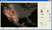
The Overlay Maker is a networked Drawing program with the ability to manipulate paint objects and add icons. It is designed to support military planning however can be used for a broad range of Drawing requirements. The program replicates the creation of overlay graphics on Maps or other background images. It supports multiple overlays and a range of graphic Drawing...
Category: Multimedia & Design / Multimedia App's
Publisher: TheOverlayMaker, License: Shareware, Price: USD $37.50, File Size: 22.8 MB
Platform: Windows
Produce home or garden designs, Maps, floorplans, geometric shapes, technical diagrams, office charts, graphs and more.PC Draft PE is a low-cost, easy-to-use application for Drawing and design based on Microspot PC Draft 5.0 for Windows. Features include an accurate, scaled Drawing environment for drawings up to 43 cm (17 inches) square complete with tools for...
Category: Multimedia & Design / Multimedia App's
Publisher: Microspot Ltd, License: Demo, Price: USD $39.00, File Size: 7.3 MB
Platform: Windows
Takes the place of outdated and hard to read weld maps.
Takes the place of outdated and hard to read weld Maps. While tracking everything by hand on your blueprint or Drawing may seem convenient at the moment, keeping record of and easily using that information is another problem entirely. The visual and tactile nature of our software gives you the feel of a traditional map of welds drawn on a blueprint, but with the organization,...
Category: Multimedia & Design / Digital Media Editors
Publisher: Computer Engineering, Inc., License: Shareware, Price: USD $750.00, File Size: 14.0 MB
Platform: Windows
The Overlay Maker is a networked Drawing program with the ability to manipulate paint objects and add icons. It is designed to support military planning however can be used for a broad range of Drawing requirements. The program replicates the creation of overlay graphics on Maps or other background images. It supports multiple overlays and a range of graphic Drawing...
Category: Multimedia & Design / Fonts
Publisher: alistairdickie, License: Freeware, Price: USD $0.00, File Size: 4.1 MB
Platform: Windows
think! Bubble Maps is a Windows tool for creating bubble Maps and capturing your thought. Using simple mouse click, drags and typing, your thoughts get put to paper (virtual), quickly and effectively.
The key feature of think! Bubble Maps is speed which makes it an excellent tool for live capture. You can use this program during meetings, workshops, and seminars.
Category: Multimedia & Design / Multimedia App's
Publisher: Lowrie Associates Ltd, License: Shareware, Price: USD $41.90, File Size: 5.9 MB
Platform: Windows
Allows you to create video travel logs of all the places you visit and then turn them into movies that iMovie and other movie editors will recognize (Quicktime Format). Comes with 17 high quality Maps from all over the world that you can use as is, or customize for your specific needs. You can also use your own Maps. (.jpg, .bmp, .png, .pict or .tiff) Configure and customize...
Category: Multimedia & Design
Publisher: Sol Robots L.L.C., License: Shareware, Price: USD $9.95, File Size: 8.6 MB
Platform: Windows
RouteBuddy is the only modern, advanced digital map application for Windows and Mac OS X.
RouteBuddy is the only modern, advanced digital map application for Windows and Mac OS X. It doesn't matter on which platform you wish to use the application as it sports a universal toolbar and comparable features throughout.
- High resolution Road, Topo and Satellite Maps can be viewed in the same application using our state-of-the-art animated layer...
Category: Home & Education / Miscellaneous
Publisher: RouteBuddy Ltd, License: Shareware, Price: USD $59.99, File Size: 121.5 MB
Platform: Windows
TninkGraph is a graphic editor for drawing concept maps.
TninkGraph is a graphic editor for Drawing concept Maps. This program contains many interesting and useful features. It provides you with tools to move and design elements. With ThinkGraph you can draw Maps with different layouts: vertical, horizontal, topic Maps; and different styles: boxes, lines, branches. The program saves data in SVG format, so then you can open...
Category: Multimedia & Design / Digital Media Editors
Publisher: Michel Kern, License: Freeware, Price: USD $0.00, File Size: 6.3 MB
Platform: Windows
 Commercial
MindMaple is an effective software method for brainstorming, note taking, organizing, and managing projects by stimulating both sides of the brain through use of visual contents and Maps. MindMaple is focused on improving user friendly interface to create Maps. The interface allows the user to add topics by click-dragging from an existing topic box, so called the Drawing...
Category: Business & Finance / MS Office Addons
Publisher: MindMaple Inc., License: Commercial, Price: USD $9.99, File Size: 15.8 MB
Platform: Windows
Freeware
MindMaple is an effective software method for brainstorming, note taking, organizing, and managing projects by stimulating both sides of the brain through use of visual contents and Maps. MindMaple is focused on improving user friendly interface to create Maps. The interface allows the user to add topics by click-dragging from an existing topic box, so called the Drawing...
Category: Business & Finance / MS Office Addons
Publisher: MindMaple Inc., License: Freeware, Price: USD $0.00, File Size: 9.7 MB
Platform: Windows
With this FREE AutoCAD add-on you can create terrain sections
from geodetic points(heights) in the Drawing. You can also
specify position of pipe(cable, Road, ...) or set auxiliary
marks in the section.
Text settings, scale in X,Y axis, height of the reference
plane and type of the terrain section can be set at start-up.
There are two ways how you can create...
Category: Multimedia & Design / Multimedia App's
Publisher: Cadhedral, License: Freeware, Price: USD $0.00, File Size: 69.0 KB
Platform: Windows
This software development kit (SDK) provides the binaries and programming reference for the Bing Maps Silverlight Control. You can use this control to build your own web sites that use Bing Maps.
The Bing Maps Silverlight Control combines the power of Silverlight and Bing Maps to provide an enhanced mapping experience. Developers can use the Bing...
Category: Utilities / Misc. Utilities
Publisher: Microsoft, License: Freeware, Price: USD $0.00, File Size: 3.8 MB
Platform: Windows
The GPS Detector software is used to update the GPS detector's database , updating Maps , routes and camera locations . The device itself is based on pre-installed GPS coordinates, the device can indicate various Road hazards like: Fixed cameras, Red light speed cameras and bus lane cameras, Usual speed measurement places and dangerous zones.
Category: Business & Finance / Business Finance
Publisher: Euro Noliker Kft., License: Freeware, Price: USD $0.00, File Size: 5.5 MB
Platform: Windows
Euratlas Periodis Expert is a database and a historical atlas of Europe with editing functions.
Euratlas Periodis Expert is a database and a historical atlas of Europe with editing functions. It describes the political status of Europe, North Africa and Near East at fixed intervals, from year 1 until year 2000.
Stress is put on the precise Drawing of territories at one exact instant defined by fixed length intervals, that is the first day of each centennial year.
...
Category: Home & Education / Miscellaneous
Publisher: Euratlas, License: Shareware, Price: USD $77.80, File Size: 33.2 MB
Platform: Windows
Growing global trend in the construction industry today is crossing new borders, especially when it comes to accurate and quick designing and dimensioning. Contracting companies and investors have raised their benchmarks regarding time, value for engineering hours and cost effective construction. To meet these demands they need an automation manager like AEC Roads. Accurate and interactive, AEC...
Category: Business & Finance / Project Management
Publisher: AEC Logic Private Limited, License: Shareware, Price: USD $1500.00, File Size: 7.6 MB
Platform: Windows
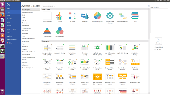
An all-inclusive diagramming software for OS X that is capable for 260+ Drawing types including flowcharts, mind Maps, org charts, infographics, floor plans, AWS network diagrams, Gantt charts, electrical schematics... and that is just the beginning! More than 260 kinds of diagrams help you analyze data easily and present information nicely. Make complex statistics understandable...
Category: Multimedia & Design / Digital Media Editors
Publisher: EdrawSoft, License: Shareware, Price: USD $99.00, File Size: 229.1 MB
Platform: Linux, Unix
A!K Mouse Off-Road is an odometer for your mouse! It tracks movement of the mouse and the time of a mouse activity. All tracked information is shown on the indicator window and may be exported to a .txt file.
Category: Desktop Enhancements
Publisher: sixfiles.com, License: Freeware, Price: USD $0.00, File Size: 474.0 KB
Platform: Windows, Mac, 2K, 2K3
The goal of Road Construction is to build a Road to connect two neighboring cities so that a first vehicle, ready to start on your heels at the beginning of the game, can reach its goal. The vehicle has to run a minimum given distance. As anybody knows, more the Road is long and loopy and more it costs money and better paid is the contractor. You arrange blocks of different...
Category: Games / Arcade
Publisher: TLK Games, License: Shareware, Price: USD $5.95, File Size: 2.2 MB
Platform: Windows
SensAct -SENSORS CONVERSION Maps AND ACTUATORS COMMAND Maps
This software pack contents the sensors conversion Maps and the actuators command Maps like motorized throttles, gasoline injectors corrections, ...
It is mandatory to install it to select the type of sensor and actuators that are equiping the ECUs, because these Maps are no longer...
Category: Business & Finance / Applications
Publisher: Skynam, License: Freeware, Price: USD $0.00, File Size: 3.4 MB
Platform: Windows
PlanetGIS Explorer is a free viewer for PlanetGIS maps and GIS exchange files.
PlanetGIS Explorer is a free viewer for PlanetGIS Maps and GIS exchange files. PlanetGIS Explorer allows you to navigate through Maps, query map elements and view attribute information from linked database tables. Also PlanetGIS Explorer allows you to customize the appearance of Maps for purposes of creating hardcopy printouts, but does not allow you to save any changes to...
Category: Multimedia & Design / Graphics Viewers
Publisher: Planet GIS, License: Freeware, Price: USD $0.00, File Size: 5.4 MB
Platform: Windows
Shareware
FPS Maps for WPF is a brand new component with a set of built-in country Maps. There are 15 Inbuilt Countries. FPS Maps for WPF contains samples of how to work with it and customize. Maps navigation can be performed via Navigation bar which supports Themes and mouse. You can pan with mouse or zoom in/out with mouse scroll. More options will be added in future...
Category: Software Development / Components & Libraries
Publisher: FPS Components, License: Shareware, Price: USD $199.00, File Size: 1.1 MB
Platform: Windows
With yalips maps you get 4 products in 1.
With yalips Maps you get 4 products in 1. You are more productive, more creative and perform better on your job when using visual software tools. With the resulting visualizations you can communicate more effectively and convincingly to your collegues, your boss, your customer or the chairman of the board. Therefore many companies spent a lot of money on such tools. Unfortunately, most...
Category: Business & Finance / Project Management
Publisher: yalips Software, License: Shareware, Price: USD $80.00, File Size: 29.6 MB
Platform: Windows

Paint online bear. Demonstrations, hints, tips and books. How to Draw Storyboards. Heres the place to start if you dont know the conventions of storyboarding. Or perhaps youd like to use existing clipart and cut.Drawing hands tutorial - learn how to draw hands from life - a free, original online Drawing tutorial.Drawing - original Drawing lessons, how to draw...
Category: Games / Kids
Publisher: Paint online, License: Freeware, Price: USD $0.00, File Size: 10.0 KB
Platform: Windows, Mac
Vectorizer for CAD/CAM/GIS professionals, designers and illustrators. Available also as Raster to Vector SDK, ActiveX and Com Component. Converts, digitizes and refines architectural, mechanical, various technical drawings, Maps, math graphs, graphics for books and journals and more from raster to vector. Digitizes math graphics. Also refines vector graphics, creates fine lines and...
Category: Multimedia & Design / Image Editing
Publisher: Algolab, License: Shareware, Price: USD $99.00, File Size: 1.7 MB
Platform: Windows