Free Downloads: Driver Gps Magellan
Are you looking for a Gps tracking system or a Gps tracker but haven't found the one that is ideal for you? Then, look no further as our site has the best deals and information about the kind of Gps tracker you should buy.
Category: Security & Privacy / Other
Publisher: Top GPS Tracking Srl., License: Freeware, Price: USD $0.00, File Size: 722.0 KB
Platform: Windows


 Shareware
ZylGPSReceiver Mobile is an event driven Compact Framework.NET component that communicates with a Gps receiver. It is designed for mobile devices such as PDAs, which run on Windows Mobile (CE) operating systems. It returns latitude, longitude, altitude, speed, heading and many other useful parameters of the current position and the parameters of the satellites in view. The component...
Category: Software Development / Components & Libraries
Publisher: Zyl Soft, License: Shareware, Price: USD $89.99, File Size: 551.3 KB
Platform: Windows
Gps Software for Garmin. Download waypoints, routes and tracks from Garmin Gps. Upload waypoints, routes and tracks to Garmin Gps. Excel and Text files supported! This software is very easy to use!
Category: Utilities / System Utilities
Publisher: Oy Frontbase Ltd, License: Shareware, Price: USD $29.95, File Size: 1.4 MB
Platform: Windows
Magellan RoadMate
Category: Utilities / Misc. Utilities
Publisher: THALES, License: Shareware, Price: USD $0.00, File Size: 0
Platform: Windows
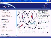
Develop precise, efficient, and reliable Gps software in record time with this multithreaded component for desktop and mobile devices, including PocketPC, Windows CE, Tablet PC, Smartphone and now Windows Mobile! Over fifty classes in one lightweight assembly give you unparalleled features while saving you hundreds of dollars in Gps device testing. Gps.NET is loaded...
Category: Software Development
Publisher: GeoFrameworks, LLC, License: Commercial, Price: USD $199.00, File Size: 8.5 MB
Platform: Windows,
Trimble Adventure Planner software is a PC-based trip planning, mapping and trip journaling application for lovers of hiking, biking, walking, fishing, running, geocaching and other outdoor activities.
Adventure Planner can be used as a standalone product or with the Trimble Outdoors phone application. Is it NOT intended to be used with the AllSport Gps application running...
Category: Home & Education / Miscellaneous
Publisher: Trimble Navigation Ltd., License: Freeware, Price: USD $0.00, File Size: 8.6 MB
Platform: Windows
Win/CE Gps client library component reads and decodes standard Gps NMEA 183 sentences from the RS232 serial port as well as compute great circle distances and bearings. Several eVC example programs with full source code are included. Requires Windows Embedded Tools eVC compiler. Some of the many features of the MarshallSoft Gps Component (MGC) are: (1) Uses the Win/CE Win32...
Category: Software Development / Tools & Editors
Publisher: MarshallSoft Computing, License: Shareware, Price: USD $105.00, File Size: 256.0 KB
Platform: Windows,
GeoVisu is a program that displays georeferenced data (images, graphics) and downloads data recorded by some Gps devices.
GeoVisu has a "Moving map" navigation function, which can be used with any NMEA 0183 compatible or Garmin USB Gps device.
Main features:
- Displays georeferenced image formats : GeoTiff, ECW and ECWP, MrSID,...
Category: Multimedia & Design / Graphics Viewers
Publisher: GeoVisu, License: Freeware, Price: USD $0.00, File Size: 1.7 MB
Platform: Windows


 Demo
DemoZylGPSReceiver is a Delphi/CBuilder component that communicates with a serial Gps receiver. It returns latitude, longitude, altitude, speed, heading and many other parameters of the position. This component works with any NMEA compatible receiver connected to one of the serial ports. You can use it also with USB and Bloototh devices, because these devices usually have a...
Category: Software Development / Components: Delphi
Publisher: Zyl Soft, License: Demo, Price: USD $129.99, File Size: 1.7 MB
Platform: Windows
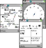
Gps/J is a console for all Bluetooth-enabled Gps receivers (now with 20000 European towns and cities!), a mobile navigation tool for cellular phone owners and the most affordable and convenient way to use location services.
It is a J2ME application for JSR82-compliant devices, which means "devices with a programmable Bluetooth interface".
Saying...
Category: Home & Education / Miscellaneous
Publisher: GPS/J Project, License: Demo, Price: USD $0.00, File Size: 281.0 KB
Platform: Windows
Gps Tracker Data Logger acts as the server and allows you to collect data from an unlimited number of various Gps trackers simultaneously. The obtained data is processed, uniformed and written to a log file or a database. Also, the program has a set of interfaces so other applications can get data in real time.
Gps Tracker Data Logger can convert data into other...
Category: Internet / Misc. Servers
Publisher: AGG Software, License: Shareware, Price: USD $80.83, File Size: 11.8 MB
Platform: Windows
GPS Tuner was first launched in 2003.
Gps Tuner was first launched in 2003. Success followed introduction shortly. Over the years it became a best-selling favourite Gps software among off-roaders as a reliable, versatile feature-packed application suiting the needs of outdoor enthusiasts and professional off-road users alike. After five years of continuous development of previous Gps Tuner versions Gps...
Category: Web Authoring / Web Design Utilities
Publisher: GPS Tuner Ltd., License: Freeware, Price: USD $0.00, File Size: 4.5 MB
Platform: Windows
The Gps Detector software is used to update the Gps detector's database , updating maps , routes and camera locations . The device itself is based on pre-installed Gps coordinates, the device can indicate various road hazards like: Fixed cameras, Red light speed cameras and bus lane cameras, Usual speed measurement places and dangerous zones.
Category: Business & Finance / Business Finance
Publisher: Euro Noliker Kft., License: Freeware, Price: USD $0.00, File Size: 5.5 MB
Platform: Windows


 Shareware
MarshallSoft Gps Component Visual Basic and .NET toolkit to read and decode industry standard Gps NMEA 183 navigation sentences from the RS232 serial port as well as computes great circle distances and bearings. Features include: - Supports both 32-bit and 64-bit Windows. - Uses the Windows API for serial port input. No special Windows Driver is required. - Runs...
Category: Software Development / Components & Libraries
Publisher: MarshallSoft Computing, License: Shareware, Price: USD $115.00, File Size: 476.8 KB
Platform: Windows
ActiveGPS is a reciever that makes the driver aware of speedcameras.
ActiveGPS is a reciever that makes the Driver aware of speedcameras. Speedcameras are being set up in many locations all over europe and they are very easy to miss when your're passing, perhaps little too fast. ActiveGPS warns the Driver 17 seconds before approaching a speedcamera/coordinate.
ActiveGPS is a 16 channel Gps-reciever.
On the display you...
Category: Utilities / Misc. Utilities
Publisher: A&TJ, License: Freeware, Price: USD $0.00, File Size: 4.8 MB
Platform: Windows
The Gps Controller software is a free program designed to allow you to configure a range of Gps receivers. There are versions that run on Windows desktop computers, or Windows Mobile devices.
Before downloading the software, it recommend downloading and reading the documentation to confirm which version you need.
Category: Home & Education / Miscellaneous
Publisher: Trimble Navigation, License: Freeware, Price: USD $0.00, File Size: 30.9 MB
Platform: Windows
GPS-CCD:is a novel computational program for the
Prediction of Calpain Cleavage Sites.
Gps-CCD:is a novel computational program for the
Prediction of Calpain Cleavage Sites.
The online service and local packages of Gps-CCD 1.0 were
implemented in JAVA/. For the online service, we tested the Gps-CCD1.0 on a variety of internet browsers, including Internet Explorer 6.0, Netscape Browser 8.1.3 and Firefox 2 under the Windows XPOperating System...
Category: Web Authoring / JavaScript
Publisher: The CUCKOO Workgroup, License: Freeware, Price: USD $0.00, File Size: 19.2 MB
Platform: Windows
The OSTN02 extension for ArcPad is a FREE tool that automatically transforms Gps data and aligns it with Ordnance Survey (OS) background map. This easy-to-use extension removes the need to manually post-process Gps data by providing’ on the fly’ transformation of WGS84 latitude and longitude into OSTN02 corrected British National Grid coordinate. Data capture using...
Category: Home & Education / Miscellaneous
Publisher: ESRI (UK) Ltd, License: Freeware, Price: USD $0.00, File Size: 8.0 MB
Platform: Windows
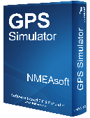
Overview Gps Simulator is software that generates a virtual Gps data Used to develop and simulation of Gps applications -Save testing and development time -No location restriction or work everywhere -No Gps device needed Feature Easy routing Selectable map(7EA Map) Support speed control Support 10EA NMEA protocol messages(GGA, GNS, GLL, RMC, VTG,...
Category: Desktop Enhancements / Shell & Desktop Managers
Publisher: NMEAsoft, License: Demo, Price: USD $150.00, File Size: 3.3 MB
Platform: Windows
Have a Gps and a laptop? Use this to find your way. Make patterns or a trail to share with others. When the application starts, you may pick your area of operations - be it North America, South America, Europe and Asia, or Australia. Your quadrant is determined by where you are in relation to the Equator and the Prime Meridian. Tracking of your position is automatically enabled when the...
Category: Home & Education / Miscellaneous
Publisher: LogicAll Solutions, LLC, License: Freeware, Price: USD $0.00, File Size: 4.6 MB
Platform: Windows
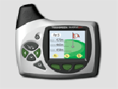
Improve your golf game with a handheld Gps that gives distance to pin, club suggestions, locations of hazards and much more. Wherever in the world you play golf, the sureshotgps will allow you to obtain distances from tee to green. Experience the difference with better club selection, speedier play and statistical information per round of golf. The sureshotgps relies on Gps...
Category: Home & Education
Publisher: Absolute Software Pty Ltd, License: Shareware, Price: USD $399.00, File Size: 3.8 MB
Platform: Windows
"In 100 meters, turn left" "You have reached your destination" "At the end of the road, Take the ferry" For any new Driver these things just seem to become a background noise after much use. But what if you could change those voices, What if you could Make your own voice. Well you can with iFX TomTom Voice Changer. The name says it all. Change and create...
Category: Internet / Communications
Publisher: iFX Sound Software Inc, License: Freeware, Price: USD $0.00, File Size: 7.1 MB
Platform: Windows
GPS Send Map is a Windows interface program which uses (sendmap.
Gps Send Map is a Windows interface program which uses (sendmap.exe) to load the IMG maps to the Gps.This program works well and setup is easy, although there seams to be minor issues in some windows OS.The Gps acted as usual and my maps appeared on the screen as usual. NICE.
Category: Security & Privacy / Other
Publisher: DougsBrat, License: Freeware, Price: USD $0.00, File Size: 1.5 MB
Platform: Windows
The revolutionary DriftBox from Racelogic is a powerful Gps based Performance meter that can measure the drift angle of your car, your lap times, and even 'LineSnap' predictive lap times, which give you instant feedback on your driving. DriftBox is the perfect tool for anybody wanting to accurately measure vehicle or Driver performance.With DriftBox you get more features...
Category: Multimedia & Design / Digital Media Editors
Publisher: DriftBox, License: Shareware, Price: USD $780.00, File Size: 10.5 MB
Platform: Windows


 Shareware
Keep your drivers up-to-date automatically and keep your PC running like new!
Are old drivers causing unexplained problems with your PC's performance? Don't panic! Driver Genius always keep your drivers up-to-date Automatically & Optimize system for better performance easily.
Category: Utilities / System Surveillance
Publisher: Driver-Soft, License: Shareware, Price: USD $22.95, USD22.95, File Size: 24.2 MB
Platform: Windows

