Free Downloads: Earth View In Maps
View amazing satellite images of earth with the free version of google earth software.
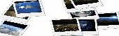
View amazing satellite images of Earth with the free version of google Earth software.Google Earth is a totally free software which enables you zoom in from satellite,View,rotate or tilt just like a camera of the entire Earth inside your pc.It works just point and click on any part of Earth or by typing addrees name of city or country and google...
Category: Home & Education / Miscellaneous
Publisher: www.satelliteimage-of-my-house.com, License: Freeware, Price: USD $0.00, File Size: 798.0 KB
Platform: Windows
Superoverlay software is a Google Earth application for tiling raster datasets and creating View based regions in KML or KMZ files.
Also Superoverlay can generate world files for all images in ArcView style (jgw, tfw,...). It helps you put large image overlays into Google Earth (for example alternative Maps or aerial photography). GE Sky mode is supported.
Category: Home & Education / Miscellaneous
Publisher: GIS Center, License: Shareware, Price: USD $0.00, File Size: 0
Platform: Windows
Free Earth Screensaver will bring the blue planet to your desktop.
Free Earth Screensaver will bring the blue planet to your desktop. You can View the Earth from the night side, the day side and from the moon. This screensaver lets you see the pictures of our planet that you have never seen before. Earth is the third planet from the Sun and is the densest and fifth-largest of the eight planets in the Solar System. This unique...
Category: Desktop Enhancements / Misc. Themes
Publisher: CustomAquariumScr, License: Freeware, Price: USD $0.00, File Size: 3.0 MB
Platform: Windows

FSS Google Maps Downloader is a tool that can download the Google Maps images to your PC. This is a clearly free program. There is no spyware or adware. It's absolutely safe to install and to run. The interface is very simple and self explaining. It runs low on system resources consumption and is supported on all Windows versions. It can save them to your hard disk,...
Category: Internet / Download Managers
Publisher: FreeSmartSoft, License: Freeware, Price: USD $0.00, File Size: 874.0 KB
Platform: Windows
 Shareware
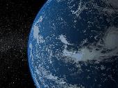
Solar System - Earth 3D screensaver invites you for an instant trip to space where you can admire the magnificent View of our planet shown against the twinkling stars. You can see the change of night and day along with the play of sunrays, as the Earth slowly revolves round the Sun. The screensaver uses modern shader technologies to produce photo-realistic effects. It's one...
Category: Desktop Enhancements / Screensavers
Publisher: Rixane Interactive, License: Shareware, Price: USD $17.95, EUR17.95, File Size: 16.2 MB
Platform: Windows
Shareware
Google Maps Terrain Downloader is a tool that can automatically download the google terrain Maps images to your PC. It can download the small tiles and save them to your hard disk. After downloading, you can View the Maps offline by its tool Maps Viewer, or you can combine the small images into one big map image. If you want to make a map of your city by...
Category: Internet / Download Managers
Publisher: allmapsoft.com, License: Shareware, Price: USD $29.99, File Size: 305.3 MB
Platform: Windows
Shareware
Google Hybrid Maps Downloader is a tool that can automatically download the google hybrid Maps images to your PC. It can download the small tiles and save them to your hard disk. After downloading, you can View the Maps offline by its tool Maps Viewer, or you can combine the small images into one big map image. If you want to make a map of your city by...
Category: Internet / Download Managers
Publisher: allmapsoft.com, License: Shareware, Price: USD $29.99, File Size: 30.6 MB
Platform: Windows
Imagenes satelite is a free satelite images slideshow screensaver for your desktop.
Imagenes satelite is a free satelite images slideshow screensaver for your desktop.View high resolution and beautihigh quality satelite images of Earth from space.This screensavers contains full color images that fit automatically on your screen.View satellite images of Earth from several kilometers from above the sky.Fly above the surface of the Earth and see...
Category: Desktop Enhancements / Screensavers
Publisher: www.vista-satelite.com, License: Freeware, Price: USD $0.00, File Size: 3.3 MB
Platform: Windows
Virtual Earth 3D brings you another step closer to knowing "what it is like out there".
Virtual Earth 3D brings you another step closer to knowing "what it is like out there". You can search, browse, and organize local information viewed in three dimensions, just the way it exists in the real world. This enables you to more effectively find the data that is relevant to you, making Live Maps more useful than ever. Even better, it's just plain fun!
Category: Home & Education / Genealogy
Publisher: Microsoft, License: Freeware, Price: USD $0.00, File Size: 13.0 MB
Platform: Windows, all

OkMap is a GPS and map software that:
-Works with vectorial Maps and calibrates raster Maps
-Organizes paths by creating waypoints, routes and tracks
-Uploads/downloads data to/from your GPS
-Uses altitude DEM data
-Supports GPS real-time navigation
-Sends/receives vehicles position and display tracks on Maps in real time
-Provides autorouting and...
Category: Business & Finance / Applications
Publisher: Gian Paolo Saliola, License: Freeware, Price: USD $0.00, File Size: 20.2 MB
Platform: Windows
Microsoft Location Finder 3.0 is a handy tool, which using the current location of the computer, generates orientation Maps, distances and optimal routes between two cities, and 3D visual tours.
The program generates this information using Wi-Fi signals detected within the area near the PC. However this PC does not need Wi-Fi, but any type of Internet connection. It runs on...
Category: Home & Education / Miscellaneous
Publisher: Microsoft, License: Freeware, Price: USD $0.00, File Size: 3.9 MB
Platform: Windows
Demo
Visualize your data in 3D! Quick, easy and inexpensive. Graph Earth enables management, marketing and other business professionals to create stunning visual representations of their data, all without the time and costs associated with a full-featured GIS. Viewable by Everyone! Create one of a kind deliverables and distribute them to the world, recipients need only install Google...
Category: Business & Finance / MS Office Addons
Publisher: Deer Creek Marketing LLC, License: Demo, Price: USD $24.95, File Size: 469.0 KB
Platform: Windows
Build your world in 3D
Use the Earth as a starting point to bring your ideas to virtual life.
Build your world in 3D
Use the Earth as a starting point to bring your ideas to virtual life. Go anywhere in the world and with a few clicks design a house or replicate your favorite building. When you're finished, share your creations online. No matter what your 3D design background may be, 3DVIA Shape for Maps makes designing realistic, 3D models fun, easy and...
Category: Multimedia & Design / Multimedia App's
Publisher: Dassault Systemes, License: Freeware, Price: USD $0.00, File Size: 508.8 KB
Platform: Windows
Earth3D is a program that visualizes the earth in a realtime 3D view.
Earth3D is a program that visualizes the Earth in a realtime 3D View. It uses data from NASA,USGS, the CIA and the city of Osnabrück.
Main features:
- viewing the Earth as a whole
- zooming in until countries, cities and even single houses become visible
- embedding external data like current earthquake positions or cloud data.
Category: Multimedia & Design / Graphics Viewers
Publisher: Dominique Andre Gunia, License: Freeware, Price: USD $0.00, File Size: 3.1 MB
Platform: Windows
Live Satellite Maps or Google maps is a web server mapping applications.
Live Satellite Maps or Google Maps is a web server mapping applications.Provides scrolling map images and satellite photos around the Earth and even the route between different places.Since 6 October 2005, live satellite Maps is part of local Google.Google live satellite Map provides the ability to zoom in or zoom out to show the map.The user can control the map with...
Category: Home & Education / Science
Publisher: www.satelliteview-of-my-house.com, License: Freeware, Price: USD $0.00, File Size: 643.0 KB
Platform: Windows
Live view of Earth from the space right on your desktop.
Live View of Earth from the space right on your desktop.
You can decorate your desktop easily with this little software.
-Weather info on the map
-Real time clouds
-Day and night (city lights in night areas)
-Time Zones. Never call your international offices at the wrong time again!
Category: Desktop Enhancements / Screensavers
Publisher: GimmeGoody Software, License: Shareware, Price: USD $24.99, File Size: 2.7 MB
Platform: Windows
Let your desktop take you on an incredible journey into space!
Let your desktop take you on an incredible journey into space! Marvel at planet Earth, receive weather forecasts and View times anywhere in the world. Zoom or rotate the Earth and watch storms from the safety of your home.
Main features:
- Zoom in and out and rotate the Earth
- View weather forecast and time anywhere in the...
Category: Desktop Enhancements / Screensavers
Publisher: Inbox.com, LLC, License: Freeware, Price: USD $0.00, File Size: 8.6 MB
Platform: Windows
Download, View, and Print Maps with the MrSID Viewer.
Download, View, and Print Maps with the MrSID Viewer.
To download and View Maps offline you need a special viewer. Maps are stored in MrSID format. The MRSID Viewer is a freeware tool. This library provides access to the MrSID viewer developed by LizardTech.
NOTE:
LizardTech dropped the link for that stand-alone viewer...
Category: Multimedia & Design / Graphics Viewers
Publisher: Lizardtech, License: Freeware, Price: USD $0.00, File Size: 2.0 MB
Platform: Windows
Create GPS enabled geo Maps directly on the background of aereal photos and road Maps from the internet. Import geodata from Google-Earth, OpenStreetMap, GPS tracks and GPS logger. Map editor , manually digitizing. Specifical graphical objects (borderlines, borderareas) to guarantee exact same borders of neighbour areas..Screen calibration for true to display on the screnn.
Category: Multimedia & Design / Digital Media Editors
Publisher: GPSur Dr. Erhard Regener, License: Shareware, Price: USD $65.00, File Size: 6.4 MB
Platform: Windows
T2K PLUS or Tiles2Kml PLUS enables you to efficiently load large set of imagery or raster Maps very quickly into Google Earth using Region-Based Network Links. This method has an onRegion option, which specifically loads the Region data only when the Region is active. Thus only the needed set of data is loaded with multiple levels of detail, larger amounts of data are loaded only...
Category: Multimedia & Design / Authoring Tools
Publisher: Tiles2kml, License: Demo, Price: USD $40.00, File Size: 8.4 MB
Platform: Windows
Earth Orbit Objects is free program which predict satellite passes for your local or any selected area. Use flat Earth View to display satellite tracks with visibility circle.
The globe View shows selected satellites around the Earth as a sphere and sky View shows satellites as you would see them in a starry night. The line elements are...
Category: Home & Education / Miscellaneous
Publisher: Bluewing Trg, License: Freeware, Price: USD $0.00, File Size: 1.6 MB
Platform: Windows
With Cartopro Evolution create,modify and save routes, tracks, and waypoints by simple click on the screen.
Main features:
-Simple and reliable.
-Scan your Maps directly from Cartopro
-3 types of powerful calibrations are available
-Large number of Datums available. You can also add them manually.
-Import and Export your track, routes and...
Category: Home & Education / Miscellaneous
Publisher: Sigrist Alain, License: Shareware, Price: USD $0.00, File Size: 0
Platform: Windows
VYM (View Your Mind) is a tool to generate and manipulate maps which show your thoughts.
VYM (View Your Mind) is a tool to generate and manipulate Maps which show your thoughts. Such Maps can help you to improve your creativity and effectivity. You can use them for time management, to organize tasks, to get an overview over complex contexts, to sort your ideas etc.
Category: Home & Education / Miscellaneous
Publisher: Uwe Drechsel, License: Freeware, Price: USD $0.00, File Size: 4.0 MB
Platform: Windows
Earth 2160 is the official sequel of the award winning, very popular and top selling Earth series and continues the brand of Earth 2140 and Earth 2150.
Only a few thousand humans managed to escape from the Earth before its collapse in 2150 A.D. They spent the next few years on the terra forming of the red planet, developing new technologies and building...
Category: Games / Strategy & War
Publisher: ZUXXEZ Entertainment AG, License: Demo, Price: USD $0.00, File Size: 3.5 MB
Platform: Windows

This animated wallpaper shows a magnificent view of the Earth as seen from space.
This animated wallpaper shows a magnificent View of the Earth as seen from space. Feel the spirit of the coming holidays in a fairy tale place near a calm forest lake. This animated wallpaper from AnimatedWallpaper7.com doesn't require installation or additional software to run. Once downloaded, it can be set on your desktop in one mouse click. It supports Windows XP/Vista/7 as...
Category: Desktop Enhancements / Misc. Themes
Publisher: AnimatedWallpaper7.com, License: Demo, Price: USD $7.95, File Size: 8.6 MB
Platform: Windows